Galdhøpiggen, Scandinavia's Highest Mountain
A walk contributed to Walking Englishman by Mark Dunn
| Statistics and Files | ||
|---|---|---|
| Start: Spiterstulen tourist hut | Distance: 8.2 miles (13.2 km) | Climbing: 1,485 metres |
| Grid Ref: SK276741 | Time: 8-9 hours | Rating: Strenuous |
| GPX Route File | Google Earth File | Mountain Information |
| Statistics | |
|---|---|
| Start: Spiterstulen tourist hut | Distance: 8.2 miles (13.2 km) |
| Grid Ref: SK276741 | Time: 8-9 hours |
| Climbing: 1,485 metres | Rating: Strenuous |
| GPX Route File | Google Earth File |
Summary: Flights to Norway from the UK are surprisingly cheap and the road network in the country is superb. Hire cars are reasonably priced so accessing the remote mountainous areas is surprisingly easy. Jotunheimen is approximately 4 hours drive from Oslo's Gardermoen airport, and what a drive! There is a huge choice of accommodation along the way from great hotels and bothy style huts to alpine style mega lodges. One of the latter kind, Spiterstulen Tourist Hut, was the start and finish point for this particular walk. There are certain halcyon days that stay with us long after the walk has finished and this, for me, was such a day. This very popular, circular route was easy to navigate and the scenery was spectacular. There was never a time when I was not smiling throughout the entire day and with each corner turned a new vista of breathtaking beauty unfolded in front of us. Old and young alike gained the summit in a party atmosphere of broad smiles and happy hearts. I am sure you would enjoy this day out as much as we did and this walk alone would be a great reason to head to Norway. I have made a promise to return as there is a lifetime's worth of adventures to be had
The Walk: In September my partner and I left for a walking trip to Norway with very high hopes and every one of them was exceeded by this incredible, majestic country. One of the things that strike you when navigating around Norway is just how huge it is and just how far apart all of the places you think you would want to visit are. So we decided to base ourselves in the Jutunheimen National Park so we wouldn’t be driving all the time. We could not have made a better choice. This area is a cross between the Scottish Highlands, Wales, Canada, The Alps and Mordor. The landscape was extremely varied, jaw droppingly beautiful and vast! Huge skies greeted us at every turn and unlike anywhere else I have been, the valleys were widely spaced and filled with azure blue fjords.
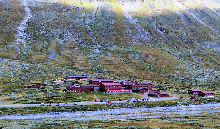 Spiterstulen tourist hut
 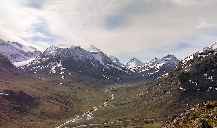 Looking towards Opland
The weather in early September was amazing, not too warm, but clear blue skies most days and no midges!!!! Our first walk was the very popular Besseggen Ridge and once we had this and one other under our belts, we were ready for Galdhøpiggen, the highest peak in Scandinavia at 2,469 m (8,100 ft) above sea level. Obviously, as the top of this walk was above the snow line and I was concerned that my partner, (who has no winter walking experience), would find it difficult. I researched the route thoroughly beforehand and soon found out that no crampons, walking axes etc were required. I was still a bit sceptical so asked a number of locals to dispel any fears. I need not have worried, this is a hugely popular walk undertaken by everyone including families with kids. It is also worth pointing out that Norway has a bewildering array of mountain huts in which to stay, so a trip walking between huts with no vehicle is very doable and in fact is a very popular way of seeing the country. These huts range from basic, bothy style, self-catering accommodation to palatial, alpine style, full service, 200 bed hostels with roaring open fires and swimming pools and saunas. (Spiterstulen hut is the latter kind.)
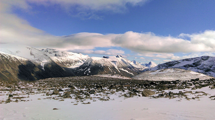
 One of the many gentle slopes towards the summit
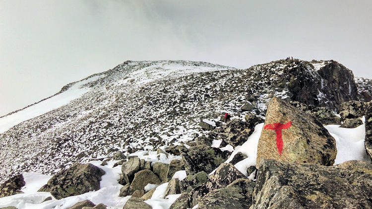 Follow that T!!
Our walk began at the Spiterstulen tourist hut which is located at 1110m above sea level so we only had just over 1300 metres of ascent and descent to do! Once we had paid our parking fee at the gorgeous hostel reception, and treble checked there was no need for winter gear, the day began. The reindeer populated valley we started in, was lush and green with steep sides which opened at the far end to a vista of jagged, snow covered peaks, a great day out walking could be had in this direction alone. However we headed up a very clearly marked path opposite the hostel following the painted letter “T”’s all the way. The same organisation who owns and manages the network of huts, marks rocks with the letter T in red paint along the popular routes in Norway. This is unobtrusive and seems to really help with route-finding, which on this walk was never an issue.
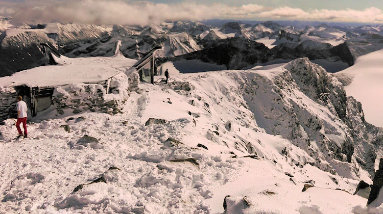 Galdhopiggen Summit tearoom, sadly closed for the season
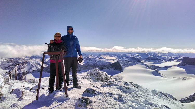 Myself and Jill standing on the roof of Scandinavia, The Mighty Galdhopiggen 8100ft
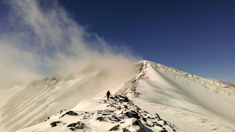
We left the valley floor on a clearly marked, sign posted path climbing steeply up above the vegetation into the scree and moraine zone. This was soon passed and we started to gain the snow line. This area was mixed with boulders and caution had to be taken until we had mostly snow underfoot. The walk had been steep but not unrelenting. There were numerous places to stop, rest and refuel and soon what looked like the summit came into view. I knew we were not at the correct altitude so I figured this was a false summit and we kept on heading upwards (this was one of a few false summits). The walk is extremely popular and despite the epic scale of the terrain there was never really a time when there was not other people in view. It all felt very safe and navigation was a breeze.
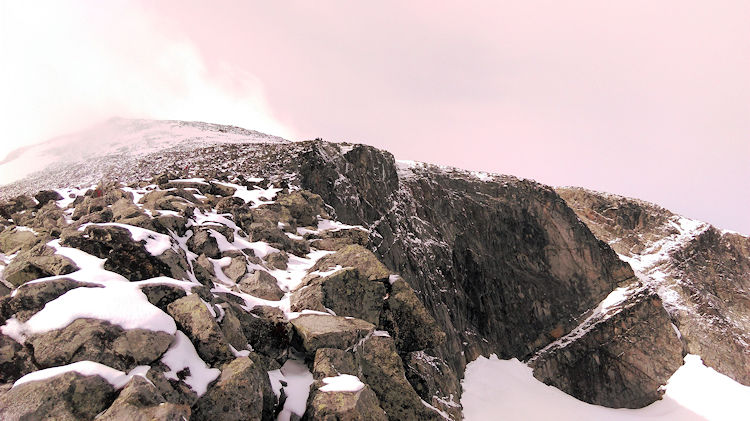 100m vertical cliffs to be avoided during the walk off
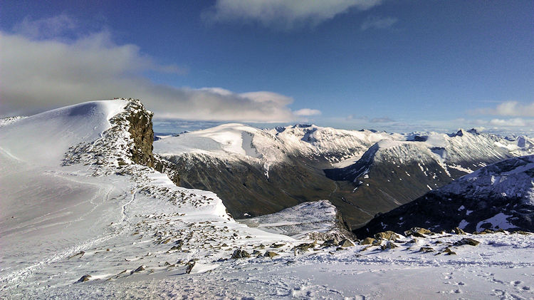 Great return views of some of Jotunheimen National Park's innumerable peaks
Soon we reached a shoulder which gave us a view of the true summit and we saw the small summit tea room from below, which was almost completely covered with snow. This was closed as the Norwegian tourist season had in fact drawn to a close before we arrived in the country. There were dozens of people at the top, however, most of whom had come a different route from the Juvasshytta mountain station crossing the Styggebreen glacier. Everyone was in high spirits and the summit cleared quite quickly of the glacier group and soon there were only a handful of people around. The 360 degree views from the summit were breath-taking and in every direction you looked there were incredible peaks, summits and wonderful mountain scenery. I was incredibly proud of my partner who had done her first winter walk without incident on her highest mountain to date. I had a lump in my throat when she told me later that this was one of the best days of her life. We had walked most of the route in windshirts and t-shirt base layers but once stationary at the top, we wrapped up in our warmer layers for some food and a few pictures. Once we had fed and rested we started on our return journey along the same route. There is a subsidiary peak to the right, which we walked down to with amazing views down its ridge, a real mountaineering challenge for another visit.
 Great return views of some of Jotunheimen National Park's innumerable peaks
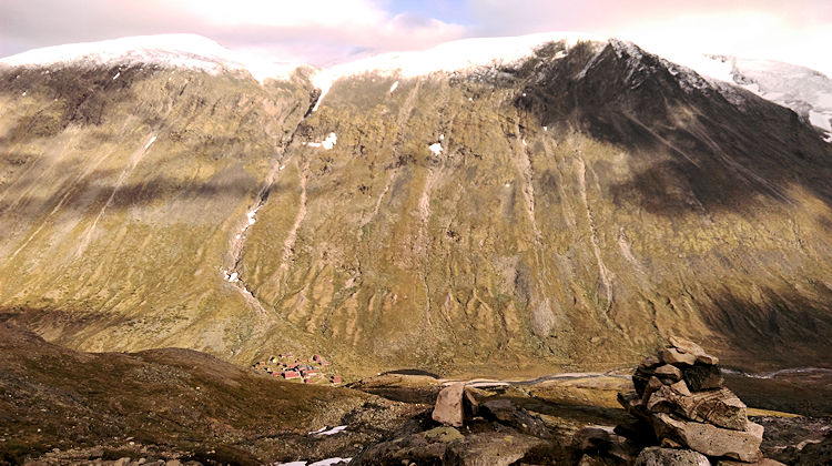 One for next time, Glittertind, the 2nd highest peak in Scandinavia right above where we parked
The descent really was as nice as the ascent and views of Glittertind the 2nd highest peak in Norway at 2464m were visible and the terrain we had missed behind us on the way up kept us interested all the way back to the valley floor which we gained all to soon it seemed. The route was 8.21 miles and took us 8hrs 21mins!! Our elevation gain was in fact 1485m according to our GPS. What a great day, I can’t recommend it highly enough.


