Waterfoot, Cowpe Lowe, Waugh's Well, Top of Leach, Irwell Sculpture Trail
This walk started for me from Edgeside though I have drawn the map as starting from Waterfoot, a more appropriate starting point. From Waterfoot, deep in the heart of the Rossendale valley the walk climbs by access roads and paths to Cowpe Lowe. Then the walk follows the Rossendale Way to Foe Edge and Waugh's Well before tracking through disused Cragg Quarry to Cowpe Moss and the high point of the walk at Top of Leach, 474 metres altitude. Then cross high country via Brandwood Moor, Jackson's Moor and Greens Moor to Lea Quarry before tracking back down to Rossendale at Stacksteads and following the Irwell Sculpture Trail back to Waterfoot.
Google Maps Open Source Maps| Statistics and Files | ||
|---|---|---|
| Start: Waterfoot | Distance: 8.3 miles (13.3 km) | Climbing: 474 metres |
| Grid Ref: SD 83338 21834 | Time: 3-4 hours | Rating: Hard |
| GPX Route File | Google Earth File | About the Rossendale valley |
| Statistics | |
|---|---|
| Start: Waterfoot | Distance: 8.3 miles (13.3 km) |
| Climbing: 474 metres | Grid Ref: SD 83338 21834 |
| Time: 3-4 hours | Rating: Hard |
| GPX Route File | Google Earth File |
Ordnance Survey Explorer Map (1:25,000)
The Walk: I used to visit Rossendale as a child. My mum's closest sister had moved across from Yorkshire to the area in the early 1960's and afterwards the sister's earliest summer holidays were alternated between the two. One year, my Aunt and cousins would visit us for a week or two in Yorkshire and the next my parents, my two next eldest brothers and I would holiday for a week or two in Rossendale. Kids would top and tail in beds; what great memories. During the days in Rossendale we would explore the local area around Edgeside where my cousins had settled. Jack Lodge reservoir at Shaw Clough was a favourite spot, the climb to Seat Naze another. We also played a lot in Edgeside Park.
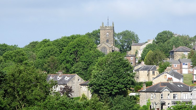 Newchurch as seen from Edgeside
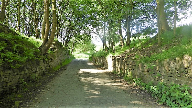 Climbing the lane to Cowpe Lowe
Going down into Waterfoot for pop and sweets was a treat. I remembered it all so vividly as I set off from my cousins house in Edgeside, while walking down into Waterfoot and setting off on my way to the south moors of Rossendale. I did have a little trouble getting out of the valley though, a helpful local pointing out the way up. There were quite a few paths to take on the climb so I checked my GPS closely to make sure I was on the right one chosen. Once comfortable with that I set about enjoying the climb, following a cobbled access road which turned to tarmac during the climb, passed a lovely house which was probably a converted mill with fine gardens and a mill pond and came to road end at a house with four old type land rovers parked in front. I passed the house, went through a five bar gate and started climbing the rough steep track to the open moor.
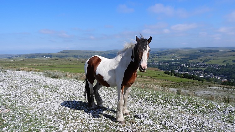 Wild horse on Cowpe Lowe
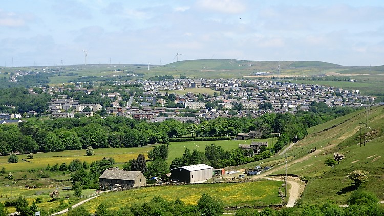
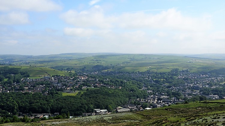 View from Cowpe Lowe to Rossendale
Up the track I went on the steepest part of the walk, making 70 metres of ascent in the first 300 metres. A sheep with a lamb stood on the left hand bank side as I climbed. Both looked, sheep knowingly and lamb learning, the parent possibly thinking "He is making this look hard. Don't fret, he would never catch us". It was just 9.30am but already stiflingly hot, clear blue sky on a near midsummer day. After the track ended at the bottom of the upturned shallow bowl which is how Cowpe Lowe looks, I tracked anti-clockwise around the fenced lip to find access up to the top. Quarter round on the north side I found a gap in the fencing and a track leading up Cowpe Lowe which was waymarked in a scatter of white. I thought the white stuff to be potash fertiliser but it smelled different, a kind of musty. Since I have been told it may have been paper pulp from a local mill. Whatever it was, the wild horses I met on the climb to the top did not seem to mind it. I walked on past the not nice smell though before taking a breather and look back across to Rossendale. I looked for those halcyon places of childhood. Seat Naze and Edgeside Park were easy to spot.
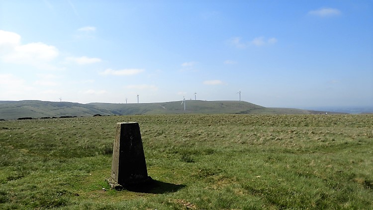 Cowpe Lowe trig pillar
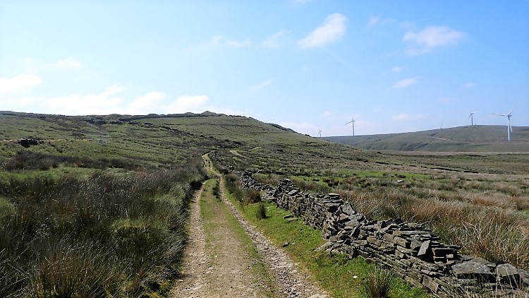 Following the path to Foe Edge
After enjoying the view of childhood favourite places I turned my attention to the walk and climbed to the flat top plateau of Cowpe Lowe. "It would make a good cricket pitch up here" I thought, so flat and round was it at the top. At the center of it all was the trig pillar, 440 metres high. I reached it, tapped the top and took a drink before continuing on my way, first by scuttling off the south edge on a 25 meter drop to meet the Rossendale Way. Heading east for 500 metres towards Black Hill and then turning south towards Foe Edge drew my attention to what lie ahead. The evening before my cousin Kevin had said "Make sure you visit Waugh's Well". My path was now leading me there.
 Foe Edge
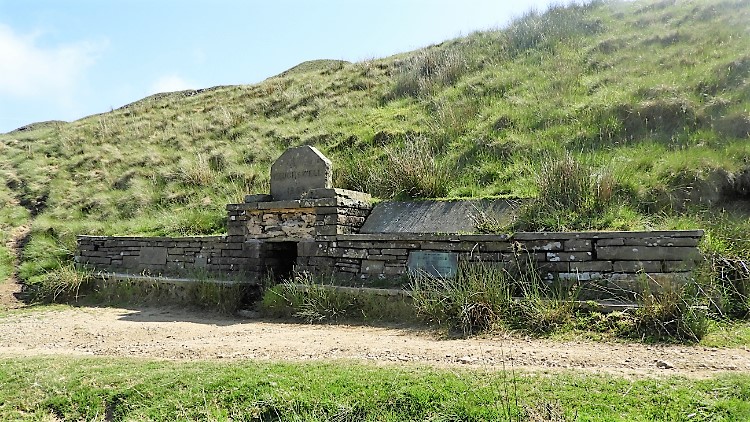 Waugh's Well
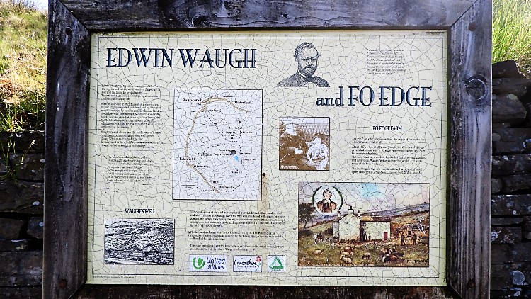
The path, a lovely one offering gorgeous views of the rolling moors, soon led me to an information board. It celebrated Edwin Waugh, (1817–1890) English poet and writer. Near to the information board is a retaining wall though no ruins of Foe Edge Farm remain. Waugh spent most of his productive writing years at Foe Edge Farm so it is a shame the local water company demolished such a place of interest instead of commemorating it. Vandals. A little further south along the Rossendale Way is Waugh's Well, built in 1866 by local enthusiasts under the lead of Mr Edmund Chattwood. The well was christened with some ceremony. While the original inscription stone was accidentally broken it was duly replaced and in 1966 the Pennine Paths Protection Society, financially assisted by the Waugh Society, repaired the well and added a bronze head. Every third Saturday in July the well is visited by Edwin Waugh enthusiasts.
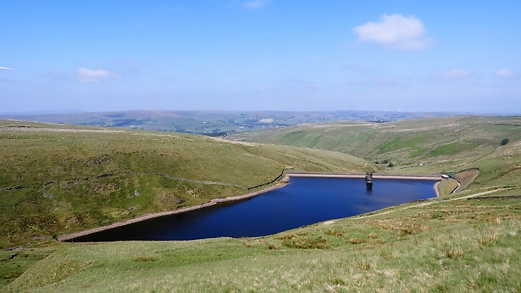 Scout Moor High Level Reservoir
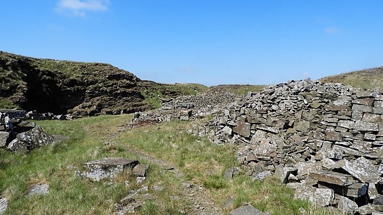 Cragg Quarry
From Waugh's Well a good view of Scout Moor High Level Reservoir is enjoyed. I doubt Waugh would have enjoyed it, the water coming long after he had left the moor. Beyond the reservoir I could see far across the West Pennine Moors to Darwen Tower. "Been there, done that" I thought. And indeed I had, all of one day ago! After my sightseeing I parted from the Rossendale Way and climbed 50 metres to Tottington Higher End Moor. The path I found on the moor led me on a winding and twisting roller coaster course through the disused site of Cragg Quarry. With industry long silenced the quarry is now used by walkers and bikers, the paths an ideal playground for those on two wheels. I saw a few bikers pass riding the rollers on routes marked with 'Mountain Bike Trail' as I walked my own course on the path marked 'Cragg Quarry Walk' while inspecting the redundant sites of quarry works and workhouses.
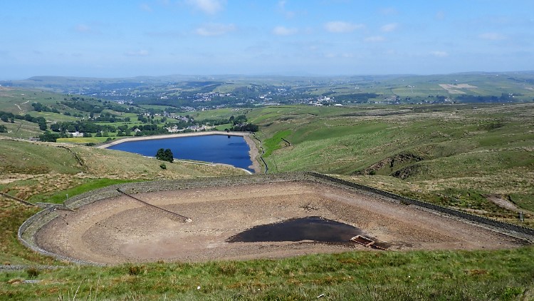 Cowpe Reservoir and Cragg High Level Tank
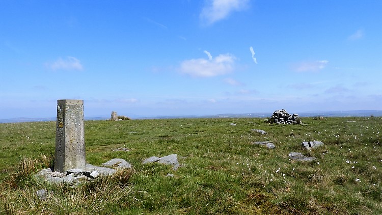 Top of Leach
From the quarry the path I was following took me due east across Cowpe Moss and to a point where I could see directly across Cowpe Reservoir to Rossendale valley and the Rossendale Forest beyond. While the reservoir was stocked I was shocked to see Cragg High Level Tank which feeds it empty. apart from a puddle in the sump that is. We had a relatively dry winter and dry spring of 2019 but I was still surprised to see high level reservoirs at low levels or even empty so early in the summer. Perhaps we shall get used to such sights in these times of climate change? From the scene of a dry water feature I followed the dusty dry path to meet the Pennine Bridleway at a point just south of Top of Leach. I left the bridleway as soon as I had reached it to track due south on an unpathed course up the hill to Top of Leach. Twenty five metres of ascent took me up to the high point of my walk, 474 metres. After a 360 degree look all around at the Lancashire Moors, all of it beautiful on such a perfect day, I found a small stone windbreak shelter and sat down. Time for lunch.
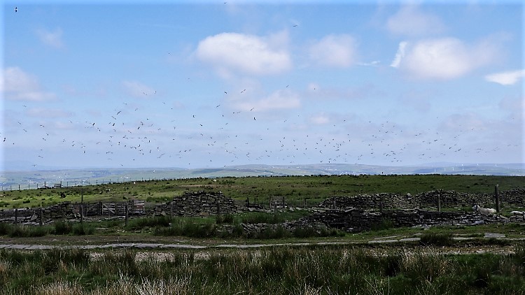 Flock of Gulls
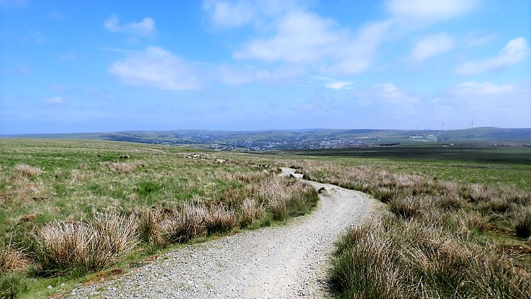 Track across Brandwood Moor
Replete with refreshments I did my customary tapping of the trig pillar and set off walking with the comforting thought that I could now amble. With all the climbing was done, I looked forward to a slow travel downland across the gentle gradient of Brandwood Lower End Moor to Jackson's Moor and from there continue much the same way to Greens Moor. On my way I came across a large flock of Gulls using the moors as a gathering roost. As I approached their particular roost field they all rose to the sky and settled down in the adjoining field. after i was gone they went back to their original place. I met no more gulls on the travel over the moor, just sheep. They were not too bothered about me, going about their business.
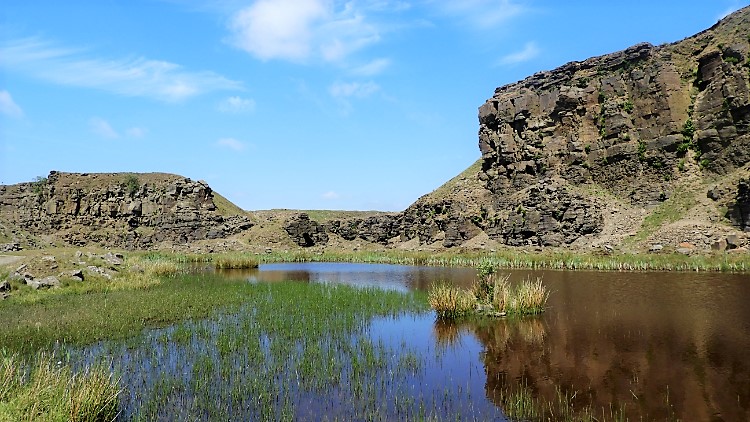 Lee Quarry, Greens Moor
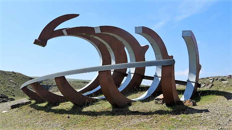 Ferroterrasaurus
Between Jackson's Moor and Greens Moor came across a few banks of earth and a couple of brick built wells. Evidence of disused mines which were marked on the map. Then on Greens Moor I arrived at a substantial quarrying site. A sign told me I had arrived at Lee Quarry. The quarry, like Cragg Quarry earlier, is a popular mountain bike trail site. However, it is as inviting for walkers too, a lovely transformed place of pools and artificial cliffs. There were a couple of bikers scuttling around while I explored but there were more walkers. Half a dozen or so, some at simple leisure and some dog exercising. All were enjoying the splendid scene as much as I. Lee Quarry is great. There was even modern art to find and enjoy, collectively titled Valley of Stone. A large metal plough like creation amongst the exhibits was by artist Robin Dobson and titled Ferroterrasaurus. There were stacked timber and stone sculptures too.
 View from Lee Quarry to Rossendale and Bacup
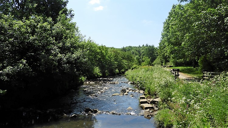 River Irwell
My modern art cultural experience ended as I made my way from Lee Quarry head off the moor. A wide hard stone track led me steeply down the hill and off the moor and through a wood of young trees before I reached a well trod path leading further down and beside a field of green grass and yellow jewelled Buttercups which thrilled my eyes. I was a little sad to leave the moors and colourful field behind to hit the streets of Rossendale. I had planned not to reach the main road running through Rossendale but I could not find the designated path of the Irwell Sculpture Trail when I crossed a bridge over the river so guessed it was a redundant area reclaimed by property. Forced, I walked, not unpleasantly, along the road of pretty stone houses, small work buildings, shops, worship houses and the like near to Stacksteads until at Nun Hill I turned into Blackwood Road, re-found the River Irwell and found the Irwell Sculpture Trail.
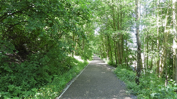 Following the Irwell Sculpture Trail
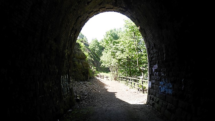 Tunnel on the Irwell Sculpture Trail
The finale to my walk was a delightful walk following the Irwell Sculpture Trail westwards along the Rossendale Valley to Waterfoot. I came across the first sculptures almost immediately. Carved out of local stone some were more surreal than others. I think the first I saw was a frog, the second one a family of faces. Along the trail I arrived at Stacksteads Riverside Park. Here I found out I was nearly right with the frog. It was a toad. And the family of faces was a totem pole where families of faces are often found. So not bad. Another I saw which resembled a Easter Island edifice was actually a representation of 'Scream' by Edward Munch. Still more like one of the Easter Island figures to me. After the park I followed the lovely leafy trail for a further kilometer until I reached the dismantled Rossendale Railway Tunnel. It was fun walking into the dark and through the tunnel back into the light. A great way to end my walk. "I wish we had done this as kids". Then again, perhaps it would have been too much then. It was a great revelation now. I loved it. Everything about it; the sights, the moors, the history, the heritage. The lot.
Footnote: I received this e-mail from Graham Barnes who on reading the walk commented:-
"I have just read with interest your walk - Waterfoot/Cowpe Lowe/Waugh's Well etc. I used to live at Foe Edge in the 1940/50's. My father was reservoir superintendant of Scout Moor High Level Reservoir.When we lived there it was about the most isolated property in Rossendale. With my mother I had to walk to school approx two miles down to Cowpe and then climb the hill back in the evening an experience which has lead to a life long passion for walking. Our water supply came from a stone tank above the well via a pipe across the hill side. About three years ago I notice that part of the tank top had fallen in, so together with a friend we repaired it. The tank is supplied by ice cold water from a spring, the overflow goes down a drain and flows out in Waugh's Well. Nine large stone flags cover the tank top and with sods covering these there is no visible sign that it is there. I have photos of the tank repair, but also of Foe Edge as well both colour and black and white. In 1974 an article in the Rossendale Free Press under " 25 years ago " told of a large storm in Rossendale and gave details of the property of Frank Barnes at Foe Edge that was badly damaged by lightening. Actually the thunderbolt came down the chimney demolished the stack and distributed the fireplace around the lounge. When I visit the site of Foe Edge I can still visualise all the rooms."
A very interesting postcript. Thank you Graham.


