County Tops of England: Cumberland
Scafell Pike: 978 metres (Grid Ref: NY215072)
Google Maps Open Source Maps| Route Statistics and Files | ||
|---|---|---|
| Start: Seathwaite Farm | Grid Ref: NY235122 | Distance: 11 miles (17.5 km) |
| Climbing: 1,639 metres | Time: 7-10 hours | Rating: Hard |
| GPX Route File | Google Earth File |
Map:
OL4 The English Lakes – North Western Area
OL6 The English Lakes – South Western Area |
| Statistics | |
|---|---|
| Start: Seathwaite Farm | Grid Ref: NY235122 |
| Distance: 11 miles (17.5 km) | Time: 7-10 hours |
| Climbing: 1,639 metres | Rating: Hard |
| GPX Route File | Google Earth File |
| Map:
OL4 The English Lakes – North Western Area
OL6 The English Lakes – South Western Area |
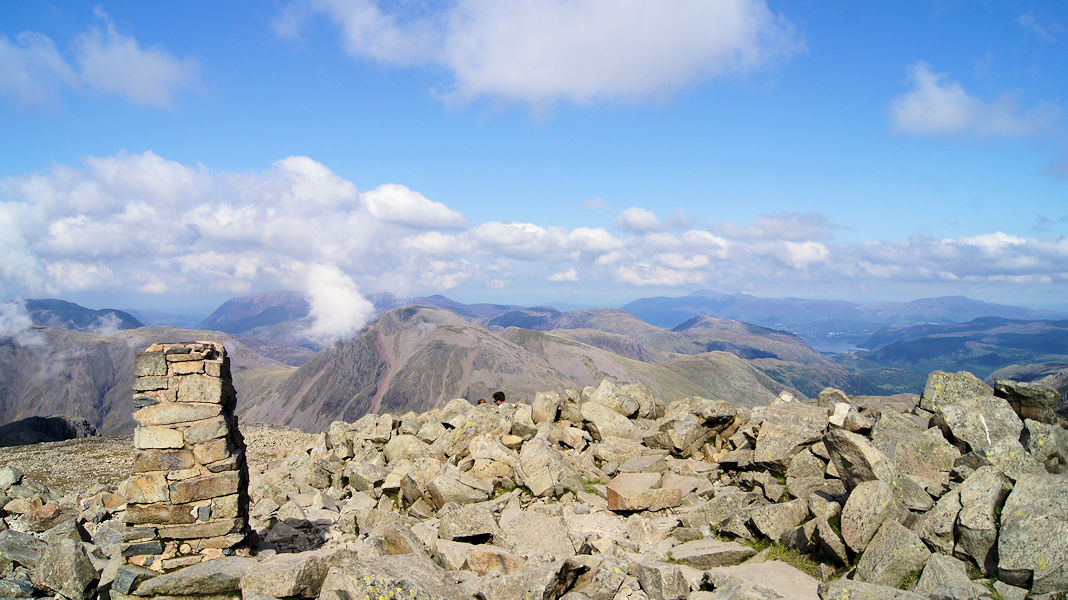
The Walk: There are a number of ways to get to the summit of Cumberland which is also the highest point in England. The shortest and most direct route is from Wasdale Head which is followed by all those doing the National Three Peaks Challenge but as a compliment to Scafell Pike I prefer this approach from Seathwaite Farm via Styhead Pass and the Corridor Route. It is my favourite way up the mountain and the route taken by most who climb the mountain. To shorten my route you could leave out the detour to Lingmell and the ways to and from Scafell. I would not though, I would follow this route exactly.
Note: Click here for the most direct route (.gpx file).
The Walk I Would Do: As I have described I would set off from Seathwaite Farm and walk my favourite route to Scafell Pike.
Information: There are a number of routes to access Scafell Pike, the most popular ones being from Borrowdale, Wasdale, Langdale and Eskdale. (See Wikipedia for details)


