County Tops of England: Gloucestershire
Cleeve Hill: 330 metres (Grid Ref: SO996245)
Google Maps Open Source Maps| Route Statistics and Files | ||
|---|---|---|
| Start: Cleeve Hill South Car Park | Grid Ref: SO994248 | Distance: 3.0 miles (4.7 km) |
| Climbing: 119 metres | Time: 1-2 hours | Rating: Easy |
| GPX Route File | Google Earth File | Map: OL45 The Cotswolds |
| Statistics | |
|---|---|
| Start: Cleeve Hill South Car Park | Grid Ref: SO994248 |
| Distance: 3.0 miles (4.7 km) | Time: 1-2 hours |
| Climbing: 119 metres | Rating: Easy |
| GPX Route File | Google Earth File |
| Map: OL45 The Cotswolds |
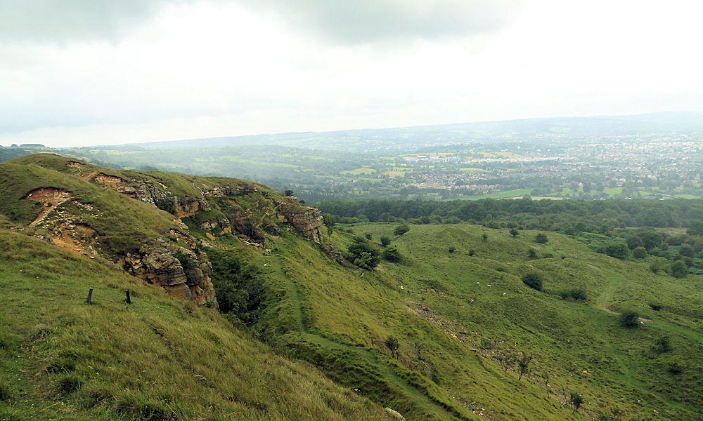
The Walk: You could make the walk from the start to the county top of Gloucestershire almost as simple as they come by walking 400 metres south-east on the fence line to the trig pillar and then after claiming your goal walk back. Try not to though. If it is pouring down and if there is no visibility then fair enough; I would probably do the same. But if conditions are fairly reasonable and you can see into the distance then a tour of Cleeve Hill is recommended. Not only is the view to nearby Cheltenham a great one but those beyond stretching as far as the Severn Estuary and to the Black Mountains of Wales are superb. My designed route takes you from the car park straight to the trig pillar and from there on a course north-west across the Cleeve Common to a second trig pillar on Cleeve Hill which presents a stunning view north-west over Woodmancote and Bishop's Cleeve to Tewkesbury and beyond to the Shropshire Hills. From the north-most trig pillar follow paths running on the west edge of Cleeve Hill to Cleeve Cloud and a disused quarry which was once home to an ancient fort. Then walk back to the start have enjoyed the best of Cleeve Hill while collecting a county top.
The Walk I Would Do: This one, or a slight variation of my Cleeve Hill and Cleeve Common walk to include the county top.
Information: Cleeve Hill (also known as Cleeve Cloud) is the highest point both of the Cotswolds hill range and in the county of Gloucestershire, at 1,083 feet (330 m). It commands a clear view to the west, over Cheltenham and the racecourse, over the River Severn and into Wales; and to the north over Winchcombe. It is a conspicuous outcrop on the edge of the limestone escarpment, (sometimes called the "Cotswold Edge"). It is crossed by the Cotswold Way footpath. With the hill's south slopes draining to the River Coln, Cleeve Hill is the highest point in the drainage basin of the River Thames. (Source: Wikipedia)


