County Tops of England: Suffolk
Great Wood: 128 metres (Grid Ref: TL786558)
Google Maps Open Source Maps| Route Statistics and Files | ||
|---|---|---|
| Start: Roadside | Grid Ref: TL787558 | Distance: N/A |
| Climbing: N/A | Time: N/A | Rating: Easy |
| GPX Route File | Google Earth File | Map: 211 Bury St Edmunds and Stowmarket |
| Statistics | |
|---|---|
| Start: Roadside | Grid Ref: TL787558 |
| Distance: N/A | Time: N/A |
| Climbing: N/A | Rating: Easy |
| GPX Route File | Google Earth File |
| Map: 211 Bury St Edmunds and Stowmarket |
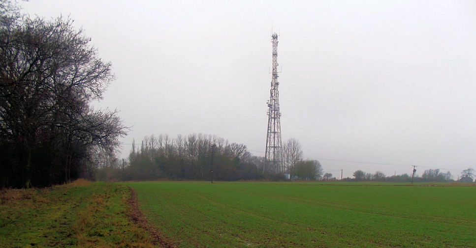
The Walk: There is no walk here. Just find a convenient place to stop near the transmission mast and step onto the highest ground in Suffolk. Pace around a little and leave.
The Walk I Would Do: No disrespect to Suffolk but I would not do a walk here. I would step onto the highest point in Suffolk and then I would step off and head for the Suffolk coast. I would find a good walk along the coastline which included walking through some nice villages.
Information: Suffolk is an East Anglian county of historic origin in England. It has borders with Norfolk to the north, Cambridgeshire to the west and Essex to the south. The North Sea lies to the east. The county town is Ipswich; other important towns include Lowestoft, Bury St Edmunds, Newmarket and Felixstowe, one of the largest container ports in Europe. The county is low-lying with very few hills, and is largely arable land with the wetlands of the Broads in the north. The Suffolk Coast and Heaths are an Area of Outstanding Natural Beauty. (Source: Wikipedia)


