Ashby Folville, Thorpe Satchville, Twyford and Midshires Way
The Leicestershire Round and Hunting Country - Gently rolling countryside once ridden by Royalty and the upper classes to eradicate the pesky Fox. They failed, the fox still roams, but they left behind a pleasant area for walking.
(Note: This walk is kindly contributed by Ken Brockway)
Google Maps
Open Source Maps
| Statistics and Files | ||
|---|---|---|
| Start: Ashby Folville | Distance: 6.8 miles (10.9 km) | Climbing: 141 metres |
| Grid Ref: SK706121 | Time: 3 hours | Rating: Moderate |
| GPX Route File | Google Earth File | About Ashby Folville |
| Statistics | |
|---|---|
| Start: Ashby Folville | Distance: 6.8 miles (10.9 km) |
| Grid Ref: SK706121 | Time: 3 hours |
| Climbing: 141 metres | Rating: Moderate |
| GPX Route File | Google Earth File |
Ordnance Survey Explorer Map (1:25,000)
The Walk:
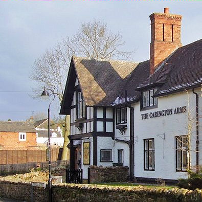 The Carington Arms in Ashby Folville
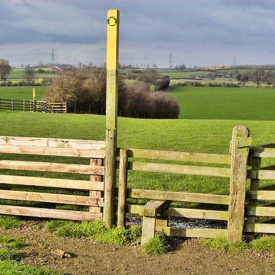 Galloping fields
The forecast was for a glorious sunny day with a little rider that snow clouds formed over Finland would deposit up to 50mm around the Wash. As I travelled to Ashby Folville the black sky behind me suggested the clouds were keen to dump the snow before they arrived at the Wash. I was lucky, the black clouds passed but the sun remained hidden for part of the walk.
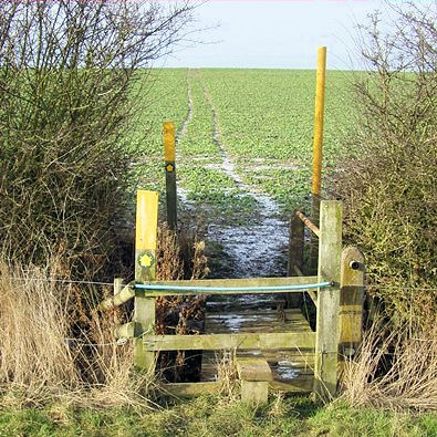
We start up the lane by The Carington Arms a name that gives a clue to the landowner here. The Leicestershire Round is a circular walk of one hundred miles around the county and we use a section of it here to reach Thorpe Satchville across some pleasant fields of grass. There are bridlegates and jumps in the hedges that are specifically provided to allow access for the followers of the Hunt.
There are some huge fields here, all pasture, where I could, should I be able to stay on a horse, gallop wildly into the distance. Some lovely wide open spaces but not wild, it's all well managed and looks fresh and green in today's winter sunshine.
 Midland and Great Northern Joint Line
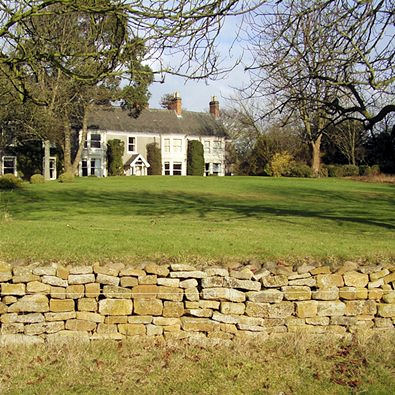 Approaching Thorpe Satchville
We pass under an old railway bridge, some of the bricks look ready to fall so take care. Although built primarily to carry coal and ironstone this joint line through High Leicestershire provided convenient transport for households and horses moving from town to country for the hunting.
From 1700 onwards Melton Mowbray became a centre of the hunting season and the surrounding villages had their own lodges which were owned or rented by those wanting to be part of the hunting set.
A path is not shown through the churchyard but a stile provides access, then into Church Lane. Church Walk looks inviting but I opt for the main street where on the corner the former chapel now accommodates Thorpesatchville (sic) Garage.
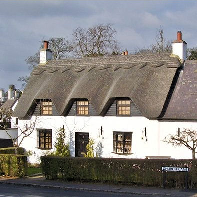 Thatched cottage Thorpe Satchville
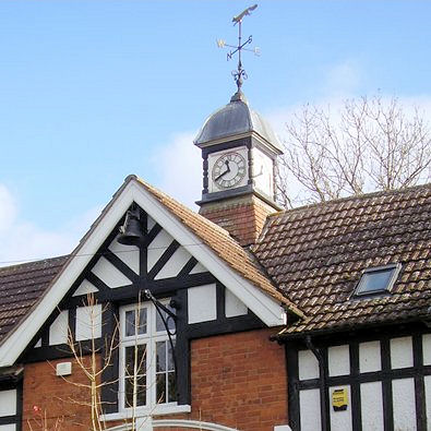 Former Hunt stables Thorpe Satchville
The last time I stepped inside The Fox Inn in Thorpe Satchville it was a ramblers dream because the wall was covered with abutting sheets of the 1:50,000 Ordnance Survey maps. Today The Fox, built in the style of a 1920 town pub, offers a French theme to the extent that the barmaid will happily converse in French should the clientele feel more comfortable with this. An eccentricity in this typical village or a welcome alternative eating experience?
Our walk leaves the village passing a former stable block, now converted to homes opposite a large house in the same style. Take a right into Gated Road, yes that's the road name as well as correctly warning drivers that they will have a broken journey to open and close gates blocking their free passage.
 Winter colours
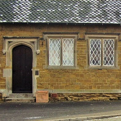 Twyford Old School
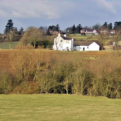
We soon enter another field of grass which allows our eyes to wander and take in the far ranging views over that galloping countryside. If you feel tired and brave you could take the road to Twyford but I would recommend the field path route if only for a view breaking the horizon as we climb to the return point. This gorse covered hill is Leicestershire's well preserved Iron Age Hill Fort, Burrough Hill. On the way you will note that we strayed from the Definitive line of the bridleway because there was no trace of a track into the crop so I stayed on the headland.
This is another quiet spot, disturbed only by the lazy creak and click of a wind powered bird scarer. Considering this is winter the colours are great today. The grass is fresh green, newly cultivated soil shades of brown and some of the trees have a yellow glow all set against the blues of the sky, wonderful. On the return it may also be easier to stay on the headland then turn right to find stiles and a stream crossing, which take us back into pasture and a stunning field of deep dramatic ridge and furrow. It sets the historical imagination running. Would the men who had their arable fields taken from them still recognise the humps and hollows they had created? This field has perhaps remained uncultivated since the enclosures over two hundred years ago.
Passing through sleepy Twyford I spot the old school's decorative roof tiles and diamond cast iron window frames. The Saddle Inn reminds us we are in hunting country and then I nearly missed the old inscribed stone on the village hall 'Oddfellows Hall 1908' next door to the Wesleyan Chapel of 1845. So much left to discover but I must press on.
 Leicestershire waymarkers
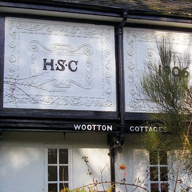 Wootton Cottages 1906
Most of the fields back to Ashby are again pasture making the going easy. Twyford Lodge appears to be having a major makeover or perhaps rebuild would be a better description but has work ground to a halt? As often happens the final field is ploughed so boots get a build up of mud. There is also another hazard, we need to locate a cross path in the centre of the field and turn right and there is no marker. On the day of my visit this being the Midshires Way, a route for horse riders, it has been well used and hence is easy to locate but muddy to follow. Make good use of the grass verge on the final stretch before joining Folville Road.
The big house is set well away from public view but we can get a glimpse of it and it's manicured lawns from this path. The village was clearly provided by the Estate but the rebuilt Carrington Cottages of 1981 have no visual appeal. There have been a few out of character buildings on this walk, The Fox and a thatched cottage at Thorpe Satchville and here we find pargetting from East Anglia on the Wootton Cottages of 1906. This fancy plaster work had been revived throughout the country in the last decades of the 19th century with an interest in 'arts and crafts' skills.
So ends an easy stroll through pleasant gently rolling countryside once the playground of Royalty and high society. They shaped the villages and countryside to improve their sport providing interest to our walk.


