Church Stretton to Shrewsbury
The walk which complements part of the Shropshire Way and is also part of 'The Great English Walk' devised by Margaret and Brian Nightingale. Starting in the market town of Church Stretton the walk immediately climbs from the town to Caer Caradoc Hill with its ancient hillfort before descending to the low ground at Comley which abruptly heralds another stiff climb of The Lawley. The walk then hits the level and remains so at around 100m height for the duration which includes visits to many superb middle England villages including Longnor, Dorrington, Stapleton and Chatford. After Chatford a slight bump which is Lyth Hill, home of Lyth Hill Country Park is climbed before the final stretch from rural to urban at Bayston Hill and then the final fields of the walk are crossed to Meole Brace and the town of Shrewsbury where a celebration drink is well deserved.
(Note: This walk is kindly contributed by Ken Brockway)
Google Maps
Open Source Maps
| Statistics and Files | ||
|---|---|---|
| Start: Church Stretton | Distance: 18 miles (29.0 km) | Climbing: 695 metres |
| Grid Ref: SO436936 | Time: 8-9 hours | Rating: Strenuous |
| GPX Route File | Google Earth File | About Church Stretton |
| Statistics | |
|---|---|
| Start: Church Stretton | Distance: 18 miles (29.0 km) |
| Grid Ref: SO436936 | Time: 8-9 hours |
| Climbing: 695 metres | Rating: Strenuous |
| GPX Route File | Google Earth File |
Ordnance Survey Explorer Map (1:25,000)
The Walk: I have not met many, if any, walker who would extol the virtues of a linear walk which returns along the same track. We usually try to create a circular route but this has limitations on the ground covered so a linear walk without the need to backtrack is rather appealing. This walk of 18 miles uses the train to return to your start point, Church Stretton station where there is adequate free on street parking. The walk departs the town from Sandford Road into Essex Road before crossing the railway then A49. Cwms Lane starts the walk up the Cwms valley before the steep climb first on a definitive, then permissive path to the ridge of Caer Carodoc at Three Fingers Rock.
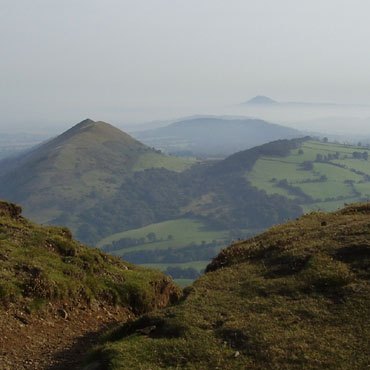 The Lawley and The Wrekin from Caer Carodoc fort
 From The Lawley looking north
This was my second visit to Caer Carodoc, the first having been in driving cold drizzle, today the mist lay passively below in the valleys. Having made an early start at 9.30am I sat on the summit having a sandwich looking east into the mist filled valleys where the hills appeared like islands from the sea, magical. While weather conditions can make each visit different my anticipation today was a first walk along The Lawley and here I was not disappointed. At the summit (377M) the base of the trig point can still be seen alongside the bird topped pole. From the top the onward journey to Shrewsbury looks flat and uninteresting but heights can harm perspective as I would find out later. For a good mile my path along the narrow ridge offered glorious views to left and right as I gently descended to the road and a small car park.
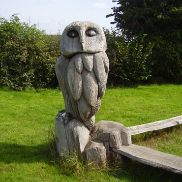 Owl at Dorrington
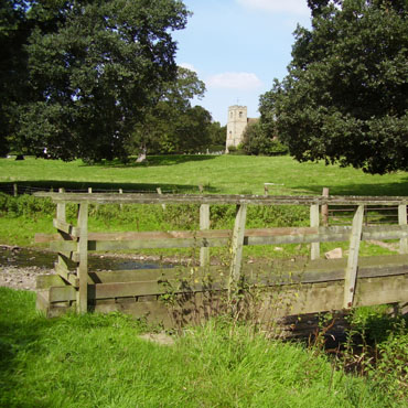 Footbridge at Stapleton
Just south of Dorrington the farmer should have charged me to walk through the fields. It was a 'Maze of Maize', a crop which in limited quantity can be fun to walk through. I entered the village around noon and was pleased to find a well stocked shop. Lunch was then taken on the handy picnic bench in the park with its owl sculpture adjacent the splendid new village hall. After Chatford another surprise, caused by my disregard of contour line and a climb to Lyth Hill Country Park, a popular spot where my route met another section of the Shropshire Way.
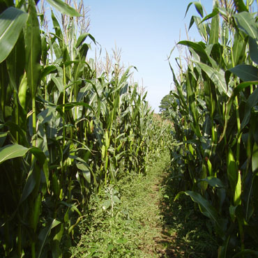 The Maize Maze
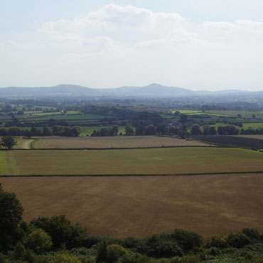 The Lawley and Caer Carodoc from Lyth Hill
Suddenly there are lots of folk but why does every walker have one or more dogs either in tow or more usually chasing uncontrolled in every direction. The view back to The Lawley and Caer Carodoc warrants a short break but I’m short of water so I press on in search of a tap. Entering Bayston Hill I anticipate an end to the countryside and foresee a long urban approach to Shrewsbury but I am pleasantly surprised by the route as it keeps to narrow green spaces before entering the town by the imposing river crossing of Kingsland Bridge.
 Rower on the River Severn from Kingsland Bridge
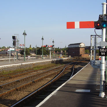
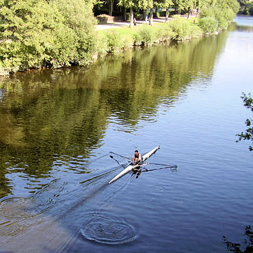 Shrewsbury Railway Station
With time to spare before the train back to Church Stretton I had a wander around the town, avoiding the shopping streets. Shrewsbury is enclosed by a meander of the river Severn over half a mile wide and about the same in length, with the Welsh and English bridges providing the main access. The castle, gaol and station are pressed into the narrow pinch point and would all disappear if the river were able to break through and create an oxbow. The perimeter road on the river side stands high and offers good views over the tree lined riverside path, this green space provides excellent recreational space close to the town centre. The streets are narrow and lined with interesting buildings including the Coach & Horses on Swan Hill where a good range of beer from micro breweries was on offer, sadly railway time governed my stay so there was time for just the one pint.
This walk is part of 'The Great English Walk' devised by Margaret and Brian Nightingale. It starts just in Wales at Chepstow and wanders through the English shires taking in some of the best countryside on offer along a route to the Scottish border town of Berwick upon Tweed.


