Sheffield Country Walk
The Sheffield Country Walk is a long distance footpath which takes a varied route around the outskirts of the city and on its course passes many sites and buildings of archaeological, historical and industrial interest. It follows woodland and riverside paths, crossing undulating farmland and the open gritstone moorlands to the west of the city. Stephen Tozer-Loft spent three days of early 2019 on the long distance footpath. This is his story.
Google Maps Open Source Maps| Statistics and Files | ||
|---|---|---|
| Start: Chequers Inn, Coal Aston | Distance: 53 miles (85 km) | Climbing: 1,720 metres |
| Grid Ref: SK 36120 79598 | Time: 21 hours | Rating: Strenuous |
| GPX Route File | Google Earth File | About the walk |
| Statistics | |
|---|---|
| Start: Chequers Inn, Coal Aston | Distance: 53 miles (85 km) |
| Climbing: 1,720 metres | Grid Ref: SK 36120 79598 |
| Time: 21 hours | Rating: Strenuous |
| GPX Route File | Google Earth File |
Ordnance Survey Explorer Map (1:25,000)
OL24 The Peak District - White Peak Area
269 Chesterfield and Alfreton
278 Sheffield, Barnsley and Rotherham
The Walk:
 Sheffield Round Walk sign at Eckington
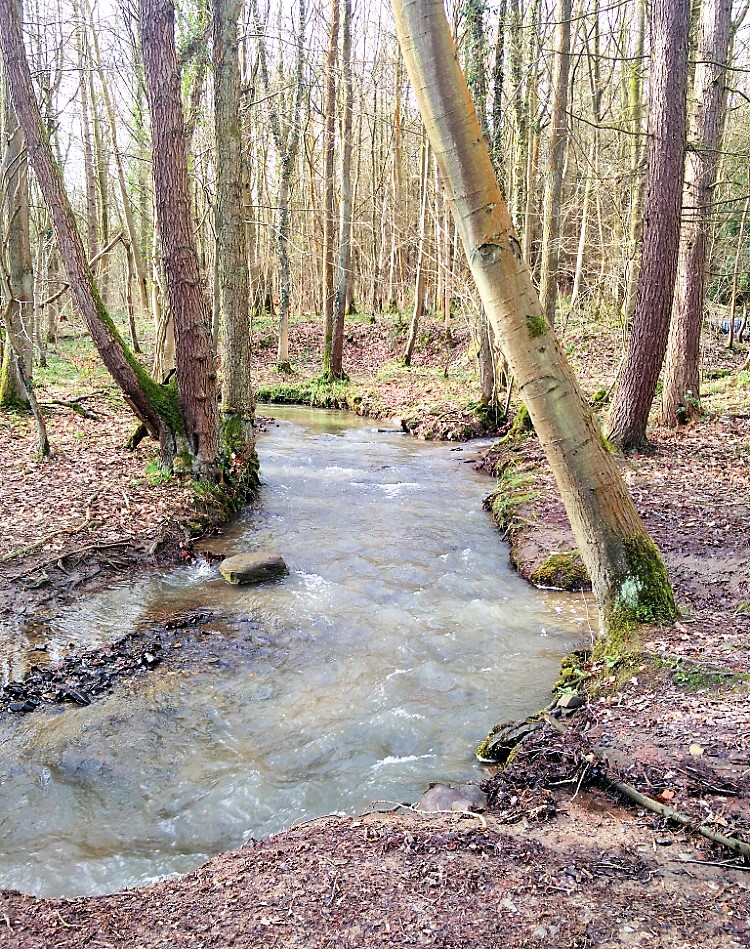 Totley Brook
Day One
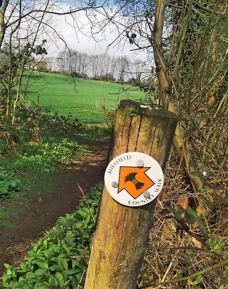
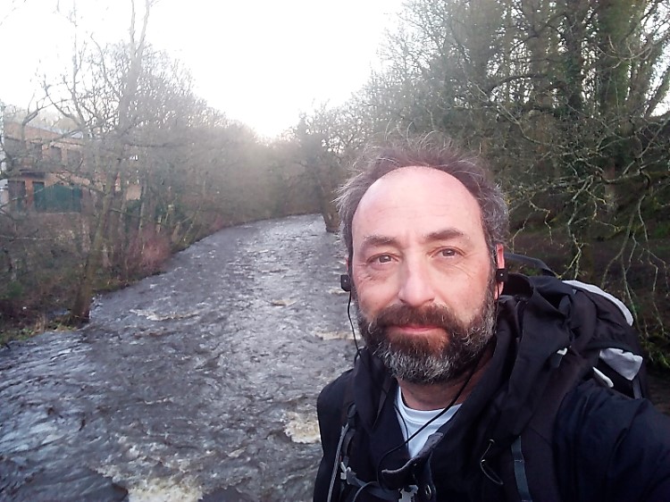
I had occasionally come across the signs featuring a yellow wheatsheaf and more often had noticed the label "Sheffield Country Walk" on Ordnance Survey maps around my Sheffield home. So when the opportunity arose to spend a few days doing my own thing I thought of the Sheffield Country Walk, a 53 mile orbital walk centred on my home city. The official starting point is Eckington and my initial research hinted at an anti-clockwise circumnavigation, but the excellent guidebook published by Sheffield City Council clearly proposed clockwise and, in fact, the signs are all in the clockwise direction, making the Widdershins walk a distinct challenge. The guidebook divides the route into ten sections of between 3.75 miles (6km) and 8.25 miles (13.3km) each, but, as a man in a hurry with only two days free, I needed to cover multiple sections each day. A bus from central Sheffield took me to the Chequers Inn at Coal Aston from which Section Two started and I was walking by 8.00am. It was the second week of March and Storm Gareth was in its pomp; the fierce wind in my face for the first quadrant of the walk. Winding footpaths from the pub car park led me out of the village into hilly agricultural land, under the Chesterfield bypass, grazing the edge of Dronfield Woodhouse and through ancient woodlands up to Totley which, these days, is at the south-west tip of Sheffield City and South Yorkshire.
 View to Sheffield from Totley Moss
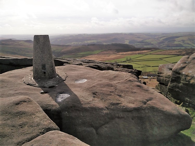 Trig point at Stanage Edge
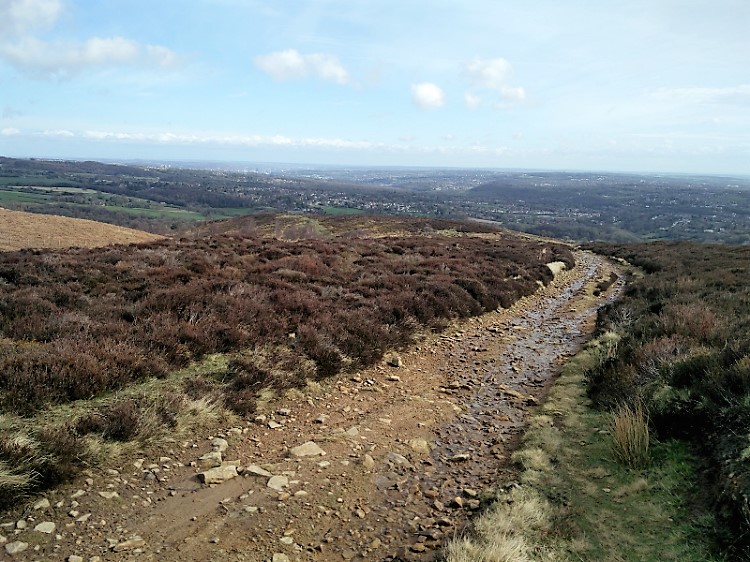
A crossing of the Totley Brook marked the first encounter with Sheffield’s five rivers – the Totley Brook joins the Sheaf from which the city takes its name and the Country Walk signage takes its emblem. This river formed part of the boundary between the ancient kingdoms of Mercia and Northumbria. Although the name Sheffield Country Walk is apt, evidence of industrial workings bestrews the whole route, a reminder that ways of scraping a living from the environment have always shaped the landscape. The climb from Totley, very steep in places, passes spoil heaps and ventilation shafts for the Totley tunnel, previously an area used for lead smelting. The Totley tunnel is still the longest onland railway tunnel in use in the UK (not counting London underground tunnels) and carries the scenic Hope Valley line to Manchester. On a different walk up past the second ventilation shaft in this direction I made my 13-year-old son calculate the height of the shaft from an estimate of the volume of the spoil heap which surrounds the shaft head – it seemed to give an accurate answer although there are rumours online that this shaft breaks into a large cavern which should invalidate the maths. Today I turned north before reaching the second shaft, and entered the proper Dark Peak, where millstone grit edges attract climbers from far and wide (on less windy days at least). A squally shower had me stopping to don waterproofs which weren't actually needed for the remainder of Day One, although they usefully kept the mud out. After the Fox House pub, the path skirts a corner of the National Trust estate at Longshaw and the long arc of Burbage Edge drew me past the distinctive citadels of Carl Wark and Higger Tor, climbing to the south westerly end of Stanage Edge. This is the highest point of the whole walk (trig point at 1,499 feet or 457m) from which a panorama, centred on the flat top of Kinder Scout is revealed
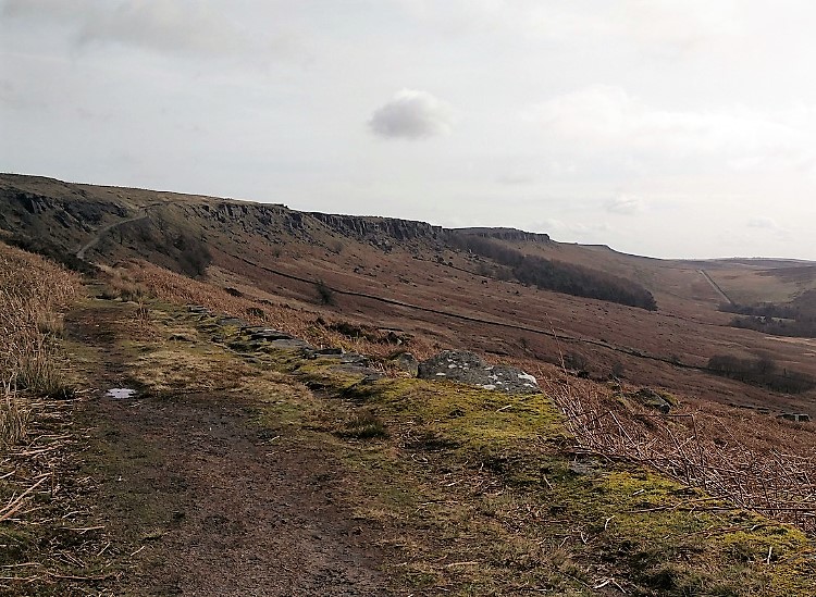 Stanage Edge
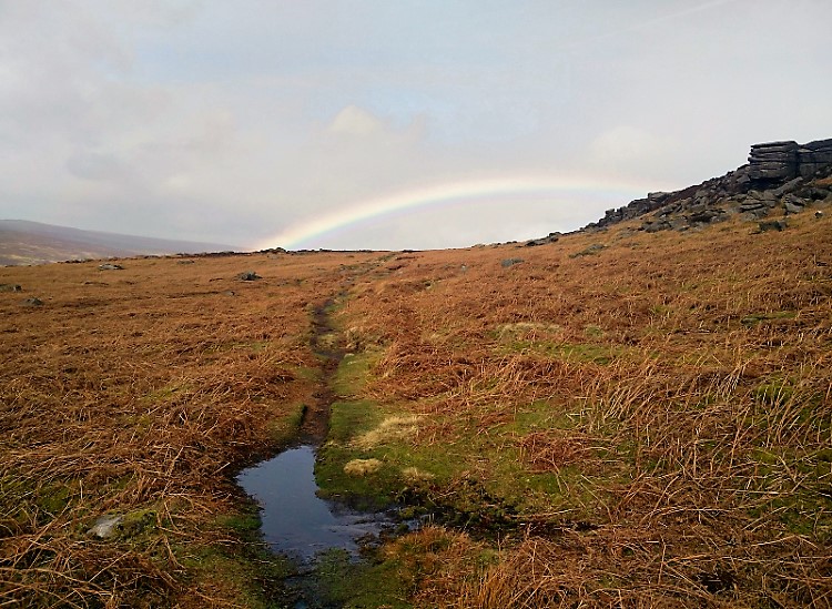 Rainbow at Moscar
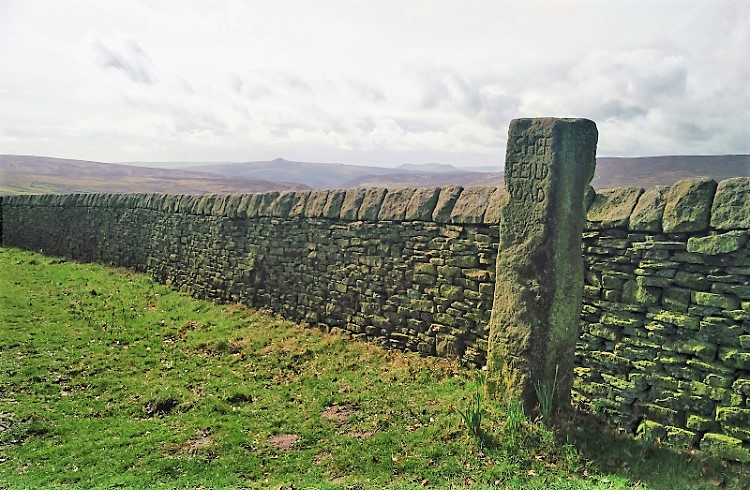
The wind was at its gusty worst, making a vertical attitude a status not to be taken for granted. At least it was generally blowing on to the edge from the west, but forward motion was hard work, and rapid progress felt all but impossible. Hats off to the few, lone fell-runners who tripped along the edge with a cheery greeting. Eventually the track works down Stanage Edge, exposing rear views of its jumbled buttresses, which had been obscured from the top, and on across peaty moorland, between abandoned millstones, to a crossing of the A57 Snake Pass at Moscar – the end of Section Three. Boggy puddles teemed with frogspawn and some protective parent frogs. The landscape reverted to pastureland with some arable, and I sheltered gratefully in the lee of a strong stone wall by a ’guide stoop’ or standing stone known as Moscar Cross, as the tumult roared across the bare southern Pennines from the Ladybower reservoir to the West. Over easier farmland and stiles, the path weaves through a mini-jungle of rhododendron bushes, almost through the front garden of Sugworth Hall, then out onto a sheep-sprinkled plateau where Boot’s Folly draws the eye to its ornamental turret. Soon I was looking down into Dale Dyke Dam. Seeing the wind frothing spray over the dam wall made me hope that lessons were properly learned when the predecessor of this dam burst in 1864, sending a wall of water the length of the Loxley valley, devastating parts of central Sheffield, eight miles way, and killing more than 240 people – the largest loss of life of any mainland civilian disaster in the Victorian era. Along the valley, and across the Loxley (River four out of five – we don't see number two, the Porter, or number three, the Rivelin, both of which rise on the Sheffield side of Stanage Edge) to Low Bradfield village then up the hill to High Bradfield where I allowed myself a half hour break and a locally brewed pint in the Old Horns Inn. On the edge of Bradfield was a sign marking ‘Côte de Bradfield’, a category four climb when the Tour de France came to Yorkshire in 2014.
 Moscar Cross with Win Hill in the background
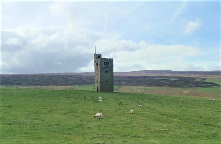 Boot's Folly in Bradfield Dale
The wind continued to buffet, but now I was before the wind as I followed the path over many stiles and fields and down into Worrall. The Country Walk seems to do a slightly unnecessary detour around the village, perhaps because the next stretch is beside the busy Worrall Road (the longest part of the walk beside anything like a major road) before dropping down to Middlewood at the bottom of the Don Valley. The Don (River five out of five) is the largest of Sheffield’s main rivers. The Rocher Footbridge is the only crossing of the Don in a 4km stretch of river, so the short northerly detour required to cross it is good value. The path away from the river follows fences around recycling plants and factories, entering the larger scale industrial areas which lined the Don Valley, juxtaposed with scrubby woodland and stonewalled fields, then climbs to Birley Edge. The light had faded at this point on my walk, and I knew I was going to be later at my lodgings than I had promised, so I missed the Birley stone, Cote de Oughtibridge, and probably a lot of other views and points of interest. The now-familiar yellow on white sheafs which mark the Sheffield Country Walk were especially precious to me then, and the full moon made my headtorch almost redundant as I picked out the path, climbing gently through areas of woodland, and eventually down through Greno Wood, to cross the A61 Penistone Road at Woodseats. A hamlet and a field further on, my headtorch reflected back from the eyes of a field full of interested-looking cattle, with calves, which I had to cross, but they satisfied themselves with watching my progress between them into another small wood. Day One finished for me at a very comfortable Airbnb cottage in Chapeltown, a suburb to the north of Sheffield with a villagey ambience and a decent range of shops, pubs and takeaways for refreshing the weary walker. There is a good train service, and the M1 is easily reached, making it a good (unofficial) trailhead. Twelve hours to cover nearly 50km of walking and shelter from the interminable Storm Gareth meant a good night's sleep was assured.
 Crossing the River Don at Rocher Bridge
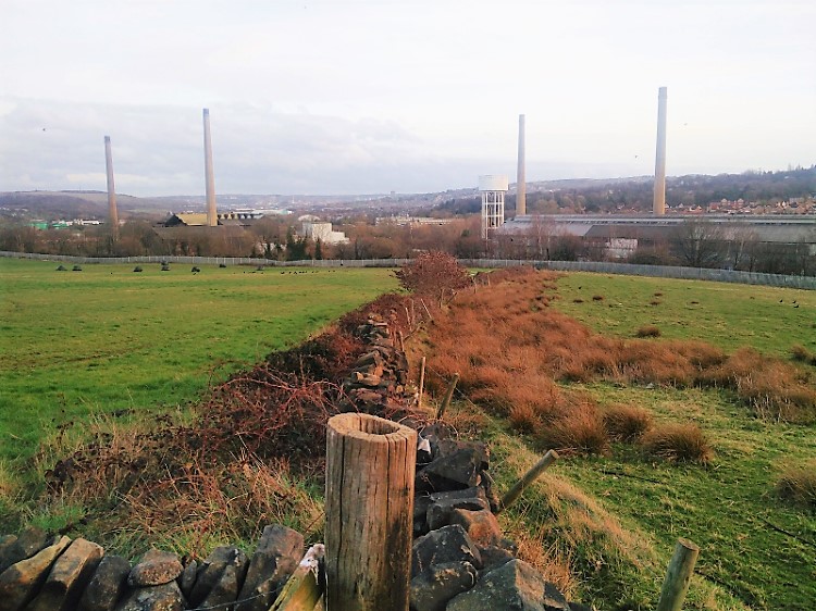 Don Valley Industry
Day Two
The wind had dropped as I retraced my Chapeltown steps towards the most northerly point of the Sheffield Country Walk to start the second day, but the rain had set in and continued to come and go throughout the day. I found out later that flood warnings were in place for parts of the Don I’d crossed the night before.
The route follows a lovely wooded track marked as Windmill Hill Lane down the valley of the Ecclesfield Brook, then over a sports field and away from the roads again, into an industrial area.
From Ecclesfield, a level pedestrian crossing over the Barnsley line, and a straggly wood around some more factories and depots led to a footbridge over the little-known Blackburn Brook. This doesn’t count as one of the big five rivers, feeding the Don near Meadowhall, but its waters caused some of the most significant damage during the major flood event which Sheffield suffered in 2007.
I took some time to find my way at this point where several established footpaths converge with a few more recent recreational routes. Eventually I found the obscured yellow sheaf and set off over muddy fields with the rumble of the M1 getting louder.
Over a few stiles the path joins with the Trans-Pennine Trail, parallel and close to the M1, the railway, and the Blackburn Brook, which I crossed on a footbridge before entering a long strip of woodland below Concord Park. Out of the woods, and with junction 34 looming, I rejoined the TPT along an old railway line into Meadowhall Interchange.
This is the least ‘country’ part of the Sheffield Country Walk, so I tarried just long enough for a machine coffee from the Interchange waiting room, then set off to do battle with the traffic, crossing the Don for a second time, en route to the peaceful towpath of the Sheffield and Tinsley Canal. Other variations of the Sheffield Country Walk spend more time along the Don, and none on the canal.
Just to add excitement to the day, my phone (carefully charged overnight) decided to turn off. I wasn’t dependent on the phone for navigation so didn’t see this as a particular problem until later. No photographic record exists, though, of the rest of Day Two.
My path crossed and left the canal behind, after a mile or so, and soon passed a group of Muslim graves in Tinsley Park Cemetery, oriented such that the inscriptions could be read from the path. Many graves were for those who came from afar, especially from Yemen since the 1950s, to work in the steelworks and other factories which surrounded Tinsley. A climb up a surprisingly grassy hill opened a up a new vista over the former Sheffield Airport site to an amazing array of high-tech buildings, many connected with the nearby Advanced Manufacturing Park which has risen from the ashes of old mining sites, and demonstrating how Sheffield continues to reinvent itself, as old industries decline.
The dual carriageway which connects the M1 to central Sheffield, known as the Parkway was making its presence felt at this point, and the path has a subway beneath it and beside another major road before encountering the River Rother which dominates the south-eastern quadrant of the walk. The site of the Orgreave Colliery, the famous scene of some of the most violent clashes between police and striking Miners in the early 1980s, showed signs of transformation as plans for new housing, commercial and environmental projects begin to take shape. Some of the substantial lakes in this area were formed by flooding in subsided old mineworks which have then been left for the birds and fish to enjoy.
The path tracks the Rother briefly then through an expanse of marshy rushes, into the village of Treeton with its prominent church. South of Treeton I must have missed a ‘sheaf’ and detoured briefly before joining the path beside Treeton Dyke, a lake around 1km long.
Beyond the Dyke, after a quick sprint along a major road, the path is reunited with the Rother along a large expanse of flood plain, mostly given over to a nature reserve. However - on that day there seemed to be too much rain even for the wildfowl, but I was grateful for the flatness of the terrain as I trudged beneath a viaduct carrying the Sheffield-Worksop line. Here, on the edge of Beighton, I made a mistake and instead of entering an area of woodland, I found myself in a scrubby set of fields, fearing that I was on the wrong side of another railway (this time the Chesterfield line) and the Rother. A family out walking reassured me that I could get through and I soon found a very substantial green bridge emerging from a scrap yard for presumably rare pedestrians to cross the tracks into Rother Valley Country Park. At this point of my walk, getting up a score of steps to cross the bridge felt like very hard work.
Rother Valley at the end of this wet Saturday afternoon in March was almost empty, but in warmer seasons the place is buzzing with recreational activity – barbecues, cycling, angling, a miniature railway, and all kinds of watersports including a sailing club and an excellent wakeboarding centre. Today it was just me and the geese.
After the 4km length of the park, at Killamarsh, the route follows an unused part of the Chesterfield Canal. There are plans to try to join up the working part of this canal to the River Don Navigation near Rotherham, and thence to the Humber.
Passing over part of the old Great Central Line, now occupied by part of the Trans-Pennine Trail, our route is soon reunited with the Rother, which I followed along its floody plain for another couple of kilometres, to finally arrive at Eckington.
The church at Eckington is the official start and end of the Sheffield Country Walk, but I had started at Section Two, so I still had a 10km stretch to get to Coal Aston, by headtorch through unfamiliar countryside, probably requiring a taxi home when I got there after the last bus, if not an ambulance. The light had gone, I was tired, hungry, cold, and wet, and the guidebook was getting soggy. I made a massive navigational mistake trying to get out of Eckington - most importantly, my wife was expecting me home in half an hour, and my phone had failed – we had joked about helicopters. So, when I came across a bus station with imminent buses to Sheffield centre, discretion trumped valour, and with 35km under my belt on Day Two, I put off Section One until ‘Day Three’ and climbed slowly onto a bus.
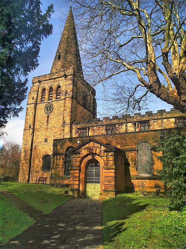 Eckington Church
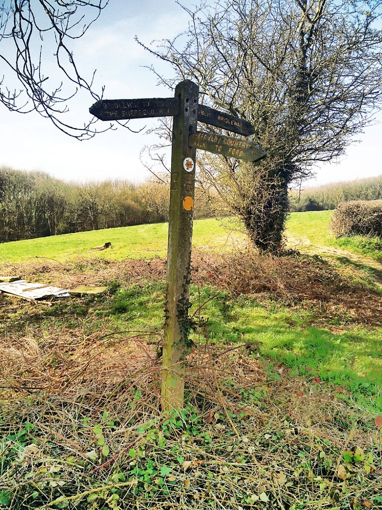 Waypost between Ford and Troway
Day Three
Two weeks later, blisters healed, I persuaded my brother and Dad to drop me off at Eckington church to complete my circuit, and the conditions could not have been more different to the first two days - a classic spring morning, warm and calm, birds singing, with nature popping into bud all around.
This stretch of the Sheffield Country Walk is easy to follow along wide paths, well sign-posted and gentle underfoot. The river Moss has created something of a hidden valley, being only just outside Sheffield, but untrammelled by major roads. The Moss is a tributary of our old friend the Rother, and sets the industrial scene for the whole walk, having been dammed to provide power for mills, surrounded by mining activity, and was well known as a centre of scythe and sickle production.
The first half of this section of the route follows the Moss closely, crossing and re-crossing it several times until it arrives at the hamlet of Ford, where I stopped to eat and drink at ‘The Bridge’ pub. Walkers should have a very good excuse for not following my example.
West of Ford, the path goes past more fishing lakes then up the southern side of the valley to Troway. The guidebook gives walkers a choice of route, but I would take their second alternative, and climb the clear bridleway, rather than the poorly signed farmland path over stiles, to the village. There is another pub here, and a farmyard tea shop – again, think hard about why you wouldn’t stop.
Views across the valley towards Sheffield open up as quiet lanes lead into a larger area of woodland, which is crisscrossed by many paths, making the precise route a little tricky to follow, but soon I was crossing open fields, back into Coal Aston and completing the circuit at the Chequers pub.
Overview
Each time I leave Sheffield's boundaries now, I shall look for the place where my radial route crosses the circumference I have walked. The Sheffield Country Walk covers an extraordinary spectrum of landscapes, but themes emerge – the ongoing significance of water, the vanishing importance of coal, and a centuries-old cycle of innovation, industry, decline or disaster, and regeneration. Completing this circuit provided an un-paralleled overview of a city I thought I knew, demonstrating its scale, and a sense of just how much more there is to explore. When we think of a city, I suppose we tend to picture the features of its city centre, but perhaps we learn more about the character of a place when we study its periphery: where the dominant connections are to the world beyond; where history and geography are still visible; where concrete and tarmac have yet to reach.
Practicalities
In summer with plenty of daylight, decent weather, good levels of stamina, and some planning, completing the circuit in two days would not be an unreasonable undertaking. Starting at Eckington makes sense because the bus connections are good, and most of the height gain is on Day One, but starting at Totley (which has a railway station) is attractive too, and would make the distance to Chapeltown accommodation less daunting. The booklet published by Sheffield City Council (2016 edition) is highly recommended whatever approach is being planned, and includes return routes for each of the ten sections.
See my original photographs here.
Stephen Tozer-Loft


