Tryfan, Glyder Fach and Glyder Fawr
This was my second walk on Tryfan, the first one some years earlier had been to Bwlch Tryfan and then along the Heather Terrace therefore missing out the top crest. This time I was aiming for as many high points as possible so the summit points of Tryfan, Glyder Fach and Glyder Fawr were all plotted into this 7.2 mile spectacular.
Google Maps Open Source Maps| Statistics and Files | ||
|---|---|---|
| Start: Llyn Ogwen | Distance: 7.2 miles (11.6 km) | Climbing: 1,140 metres |
| Grid Ref: SK150757 | Time: 6-7 hours | Rating: Technical |
| GPX Route File | Google Earth File | About Glyderau |
| Statistics | |
|---|---|
| Start: Llyn Ogwen | Distance: 7.2 miles (11.6 km) |
| Grid Ref: SK150757 | Time: 6-7 hours |
| Climbing: 1,140 metres | Rating: Technical |
| GPX Route File | Google Earth File |
Ordnance Survey Explorer Map (1:25,000)
Note: I have allowed six to seven hours for a walk of just over seven miles as this is no ordinary walk. Much of the ascending is done using hands as well as feet with scrambles necessary on both Tryfan and Glyder Fach, should you follow the course I took through gullies and around rock faces to reach each of their summits. Glyder Fawr was a more straightforward affair. Finally please note that while the route I chose is ideal for scramblers who like a quick exhilarating way up the mountains there are easier ways to the tops, via paths up scree slopes and on paths hewn through rock.The Walk: I was so excited when I awoke at my accommodation in Betws-Y-Coed and opened the curtains to see a full blue sky with not a cloud in sight. BBC Breakfast promised me the weather was set fair for the whole day so providing perfect conditions for my assault on Tryfan and the Glyders. I had been on Tryfan before, on a super short walk about 10 years earlier when I followed the Heather Terrace Path on the east side of the mountain rather than follow my pals over the top crest. This time I had no such thoughts, it was a climb to the top followed by climbs to the top Glyder Fach and Glyder Fawr, mountains new to me.
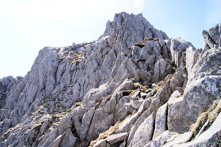
 Tryfan on a gorgeous Spring morning
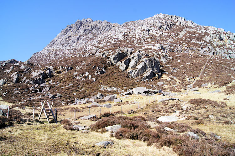 Heading across Tryfan Bach
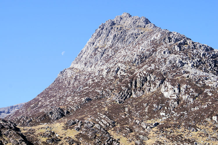
After parking up in the generous lay-by on the south side of Llyn Ogwen I walked east on the roadside to the east side of Tryfan near to Glan Dena. It was just after 9.00am when I left the roadside and followed the footpath leading south. As I approached the north east flank of Tryfan I looked up to the white crescent of the moon in the sky, it being in view half way up the mountain just above the clear line of the Heather Terrace. It was an evocative sight to start my day and I pressed on to Tryfan Bach by skirting around the east side of Creigiau'r Dena which forms the northern part of the mountain. Twenty minutes after my start I reached Tryfan Bach, only half a kilometer in the walk but reassuringly 300 metres further up Tryfan than from where I started.
 Ascending to cross the Heather Terrace
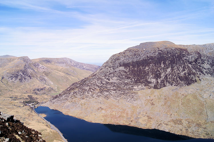 Looking back down to Llyn Ogwen from Heather Terrace
At 9.45am it was already quite hot and warming up by the minute as the sun rose high in the Springtime sky. I do not know how I did it, but after crossing a stile I followed a path up from Tryfan Bach which was not my intended one, my choice meandering a course south of where I should have been. Rather than backtrack to my intended path I chose to forge on and work my own way up Tryfan. I had been told there were 'hundreds of ways up' by walkers in Betws-Y-Coed the night before. Make that one more. First target was to reach the Heather Terrace which I did just as two walkers passed along it going from north to south. I continued straight up and across Heather Terrace. At regular intervals I took short breaks to relax from my haul up to the heights of Tryfan. In doing so I had time to enjoy the emerging views including the one back to Llyn Ogwen shown in the photograph above right.
 Weaving a path up through rock and heather
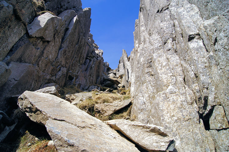 My gully route up to the heights of Tryfan
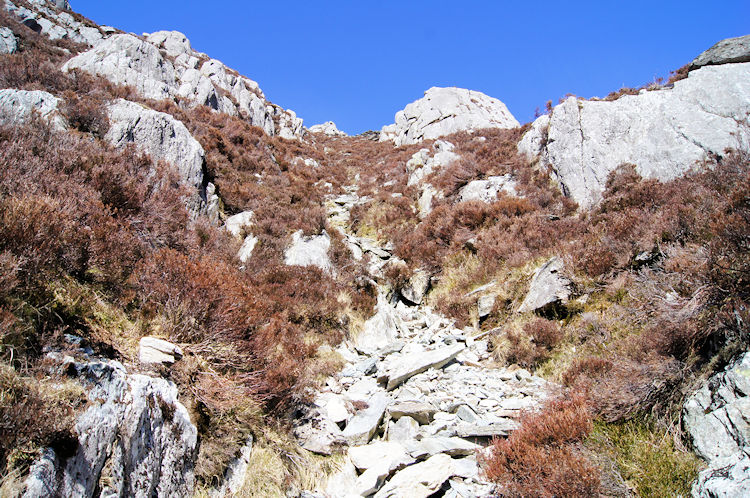
After crossing over the Heather Terrace Path the climbing became steeper but never difficult. I took time after each short burst up the mountain to determine my next course and then took steps accordingly. Sometimes steps were accompanied by use of hands and arms but the first short scrambles were easy affairs. Then after about ten or so clambers upwards and at about 620m elevation I came to a gully which determined my next course clearly. Some rocks strewn in the gully were clear dislodges and falls from higher up Tryfan, probably during storms. The mountain was silent in the calm now though and the gully no threat for an ascent. I made my way into the heart of the gully and climbed.
 Looking back down the gully and across to Gallt Yr Ogof
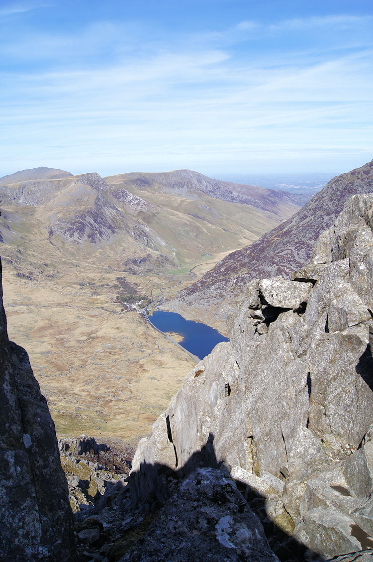 View from the top of the gully to Llyn Ogwen and Foel Goch
I thoroughly enjoyed my scramble up the gully. I really did enjoy myself making the height as quickly as I could. It was hard work and I was breathing very quickly as I managed my way up the narrow access of my chosen environment but it was a spellbinding experience. On the occasions I stopped and looked downwards I revelled in the sight of the ground from which I had just came. Then at the top of the gully I could look over to the west side of Tryfan for the first time on the walk with a view to the western tip of Llyn Ogwen, to Afon Ogwen valley and to the valley road out of Snowdonia leading to Bethesda and the north Wales coast and Anglesey at Bangor.
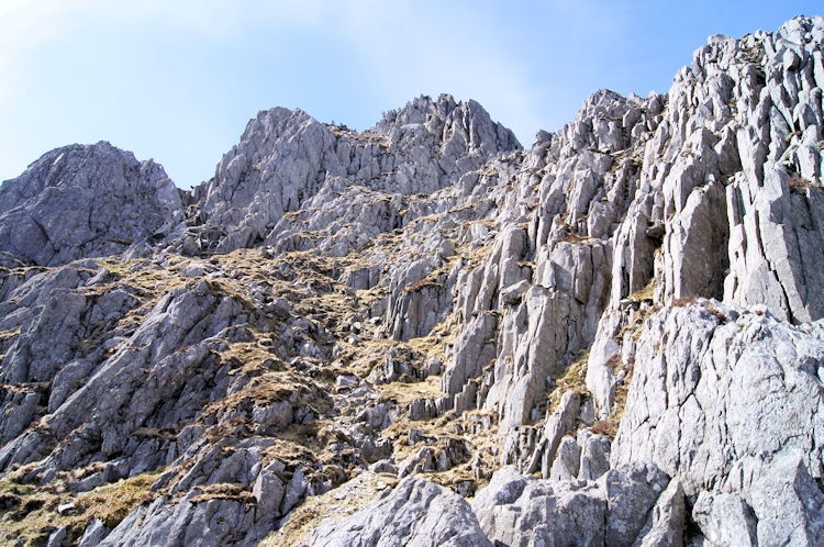
 The higher reaches of Tryfan are an exciting place...
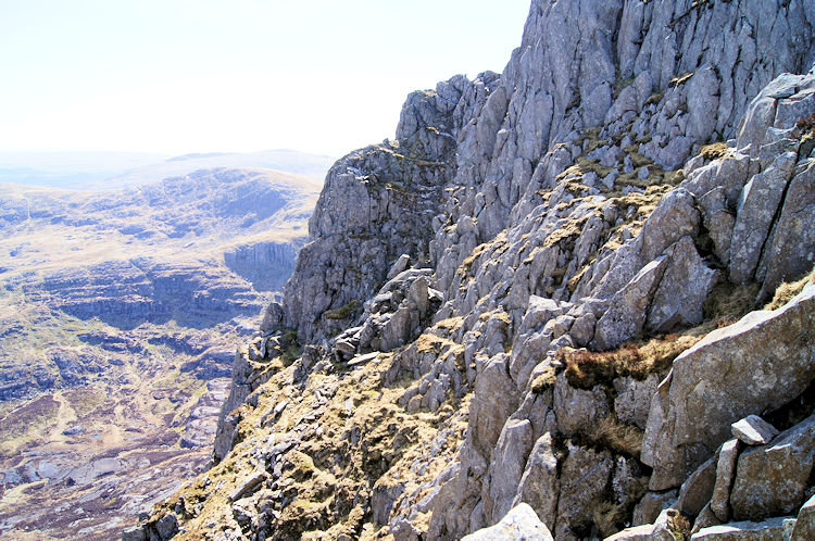 ... but try not to look down on some parts of the climb
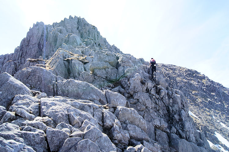
When I reached the top of the gully I assumed I was somewhere near the top of the mountain. I was wrong. I had simply reached the northern ridge of Tryfan but I still had 200 metres to go before I reached the summit. And between me and the summit were 200 metres of thrilling mountain ridge walking and scrambling, much more challenging and exciting than Striding Edge and Sharp Edge, the popular Lake District icons. These ridges were wide, scattered and offering plenty of courses to take. As I began my course from the gully on a south heading along the ridge I noticed the drops to the west were steep and vertiginous Not something I bother about any more; I look forward not back and for me that does the trick.
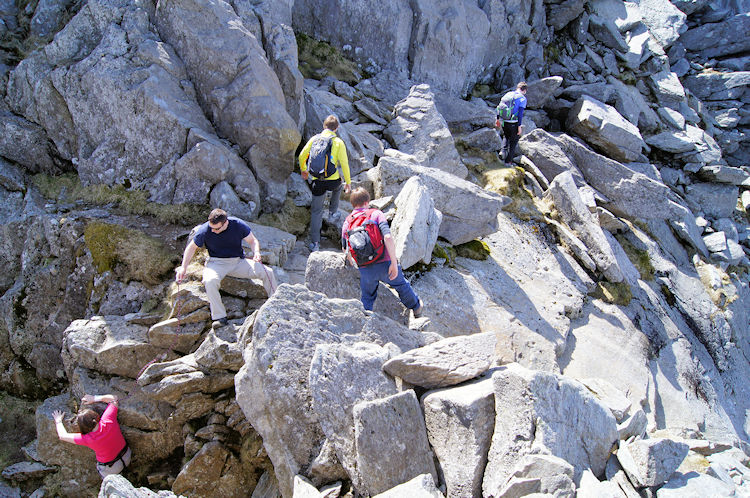 Walkers weave their way up the mountain
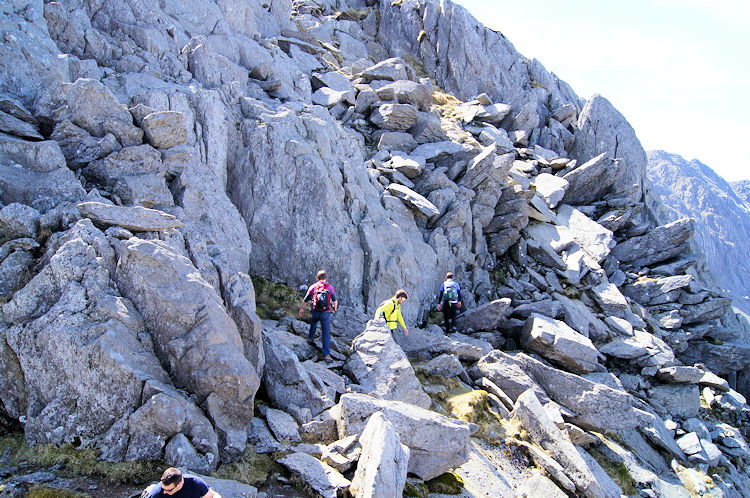 The final rock face to the summit of Tryfan
A further 100 metres of ascent along the top ridge done and I came to a point, often frustrating, where I had to drop 15 metres or so to continue my climb. As I looked down from my lofty perch I noticed a group of other walkers below me. Three young men were forging on their way while another chap in the company of a lady was helping her with reassurances as she scrambled her way around a rock. After getting down to their level I passed the couple and caught up with the three lads who I followed on a meander through gaps in rock and across faces of others to make the final push to the top. Soon after the snakes and ladders course up the final 50 metre ascent I reached a small plateau and saw what I was looking for. Two rocks standing on top of the mountain were one of my priority objectives for the day and they were right in front of me.
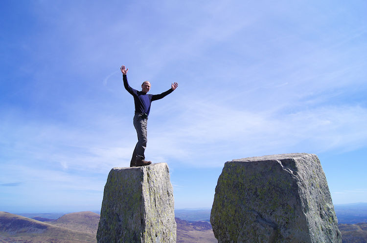 Celebrating reaching the summit of Tryfan on Eve...
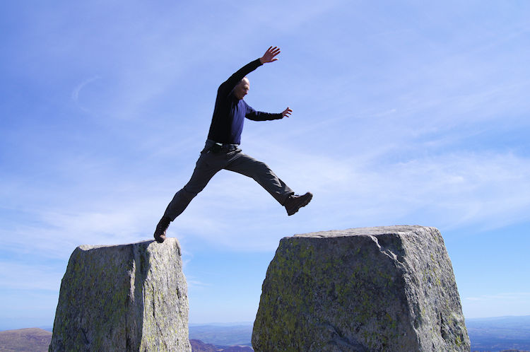 ... and making the iconic leap from Eve to Adam
From Wikipedia: The summit of Tryfan is famous for the twin monoliths of Adam and Eve, a pair of rocks some three metres high and separated by 1.2 metres. The rocks are visible from the Ogwen valley, from where they resemble two human figures. It is traditional for those climbing Tryfan to tackle the spectacular and risky "step" between the two rocks; in doing so one is said to gain the "Freedom of Tryfan". The exposure on one side is quite great and those without a head for heights are advised not to attempt the step. Adam is not easily scaled being high and smooth. There is a foothold on Eve which allows the climber to scramble to the top. And I had to make that leap of faith to gain the 'Freedom of Tryfan'. I did it without hesitation, not wanting to give myself any time to talk myself out of it; immediately asking one of the three lads I followed up the final stage of the ascent to take photographs of my jump. I will be eternally grateful he caught my leap in mid air - a moment I will never forget.
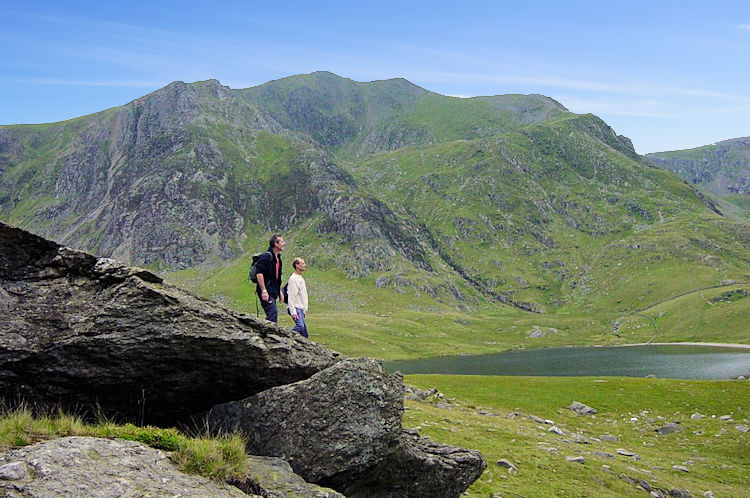
 Llyn Bochlwyd,the north edge of Llyn Idwal and Y Garn
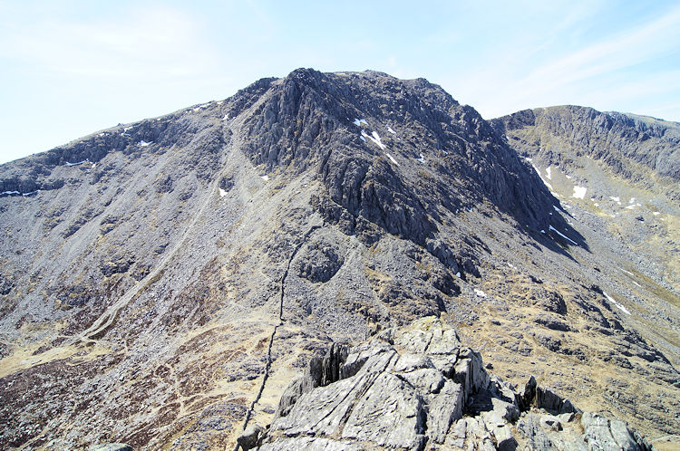 First view of Glyder Fach from Far South Peak
After my gymnastics on Adam and Eve I took a short break to take a drink and a bite to eat with the three chaps enjoying their day on Tryfan before moving on to complete my crossing of the mountain via the Far South Peak. Nothing is easy on Tryfan, it is a narrow rocky mountain with pinnacles, outcrops, gullies and majestic rock obelisks everywhere. Thus my walk from the summit was first a short steep descent to the north face of the Far South Peak before managing a course over the peak and then by descending by a mix of walking and carefully scrambling down to Bwlch Tryfan.
 Which way shall I go?
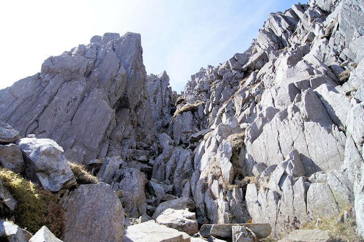 This gully looks very inviting
At Bwlch Tryfan I paused to chat with a couple of mature gentlemen who were done with climbing for the day. They were not looking for the mountain tops as objectives being satisfied with their achievement on reaching the top of the pass at Bwlch Tryfan and enjoying the views. For me it was now time for another climb, this time to the summit of Glyder Fach. I looked at the way in which I should go. One of the men told me he had seen walkers ascent by a path beside a scree slope to the left of the rock pinnacles slightly higher up the mountain on the skyline. I decided that was too unexciting for me and so, as I had done with Tryfan, I plotted a course straight up. Again I did this by first taking an overall view of an approximate course and then by working out short sections, one at a time. And like I did on Tryfan the first course through areas of rock and instead of heather, over course grassed ground found me arriving at the bottom of a convenient gully which invited me to follow its course up.
 After the gully it is a lovely climb up Glyder Fach
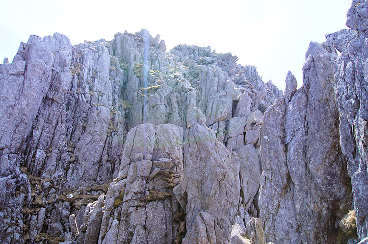 An intimidating rock face poses a logistics problem
The climb through the gully was straightforward apart from one bad step which was very similar to Wainwright's bad step he chose to circumnavigate on his walk on Crinkle Crags in the Lake District. I negotiated my personal Glyder Fach bad step by way of a full arm length hold on a rock beside the step and accompanied by a foot hold on the same rock I made one single heave to clamber onto and over the obstacle. On reaching the top of the gully I looked up to a prominent rock outcrop and saw a climber making his way around it by the west facing side. I chose to follow his course. At the top of the outcrop it was necessary to scale down from it before facing a more intimidating outcrop, this one more sheer than the preceding one but again by following my new found leader I took a safe path up the face.
 A fellow route finder on the crags of Glyder Fach
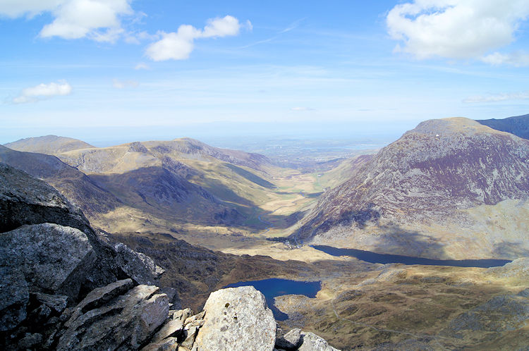 Looking north to Afon Ogwen valley and to Bangor
As I continued on the exciting climb up Glyder Fach, one I found to be every bit as exciting as my climb up Tryfan, I met another climber. This one was in the company of the leading climber I was following. On meeting up with him he said his friend was the "fearless crag climber" he invariably followed on such expeditions on mountains. Despite the challenge we both agreed the younger leader had the right idea on how to climb a mountain such as Glyder Fach and that we were both doing it 'the right way'. We surely were. The views to the west from our exposed mountainside spots were breathtaking - being so close to the edge of a mountain provides excellent views not just into the distance but straight down too, views not to be had on wide tracks which block such vertical vantage points. How lucky we were to enjoy such views as the weather continued to make the day perfect for looking out into the beauty of Snowdonia.
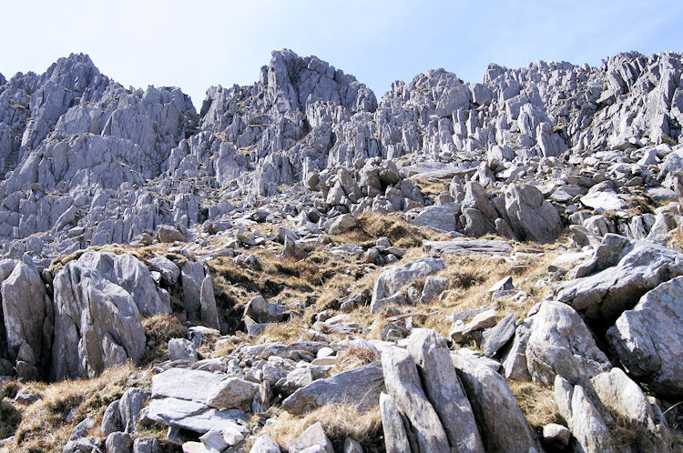
 Magnificent rock structure on Glyder Fach
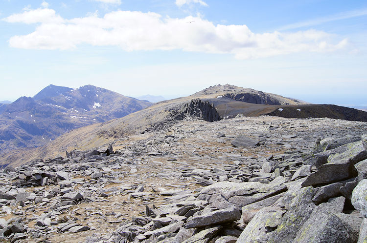 Looking west from Glyder Fach to Glyder Fawr
The final section of climbing up to the summit plateau of Glyder Fach was every bit as exciting as the early part through the gully and across the first outcrops. Sadly it was soon over as a few more heaves, hauls and pulls up the last bit of ascent saw us reach the top. Hands were now redundant of holding rock, back to their usual activity of assisting balance as we walked in a normal manner across the top of the mountain. Sometimes we chose to cross over rock formations which required careful balance, some with vertical and shapely pinnacles like those created as backdrops to sci-fi planet landscapes.
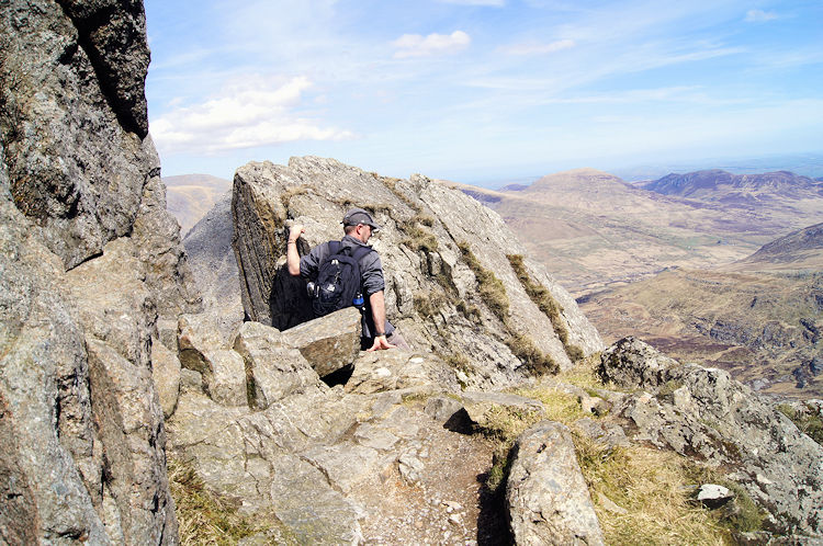
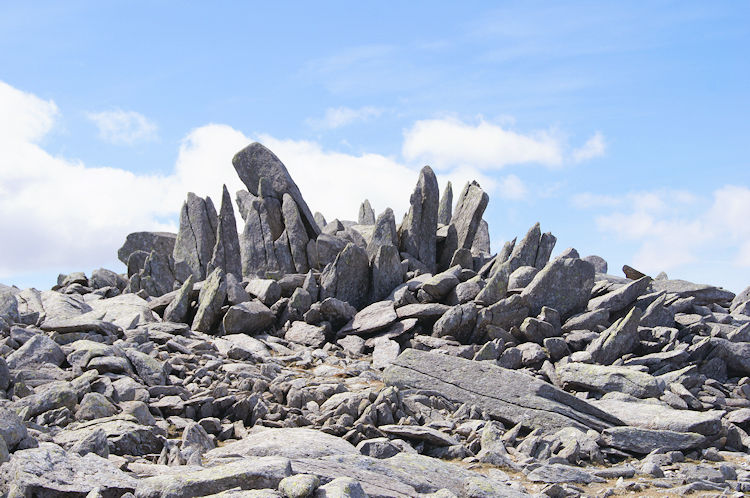
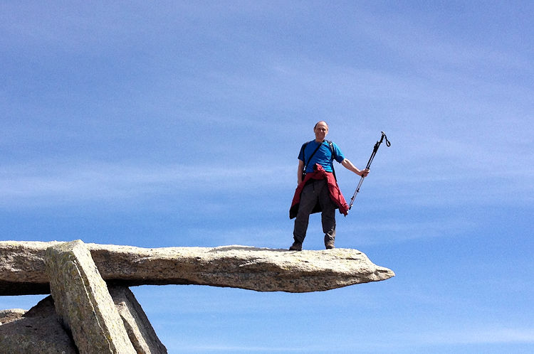 Standing on the Cantilever Stone, Glyder Fach
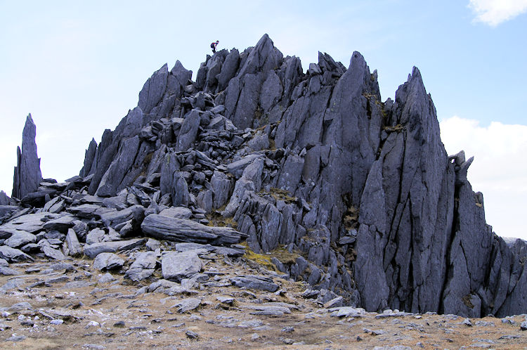 Castell y Gwynt
On one of the rock outcrops on the mountain summit an icon stood. It was the Cantilever Stone, Glyder Fach's answer to Tryfan's Adam and Eve. The Cantilever Stone, a large rock which from the correct angle appears to be precariously balanced is a popular place for photographs and so I had to oblige and do the requisite pose for the camera. Another notable feature near to the Cantilever Stone and just west of the summit of Glyder Fach is Castell y Gwynt, 'Castle of the Wind' and another of the beguiling spiky rocky outcrop which are randomly strewn across Glyder Fach. My new found friend who led the way over the final climb to the top of Glyder Fach clambered his way up and over the castles fortifications while his colleague and I walked a sedate path around the monumental feature.
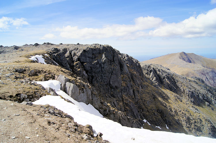 Snow on north facing high ground between Glyder Fach to Glyder Fawr
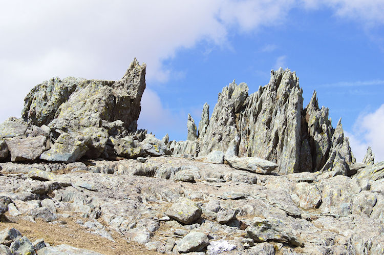 The fascinating outcrops captivated me
We then walked a leisurely kilometer over generally flat ground linking Glyder Fach to Glyder Fawr by way of Blwch y Ddwy Glyder. As we walked we noted snow clinging to the edge of the north facing slope. Only a few weeks earlier we had experienced heavy snowfalls in the UK and the snow was widespread on the mountains which would have made the course I had taken impossible. I thought how lucky I was that the snow was now practically gone from the mountains of Snowdonia. The walk to Glyder Fawr from Glyder Fach was so easy that I took my time and took full advantage of the views. Again I was drawn to look out to the west and across the west most mountains of Snowdonia to the shimmering blue of the Irish Sea. My two companions stopped to take photographs of the surroundings and of each other after accomplishing their goal. I thanked them for their company over the last hour and walked on waving them goodbye. I continued to the summit of Glyder Fawr.
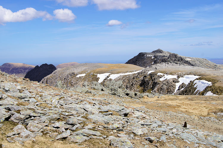 Sublime mountain views from Glyder Fawr
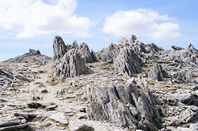 The surreal landscape of Glyder Fawr
As I walked the final steps to the summit of Glyder Fawr I looked out to the south west and to Mount Snowdon. I could clearly see the route up and over Crib Goch which I was going to cross for the first time during my next walk on the next day. The view of Crib Goch, the intermediate pinnacles of Garnedd Ugain and the summit of Mount Snowdon shimmering in the early afternoon sunshine excited me for the challenge ahead but for now I enjoyed some more the surreal and almost out of world landscape that exists of Glyder Fawr. It is a remarkable mountain top, ever so fascinating.
 Llyn Idwal
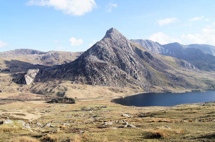 Llyn Ogwen and Tryfan
Note: This walk report is taken from a linear walk I did on a walk from north to south Wales in 2013 (Conwy Castle to Cardiff Bay). Hence I left the summit of Glyder Fach by descending south to Pen y Pass. For the purposes of this circular walk the descent from Glyder Fach is by the path leading north off the mountain to Llyn y Cwn and Devil's Kitchen. From there follow the path north-east past Llyn Idwal to reach the A5 at Idwal Cottage. See my Y Garn and Devil's Kitchen walk for report and photographs.


