Beddgelert, Moel Hebog, Moel yr Ogof, Moel Lefn and Beddgelert Forest
Approach Beddgelert from the north-east on the A498 and you will not fail to see Moel Hebog towering over the village. The 'Hill of the Hawk' as it is locally known is a mountain which stands out for the tremendous views to be seen from the summit. North of Moel Hebog, the satellite mountains of Moel yr Ogof and Moel Lefn appear to be as almost in a direct line of approach and make for an undulating airy transit. Afterwards the descent to Bwlch Cwm-trwsgl and fork right into Beddgelert Forest complete the circle to provide an exciting circular walk.
Google Maps Open Source Maps| Statistics and Files | ||
|---|---|---|
| Start: Beddgelert | Distance: 7.6 miles (12.2 km) | Climbing: 958 metres |
| Grid Ref: SH 59035 48149 | Time: 4-5 hours | Rating: Hard |
| GPX Route File | Google Earth File | About Beddgelert |
| Statistics | |
|---|---|
| Start: Beddgelert | Distance: 7.6 miles (12.2 km) |
| Climbing: 958 metres | Grid Ref: SH 59035 48149 |
| Time: 4-5 hours | Rating: Hard |
| GPX Route File | Google Earth File |
Ordnance Survey Explorer Map (1:25,000)
The Walk:
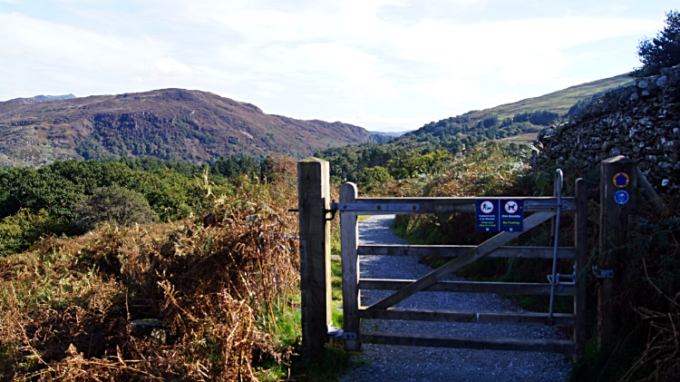
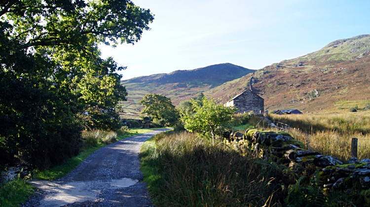 The track from Beddgelert
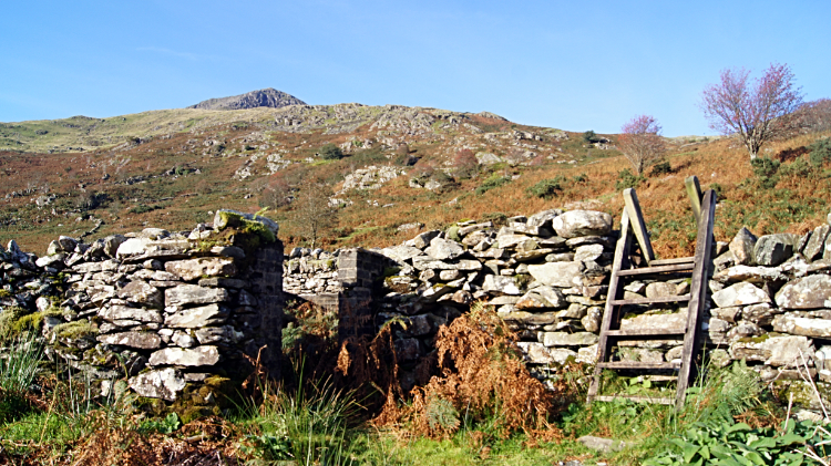 This stile marks the beginning of the climb
The guide book writer said about Moel Hebog "People come from far and wide to enjoy the views from the summit". Well, where are they? Perhaps it was a little too early in the morning for the masses for at 9.15am on the first Monday in October I was he only walker setting off from Beddgelert and heading down the track to the right of the Royal Goat Hotel on my way to meeting with the mountain. Despite it being November it was a lovely warm day with a cloudless sky. I didn't need my coat, just a light jersey over my t-shirt as I walked past Beddgelert Railway Station, then along a lane crossing the railway line, then past a farm and through a small wood to reach the wide open spaces. Following a hard path across the open ground within a course grassed field a post in the ground indicated a parting of the ways. I needed to go left and head for a stile on the drystone wall at the edge of the field.
 Moel Hebog
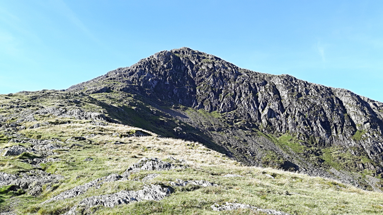 Y Grisiau
Crossing the stile led to the climb of Moel Hebog properly beginning. Walking the path from Beddgelert had gained me 45 meters height in a kilometer of walking. Without really noticing. The next kilometer would gain me 180 further meters and the one after that a further 320 meters. And the next half kilometer after that would see me gain another 200 meters to top out on Moel Hebog, 782 meters above sea level. Resulting in 700 meters of continuous climbing in two and a third kilometers from the stile. I was up for it, walking uphill steadily. At first the path was a meandering course on good short grass with rust brown dying ferns set in a landscape of small outcrops and erratics. As I climbed, at intervals I took short breaks to look over the unfolding landscape picture. First impression of the Beddgelert area was of low craggy fells with lots and lots of woodland/ plantation set in the sheltered low fells and valleys. As I reached the picturesque arched rock wall of Y Grisiau at around the 600 meter high mark the lakes set beside upland ranges made their appearance. I instantly recognised Llyn Dinas. An old favourite from my first walk in this area fourteen years ago.
 View to Snowdon from Moel Hebog
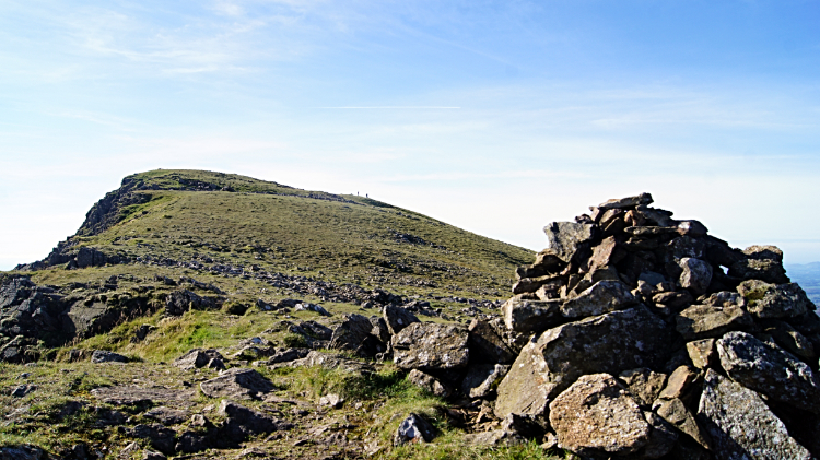 First sight of the summit of Moel Hebog
Continuing my climb beyond Y Grisiau the steepness of the climb never relented. Ascending Moel Hebog is a good workout. That is for sure. Just beyond Y Grisiau I took a little break, again enjoying more of the tremendous views revealing themselves for me. To the north the impressive profile of Snowdon and Y Lliwedd was a sight to behold. I identified more of the distinctive Snowdonia mountains including the Welsh Matterhorn, Cnicht to the east which I had climbed just a day ago. After the viewing and on resuming my climb I eased myself up the sloping plateau rising up the north face of the upper mountain. A couple of resting sheep watched me attentively as I walked close by them on my way to the top. Realising I was no threat, they did not bother to get up.
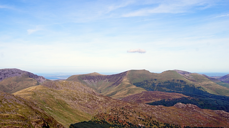
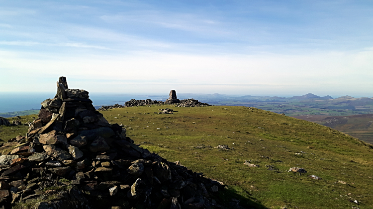 Summit of Moel Hebog
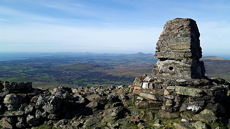 View from Moel Hebog to Tremadog Bay
And then I was there, standing at 782 meters elevation on the summit of Moel Hebog. First impressions. The Snowdon Range looked magnificent with the full sweep of the west facing arch around Bwlch Main and Llechog a stunning sight. It looked every bit as impressive as the opposite face to Pen y Pass which we are all familiar with ad it fed me with an idea for a walk in the future. Also Carnedd Moel Siabod, translated from Welsh as the shapely hill showed just how shapely it is, from my viewpoint rising smoothly to a high point from the left and plunging steeply from the summit to the right. "Another one I must do" I mused to myself. Turning to view south, Tremadog Bay provided a startling sight. The curvature of the bay and the estuary of Afon Dwyryd with its sweeping curves and sand banks was a gob-smacker as was the picture into the Vale of Ffestiniog. No doubt about it, Moel Hebog is an extra special viewing mountain. I was more than pleased with the drama of observation up here.
 The way down from Moel Hebog to Bwlch Meillionel
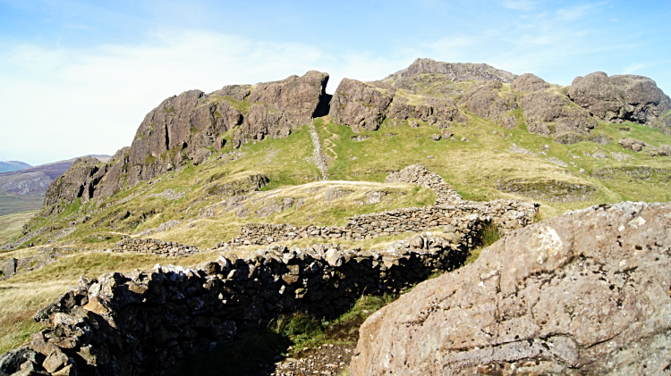 Heading for the cleft in the rock face
If the climb to the summit of Moel Hebog and the brilliance of the views were not enough to satisfy a good walk then what followed turned this walk from excellent into truly awesome. Why was no one else up here? I could not believe my luck having all this to myself and once I had set my attention to the line I was to take to Moel yr Ogof and Moel Lefn then I was struck with joy. The view of the rolling line of steeply down to Bwlch Meillionel and then rolling up and down from there was a salivating thought. And so down I went, side stepping the steep descent of 240 meters. A drystone wall line assisted my navigation down. Not that I needed it. And on the descent I met my very first walker of the day, a lady walking with her black and white Springer Spaniel. She was sat on a rock stroking the dog as I shuffled down the bank. She was on her way up. We agreed it was a lovely day to be out. At Bwlch Meillionel a remarkable cleft in a rock face led my way through it. It was a bit of a stiff steep climb through though, calf muscle testing after the leg resting ease of the descent from Moel Hebog.
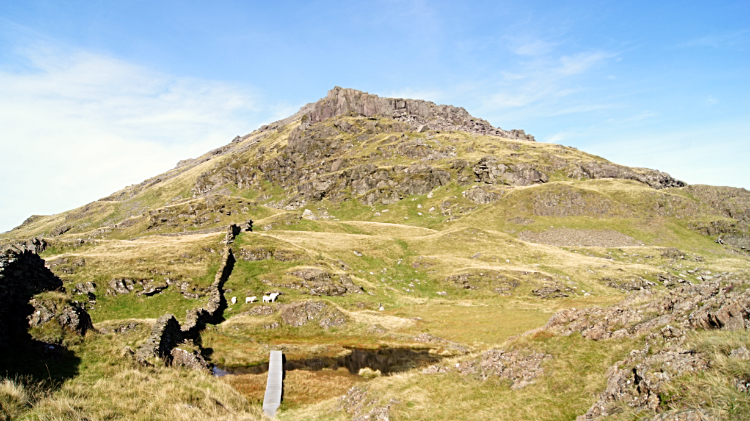 Moel yr Ogof
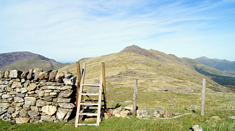 Moel Lefn
Into the open after the darkness walking through the gap in the rock I crossed a mountain stream by way of a walking board placed for the ease of us in the mountains and then it was a straight forward task to climb the south face of Moel yr Ogof. Just 100 meters of climbing to the top, a doddle after the 700 meters of Moel Hebog. A bit of open grassland, rocky outcrops, bits of scree and the like took me up. The terrain here reminded me of the Langdale Pikes in the Lake District, around Harrison Stickle in particular. At the summit I viewed Moel Lefn and saw the easy banana curve shaped path between me and my final peak of three. I headed straight off to attain it, this stretch an easy course grass path which reminded me of the walk between Crinkle Crags and Cold Pike and of the path from Thunacar Knott to High Raise, both also in the Lake District.
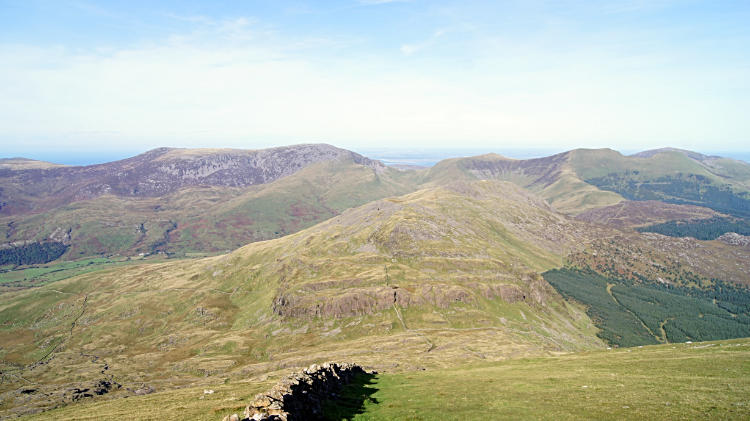
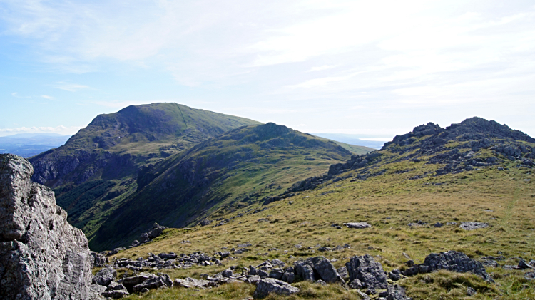 Moel Hebog, Moel yr Ogof and Moel Lefn
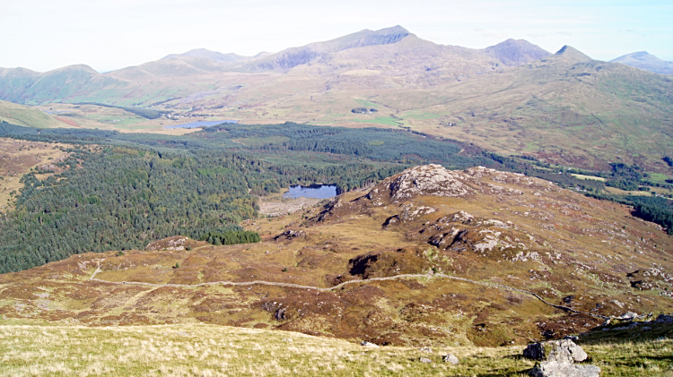 Beddgelert Forest
On the rocky summit of Moel Lefn I found a smooth rock and used it as a seat to enjoy a fifteen minute lunch. With the peace and quite up here and the welcome warming sun of the early October day I could not have picked a better spot to rest. Looking back from my seat to the high line I took from Mel Hebog and over Moel yr Ogof pleased me immensely. After my break I set off on a continuing northward line to descend from the mountains to Beddgelert Forest via old mine workings at Bwlch Cwm-trwsgl. A steep path, needing some care, took me down from the 500 meter to 300 meter levels and from open terrain to the enclosure of wooded tracks. The change in terrain was immense.
 The path through Beddgelert Forest
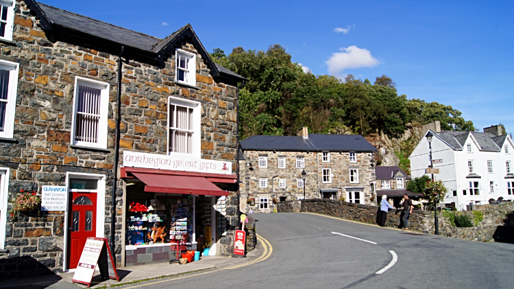 Beddgelert
From walking over unmade ground and on paths needing care and attention to hop the feet over rocks I was now on a managed man made hard path. Beddgelert Forest was pretty enough and even in Autumn there was some birdsong coming from the trees, high grasses and dying off ferns. Sometimes I was hemmed in from enjoying any views by high straight conifer trees, typical of plantation. Especially in the higher reaches of the forest but as I descended lower and nearer to Beddgelert the high trees diminished somewhat and thus the views opened out again. I was happy with that. And then, lo and behold, I was back at the field with the fork in the path from where I had started the climb to Moel Hebog about four and a half hours earlier. From here I walked back into sun kissed Beddgelert and straight to a local cafe for tea and cake. I decided I had earned it. As I enjoyed my afternoon tea in the cafe I reflected on the magnificent walk I had just completed. My time on the mountain of the hawk was everything and more as superb as I had imagined.


