Marsden, Standedge Trail, Oldham Way, Pennine Way and Willykay Clough
Having been a supporter of the Huddersfield Canal Society from the very early days when most thought we were barking mad to think about restoration of this waterway, it was with immense pleasure that in June 2008 I finally took a boat from Huddersfield to Ashton under Lyne. This Pennine canal climbs through 42 locks up the Colne valley from Huddersfield then descends by a further 32 down the Tame valley towards Manchester. This is no place for crew averse to hard work, there is hardly any opportunity while cruising to prepare a meal or even make coffee.
At the time of our passage we had a rest period on the summit while staff from British Waterways towed a string of boats, including ours, through the wonder of the waterways, Standedge tunnel. At 5.2km (3 miles 400 yards), it is Britain's longest canal tunnel. The tunnel bore is diminutive having been cut using pick and shovel through hard rock, so it was made to take a narrow boat with no room to spare. In the days when horses were the motive power men legged the boat in the tunnel and the horse walked, over the top. (Summary, report and pictures kindly contributed by Ken Brockway)
Google Maps
Open Source Maps
| Statistics and Files | ||
|---|---|---|
| Start: Marsden | Distance: 10 miles (16 km) | Climbing: 545 metres |
| Grid Ref: SE040119 | Time: 4-5 hours | Rating: Hard |
| GPX Route File | Google Earth File | About the Standedge Tunnels |
| Statistics | |
|---|---|
| Start: Marsden | Distance: 10 miles (16 km) |
| Grid Ref: SE040119 | Time: 4-5 hours |
| Climbing: 545 metres | Rating: Hard |
| GPX Route File | Google Earth File |
Ordnance Survey Explorer Map (1:25,000)
OL1 The Peak District - Dark Peak Area
The Walk:
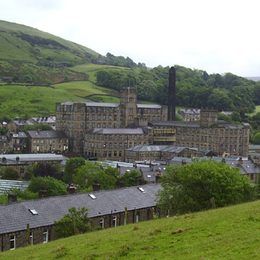 The Mill on Mount Road Marsden
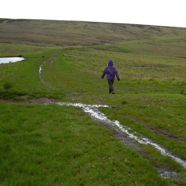 Former Turnpike Road, now a footpath
As required, we had arrived at Marsden the evening before the day of passage. After 'Last of the Summer Wine' made Holmfirth a honey pot, the film crew moved to Marsden so fans should look out for locations. With another walking crew member I had itchy feet, despite having walked most of the canal from Huddersfield. My plan was to follow the track the horses would have taken. The canal guide book offered us a track and the O.S. supplied the modern day rights so we set off with a circular route in mind. . The paths are awash with diamonds in this area and the Standedge Trail looked right for us. We shunned the road and were rewarded by taking early to the hills. The view of the mill in the valley bottom is real northern industrial landscape, surrounded by terraced houses and backed by green hills, I just love the contrast.
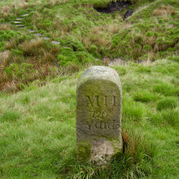 Thought to be a Turnpike marker c1839
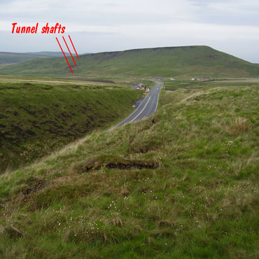 Summit cutting of A62 and tunnel air shafts
Although marked on the map as a footpath our track passing Redbrook Reservoir is clearly defined on the ground, suggesting man's intervention to improve this route over Standedge. Canals, also being man made, need a planned water source and this comes from Swellands and Black Moss Reservoirs, both on higher ground above the smaller Brun Clough which we pass very soon. The A62, relieved of much traffic with the building of the M62, reaches its summit at the old boundary of Yorkshire and Lancashire, counties long since lost for administrative purposes. At this very point 200 metres below us the water of the canal is undecided, should it flow to the North Sea via the Colne or the Irish Sea via the Tame? Looking back towards Marsden we can see the line of the tunnel evident by the shafts used to first dig the the bore and later to provide ventilation on that long journey underground.
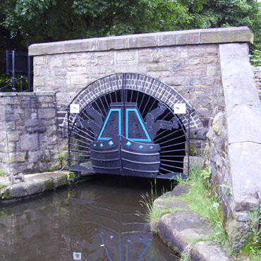 Diggle tunnel portal 1893
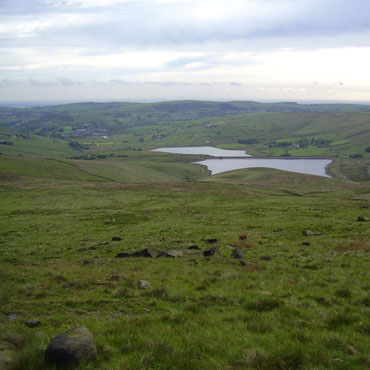 Castleshaw reservoirs from the Pennine Way
Dropping down past more air shafts and spoil heaps we arrive at Diggle where our boat will emerge from the darkness tomorrow. The attractive gates prevent unauthorised entry and a blue plaque tells us that Thomas Telford's skill enabled completion of this major project to finally open the canal in 1811.
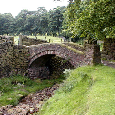 Close Gate (or Eastergate) Bridge
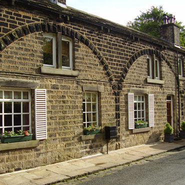 Cottages at Hey Green
Now to find an alternative route back and there on the watershed is the Pennine Way inviting us to go north until we meet more ancient routes over the backbone of England. As we cross the high ground and pass a trig point the view down the valleys to towns on the fringe of Oldham makes this bleak location very different from a walk on Kinder or Bleaklow. At Haigh Gutter we turn east and join a bridleway, the ancient Rapes Highway which takes us back down to the area of Marsden aptly named Tunnel End. On the way we admire Close Gate (or Eastergate) packhorse bridge and strange cottages which we are told were originally built to house not people but carriages.
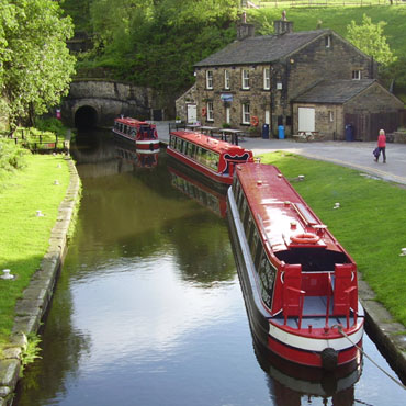 Boats wait in line for a tunnel passage
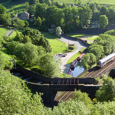 Canal, rail and river at Tunnel End
Next morning we watch, wait, then eventually the electric powered tug drags our boat through the tunnel while we take pictures and too soon become tired of this confinement perhaps wishing we were again up on top.


