The Great British Walk
A personal record of my three month walk of the full length of Great Britain from north to south with written journal and photographs. Tracklogs for GPS units and for use with Google Earth are available for download for each stage.
Stage 56: Chipping Campden to Winchcombe
Google Maps Open Source Maps| Statistics and Files | ||
|---|---|---|
| Start: Chipping Campden | Finish: Winchcombe | Distance: 18.1 miles (29.1 km) |
| Time: 8-9 hours | Climbing: 708 metres | Total Distance: 767.5 miles |
| GPX Route File | Google Earth File | About Chipping Campden |
| Statistics | |
|---|---|
| Start: Chipping Campden | Finish: Winchcombe |
| Distance: 18.1 miles (29.1 km) | Time: 8-9 hours |
| Climbing: 708 metres | Total Distance: 767.5 miles |
| GPX Route File | Google Earth File |
Ordnance Survey Explorer Map (1:25,000)
Summary
The first stage of my Cotswold Way walk begins in Chipping Campden and immediately climbs to Dover's Hill, the first high place on the walk. From there the way continues climbing steadily to the highest point of the day at Broadway Tower, standing on ground 313 metres above sea level. After a swift descent to the village of Broadway the walk continues on an uphill course to Shenberrow Hill before descending into Stanton and crossing lower ground to Stanway. A further climb ensues to Upper Coscombe before descending to the ruins of an abbey at Hailes before the approach to Winchcombe is made across a series of fields and then along a lane.(Note: My walk of the Cotswold Way was a part of my Great British Walk from the north coast of Scotland to the south coast of England)
Stage Report
Every morning of my long walk was a good one as I stood at the start and thought about what I might discover. Some of those early day thoughts were dampened when the weather was not playing ball and some more in the early days and weeks of the walk were affected by the aches and pains I had suffered with. But this day everything was right for me. The weather forecast for the day was fine and the forecast for the coming week was very good. And all my aches and pains were distant memories. Therefore I set off on my Cotswold Way walk in such high spirits. I smiled with happiness and much anticipation, standing at the start of a National Trail i had been wanting to walk for a few years.
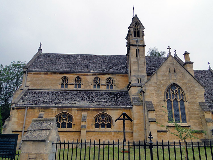 St Catharine's Church, Chipping Campden
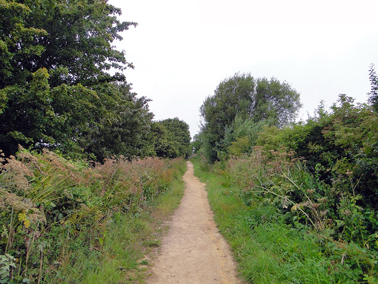 Hoo Lane on the Cotswold Way
It had been fun in my Bed and Breakfast the night before. It was Flying Ant Day in Chipping Campden and they had invaded my en suite shower room. My hosts were so apologetic and blocked off the air vents the Ants seemed to be coming in by as best they could. I showered quickly after their vain efforts to stem the infestation while more Flying Ants appeared from goodness knows where. I just about managed to cope with the distraction and after drying off and dressing in the quiet asylum of my room I went out. By the time I had returned to my accommodation from refreshments and dinner in the early evening all seemed to have quietened down in the shower room and in the morning all evidence of the Nuptial Flight of the Ants was gone.
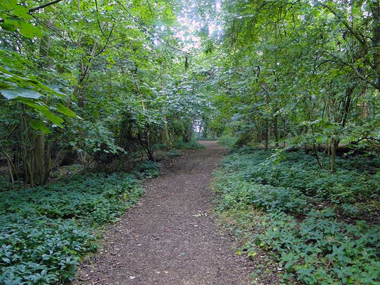
I had forgotten about the incident of the Ants by the time I reached the starting point of the Cotswold Way National Trail. It is in the High Street of Chipping Campden and marked by a stone post with a plaque fixed onto it which says "Cotswold Way - The beginning and the end". Below the plaque and etched into the stone is written "Bath 100M". I set off on the first of those miles by walking a short way south-west along the high street and past St Catharine's Church before turning right and walking along Hoo Lane, leading directly up hill towards Dover's Hill.
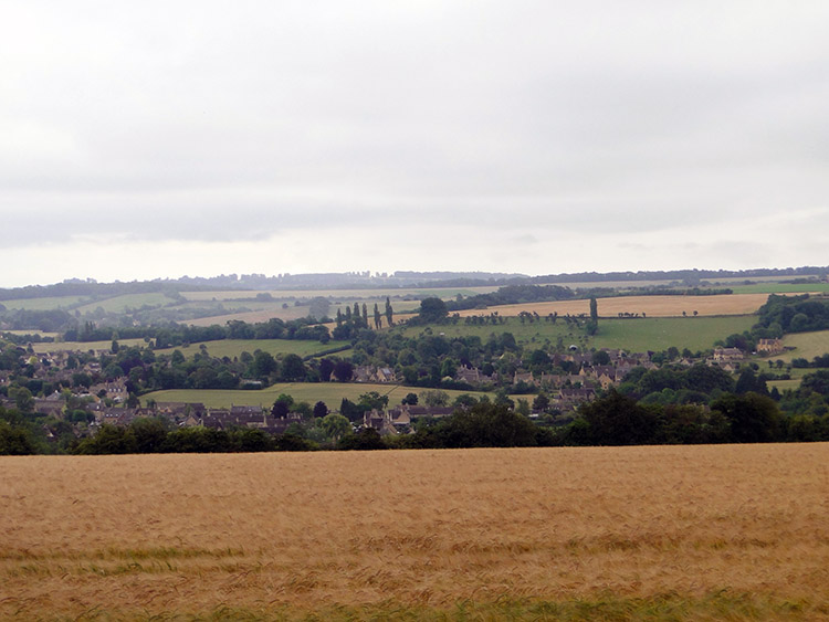 Chipping Campden seen from Dover's Hill
 Dover's Hill
The climb to Dover's Hill was an invigorating start to the day. The ascent, just short of 100 metres to reach the trig pillar on the hill took me just less than a half hour and in that time I had cleared the first of my 100 miles on the Cotswold Way. There was an information board near to the trig pillar which told me something about Dover's Hill. It started by saying "Welcome the Dover's Hill, a natural amphitheater high on the Cotswold escarpment with glorious panoramic views over the Vale of Evesham. On a clear day you can see more than 60 miles looking west over the Worcestershire plains towards Wales". Alas while it was dry it was not clear. I could see Chipping Campden set below the hill and across neighbouring hills at around 5 miles distant but not much further than that. Perhaps it would clear later on.
I read the information board thoroughly. I learned about the Cotswold Olimpick Games which probably began in 1622 and therefore precede the modern Olympic Games by a few centuries. One of the sports in the games is shin-licking, a local specialty which sounded pretty painful. Reading the information board further I also learned more on the flora, fauna and geology local to the area. Filled with information I felt suitably equipped to carry on walking.
 The Cotswold Way crossing Mile Drive
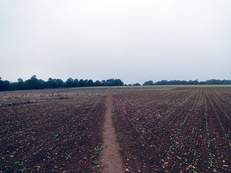 Approaching Fish Hill
To be honest the next couple of miles after Dover's Hill were pretty mundane. I followed a path along the top of the escarpment, gradually climbing higher all the time. The first part was along the roadside next to Weston Park Wood. It was the beginning of a stretch of the walk called 'The Mile Drive'. A little down the escarpment to my left was Campden Wood and in between a field of hay pasture which was being cut. I watched the tractor doing the grass cutting going up and down the rows as I walked for a bit of entertainment. Eventually I left the roadside and crossed the aptly named Long Hill. Afterwards I came to and crossed Buckle Hill before crossing a newly sown field. This would lead me to Fish Hill.
 Fish Hill Picnic Place
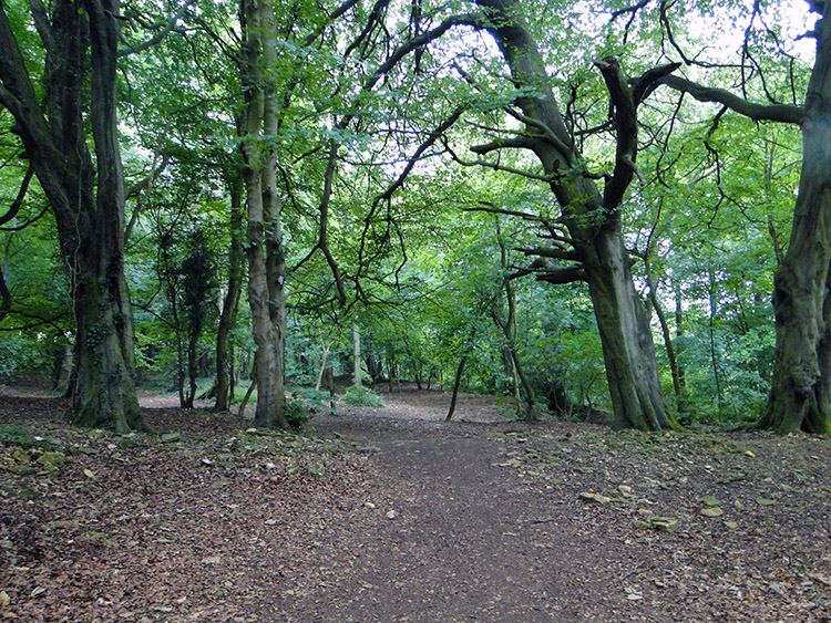 Armley Bank Wood
Reaching Fish Hill was a relief, the walk from Dover's Hill to it was not the most exciting of walks for me. The fields I crossed had been pretty featureless and with the cloud staying low the extensive views which would have kept me entertained had been curtained off. At Fish Hill I was 275 metres high and the cloud base was not much higher than that. At least I came into an area of woodland/ parkland at Fish Hill Picnic Place which broke up the gloom. Actually I found it pretty delightful. Having walked for one hour nonstop since Dover's Hill I took advantage of the seating provided and took a first short break of the day. I was not alone in the picnic place. Cars were in the parking area provided and some people were walking dogs around the parkland. The people had probably come up here from Evesham which was just a few miles away, being linked to Fish Hill by the A44 which meandered its way up Fish Hill in tight curves.
As it was on Dover's Hill, there was an information board on Fish Hill. In fact there were several. One welcomed people to Fish Hill, saying "Fish Hill Picnic Place is an excellent place to break a journey, have a leisurely picnic amid the lovely Cotswold countryside or perhaps join the Cotswold Way National Trail". It went on to say the picnic site was formerly a limestone quarry. A second board had a map showing local walks, a third had a relief map showing the whole range of the Cotswold Hills and a fourth showed a map of the Cotswold Way.
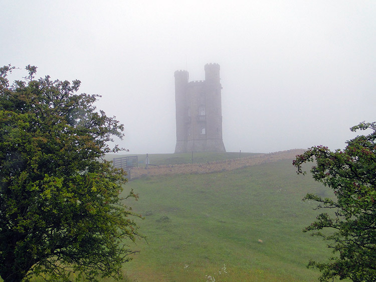 Broadway Tower
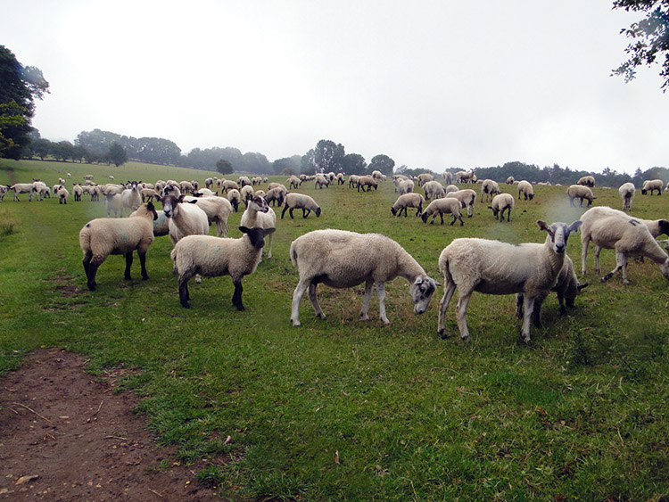 Sheep wanting feeding
I left Fish Hill by crossing the A44 and then walking through the peaceful beauty of Armley Bank Wood to reach a lovely undulating area of pasture inhabited by sheep which made walking very easy. They do keep the grass very low to the ground. I was still climbing as I crossed the pasture and encountered the sheep responsible for the natural tending of the grass. Watching them watching me was soon overcome by a sight beginning to appear through the gloom. I was approaching Broadway Tower. Cloud hung around the tower as I approached and stayed when I arrived, swirling in defiance of me enjoying a clear view unless I touched it. It started raining too, just a little nigglingly but hey that was not in the forecast. "Ah well" I thought, it can only get better now. A near the tower sign said "The highest little castle in the Cotswolds". It stands on the top of Broadway Hill at a height of 313 metres. I had reached the highest point of my day.
Incidentally I had entered Worcestershire at Fish Hill and I would stay in the county until I reached Stanton a few miles further on. It would be my shortest stay in an English county on my long walk. My Worcestershire walking continued from Broadway Tower down the banks of Broadway Hill towards Broadway village. The descent was steep and I would lose over 200 metres of height in a mile. During it I had the funniest of times. When I stepped into a long field which I needed to cross after leaving Broadway Tower I was completely alone. Half way across the field I spotted sheep on the far side of it, a good 400 metres away at least. Once the first of them had seen me it must have called to the remainder of the herd in the field. The next thing I knew is that they were all racing towards me. Nothing was casual, they were at full speed and massed together hurtling towards me. As they closed in, baaing with loud expectation they slowed but still approached to within a few feet. The whole herd was all around me and the cacophony of noise led me to believe they were expecting to be fed. I had to disappoint them, I was not the feeder. They slumped away, some chewing more grass while others went to the field edge and challenged the barbed wire fencing while standing on hind legs to reach for succulent young Hawthorn leaves on nearby field edging trees. Then as I was about to step over a stile and out of the field someone arrived on a Quad Bike carrying hay. That is who they had mistaken me for.
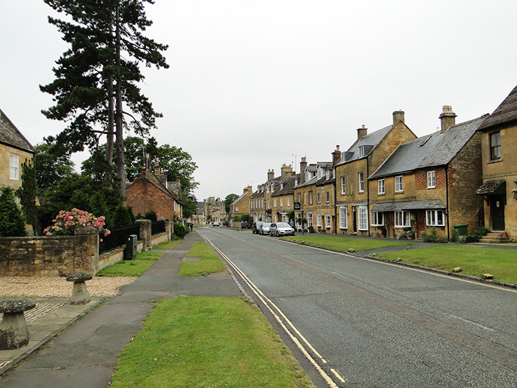 High Street, Broadway
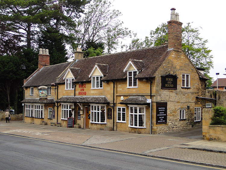 Horse and Hound, Broadway
I descended on my way down to Broadway village in the drizzle. I knew nothing of the village as I approached it from the south. The Cotswold Way led me straight from the hill into the high street. I was instantly struck by the handsomeness of Broadway village. Every building had the Cotswold stone elegance though some were brick at the sides. Cottages of varying shapes and sizes were set on either side of High Street at the east end of the largest village within the Cotswolds. Large? my home village of Brompton in North Yorkshire is much larger than Broadway. As I ambled down the high street the buildings got grander. Domestic houses gave way to commercial establishments. Pubs, Cafes, Shops and Hotels held the west end. As I neared a cafe which I thought about patronising a large group of people who had just arrived by bus beat me to it. I walked on by. There were three large tour buses parked in the village and seeing the tourists dispersing to all the commercial establishments I walked on and through the village. My visit to Broadway was done.
 Broadway Coppice
 Climbing to Shenberrow Hill
I continued on my Cotswold Way walk from Broadway by crossing a couple of low level pasture fields and then climbing to Broadway Coppice. Though it was still cloudy the spell of irritating light rain had passed which pleased me somewhat. Via a mix of woodland trail, farm lanes, field paths and bridleway I continued my second major climb of the day, another 200 plus metres ascent towards Shenberrow Hill. reached a point near to the top of my climb at about 12 noon so having been on the walk for four and a half hours I stopped for lunch. As I enjoyed lunch and looked around the environs of Shenberrow Hill I noticed a glint of sunshine. Perhaps the weather I was promised would arrive after lunch.
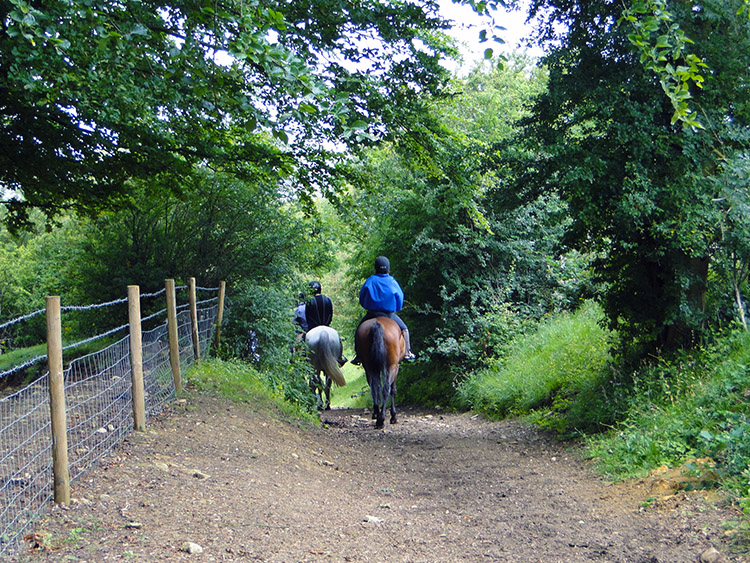 Horse riders on Shenberrow Hill
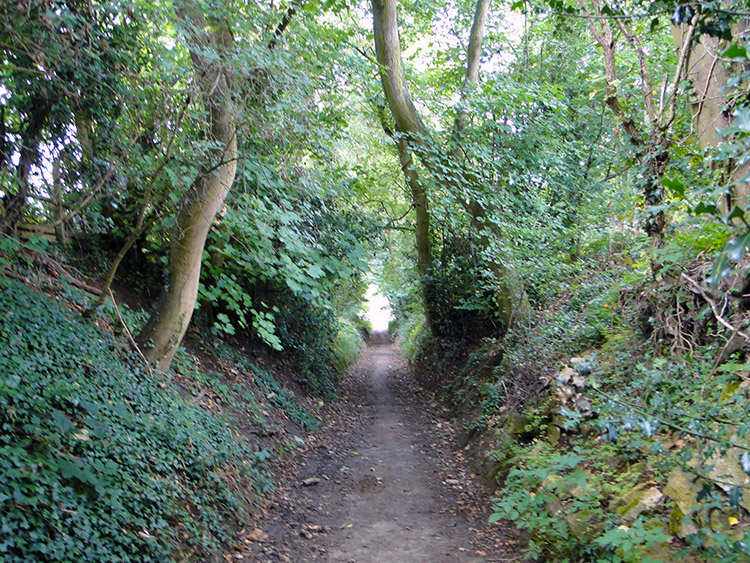 Leafy lane near Stanton
And indeed it did. Soon after I had set off walking after my refreshment break the sun did come out. It was a milky sun fighting with the cloud flowing across the Cotswold sky but every now ands again it rewarded me with a little of its warmth. A nice spell of that sunshine, which had been missing all morning, joined me as I followed some leisure horse riders hacking their way down a tree and shrub lined lane from the heights of Shenberrow Hill towards the village of Stanton. I was on the second of my steep descents of the day, another loss of 200 metres elevation which I had gained just a little earlier. This first stage of the Cotswold Day was one of three separate ups and downs.
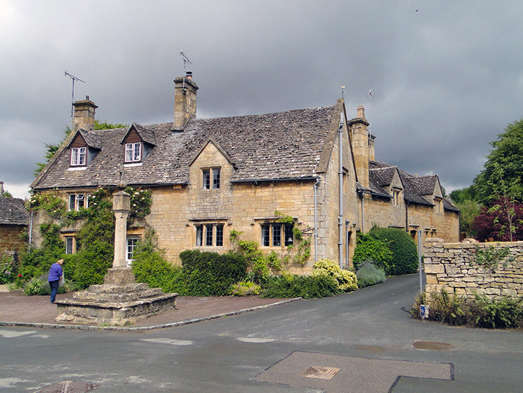 Stanton village
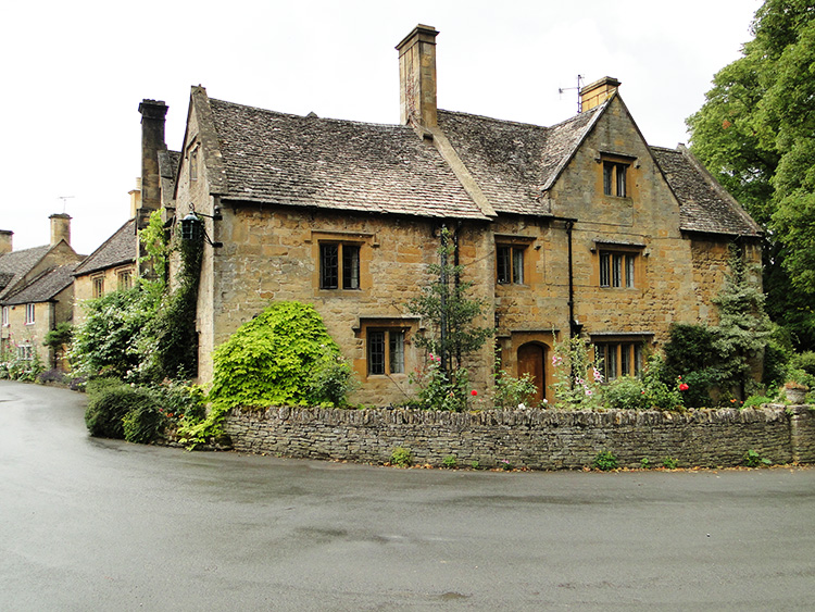 The beauty of Stanton
The second descent of my walk took me from my brief skirmish into Worcestershire and back into Gloucestershire. The descent also helped me arrive in the village of Stanton. I was enraptured with the village from the very moment I set eyes upon it. Broadway was a delight for sure but for me this village was something else entirely. Stanton is one of the most beautiful villages I have ever walked through. Every building was immaculate. Every garden appeared to be in character, not too manicured and not too wild. Every exterior was tidy and I could not find a shred of litter. Stanton is so obviously loved by those who have the good fortune to live in the village. I so much enjoyed my walk through Stanton. It was a privilege.
 St Peter's Church, Stanway
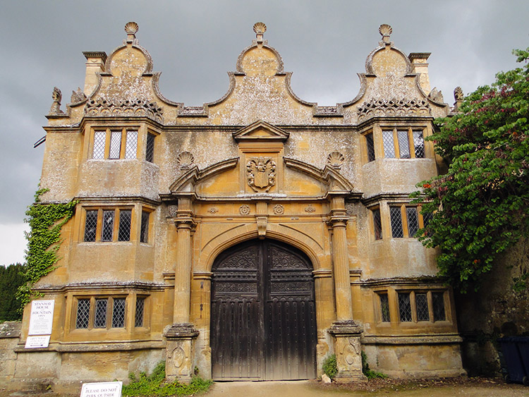 Stanway Gatehouse
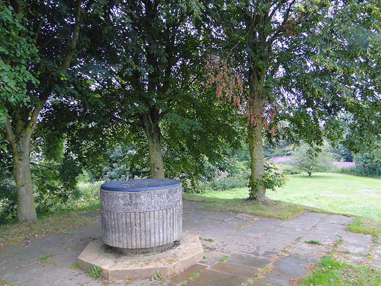
Can you get too much of a good thing? After leaving Stanton behind which filled me with lots of memorable sights I shall never forget I crossed a series of about half a dozen fields over the length of one mile of walking to arrive in the tiny hamlet of Stanway. There is little more than a church and a Jacobean Manor House in Stanway but everything there was to be seen was, as in the villages I had already passed through, was so beautiful. St Peter's Church was gorgeous and so was Stanway Manor Gatehouse. I was informed the Stanway Fountain which has a jet of water that rises to over 300 feet was within the manor house grounds. I should have stopped visited the grounds for a while but I did not. However it is a place I have found out about on my walks which I can now return to on a visit with my wife Lil. One of the beneficial advantages of walking in new places is discovering ones to return to at another time and for another purpose.
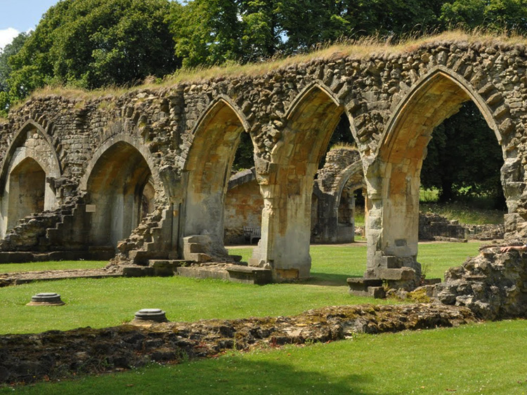 Hailes Abbey
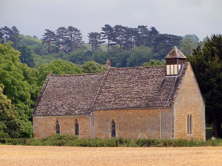 Hailes Parish Church
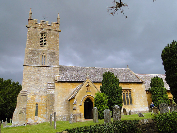
I was over sated with beauty. Broadway, Stanton and Stanway are three of the prettiest Cotswolds villages and I had just walked through all three of them consecutively. I could not help myself beaming with delight even as I made the effort of climbing my third significant hill of the day which took me from Stanway to Wood Stanway and beyond up to Stumps Cross at Upper Coscombe. Once up it was straight back down again via Coscombe Corner and the west edge of Hailes Wood to Hailes Abbey. The ruins of the Cistercian abbey are typical of those disestablished during the reign of King Henry the Eighth though it resisted longer than most, the Abbot and his monks finally surrendering their abbey to Henry's commissioners on Christmas Eve 1539. From the abbey I continued on my way past Hailes Parish Church, an impressive little Norman church which predates the Cistercian abbey by a century. Unlike the neighbouring abbey it has managed to keep its roof.
 Muddy way to Winchcombe
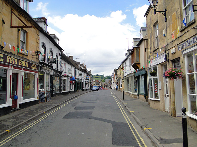 Winchcombe
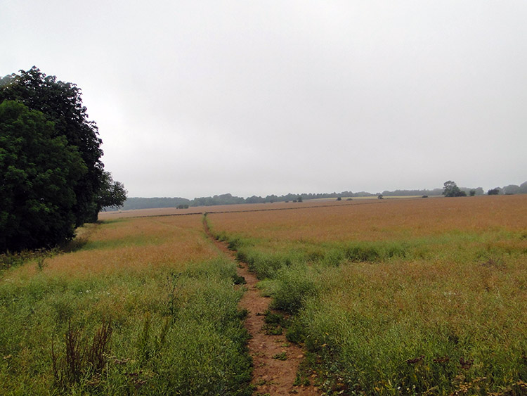
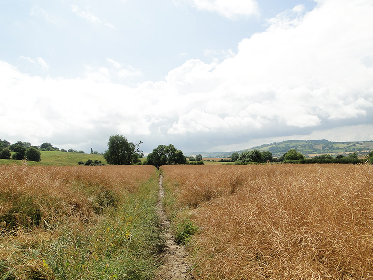
The sun had shined brightly during my visit to the abbey and church and continued to do so on the final stage of my fabulous first day of walking on the Cotswold Day. I left Hailes by Salter's Lane which petered out into a crossing of some fields before I would reach Puck Pit Lane leading into Winchcombe. Crossing the first field was easy but crossing the second was a struggle. And so funny too. It was an Oil Seed Rape field which was golden and ripe for cutting. The Cotswold Way cut straight across it and as I started to cross it myself I noticed a couple of walkers ahead of me struggling their way across. I soon found out why as I trod onto the mud topped path crossing the field. I soon found myself slipping with every step I took. he rain earlier in the day had left a fine film of wet mud which sat on a drier cake of ground below. It was so slippery and I did my best to keep to the grassed edge of the path rather than walk on the exposed mud. By doing so I soon caught up with the couple who were very slowly managing their way across. The three of us arrived at the far side of the field together. We laughed and laughed. The crossing of one field had been so hilarious.
The remaining fields were grassed pasture and easy to cross. Leaving the couple of gigglers behind I continued on along Puck Pit Lane and into Winchcombe. Thus I completed the first stage of my Cotswold Way walk. The couple of miles between Dover's Hill and Fish Hill apart the walk had been magic. The countryside of the Cotswolds and the utter attractiveness of the villages already had me beguiled. Winchcombe looked so lovely on my arrival too. I would discover more about the town in the evening. More on that tomorrow. (So excited)


