The Great British Walk
A personal record of my three month walk of the full length of Great Britain from north to south with written journal and photographs. Tracklogs for GPS units and for use with Google Earth are available for download for each stage.
Stage 65: Axbridge to Burnham on Sea
Google Maps Open Source Maps| Statistics and Files | ||
|---|---|---|
| Start: Axbridge | Finish: Burnham on Sea | Distance: 14.9 miles (24.0 km) |
| Time: 6-7 hours | Climbing: 376 metres | Total Distance: 895.9 miles |
| GPX Route File | Google Earth File | About Axbridge |
| Statistics | |
|---|---|
| Start: Axbridge | Finish: Burnham on Sea |
| Distance: 14.9 miles (24.0 km) | Time: 6-7 hours |
| Climbing: 376 metres | Total Distance: 895.9 miles |
| GPX Route File | Google Earth File |
Ordnance Survey Explorer Map (1:25,000)
141 Cheddar Gorge, Mendip Hills, Wells and Glastonbury
153 Weston-super-Mare and Bleadon Hill
Summary
After the superlatives of yesterday's stage which included walking through a number of nature reserves and through the magnificence of Cheddar Gorge this first of two transitional stages was always going to find it hard to be anything but an anti-climax. However the first half of the day on the West Mendip Way was a real delight. The second half which saw a drop from hill tops to near sea level and a walk along flatlands was less interesting but even then there were occasions of merit while walking to a seaside town where my walking pal spent many a childhood summers day.(Note: My walk of the County of Somerset is a part of my Great British Walk from the north coast of Scotland to the south coast of England)
Stage Report
Steve and I had enjoyed a lovely evening in Axbridge, visiting a couple of hostelries and chatting with some of the locals in the course of the evening. It was a routine we had got into when staying in towns or villages on the route and it had become an important feature of my long walk of Britain. I found out many things about the area I was walking through in these evenings and sometimes we even diverted our course a little during our next day of walking or perhaps looked out for things in particular on our way after learning about them from imparted local knowledge the night before. Last night we were told "Enjoy the walk along Shute Shelve. You cannot miss it".
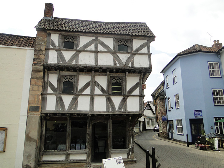 King John's Hunting Lodge, Axbridge
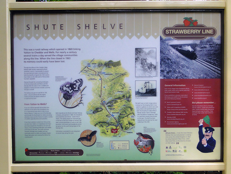 Shute Shelve on the Strawberry Line
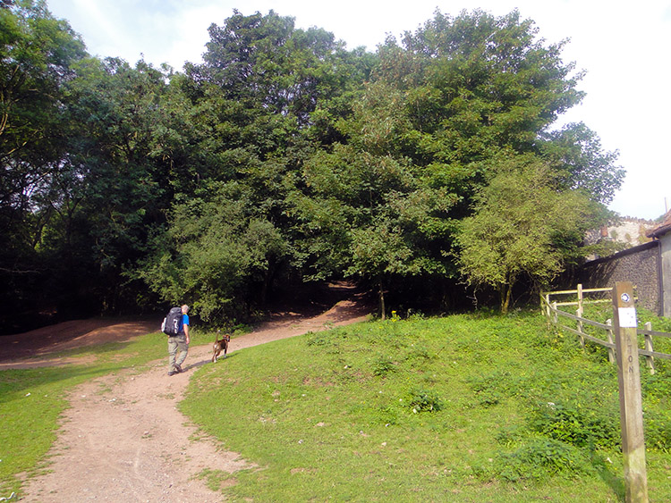
We set off walking from the very pretty village square in Axbridge. As we departed I looked back at Church of St John which was in the north-east corner of square. Steve and I had sat on the steps leading up to the church for quite some time last evening people watching. After the last glance we walked from the Square and passed the impressive timber framed King John's Hunting Lodge, along High Street and towards West Street which would lead us out of the village. We passed more striking timber framed houses some of which were built in the 1460's during the reigns of Henry VI and Edward IV while the Wars of the Roses were taking place. The houses were therefore 550 years old and they looked well for their age. As we continued out of the village the timber frame houses ceded to quaint white and cream houses on either side of the streets. Axbridge was indeed beautiful, it was a shame to leave. We followed a lane which skirted Axbridge Hill leading west and then north to a point where we came to a sign. It said "The Strawberry Line, Heritage Trail". Additional information told us we were on cycle route 26. Winscombe was 1.5 miles away, Yatton 8 miles and Clevedon 12 miles. A little further on we came to an information board telling us we had arrived at Shute Shelve. I remembered we were told to look for it.
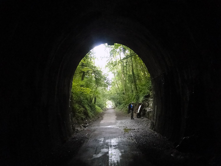 Shute Shelve Hill Tunnel
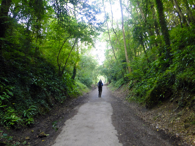 In the railway cutting
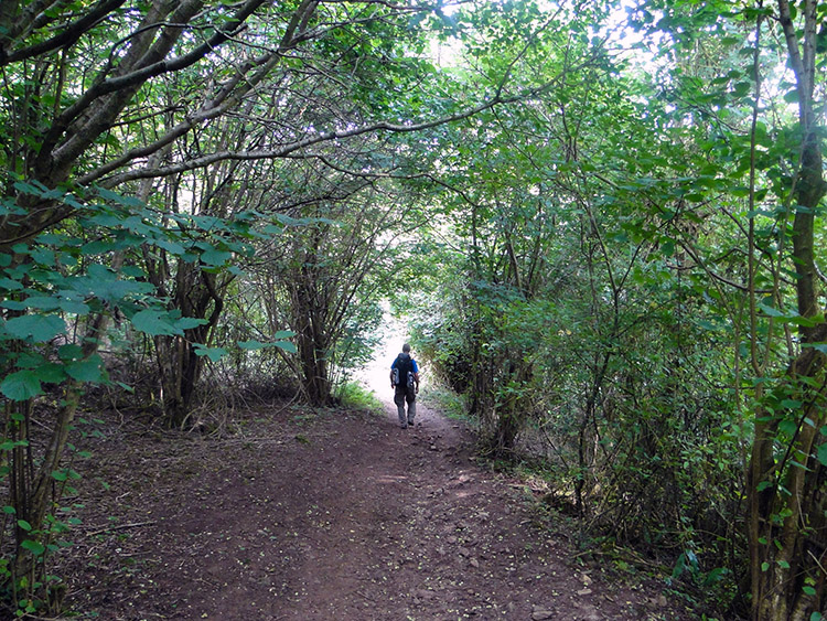
Shute Shelve is a section of the Strawberry line and now the area of Shute Shelve and Crook Peak, a destination we were heading for was a Site of Special Scientific Interest. The first part of our Shute Shelve to Crook Peak journey was along a disused railway line and 10 feet deep into a railway cutting. The highlight of the railway line walk, or perhaps I should call it low light was the walk through Shute Shelve Hill Tunnel. It was spooky and lots of fun as we entered and looked forward to the little glint of light at the end of the tunnel which got bigger and bigger as we progressed through the dark passage. A notice board at the far side of the tunnel told us it was cut out in 1867 and at 180 metres long the construction of the tunnel was where the Strawberry Line began. The title of the board said "From soft rock to hard" informing us that one side of the tunnel is of soft marl and the other of hard limestone. Thus by walking through the tunnel our limestone trail which had began around Velvet Bottom and Cheddar Gorge was over. Or so we thought. There was still a little more to enjoy in a short while.
 Climbing to King's Wood
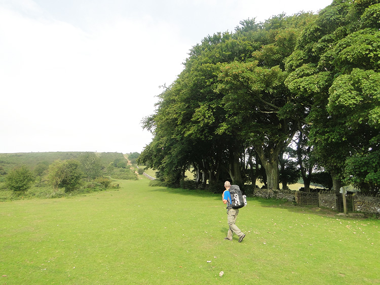 Wavering Down
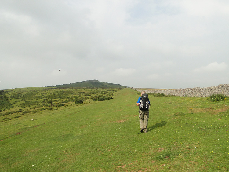
Soon after walking through Shute Shelve Hill Tunnel we left the Strawberry Line. While it continued its course north to Winscombe we turned left and climbed from the railway cutting towards King's Wood. As we started the climb a friendly dog joined us a led Steve up the path into the wood. I met the dogs owner, a lady from Winscombe who came this way to exercise her pet most days. She chatted me and Steve as we walked through the ancient woodland which as part of the SSSI site is rich in wildlife. King's Wood has records which date back to Plantagenet times. Trees and shrubs in the wood included Oak, Beech, Field Maple, Ash, Whitebeam, Hazel, Lime, and Guelder Rose. After exiting King's Wood which we had climbed for 60 metres while doing so the lady wished us well on our walk which was now following the West Mendip Way. "You will enjoy the next couple of miles" she said before waving goodbye. We continued walking to find the reason for her encouraging words by walking into new found open spaces which were a refreshing change from the enclosure of railway cutting and woodland.
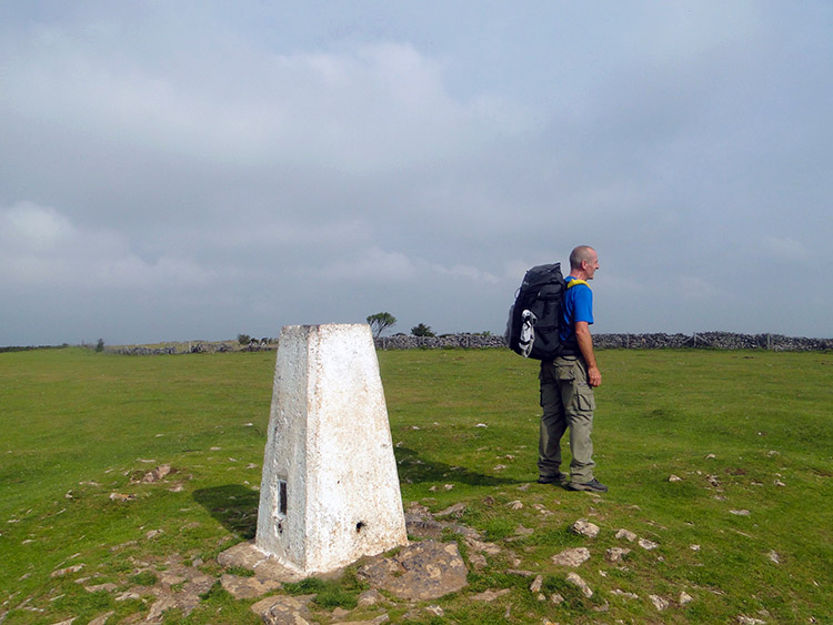 Trig pillar on Wavering Down
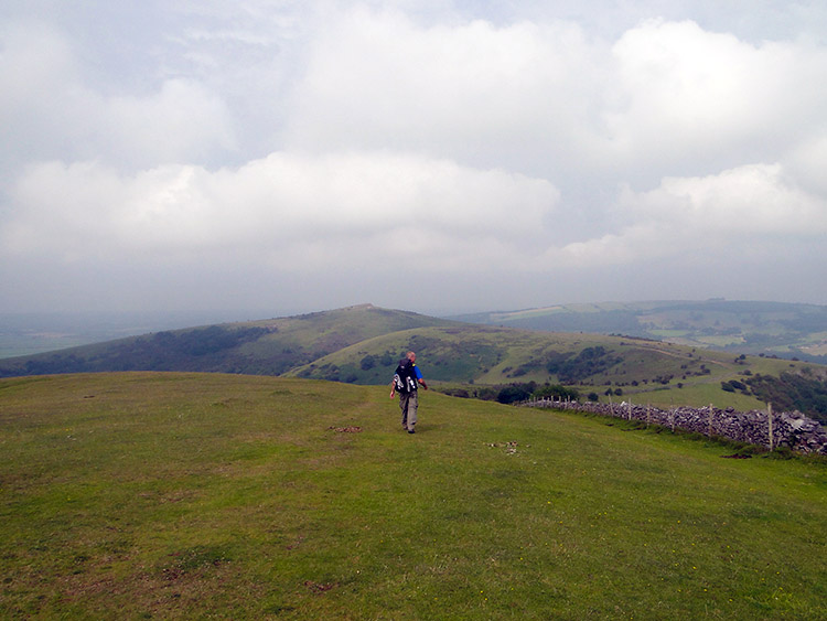 On the West Mendip Way
The climb we had began when leaving the Strawberry Line railway and which had increased in steepness through King's Wood continued as we walked on an easing ascent slope towards Wavering Down. As we approached the summit of the hill we spotted a trig pillar which would mark the highest point of our walk today. A solitary Rook had claimed the trig pillar for itself and stood on top of its proud perch watching us with fixed eyes as we approached. It cleared off when we got to about 10 metres away. By then we had started to look all around with wonder at the tremendous views all around us. The view westwards were best with the pyramidal top of Crook Peak enticing us for the first time. We could see beyond the peak and across the other side of the M5 which we could neither see nor hear yet to the most westerly of the Mendip Hills before they fell to sea level at Brean Down and Weston Bay. The view south across the Somerset Levels was immense, a dry sea of flat land.
 Compton Hill to Crook Peak
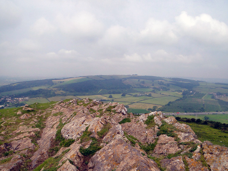 Crook Peak
By climbing to the top of Wavering Down we had made almost 200 metres of height since leaving Axbridge. It had been an easy ascent to the heady altitude of 210 metres and we enjoyed the atmosphere of being in the wide open while up on these western Mendips. After a couple of miles more on these hills we would have to drop down to the Somerset Levels and spend the next day crossing their very flat plains. For now though we enjoyed a lovely undulating walk of two slight ups and downs, first to unassuming and featureless Compton Hill and secondly to haughty and boastful Crook Peak. The walk was grand. I loved this short West Mendip stage of the journey.
I knew Crook Peak from previous encounters though I had not known beforehand. It had always enticed me, as if to say Come on, climb me. you know I am beautiful". Crook Peak is one of the most important and distinctive features of the Somerset landscape and it knows it. Anyone who has travelled the M5 motorway between Bristol and the West County cannot have failed to take theirs eyes from the road and look up to the impressive hill with its attractive pyramidal cone on top. It is the only truly peaked hill in all of Somerset and motorway travellers get a cracking view, particularly when travelling northbound. Steve and I climbed Crook Peak, the top being exposed limestone, not white or cream coloured such as the limestone of the Yorkshire Dales or Cheddar Gorge but a softer pink limestone. The 360° views we enjoyed while sat at the top beside the limestone peak and along the length of the Mendip Hills, across the Somerset Levels and across the Bristol Channel towards Wales were fantastic.
 View to the M5 from Crook Peak
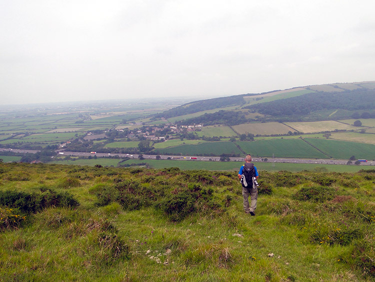
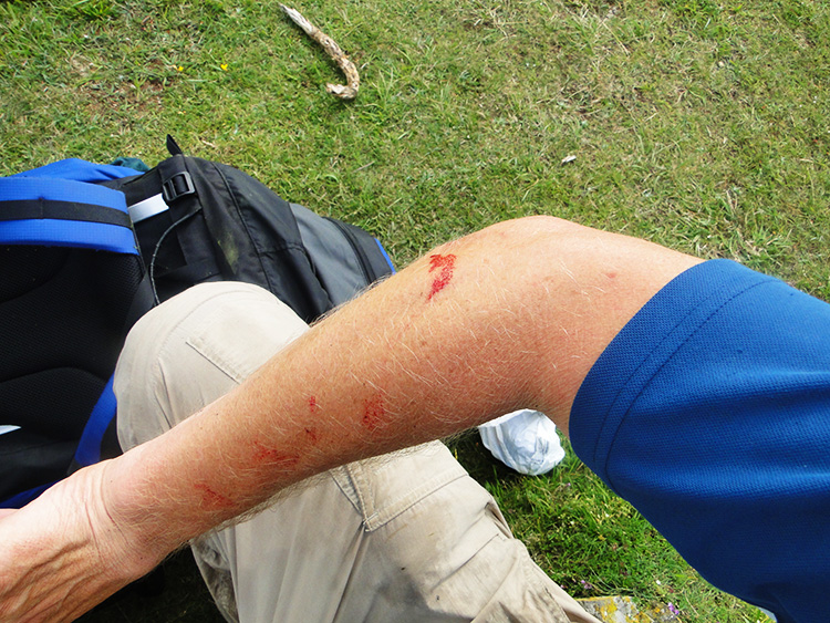 The bloody arm
 We sat on top of Crook Peak for half an hour alternating by taking in the landscape views and watching the traffic going north and south on the M5 directly below us. Across the Somerset Levels we could make out the solitary rising ground of lonely Brent Knoll which like Crook Peak offered motorway travellers a little viewing relief from the endless dirge of the looking left and right across the featureless plains. After our Crook Peak show had finished we looked down towards Webbington Hotel and by mutual consent we decided to walk directly down the slope thus cutting off a little corner of our walk. A dashed line path did show on the map showing we could do the short cut from Crook Peak. Alas the path was not there on the ground and after about 30 metres of descent we hit a line of scrub. Stubbornly we tried to make our way through it and after 15 minutes of attempting to fight our way through we gave up. My arms were blooded in several places from thorn lacerations. A painful lesson had been learned.
 Leafy lane to Webbington
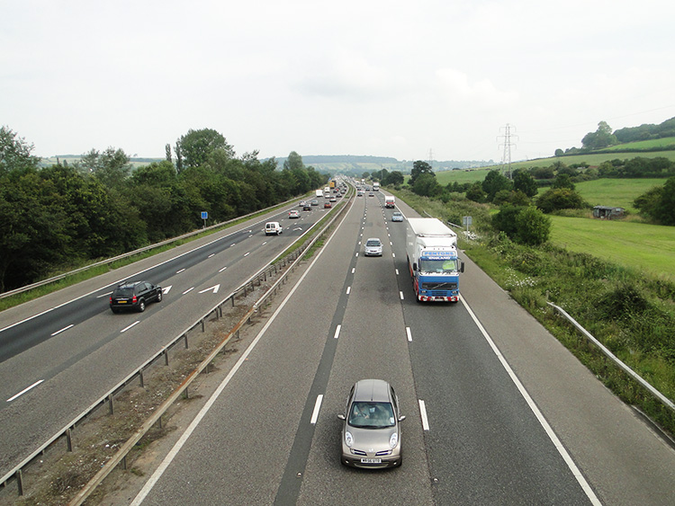 Crossing the M5 near Loxton
 We climbed back up to the top of Crook Peak and followed the true West Mendip Way route down. It was an easy untroubled descent to Webbington and down to the height of just five metres above sea level. Soon after levelling off near Webbington Hotel we crossed over the M5 by a road bridge near to the village of Loxton. From now on and for the next 20 miles or so we would be crossing the Somerset Levels which were necessary to lead us into the undiscovered West Country. I had visited there before and done the odd short walk while on holiday but in truth I was about to walk across paths, lanes, bridleways and trails of the West Country for the first time which was so exciting. After clearing the Somerset Levels that is. We walked on the first levels by following the flats of roadsides from Loxton towards Bleadon. Hang on what is this, a hill already?
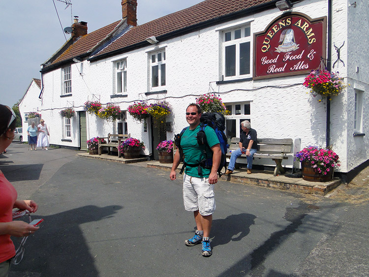 Queen's Arms, Bleadon
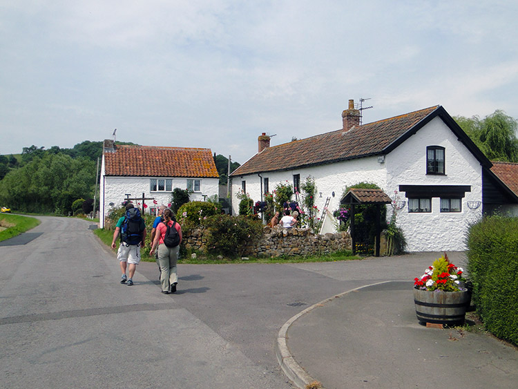 Chris and Emily on my trail
We had reached Bleadon Hill, a little hump in the road all of 50 metres high which led us up and over it into the village of Bleadon. In the village my Stepson Chris and his wife Emily were waiting to meet us for lunch. They were returning home to South Wales after a West Country holiday and so with us all being in the same place at the same time it was a convenient opportunity. Steve and I walked into the pretty Somerset village and met them at the Queen's Arms where we all shared an enjoyable lunch. Chris talked about his passion for expensive mountain bikes which Steve could not quite fathom. Each to his own. After lunch Chris and Emily joined us to walk a mile of my Great British Walk. It was good of him to carry my backpack while doing so and though it was not the best part of my walk along a busy road from Bleadon to Purn they at least did a bit. Well done to them. At Purn we wished them a safe journey home and continued on our Somerset Levels way.
 Hello gorgeous
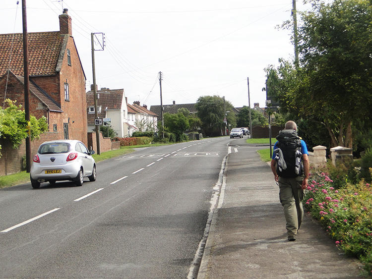 The long road
The next few miles of walking were the least interesting of the day as we headed towards Brean. The rest of today and all of tomorrow were 'transition' stage to get me around the corner of south-west England and to to the true West Country stages through Somerset, Devon and Cornwall which I so looked forward to. At least we could spend some time at the seaside though and in the places Steve spent his childhood seaside holidays. It would be nostalgic for him and nice for him to show me a few things from his formative years.
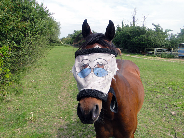
I had drawn the walk to finish in Brean on this stage. The path I had drawn to Summerways Bridge and across Bleadon Levels to cross the River Axe by a bridge near to a caravan park was shown with a dotted orange line traffic free cycle route on the Ordnance Survey map. So we walked all the way to the bridge on the Axe. It was gated at either end and locked. So we gave up that plan and backtracked to follow a permissive path which linked us back to a road. From the road we followed it south to Leaze Farm before following a lane to Wick Farm. We met a horse with a mask on the lane. It crossed its paddock to greet us. Afterward the horse whispering encounter we resumed road walking at Wick Farm and walked in to Burnham on Sea. It was a long road, all of three and a bit onerous miles.
 Arrival at the seaside
 Burnham on Sea sands
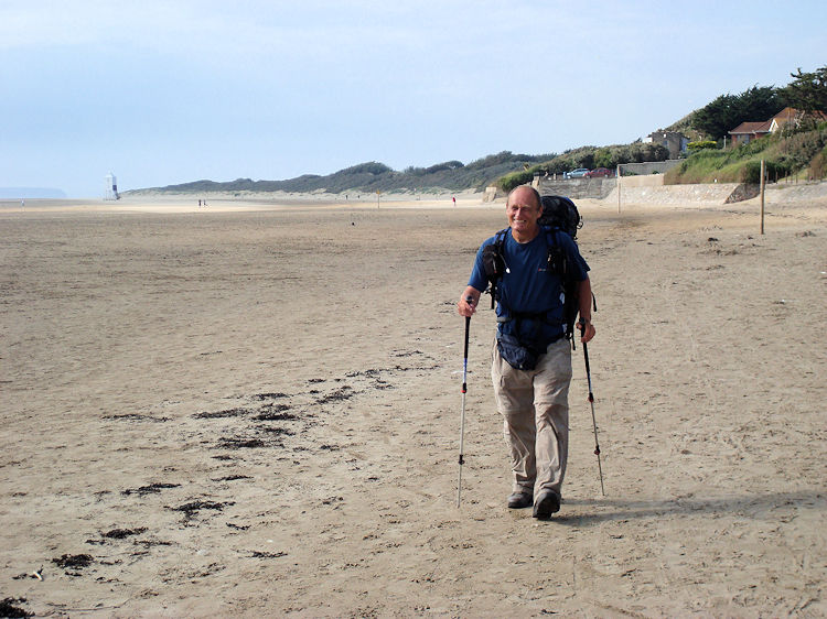
We stopped once or twice on the long road walk in. On one of those stops I lost a sock which had been airing all day on the back of my rucksack. "Can't be bothered going back for it" I said to Steve on the discovery. "I will get another pair in Burnham". After the grind of the roadside path which was accompanied by the constant drone of traffic heading to and from the popular seaside town it was quite a relief to arrive and at the first opportunity to leave the roadside and head down a street to the sandy beach we took it. The sun was shining as it had been for a remarkable five days now and the sun kissed walk along the beach was magic. Steve pointed out places he had played as a young boy and to islands out at sea which he was familiar with such as Stert Island. There were Steep Holm and Flat Holm too. I never knew they were there.
 Picture frame
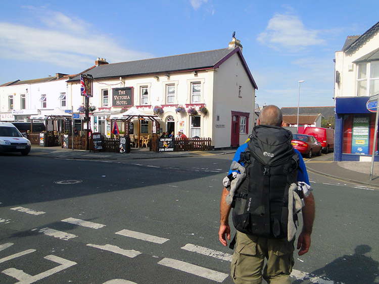 Victoria Hotel, Burnham on Sea
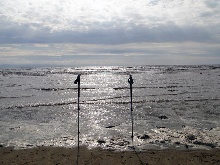
Steve and I enjoyed the walk on the fine firm sandy beach of Burnham on Sea. It was around 5.00pm in the evening and the sun getting lower in the sky to the west cast a lovely scape on the sea. I framed it with my walking poles and enjoyed the picture while Steve sat on the sea wall and contemplated. Ten minutes later we popped into the Somerset seaside town and found the Victoria Hotel. When we had diverted from Brean I had phoned Lil who had self titled herself my 'international rescue'. On my urgent pleadings she had found us accommodation in Burnham on Sea while we had walked in. It was not the first occasion she had helped with an impromptu change on the walk and it would not be the last.


