Offa's Dyke Path National Trail
A personal record of my walk of Offa's Dyke Path National Trail with written journal and photographs. Tracklogs for GPS units and for use with Google Earth are available for download for each stage.
Journal, Photographs and Download Files
Stage 4: Castell Dinas Bray to Llanymynech
Google Maps Open Source Maps| Statistics and Files | ||
|---|---|---|
| Start: Castell Dinas Bray | Finish: Llanymynech | Distance: 21.6 miles (34.8 km) |
| Time: 9-11 hours | Climbing: 1,143 metres | Rating: Strenuous |
| GPX Route File | Google Earth File | About Offa's Dyke |
| Statistics | |
|---|---|
| Start: Castell Dinas Bray | Finish: Llanymynech |
| Distance: 21.6 miles (34.8 km) | Time: 9-11 hours |
| Climbing: 1,143 metres | Rating: Strenuous |
| GPX Route File | Google Earth File |
Ordnance Survey Explorer Map (1:25,000)
The Walk:
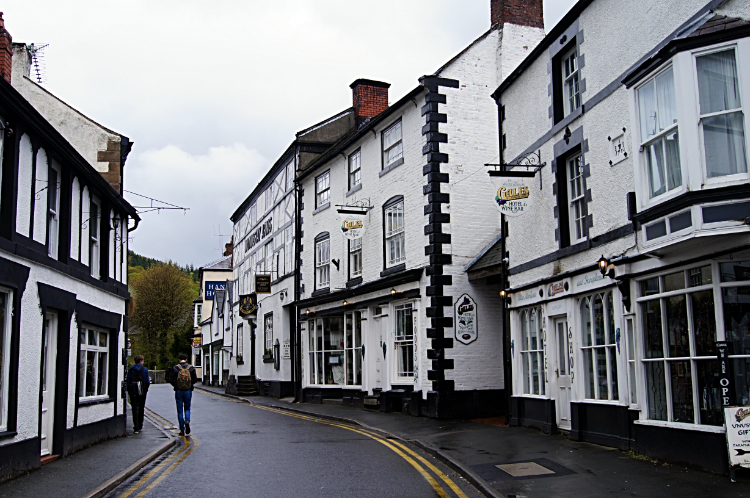 Llangollen
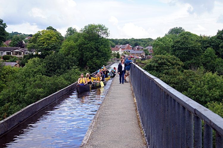 Pontcysyllte Aqueduct
After a pleasant evening in Llangollen consisting of dinner and a couple of beers, my usual long distance walking routine, and after another good breakfast in my accommodation I emerged into the streets of town and looked up to a heavy overcast sky of the same character I had walked under all yesterday. But the sky was not leaking water now and the weather forecast was for a patchy beginning and then a good day, improving towards lunchtime and with the promise of sunshine. Still, backtracking to the resumption of Offa's Dyke Path by way of the road passing around Dinas Bray was all done under cloud. And when I was back on the national trail it started raining again. On and off, quiet heavy and sleet at times. This time though it was showers and not persistent. "They will pass" I promised myself. I walked east along the road I had been on yesterday for a couple of hundred meters before taking a left fork and following the Panorama Walk road a little further before leaving it to follow the Offa's Dyke Path. If I had stayed on the road I would have walked up to the viewpoint called The Panorama which is thought to be one of the very best viewing points in the whole of Wales from which the Berwyn Mountains and on the clearest day also Snowdonia can be seen. But I had another adventure in my mind, an airy crossing of one of the highest and most exposed aqueducts in Britain. I walked through Trevor Woods to the village of Trevor and after the village I headed along the Llangollen Canal towpath to the large arched structure I could now see up in the skies above me. I was about to cross the Pontcysyllte Aqueduct. Here my previous three days of walking without people around was completely dismissed. Despite it being early morning the aqueduct was already busy with people. Some were walking across but most were crossing in canoes, small boats and traditional narrowboats. They had to wait in queues though, the aqueduct only takes one way traffic and each waterborne traveller has to wait their turn. My on foot crossing was steadily taken too, the path is narrow and two can pass carefully but no more. By the way, the views down to the River Dee from the aqueduct are gobsmacking. It is 126 feet down to the river and it looked it. A long drop!
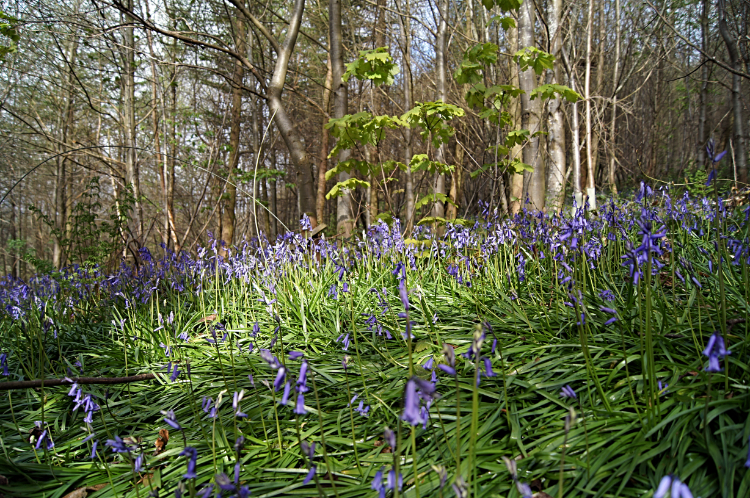 Bluebells in Gwyningar Wood
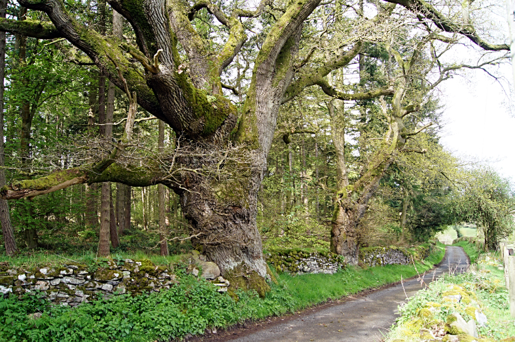 The road to Castle Mill
From Pontcysyllte Aqueduct I continued along the Llangollen Canal towpath in a easterly direction towards Pentre, shedding other towpath walkers as I went. I was soon alone again. At Pentre I left the canal and switched from heading east to a south-west course on a mix of lanes, field crossings but mainly minor roads for almost three miles to Tyn-y-groes where I turned direction again, heading south-east along the edge of Bluebell filled Gwyningar Wood. As if by magic the sun came out for the first time in the day to bless the beautiful Bluebells with sparkling colour. Is there a better springtime sight than a Bluebell woodland dappled by sunlight? I think not. I reluctantly left the wonderful scene to follow Castle Mill Road down to the Ceiriog valley. I knew I would see more though and that heartened me. What I did not know at the time is that I was walking down to the scene of a battle in the heart of the valley. I crossed the B4500 and came to a road bridge over the River Ceiriog which marked the site of the Battle of Crogen. The engagement, not known for sure as a major battle or a series of skirmishes was between the followers of Henry II of England and an alliance of a number of Welsh princedoms led by Owain Gwynedd during Henry II's summer 1165 campaign.
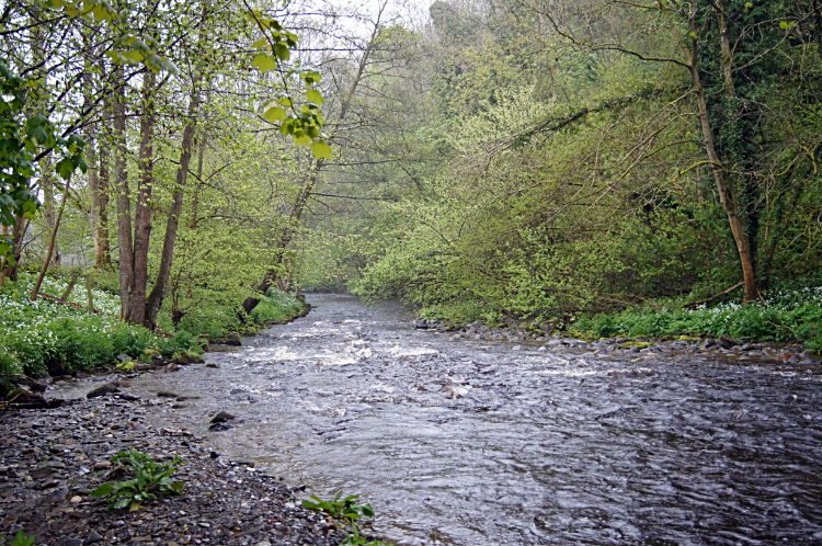 River Ceiriog
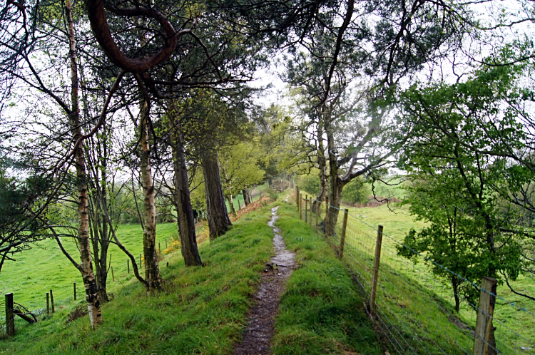 Offa's Dyke near Bronygarth
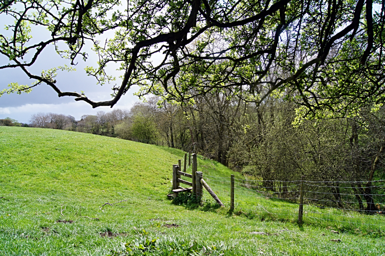
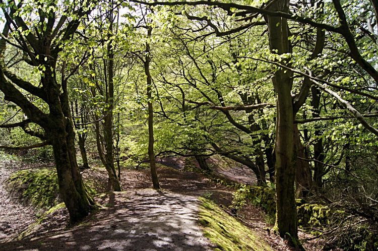
From Tyn-y-groes to the crossing of the Ceiriog valley I had descended by more than 100 meters and now on the climb from the valley to Plas-crogen I had to make that back up and more. Over the next mile and a quarter I had 260 meters of ascent to make. The first half mile was the hardest, a lung busting climb along lanes and across fields. The first compensation for the hard work of height gain was a great view across the Ceiriog valley back to the upper fortifications of Chirk Castle. If that was good then the second treat afforded to me for the altitude gain was the one I had been waiting for since my first step out of Prestatyn. At a point beyond Bronygarth and where Offa's Dyke Path crossed the Llwybr Ceiriog Trail I walked up on to the top of the actual Offa's Dyke mound. My first contact with the ancient earthwork had been made. It was a fantastic moment for me. Just as with my Hadrian's Wall Path walk three years earlier, it had taken me a few days to see the true ages old star of the walk. I walked along the top of the embankment with the ditch on my right, to the Welsh side. In some places the earthwork stopped, where watercourses cut through. "No need there" thought Offa. In other places while the mound remained the ditch disappeared, levelled off to make more pasture field for farm stock. All in all, this first section of true Offa's Dyke ran for a little over one mile. A good distance.
 Gorgeous countryside
 Site of Oswestry Racecourse
A half mile from Craignant with the first stretch of earthwork behind me I began a stretch of walking across gorgeous countryside. The sun was out and the sunshine helped fill me with good feelings. I was in my element. "Can't get better than this" I thought. From Craignant I continued south past the west edge of Sellatyn Hill and here I met a father and son walking Offa's Dyke in the opposite direction to me. We stopped for a ten minute chat before waving each other off on our respective journeys. Carrying on walking south I came across more evidence of Offa's Dyke, stretches of the earthwork here and there. And then more and more of it, some in appreciable lengths and plenty of it used as modern field barriers. Why not make use of it. If it could keep people out it could surely keep stock in. At Carreg-y-big I came to road and set off on a mile of hard tarmac walking. Don't like it too much, it wearies the feet, but inevitable in long distance walking. The road walking was one mile long with a signpost pointing to Oswestry Old Racecourse. On the way to the races I reached a chap sat on the roadside with a heavy backpack beside him. I chatted with him. He told me he was from the Netherlands and walking across England and Wales including part of Offa's Dyke. "Resting my feet, overheating with all the tarmac" was his explanation for the rest. I agreed with him about road walking and wished him luck once he was sufficiently recovered and on his feet. I continued on eventually reaching the site of the old horse racing track. It was nice to be walking on grass again. A information plaque looking south showed the location of many Shropshire Mountains including the distance to reach them. Caer Caradoc at 25 miles, Long Mynd at 24 miles, Moel Y Golfa at 15 miles, Mynydd Myfyr at 2 miles, etc. Another information plaque pointing north showed other mountains; Plynlimon at 35 miles, Cader Idris at 35 miles, Cader Berwyn at 12 miles etc. Another information board indicated the site and explained the story of Oswestry Racecourse Grandstand. I studied them all and had a sit down refreshment break on the site of the racecourse. I had already walked 13 miles after all and I still had just short of 10 miles to go.
 Racecourse Wood
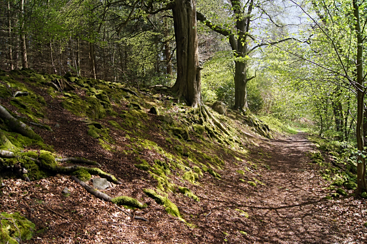 Craig Forda
The first part of the last ten miles was a real delight. I left the open grasslands of the Old Racecourse to enter ancient woodland in a lush spring colouring of pale green. Quite often the path followed or stepped over embankment. There were signs of Offa's Dyke even in these ancient woods. Racecourse Wood ceded ground to Craig Forda Wood. The join was perfect seamed. Lichens, Ferns, Fungi, old woodland craft enclosures and pens, trees of all descriptions. These brilliant woodlands had it all. To my right, a little lower down a bank, unseen and unheard ran the River Morda. The last piece of the woodland puzzle in the one and a half mile of walking under canopy was in Candy Wood and after that sweet thought I emerged into the open at a footbridge over the River Morda near to Tyn-y-coed. Continuing south and skirting the England and Wales border, I have no idea how many times I would cross it, I next came to the English village of Trefonen. It was a warm afternoon now, much unlike the last few afternoons and I fancied an ice lolly. Luckily there was a shop open in the village and I found my ice lolly. Yummy. After quenching my thirst I headed across country to Moelydd Uchaf, passing a memorial with the inscription 'Restored to the Memory of John Dumville Lees April 21st 1932'. Next I passed Jones Rough Nature Reserve and then I headed down into Nantmawr.
 Asterley Rocks on Llanymynech Hill
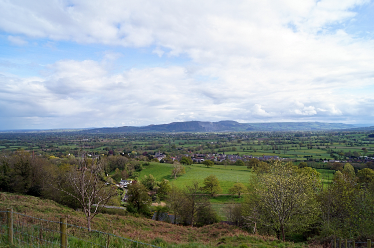 View to Llanymynech and Breidden Hill
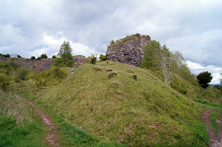
Nantmawr was passed and Porth-y-waen reached which marked the twenty miles done point of my walk. And I felt it. I did not fancy the 100 meter climb of Blodwel Rock which would see me to Llanymynech Hill and to sight of my destination. Weary step after weary step I climbed, ever hoping to see the top of the hill. Nothing to my left or right interested me. I just kept my head down looking at my feet and climbed. Slowly and surely it got lighter as I came nearer to sky. A sign even told me I was entering a golf course though the path skirted around it. Eventually I made it. I had climbed to the top. Only 225 meters at the trig point but feeling like the summit of Scafell Pike after 21 miles of walking. The view from Asterley Rocks at the top of Llanymynech Hill was worth the effort. Especially the one south to Llanymynech and Breidden Hill. I enjoyed that before making my way off the hill and into the border village. Which very much felt like a border village. Neither here nor there. Not that I was bothered. I was too tired to care.
(I was staying at the Cross Keys in Llanmynech. The pub was pretty basic, my room old fashioned but acceptably clean. In the evening I sat in the bar with the locals and had a good evening over a couple of beers. Above all, the food was exceptional. I was very pleasantly surprised, it was one of the best meals I have had in an old fashioned pub. And there was plenty of it.)
Here is what I posted on Facebook on arrival in Llanymynech: "Did someone say Offa's Dyke was one of the easier National Trails. Not if today's experience is anything to go by. After a benign start along the Llangollen Canal and a thrilling crossing of Pontcysyllte Aqueduct it was up, down, up, down, etc, etc. Hills were climbed and though not the highest some were steep, both uphill and down. This morning we had rain storms too, heavy and with sleet. Carole Kirkwood called it an occluded front. Still the sights were great, lovely countryside was crossed and nice people met. The picture is Chirk Castle which I saw from one of those darned hills. Oh, 21 miles done. I am well chuffed".


