The Great British Walk
A personal record of my three month walk of the full length of Great Britain from north to south with written journal and photographs. Tracklogs for GPS units and for use with Google Earth are available for download for each stage.
Stage 31: Drumelzier to St Mary's Loch
Google Maps Open Source Maps| Statistics and Files | ||
|---|---|---|
| Start: Drumelzier | Finish: St Mary's Loch | Distance: 13.7 miles (22.1 km) |
| Time: 6-7 hours | Climbing: 893 metres | Total Distance: 382.2 miles |
| GPX Route File | Google Earth File | About the Southern Uplands |
| Statistics | |
|---|---|
| Start: Drumelzier | Finish: St Mary's Loch |
| Distance: 13.7 miles (22.1 km) | Time: 6-7 hours |
| Climbing: 893 metres | Total Distance: 382.2 miles |
| GPX Route File | Google Earth File |
Ordnance Survey Explorer Map (1:25,000)
Summary
Back into the hills at last. This much anticipated stage of the walk took me to remote parts of the Scottish Southern Uplands. From Drumelzier I climbed to Pykestone Hill at 737m high which provided the first outstanding views of the rolling hills which typify the region. I crossed open moor and topped a few more hills in the area which provided me with my first tantalising views of England since I had set off on my long journey before descending to Megget Reservoir. From there it was a short walk to my base for the night at Tibbie Shiels Inn at St Mary's Loch.(Note: My walk of Glasgow and South Scotland was a part of my Great British Walk from the north coast of Scotland to the south coast of England)
Stage Report
At 9.30am I was dropped off at the very spot I have finished walking in Drumelzier yesterday, all thanks to the gentleman from Wigan with whom I had enjoyed my evening in Biggar. After saying goodbye and good luck to him in his quest to procreate Rugby Union stars of the future in the Scottish Borders I set off on my continuing trek south towards Cornwall. I was alone and not to see a single person until I had crossed the hills today.
 Heading into the hills
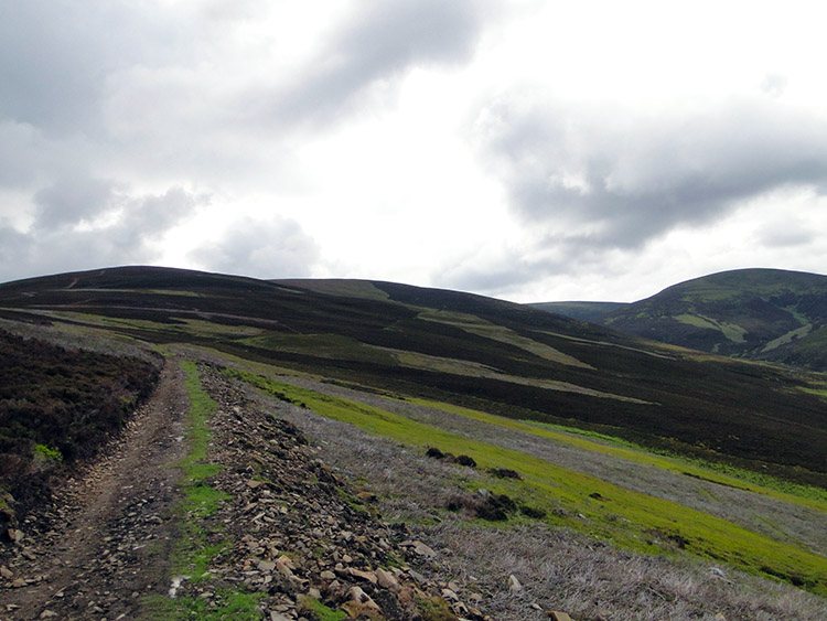 Den Knowes Head
I set off walking on a gentle incline following Drumelzier Burn upstream. The track I followed was a very good one, well compacted to allow vehicular access onto the uplands. Skies were overcast but the cloud was quite high and there was little wind. I expected to cross the tops in dry conditions and hoped that would be the case. It was clear from the start of my climb I was walking towards a different kind of upland terrain than I had experienced in the North West Highlands. The mountains there were mostly grey, craggy and austere looking. The ones I was heading toward now were rolling, heathered and green except for where controlled burning of the vegetation had taken place. There was a great swathe of burned heather either side of the trail as I walked up to Den Knowes Head. The hills were seriously singed.
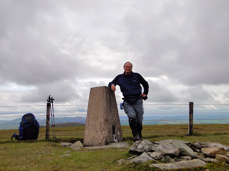 Pykestone Hill
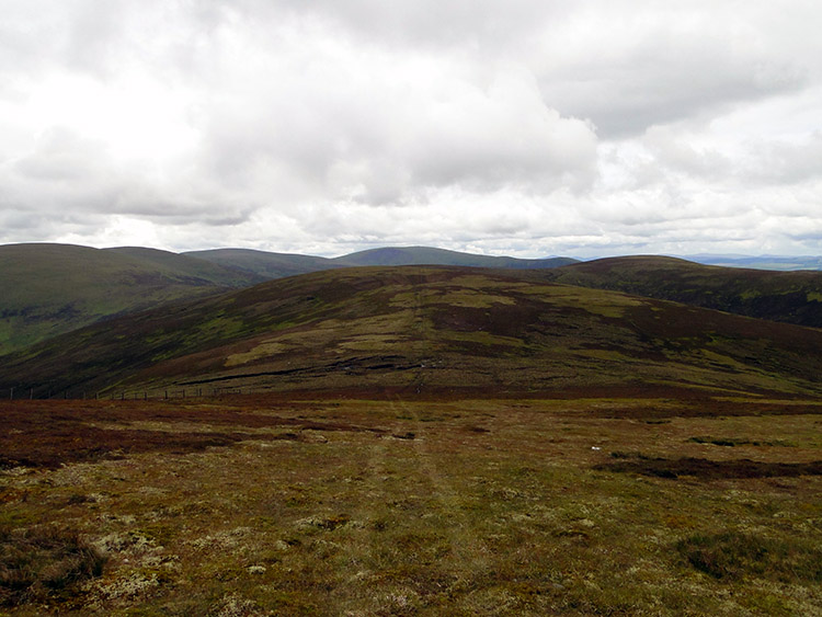 Grey Weather Law
On the way up to Den Knowes Head I imagined I could easily be on the Howgill Fells on the Yorkshire/ Cumbria border. The undulating terrain and forgiving ground underfoot was very similar. The only difference was the colour, these hills being black where burnt and a darker green where uncharred. Everything else was much the same. From Den Knowes Head I climbed 80 further metres up to the rounded upturned basin summit of Pykestone Hill. I was pleased to see the trig pillar marking the summit. They are also a welcoming sight and spur of intent to touch for a walker. When at the summit I took a short break, set the camera on delayed timer and captured an image of myself. There was nobody around to help take the shot any other way. I thought this trig pillar to be one of the lonelier less visited ones in the UK. Despite being up on top of a super hill at an appreciable height and with lovely views of the surrounding uplands who would venture up here? It is not on a well known route or marked long distance path. Well it was not until it became part of the Great British Walk that is. I moved on.
 Long Grain Knowe
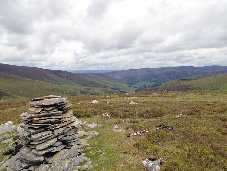 Dollar Law
From Pykestone Hill I enjoyed three miles of excellent walking on a great springy path following a gentle undulating course across a series of wonderful Southern Upland hills. It was fantastic. I was enjoying my best days walking since the fun of negotiating the tough narrow paths beside Loch Lomond over a week ago. Did I say the walking was now fantastic?
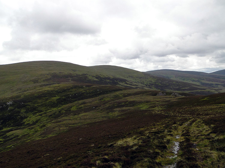
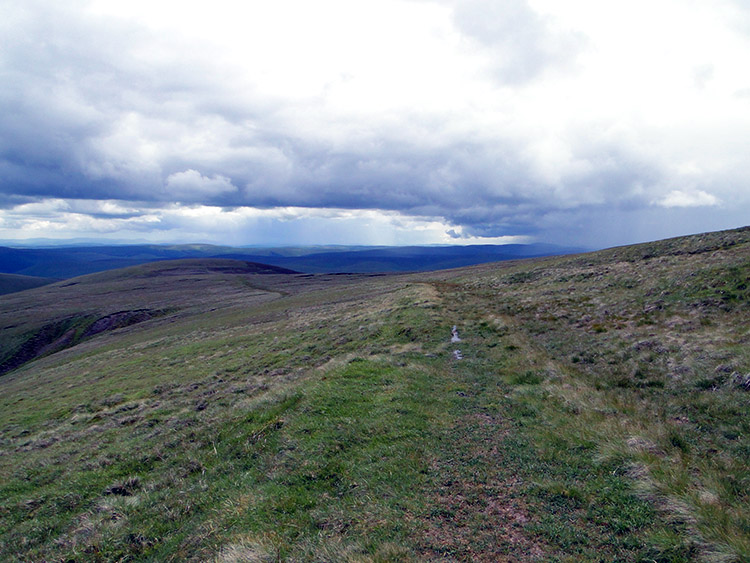 Thief's Road
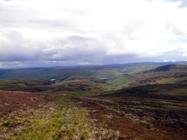 The view south from Dun Law
It was certainly fantastic and good enough to qualify as a WOW section of walking as I jauntily walked on Thief's Road from Pykestone Hill to Grey Weather Law, Long Grain Knowe, Newholme Cairns Hill, Dollar Law, Fifescar Knowe and Dun Law. What a thrill I had. Even having the heavy backpack to content with on the ups and downs of the trail did not seem to matter. I was having a whale of a time. From the high road which bounded along at over the 700 metres line I could see a long way. Was that England in the distance. After over four weeks of walking from the north coast of Scotland to the south I was closing in on my native land.
 Interlocking spurs
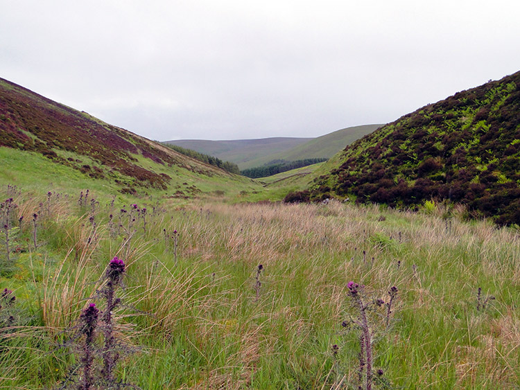 Near Cramalt Burn
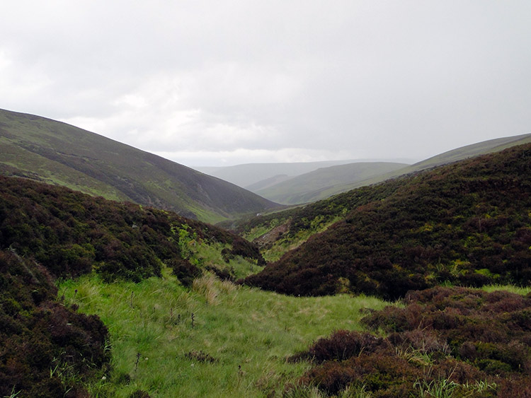
After Dun Law I had to make the sad decision to descend from the high ground. I did this by following Cramalt Crook from its source where it bubbled out of the ground between Dun Law and Notman Law. Having found the source I tracked down beside the trickle of water. I followed Cramalt Crook for its entire length, all 1.26 kilometres of it until it met other small streams to become Cramalt Burn. One thing to mention. As I followed Cramalt Crook the sky filled with heavier and lower clouds. The wind kicked up and I was hit with a short sharp, almost violent shower. It lasted no more that five minutes but it was belligerent enough to stop me making progress. I ducked down in the grass and reed beside the stream, put on my waterproofs and used my backpack as a temporary shelter by holding it above my head. Or rather I held it settled on top of my head until the storm had passed. It did and I set off walking again.
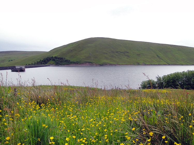 Megget Reservoir
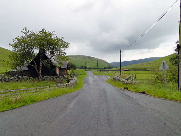 Following the road to St Mary's Loch
As I had done with Cramalt Crook I followed Cramalt Burn downstream for its entire length. All two and a half kilometres of it until it terminated in the waters of Megget Reservoir. A good path followed the entire course, it was an easy exit from the silence and remoteness of the uplands to the tarmac road beside the reservoir. I stopped on a low wall close to Megget Reservoir Dam and enjoyed my lunch. I was not in a hurry, my walk would continue by following road all the way to my destination after lunch. Soon after setting off along the road I had an experience. Let me call it a long distance walkers experience.
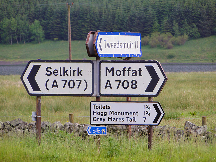 Convenience sign
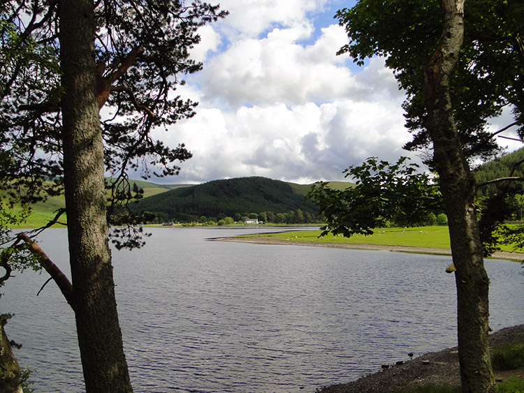
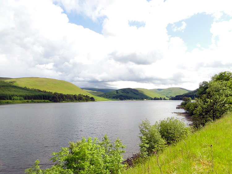 St Mary's Loch
Walking along the road from Megget Reservoir I passed the site of the remains of Cockburn's Castle at Chapel Knowe but there was no castle to be seen. At Chapel Knowe there were the remains of a chapel but I could not really make that out either. All I could see was a Bungalow. After passing the sites of nothing I felt something hit my head. It was a light tap. Then I felt another light tap. Then another....
The light taps got heavier and more frequent. Within ten seconds the skies poured with hailstones. As with the earlier rainstorm the wind kicked up too. I soon donned the waterproofs again and put up my hood. I looked down at the tarmac road as any hailstone hitting my face was painful. The hailstones were as big as peas. And harder than frozen peas. What was fun was how the hailstones swirled when hitting the tarmac, making intricate patterns as they did so. It was like looking into a kaleidoscope. I loved it. What an experience it was, so memorable. I reached the junction I was aiming for without really noticing. And all because of the fun.
 Looking across to Tibbie Shiels Inn
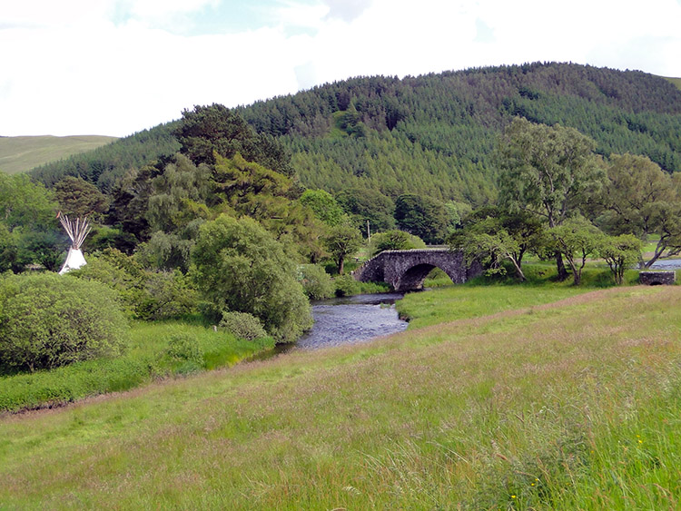 Spot the Wigwam
All that remained was for me to walk along the road running parallel to the west side of St Mary's Loch to Tibbie Shiels Inn, my home for the night. The sun came out and beamed down warmly on me. It was a lovely finishing mile to my excellent day of walking. I looked across the loch from time to time as I approached. "What is that" I though when I spied something unusual. As I left the road to walk down the lane to my inn I got my answer. The natives had put up the Wigwam. As I walked by the natives were eating at the barbecue. I joined the settlers in the Tibbie Shiels Inn. Later all the tribes met and got on fine. As tribes should.
Tomorrow's stage would see me head further into the glorious Southern Uplands. And at the end of my day I would be staying in a Bothy. Not quite a Wigwam, but on much the same lines. See you there.


