The Great British Walk
A personal record of my three month walk of the full length of Great Britain from north to south with written journal and photographs. Tracklogs for GPS units and for use with Google Earth are available for download for each stage.
Stage 34: Langholm to Longtown
Google Maps Open Source Maps| Statistics and Files | ||
|---|---|---|
| Start: Langholm | Finish: Longtown | Distance: 12.3 miles (19.8 km) |
| Time: 5-6 hours | Climbing: 222 metres | Total Distance: 430.4 miles |
| GPX Route File | Google Earth File | About Langholm |
| Statistics | |
|---|---|
| Start: Langholm | Finish: Longtown |
| Distance: 12.3 miles (19.8 km) | Time: 5-6 hours |
| Climbing: 222 metres | Total Distance: 430.4 miles |
| GPX Route File | Google Earth File |
Ordnance Survey Explorer Map (1:25,000)
Summary
This was one of the easier stages of the walk despite some navigational problems around and on the Scotland/ England border. From Langholm in Dumfries and Galloway I walked in the company of my best friend Steve over moor and on some farmland trails to the border at Scot's Dyke. Once in England we followed more paths and trails in farming country to reach the River Esk which we followed downstream into Longtown.(Note: My walk of Glasgow and South Scotland was a part of my Great British Walk from the north coast of Scotland to the south coast of England)
Stage Report
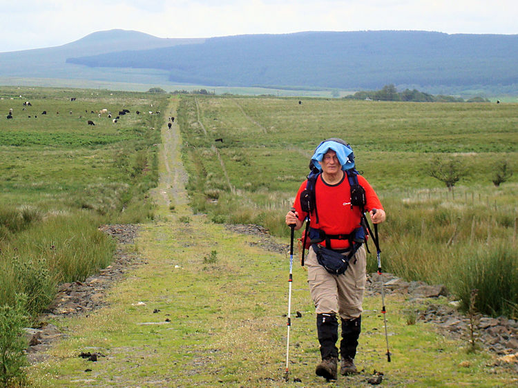
My 34th stage of the Great British Walk was like a double edged sword. There was a very significant milestone passed but the milestone was tinged with sadness for halfway through this stage I walked out of Scotland and into England. At the point of crossing the border I looked forward to over 650 miles of walking in England while I looked back at having completed over 400 miles walking through Scotland. From the north west corner of the British mainland I had used multipul trails and tracks including the Cape Wrath Trail, West Highland Way and Southern Upland Way to reach Langholm. I had seen a shifting landscape from the rugged harshness of the highlands in the far north to the smooth curved hills of the Scottish south. I had met lots of lovely people and enjoyed the culture of the country. For now though Strolling Steve was waiting for me.
 Strolling Steve Scott
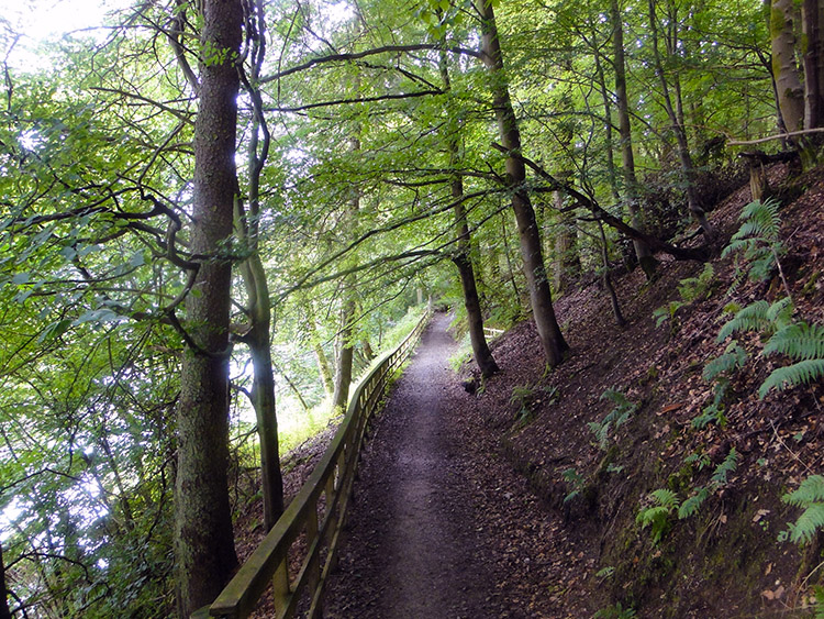 Easton's Walk
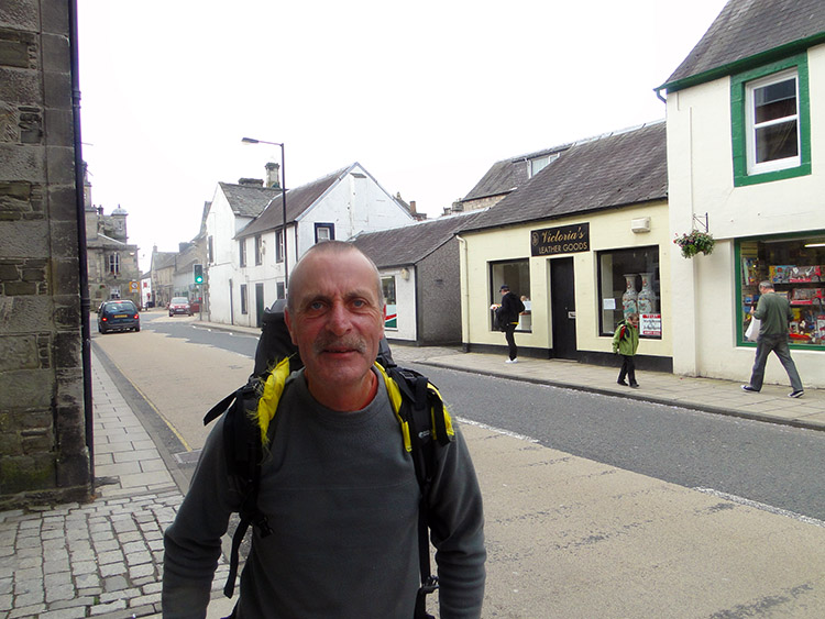
Langholm is known as Muckle Toun and is the birthplace of Thomas Telford, the famous engineer. That explains the bequest to Westerkirk Library and the resulting memorial dedicated to him which I saw in Bentpath on the previous stage of the walk. Langholm is also home to Clan Armstrong. A descendant of the clan called Neil visited the town in 1972. He happily declared the town his home and was made the first freeman of the burgh. Neil was quite famous, a few years before his visit to Langholm he had been to the moon. I liked Langholm, my last stopover in Scotland. I liked lots of the places I stayed during the walk through Scotland. I have good memories of them and I shall miss them.
Strolling Steve and I walked out of Langholm towards England by crossing the River Esk to reach Langholm Parish Church which stands in a prominent position overlooking the town and the river. We passed the church and left Langholm by following the Esk downstream along Easton's Walk. This led us to a couple of field crossings to Murtholm and then to Skipper's Bridge which was once the only bridge over the Esk which gave access to Langholm from the south.
 Last wilderness of Scotland
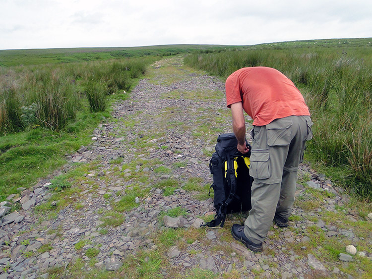 Rearranging the backpack
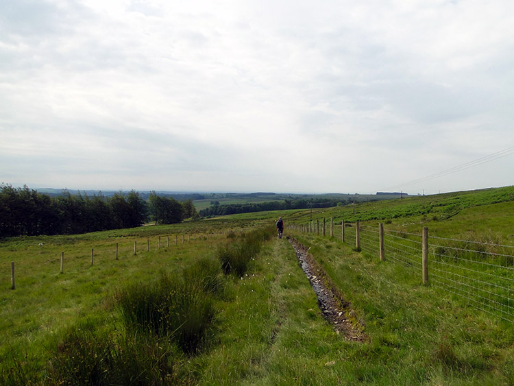
I was limping a little bit during these first miles of the day. As we climbed from the River Esk at Skipper's Bridge to Mouldy Hills Steve said "Ignore it Mike, it will go away". Alright for him to say I thought. I had walked over 400 miles. He had walked one. But he was right. The limp had been caused by the extra miles walking on tarmac to Langholm two days earlier. A day's rest had caused muscle in the foot to shut down but now the walking was loosening the muscles up nicely. Pain was abating, limp disappearing. Thankfully this was not a repeat of my ills in Fort William. We climbed from the river at 60 metres to the 150 metre level and the highest elevation for the day. We were crossing Irvine Moss, my last piece of wilderness in Scotland.
 Walking across Irvine Moss
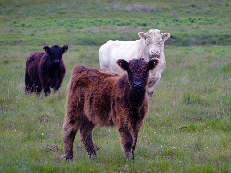 The Beasties of Irvine Moss
It was a muggy morning. Though the sun was hidden by a sheath of high cloud it was warm when we had set off from Langholm and it got warmer as we walked. As we crossed Irvine Moss the recipe of weather, natural ingredients of the moor and of ourselves provided the perfect meal for flies. They were on to Steve and I very quickly and they swarmed around our heads. Swatting was futile, the sheer number of them beat any repulse. They hovered in packs, squadrons dived in and the successful flies which beat our repulses bit with ferocity. It would have been carnage but we both defended ourselves by covering or heads with towels. The flapping of our temporary head tents did just enough for us to survive the onset of madness.
There was a herd of Cattle on Irvine Moss. As we had walked across with arms waving and then with covered heads they must have been bemused as to what was going on. They never took their eyes of us as we walked past them. I wonder if they had found it amusing.
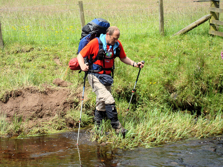 Crossing Saddlers Sike
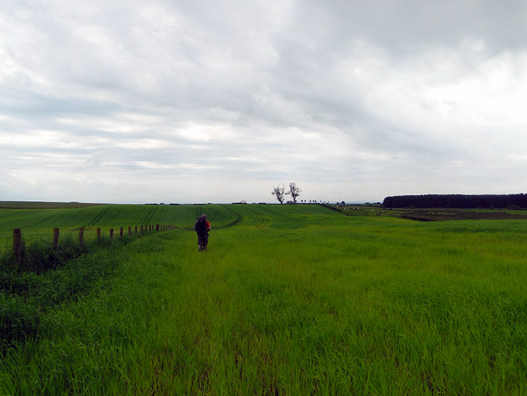 Field crossing near Evertown
We were relieved to get across the open spaces of Irvine Moss. A short stretch of road followed which the flies did not bother to follow. We could free our heads from the protection of cover. At Saughtree Cottages we left the road to follow fields and cross a couple of small becks which are called sikes in this part of the world. The map had shown the watercourse crossings to be forded but in reality they were not. We had to wade across as best we could. It was fun. Soon we walked into Evertown, the last marked habitation in Scotland of my Great British walk.
 Evertown Bus Shelter
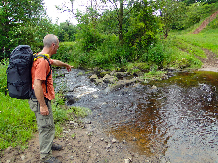 Steve shows his way to cross Glinger Burn
We stopped at Evertown for a break. There is not much there, just a few houses and small farms. The B720 passes through Evertown which affords it a bus shelter. We took shelter in the bus shelter for a short break. We were there about ten minutes. Not a vehicle passed on the B720. We saw not one person in Evertown either. In fact the day was proving eerily quiet. We had seen nobody since leaving Langholm, not even a farm worker. We left Evertown without the opportunity of a greeting and walked the final mile towards England. One more stream barred our way to the border. At Glenzierfoot we reached Glinger Burn. With Steve pointing the safe way to cross we did so and walked the final steps from Scotland to England.
 Pointing to the nations on Scots' Dyke
 Steve looks from Scots' Dyke to England
We had reached Scots' Dyke and in doing so I had completed my walk from the far north to far south of Scotland. My GPS track shows the distance as 411 miles though I estimate it was a good deal more. Usually my actual track logs are 10% greater in distance than my plots so I guess it was actually a little over 450 miles. Whichever the true distance I shall never forget the 34 days of walking through Scotland and shall never forget the tremendous experiences. Some of them I have written about already and some more will feature in further posts during this journal. Other recollections will appear in other walks reports and more will be permanently banked in my mind. Thank you Scotland.
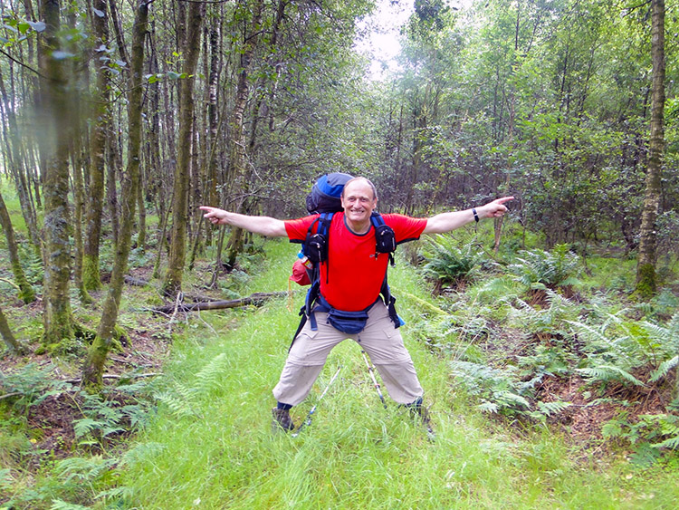
Scots' Dyke is a three and a half mile long linear earthwork constructed by the English and the Scots in the year 1552 to mark the division of the Debatable lands and thereby settle the exact boundary between the Kingdom of Scotland and the Kingdom of England. So Steve and I stood on a 459 year old national boundary which remains a prominent landmark. Apparently each nation dug a ditch, each being parallel to the other. The earth from each ditch was flung into the middle and we now stood on the resulting bank. Birch trees cover both banks now making the Dyke a more prominent landmark. Fences on both sides of the Dyke, each topped with barbed wire make the crossing of the border a more difficult proposition. We made it safely though, not before I had stood on the boundary and pointed with arms outstretched and saying "One down, one to go". I was very proud.
Once safely in England I took one final look back to Scots' $yke and to Scotland and then I walked south into England. We followed a farm lane which turned into a tarmac road which in turn led us to the A7 road. We crossed it safely and entered a small wood.
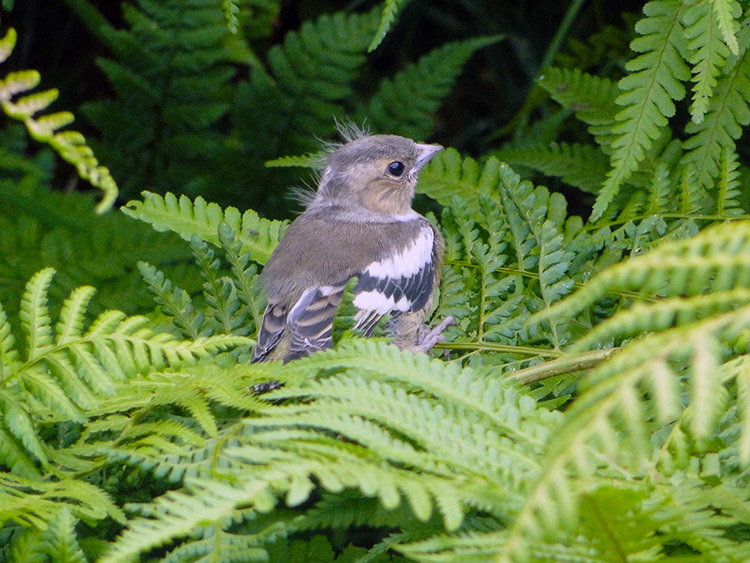 Fledgling
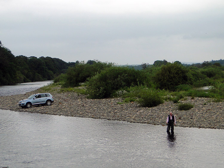 River Esk north of Longtown
We were not long in the woodland but there was enough time for a fledgling to pop out from cover as if to say "Welcome to England". The more likely reason was simple curiosity. From the woodland we walked into a field with a river running alongside. I was back beside the River Esk, a river I had come familiar with over the last few days of the walk. I had first met it as the White Esk at the Tibetan Centre and crossed over it by bridge at Eskdalemuir. After White Esk met Black Esk I had crossed it as the River Esk at Enzieholm Bridge. I had walked beside it and crossed it more times since as it flowed quickly from the higher places. This meeting was different. The river was now calmer and significantly wider. A car had been driven over a field and down a shingle bank to the riverside. The car driver was stood in the middle of the river. He was fishing and we watched him ply his art for a while. There was no rush as it was only mid-afternoon and we had little further to go. We could see Longtown downstream of the river.
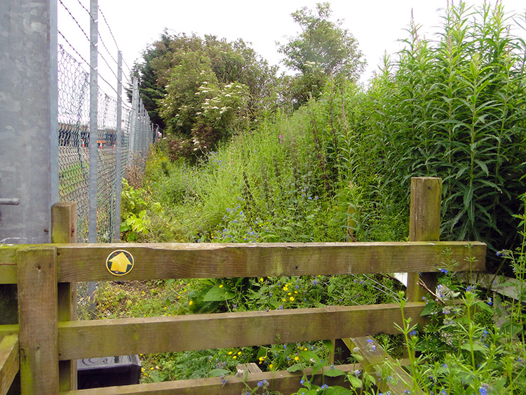 Unmanaged public right of way
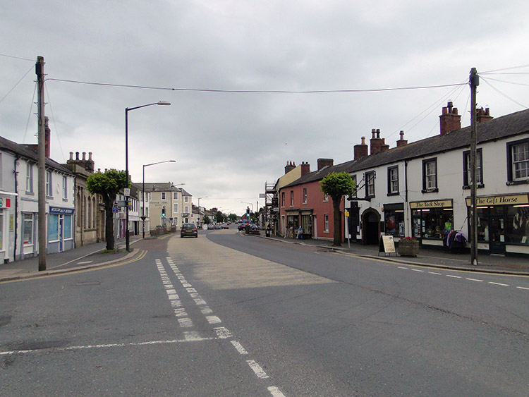 Longtown
After watching the angler ply his skills for five minutes we continued on our way to Longtown. First we followed the side of the river and then we cut straight across the field to a yellow public right of way sign on a fence in the right hand corner of the field. Finding dashed green lines on the map again was a comfort after the scarcity of them in Scotland. I needed them here for I had left the liberal free walking rules of Scotland behind when I had crossed the border. But this green line was no blessing. The first public right of way we followed south to Longtown Bridge in England was a nightmare.
I asked Steve his opinion on the state of the path. He said "I have got a message for Walking England. If you want people to go out there and get fit, if you want people to enjoy the countryside then look at this. It is shite. No wonder people don't go out walking. I would rather spend all day in the pub than go out in this. But, you know what. I'm going to do it". So he did and I followed him through the mass of overgrown thicket which was the narrow path set between the hire wire fence of a haulage yard to our left and high hedge to our right. All it needed was a good day of hack back and strimming and all would have been fine. The neglect and the overgrowth caused by the haulage yard workers and others using the path as a rubbish dump was sad. It deserved better.
After carefully working our way through the detritus of the neglected public right of way we reached Longtown Bridge and after crossing the bridge we walked along the main street into town. We came to a junction and crossed it to reach the Graham Arms Hotel, our home for the night. In the evening as we chatted and enjoyed the hospitality of the locals I thought back to my memorable walk through Scotland. I also anticipated the immediate walk ahead in the splendour of Cumbria.


