The Great British Walk
A personal record of my three month walk of the full length of Great Britain from north to south with written journal and photographs. Tracklogs for GPS units and for use with Google Earth are available for download for each stage.
Stage 45: Hebden Bridge to Diggle
Google Maps Open Source Maps| Statistics and Files | ||
|---|---|---|
| Start: Hebden Bridge | Finish: Diggle | Distance: 16.1 miles (25.8 km) |
| Time: 7-8 hours | Climbing: 711 metres | Total Distance: 597.3 miles |
| GPX Route File | Google Earth File | About Hebden Bridge |
| Statistics | |
|---|---|
| Start: Hebden Bridge | Finish: Diggle |
| Distance: 16.1 miles (25.8 km) | Time: 7-8 hours |
| Climbing: 711 metres | Total Distance: 597.3 miles |
| GPX Route File | Google Earth File |
Ordnance Survey Explorer Map (1:25,000)
OL1 The Peak District - Dark Peak Area
Summary
Another stage which apart from the very start and very end follow the route of the Pennine Way National Trail. Significantly this stage sees me leave Yorkshire after five days in my home country to finish in the Greater Manchester area of the Pennines. The Stoodley Pike Monument is passed on this stage of Pennine Moors and watershed reservoirs and the M62 motorway is also crossed.(Note: My walk of Yorkshire was a part of my Great British Walk from the north coast of Scotland to the south coast of England)
Stage Report
For the last time until the final week of walking in Cornwall Steve and I were joined by a group of friends on this stage. My brother Dave came along once more, this time with a couple of friends from Harrogate, brothers CJ and Tim Farmer. So Steve did not just have one set of brothers to handle as he often does with me and Dave. He had a double dose!
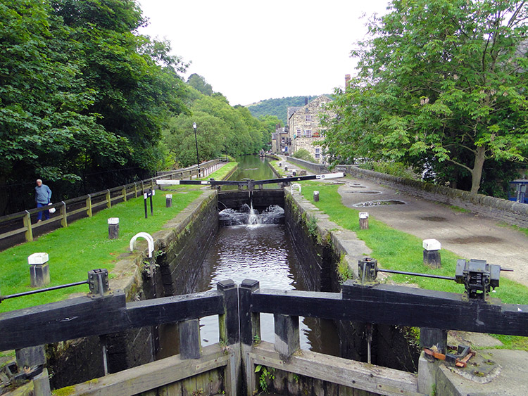 Rochdale Canal at Hebden Bridge
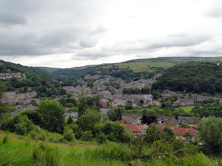 Hebden Bridge
It was an overcast morning with a bit of drizzle in the air. Nothing like the deluge of the night before though which, had it continued much longer, would have flooded Hebden Bridge which it seems to do every other year these days. We were lucky. Anyway, after the let off we left Hebden Bridge in a good state. Dave met Steve and me near the town's information centre. He told us CJ and Tim were waiting further up the Dale where CJ had parked his van. So we set off climbing to meet them.
Remember the steep descent we had down the cobbled lane into Hebden Bridge yesterday? Well, it was an equally steep climb out of the town. Upper Calderdale, where Hebden Bridge is situated, is a narrow enclosed valley with steep banks. Whichever way you leave the valley, to the north or to the south, your will have to work for the height gain. Before the climb started though we had one final highlight in Hebden Bridge at the point we crossed over the Rochdale Canal. Then we crossed a bridge over the Calderdale Railway line.
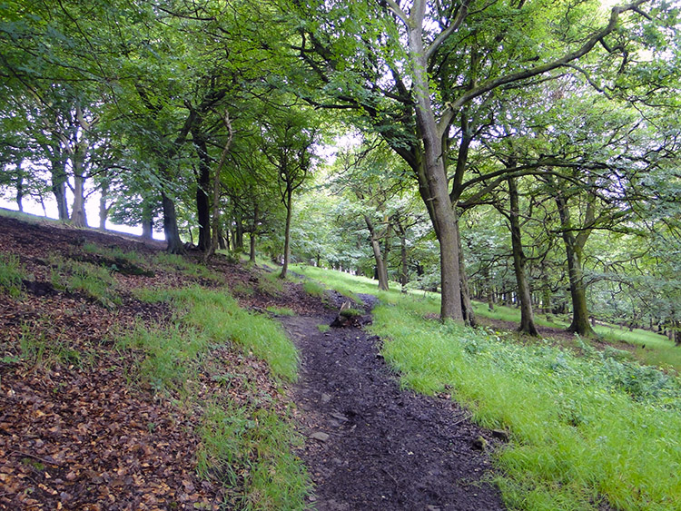 Crow Nest Wood
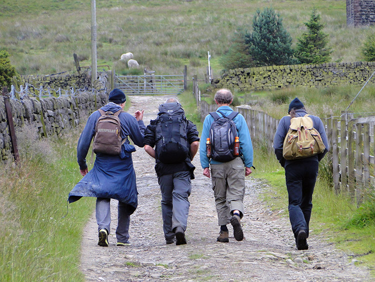 Friends reunited
After crossing the railway bridge Dave, Steve and I climbed firstly in a zig-zag manner through the lines of street clinging to the banks in the southern suburbs of Hebden Bridge and once clear of the buildings we continued climbing in one final zig-zag course before ending on a straight line course upwards through Crow Nest Wood. After clearing the wood we followed a lane to the TV mast at Fairfield and on further to a dead-end road where the Farmer brothers were waiting. We had climbed just short of 200 metres to reach them. Once greetings had been made we all set off together on our walk. All smiling, all chatting merrily away. (Note: The lads must have been up early. Before meeting us they had driven from Harrogate to Diggle where Tim had left his van and then traveled to Hebden Bridge. My respect to them for making the effort to walk this stage of my walk with me and Steve)
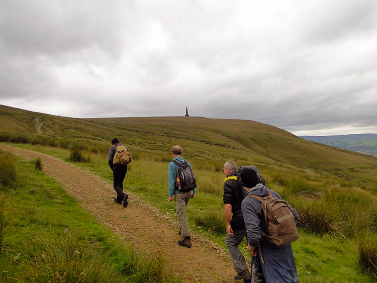 Climbing from Calderdale
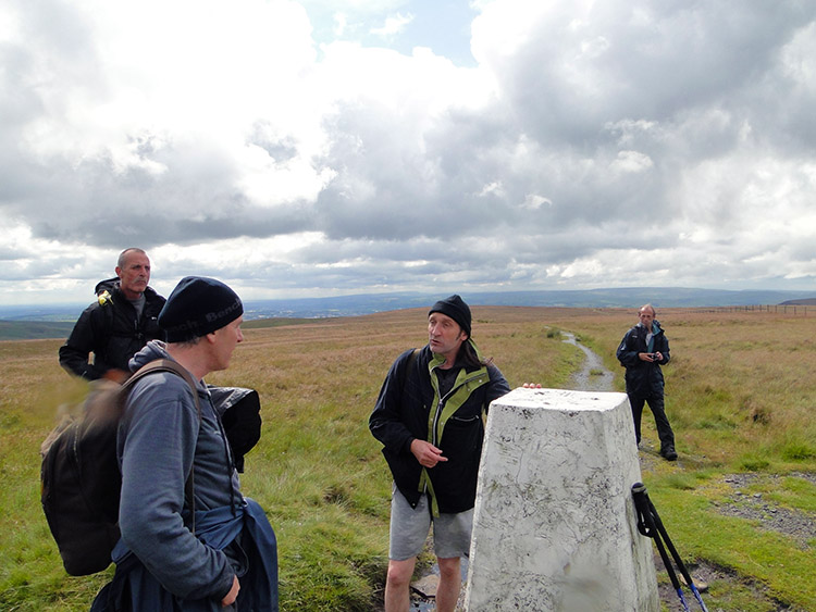
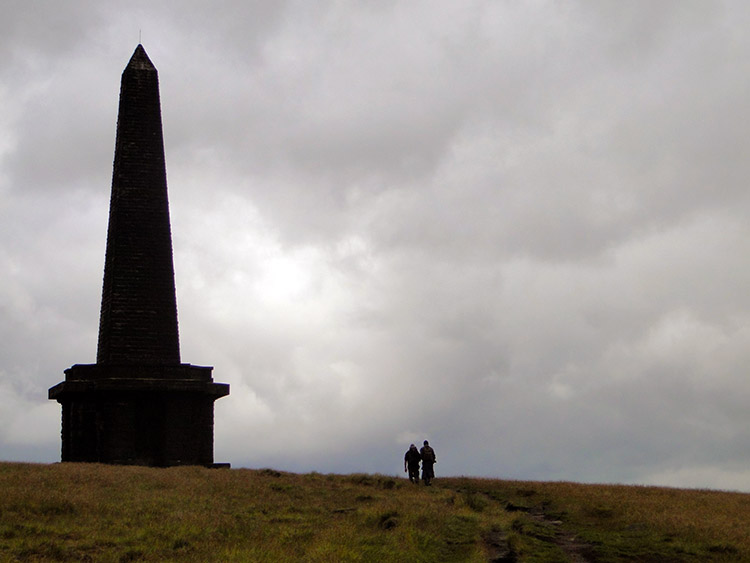 Stoodley Pike
We followed Pinnacle Lane which led us further from the Calderdale valley on a steady climb towards the top Pennines. A huge finger pointed straight up to the sky beckoning us to it and keeping us on the right path. The finger of Stoodley Pike Monument which, when we reached it, would put us back on the Pennine Way National Trail. First we had to get there, a further 150 metres of climbing since meeting up with CJ and Tim. It was three kilometers and it took us 40 minutes to do so. Good time considering all the chat going on.
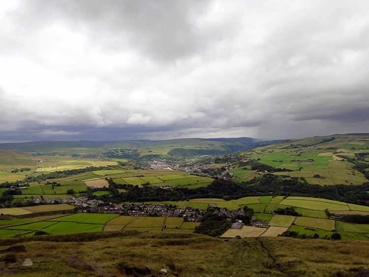 View to Lumbutts and Todmorden
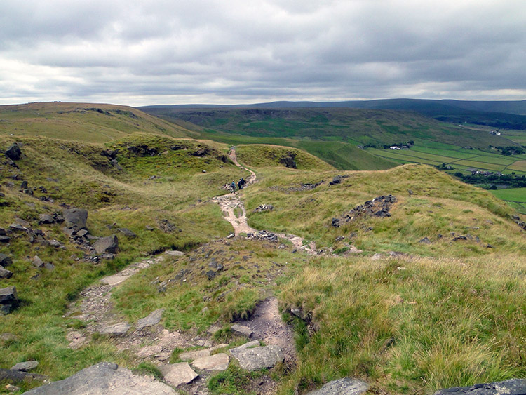 Classic Pennine Way terrain
At Stoodley Pike Monument we took a short break. We had done all the climbing of the day already, bar a few humps and bumps over the Pennine moors so a stop to take in the views and inspect the impressive monument was the right thing to do. A monument has stood on this site since 1814, the original one commemorating the defeat of Napoleon and the surrender of Paris during the Napoleonic Wars. That one collapsed 40 years later after weathering and lightning took its toll so it was replaced with the one which we were now admiring. Tim and Dave stepped inside the monument and climbed to the monument platform to admire the view and to also play a little. And why not. (Note: when I say we had done all the climbing of the day I thought it so at the time and it should have been the case. Read on to find out why it was not in fact the last climb)
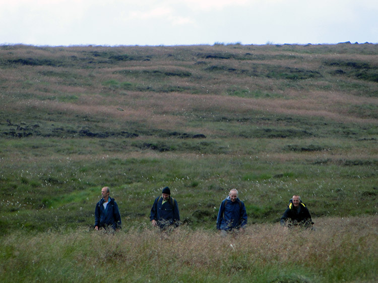
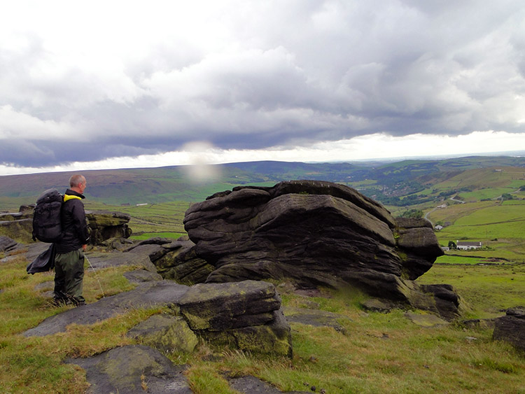
 Sentinel on Bald Scout Hill
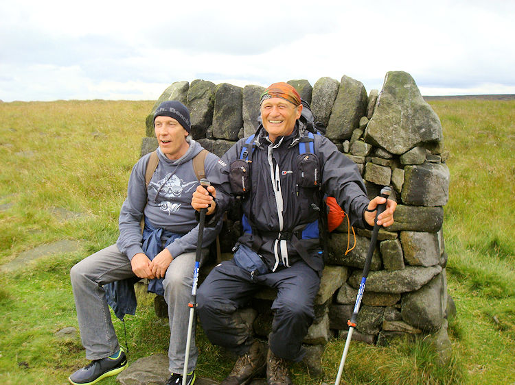 Pennine Way fashion icons
The next phase of walking from Stoodley Pike southwards towards the A58 and Blackstone Edge Moor was an absolute delight. Yes we were crossing desolate Pennine Moors at around a constant 380 metres elevation and accompanied by a sheet grey sky throughout the six mile/ two hour passage but all I have to bank are good memories. During the walk between Stoodley Pike Monument and Blackstone Edge there were plenty of amusing interludes. I have a number of photographs and all with the lads in show them laughing. We find seats to sit on in the most unexpected places. I show off my creative fashion attire. Dave spots a big green furry caterpillar with black rings and spiky yellow spots on the way and explains to us all about the species. Tim says "A long walk. I love it!". My four pals test the strength of an arched bridge across a ditch - it passes the stress test. We catch sight of the White House Inn and as we do the clouds, as they had threatened to do all along, burst open. We hastened our pace to the inn hoping it was open.
 Littleborough and Rochdale
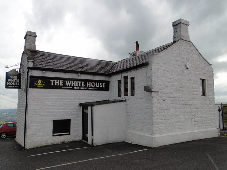 Time for a cup of tea
In rushing out of the rain to make the sanctuary of the White House Inn we had ran out of Yorkshire and into Greater Manchester. I had abruptly and unintentionally rushed from my home county which had provided some wonderful moments on my walk without realising. Oh well, all the good stuff is banked even if a rainstorm kicked me out! While the shower came down, and that is all it was, we enjoyed tea and light refreshment in the inn which is most popular with Pennine Way walkers. It was an enjoyable interlude and I recall standing in the doorway of the inn with some of the lads after the refreshments while waiting for the last of the shower to pass. We set off on our walk again in the dry and in good spirits. And with not a care in the world. Joie de vivre.
 Finding the way across Sun End
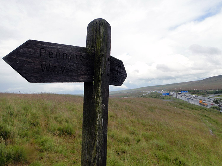 Pennine Way Signpost
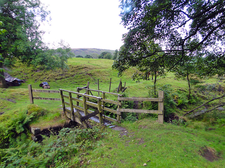
The carefree attitude I took from the inn and which was shared by my companions followed us across the A58 safely and partway around the rim of Blackstone Edge Moor. We should have continued around Blackstone Edge to the Aiggin Stone, a gritstone pillar on the Pennine Way which marks an old boundary. But we did not. A clear path which we all assumed to be the Pennine Way led us on a parallel line to Broad Head Drain and then westwards to Clegg Moor. We were in a line too, me at the rear and only after descending for about a good mile and being 50 metres lower than we should be did I begin to realise something was amiss. And it was only when I spotted the M62 that I twigged the error. "Where is the Pennine Way footbridge across the motorway" I thought to myself. I scanned the map quickly. "Oh b***er" I cursed under my breath. "STOP, WE HAVE TO GO BACK" I shouted to the lads who were all ahead of me as I held the rear. When they asked why we had to backtrack I told them we could not improvise. The next possible footbridge was too far further down the moors which would require a long climb back up. So we turned tail.
From being at the rear of the group I was now at the head so I hastened the pace on the climb back up towards Blackstone Edge. I gained for us the 50 metres of height we had lost and then made a decision to leave the path rather than walk all the way back to the Pennine Way. It took us across Sun End, about 800 metres in total of off route walking across untamed moor but at least it was on a level line rather than a laborious ascent. We regained the Pennine Way near Longden End Brook. Soon after I sighted the footbridge. We were back on track.
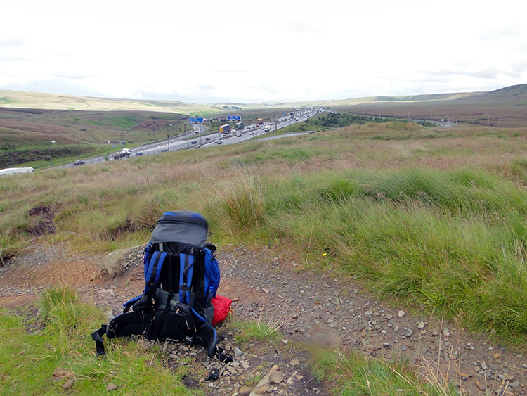 My backpack and the M62
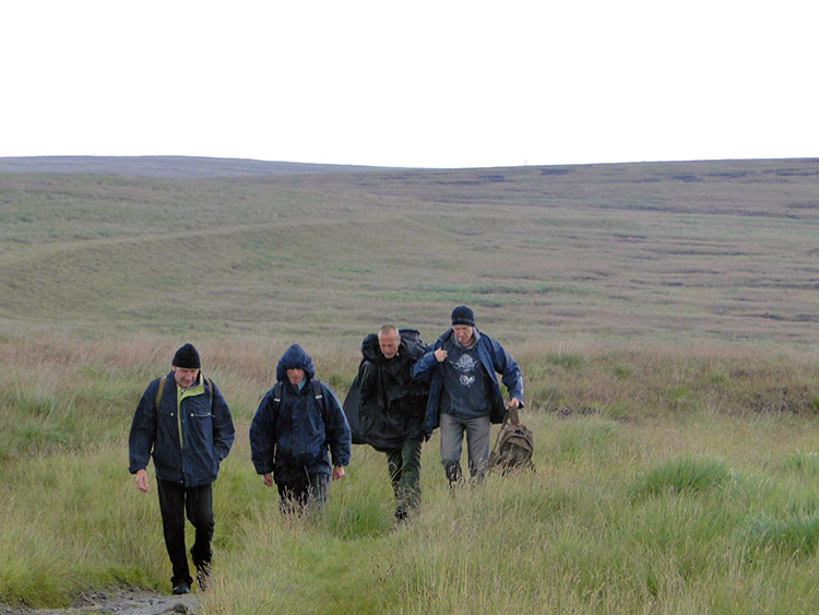 Crossing White Hill
And so we crossed the famous Pennine Way footbridge which spans the M62. The footbridge is an impressive landmark which has a span of 320 feet and carries us 65 feet above the carriageway. After crossing the motorway we took a break on the south side and while we sat we watched the flow of traffic on the busy road. I imagined all the times I had commuted under the footbridge and thanked the fact I had walked across it this time. As my love for walking has grown my want to drive has waned. What was once fun and a pleasure looked forward to is much of a dirge to me. Given a choice now and with reasonable practicality I would walk rather than drive every time. We finished our break, turned away from the motorway and walked away from the odious noise to the peace of White Hill.
 Brothers discussion on White Hill
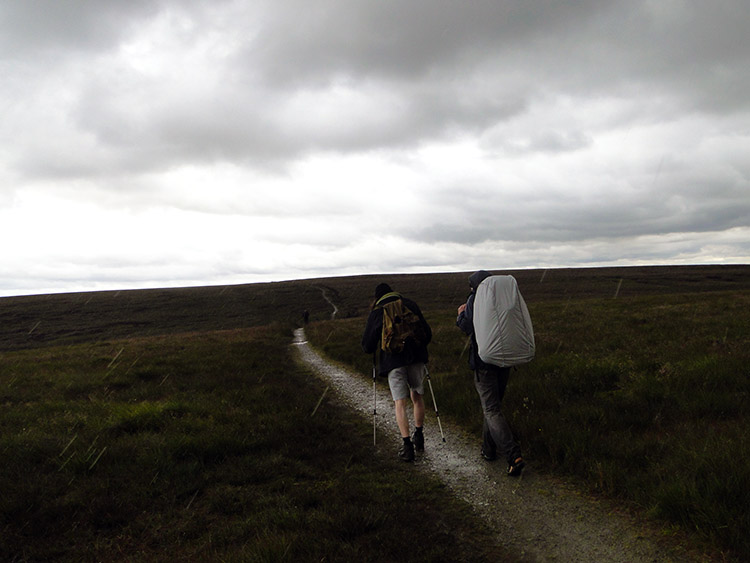 Tim takes my poles to ease his pain
While crossing White Hill Tim had started to lag behind the rest of us. It was clear he was starting to struggle and although we had no climbing left on the walk we had still just short of five miles to do. He explained his situation and we teamed to help as best we could. Ever since my injury in Fort William I had double poled and though I would continue to do later I was OK and he was not. So my poles went to Tim in an effort to see him home. CJ took my heavy backpack to compensate for my loss of poles and I took his. Teamwork applied and so we soldiered on our way.
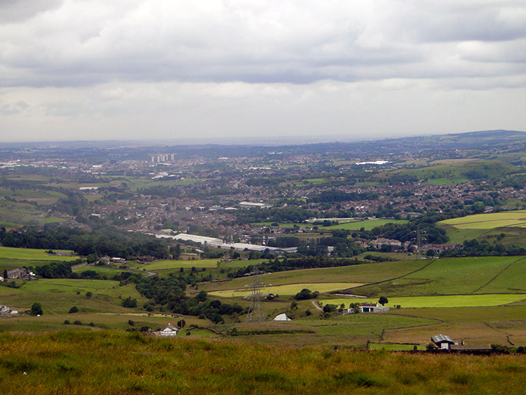
 Northern Rotcher
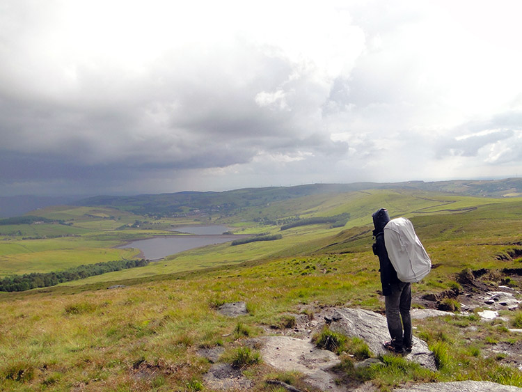 View towards Oldham
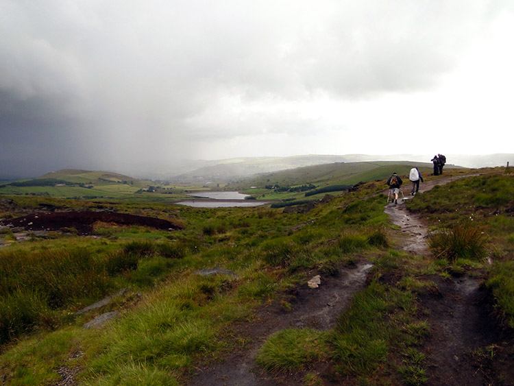
Slowly and steadily we carried on across White Hill and to Haigh Gutter on the Huddersfield to Rochdale Road. Tim hobbled with poles and without complaint. A few light showers came and went. It was never too bad though. No Hebden Bridge washout. Eventually we came to Northern Rotcher at a point where the Pennine Way met with the Oldham Way. And now we could see from the gritstone edge to Oldham and its satellite towns and villages in the south-west. By looking to the Castleshaw Reservoirs I could work out which one was Diggle, the home Steve and I for the night. The end of the stage was in sight.
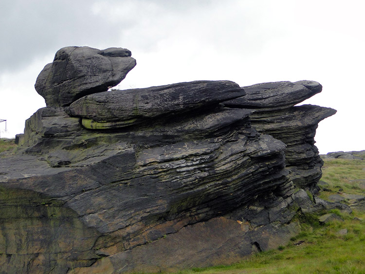
 Dinner Stone
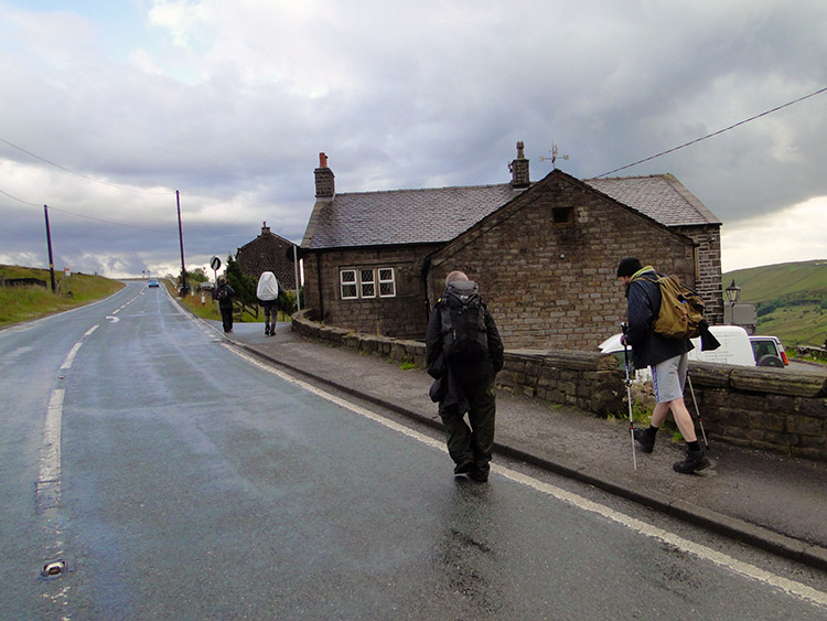 Harrop Ridge
Before finishing the stage though we still had some miles to do. First in line was a short and pleasant walk along the gritstone edge to a point called Millstone Edge. We passed a trig point, height 448 metres and some interesting gritstone outcrops and boulders. One had a name, the Dinner Stone. Who dined on it I wonder? After Millstone Edge we dropped from the moor by track to Bentley and then by road to Globe End, by track again to Dry Bridge and then by road again to Harrop Ridge. By now the showers were getting more frequent so there was less of the talk and more of the head down.
 Near Harrop Green
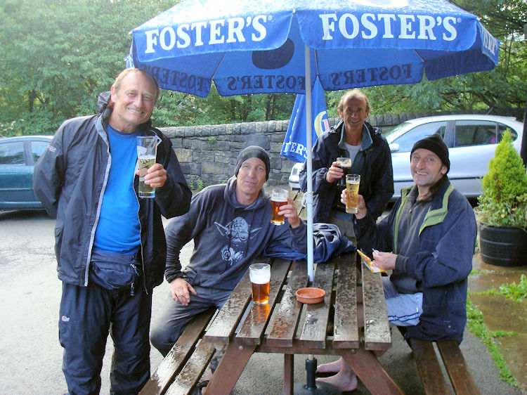 Drinks at the Diggle Hotel
A short excursion from road through some paddock fields and then a good straight stretch of road led us through Harrop Green and into Diggle. We were done when we reached the Diggle Hotel. Both physically and mentally. Actually not quite done. Tim still had to find where he had parked his van and once that was done he drove it back to the pub car park so we could finish the walk off properly. That we did by getting drinks from the pub and settling down on a bench while under cover of what was now steady rain and enjoying the drinks.
The day was done and I have to say a thoroughly enjoyable one. I know we all really enjoyed it, the walk and the company. While Tim recovered from his injury it was not the end for me, Steve, Dave and CJ. "See you in Cornwall!".


