The Great British Walk
A personal record of my three month walk of the full length of Great Britain from north to south with written journal and photographs. Tracklogs for GPS units and for use with Google Earth are available for download for each stage.
Stage 43: Airton To Oakworth Moor
Google Maps Open Source Maps| Statistics and Files | ||
|---|---|---|
| Start: Airton | Finish: Oakworth Moor | Distance: 18.7 miles (30.0 km) |
| Time: 8-10 hours | Climbing: 975 metres | Total Distance: 570 miles |
| GPX Route File | Google Earth File | About Airton |
| Statistics | |
|---|---|
| Start: Airton | Finish: Oakworth Moor |
| Distance: 18.7 miles (30.0 km) | Time: 8-10 hours |
| Climbing: 975 metres | Total Distance: 570 miles |
| GPX Route File | Google Earth File |
Ordnance Survey Explorer Map (1:25,000)
OL21 South Pennines – Burnley, Hebden Bridge, Keighley and Todmorden
Summary
A poignant stage as I leave the Yorkshire Dales and head into the South Pennines. Though the area is familiar most of the paths I tread here were unknown to me before the stage. Not the first part though as I left the much walked Limestone Dales north of Skipton to head toward adventure in the darker land of millstone grit and moorland at Ickornshaw. I also reacquainted with sentinels and follies near the village of Cowling on this stage.(Note: My walk of Yorkshire was a part of my Great British Walk from the north coast of Scotland to the south coast of England)
Stage Report
After a final night at home in the comfort of my own bed Lil returned Dave, Steve and me to where we had finished off in Airton the previous day. Bye, home sweet home, see you in a couple of months. When we arrived in Airton I kissed Lil goodbye, promising to keep in touch every day and while on the walk to be careful. We met another group of walkers in the village when we arrived. Jez and Martyn I knew well, friends I had often walked with in the past. John Lister, as you may recall had walked with Steve and me on the Caldbeck to Keswick stage of the walk, being the first fresh acquaintance I had made directly as a result of my social media blogs throughout this very special long walk. It was nice to have him back with us for a second time.
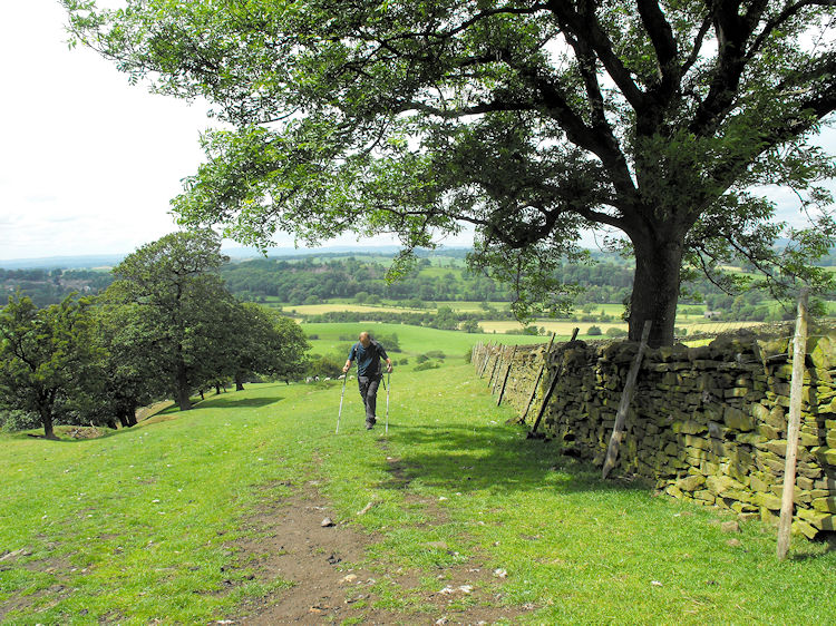
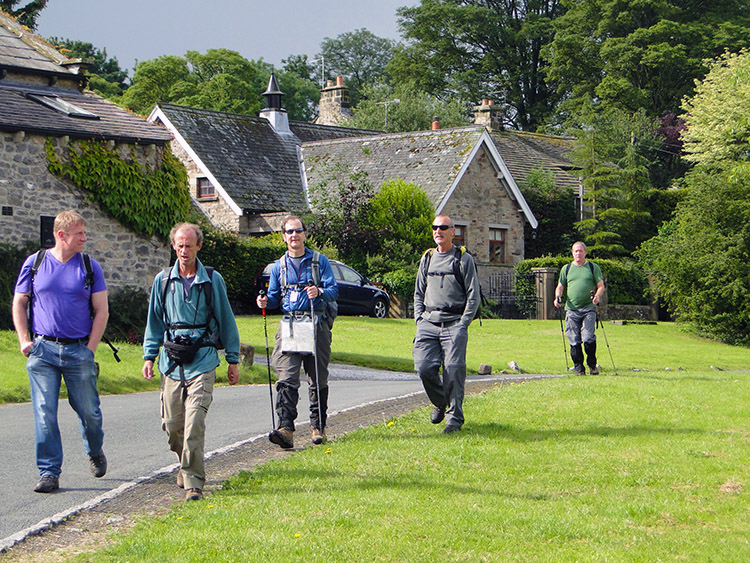 The pals stride out of Airton
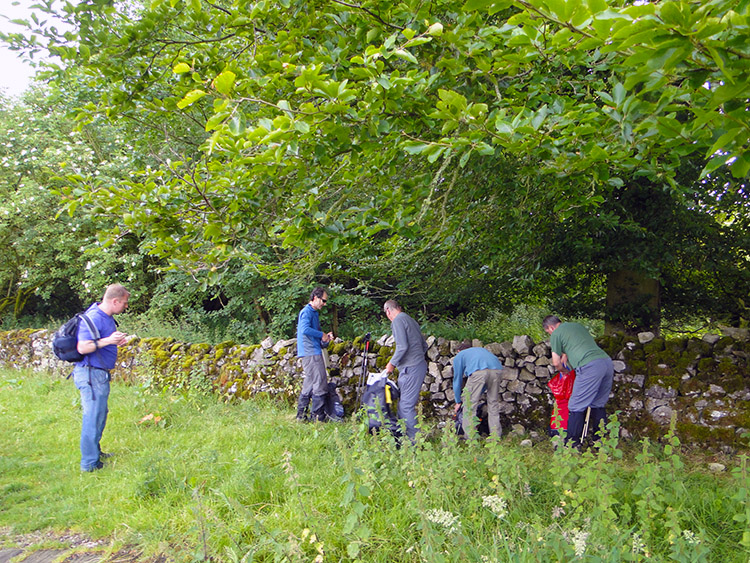 Quickly into the wet weather gear
It was a bright sunny morning and we stepped out of Airton in an assembly of t shirts and light jackets. After crossing the village bridge over the infant River Aire we rejoined the Pennine Way footpath and headed south following the river downstream through an assembly of pasture and grain fields to cross a minor road at Newfield Bridge. We stepped from the north side of the road in dry weather. We stepped from the north side of the road into a field in the wet. I had seen the clouds brewing up quickly as we had walked from Airton and they had ruptured at a pace. We all dived for cover under a copse of trees near the bridge and put on the wet stuff.
 Crossing Eshton Moor
 Walking into Gargrave
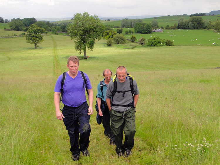
The weather forecast had been for sunshine and showers so we were not surprised at the opening of the heavens. Perhaps a little disappointed the rain had arrived so early though. And it did not stop, continuing on as we walked across more fields, some of them large expanses of green across Eshton Moor. The boys paired off in teams to talk while we walked. I noticed John and Jez make each others acquaintance for the first time and they particularly seemed to hit it off with each other. Dave and Martyn also teamed up for a chat. They always get on well together. Steve forged on ahead, head down under his bin liner poncho. I enjoyed watching my friends interactions while we walked. Still it rained. And rained. By the time we had crossed Eshton Moor and then Harrows Hill the clouds had completely filled in the blue pieces of sky. It was a dark grey carpet above our heads as we trundled from the fields to reach road near Mark Plantation, a road which led us into Gargrave. We crossed the Leeds and Liverpool Canal as we entered the village. More on that later, time for refreshments.
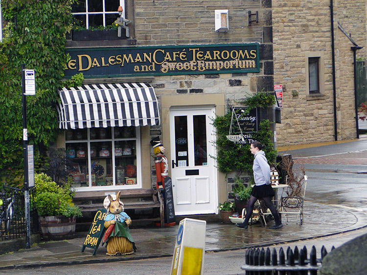 Teashop sanctuary
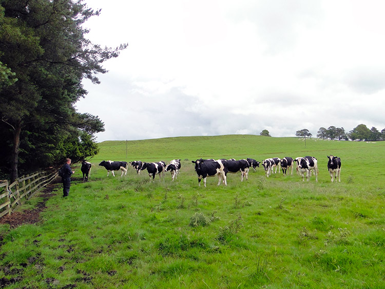 Martyn's act of defiance
We would not have stopped so early into the walk for refreshments but as the rain was pouring down the democracy resulted in a 5-1 aye vote. Dalesman Cafe Tearooms it was to be then, an establishment we all had passed many times while commuting from our homes to the Yorkshire Dales of, most likely, Airedale and Ribblesdale. I had never been in before though. We all revealed ourselves to the staff from under our disguise sheathes of wet gear. Then we ordered refreshments. Five for tea and one for coffee. Dave is the coffee man. He also availed himself of some sweets in the cafe, to enjoy and share during the rest of the walk. After our delightful cafe break, during which time the rain stopped, some of us called in at the village shop for lunch break supplies. After shopping and spotting a cash point while not knowing the next time I would come across one, I patiently stood behind a lady to get some cash. I told the lads to set off. She took what seemed an eternity to complete her transaction. I got my cash and attempted to catch up.
Martyn had waited for me on the bridge over the River Aire. The other four were out of sight. We talked as we walked out of the village and in doing so forgot to look at the map. I blame Pendle Hill which we could see in the distance, the hill Martyn and I had last walked together the previous summer. We continued following the road and by the time I realised we had missed the turning from the road we were almost a kilometer further than we should have been. Looking at the map we improvised. By following a permissive path between Mickleber Hill and Mickleber House we would rejoin the planned route and meet up with the team on Scaleber Hill. Sorted.
The path went across a large field to the south of Mickleber Hill. For half a kilometer. We were halfway across it when we spotted them running across the field towards us. A herd of frisky and excitable young bullocks. They were on a charge and we were the centre of their attention. Instinctively we ran towards the nearest fence line which we know to be wrong but which is what we did on this occasion. I just made it and leapt over the fence with much haste and little decorum. Martyn did not make it. With no other choice he defiantly turned to face the onslaught of aggressive young muscle and he stalwartly stood his ground. For a while it was a face off, the only noise being the grunt of the leading bullock while it stomped its feet in a feign to attack. Martyn fixed his eyes on the gesticulating top boy and never faltered. Eventually his resolve worked and the aggressor turned. It fled back across the field with its followers close behind. Well done St Martyn the Appeaser.
 Following the line to East Marton
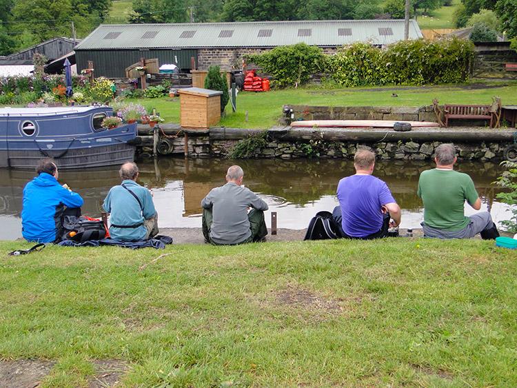 Lunch by the canal near East Marton
After I had skulked from behind my fence of protection, having left my friend the face the hoard, we continued our mission to rejoin the company of pals walking the true path. While we did so I asked Martyn what he had thought during the face off. "I just knew I had to stare him out as there was no other course of action". (note: In an instance of Deja Vu later in the walk this happened again. When there was just Steve and me. On that occasion Steve was the quicker. What happened? You will have to wait to find out when we reach Cornwall)
Eventually Martyn and I spotted the lads crossing Scaleber Hill. Soon after we had caught up with them and we told the tale. We also stripped off the wet weather gear. It was not exactly cracking the flags on this early July day but the rain had stopped and the temperature was rising. Still on the Pennine Way we passed Great Meadow Plantation and soon after we passed Langber Plantation. We then arrived at Williamson Bridge close to the village of East Marton. The bridge spanned the Leeds and Liverpool Canal which we had seen earlier in Gargrave. We stopped for lunch. Everyone chatted away happily with feet dangling over the towpath edge and watching Ducks paddling past while resting. All was good with the world.
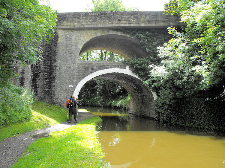 Double Arched Bridge
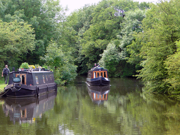 Leeds and Liverpool Canal
After lunch the next phase of walking was a one kilometer walk along the towpath. And all the better as the sun which we had briefly enjoyed when setting off for the walk had come out to bathe us in solar rays again. As we walked some narrow-boats chugged by and when they did walkers and boat people waved to each other while passing friendly courtesies. While walking the towpath we also passed under Double Arched Bridge. The original arch carried traffic on the old Skipton to Gisburn road. The new arch set on top of it was deemed the easiest way to improve the road when it was upgraded to the A59 trunk road. I am glad they did, it makes for a curious yet beautiful sight.
 Pinhaw Beacon
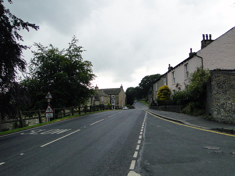 Thornton in Craven
We left the course of the Leeds and Liverpool Canal at Langber Hill and walked on a due south course across more fields towards Thornton in Craven. We were still following the Pennine Way, something we would be doing all day. For all the near 19 miles and 30 kilometres we would be following this National Trail, but perhaps not its most familiar and austere parts. I was saving some of those for later days. For now we crossed lush green fields between East Marton and Thornton in Craven. The sun shined most of the way, only hiding behind a thick cloud of black as we reached the village sitting on the A56 Colne and Broughton Road. Stopping under trees in the village some of the team, in anticipation of rain thought it prudent to adopt the wet weather gear. Some, including me, did not bother.
 Sunshine again
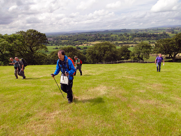 Climbing to Thornton Moor
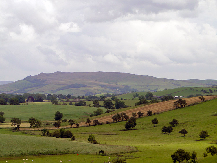
Five minutes after leaving Thornton and heading south east towards the hill of Pinhaw Beacon those who had put on the extra layers had taken them off again. The sun was shining again. It was one of those days. I was unfamiliar with this piece of Yorkshire countryside and I enjoyed it all the more for the novelty. Especially as the sun beat down on us again. It was now early afternoon and we were all on good form as we crossed Brown House Beck and climbed for the first time in almost 10 miles of walking. It was a steady climb too, each step revealing more widespread views. Those back to the north from where we had come were gorgeous, a tapestry of countryside features including hedgerows, copses, fields of pasture and fields of cereal. Intersecting roads between the villages of the area too. In the sun of high summer it was a gorgeous scene.
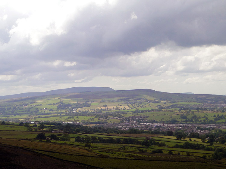 View south to Cowling and the moors
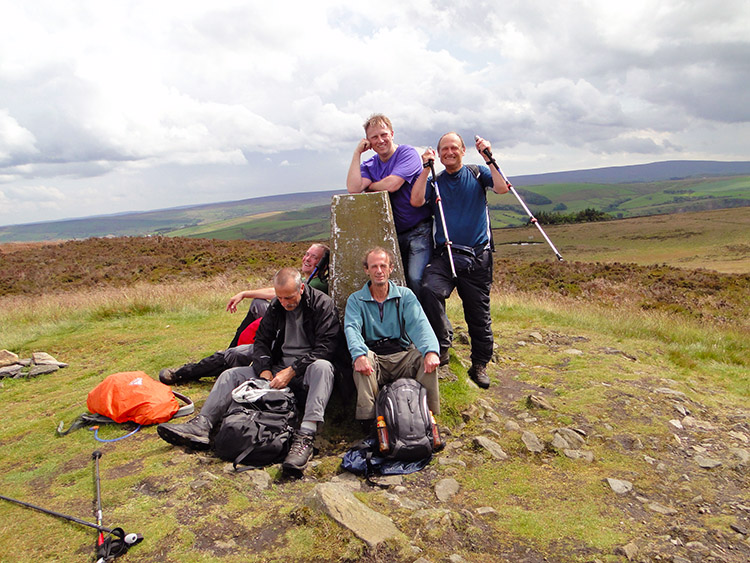 At the trig pillar on Pinhaw Beacon
We kept on climbing, first to Stone Pit Hill and then to Hare Hill. Next on the list was Cripple Hole Hill but these were mere intermediaries. It was Pinhaw Beacon I had set my intentions on, the highest of the lot at 380 metres and a good 250 metres higher than from where we had began climbing. Reaching Pinhaw Beacon was, at the time, the anticipated highest point of the day for the idea was that when we reached Cowling, which we could now see in the distance ahead of us, Steve and I would stop and find camp. The other lads would all go home when in Cowling while the two of us continued on my Great British Walk to Cornwall. Some would rejoin us later on for the odd stage but after Cowling we would be a two man expedition again. With this in our minds we celebrated on Pinhaw Beacon and I thanked all my chums for joining me on this day. The sunshine kept us company for the celebratory moment.
 Quick change of gear near Lothersdale
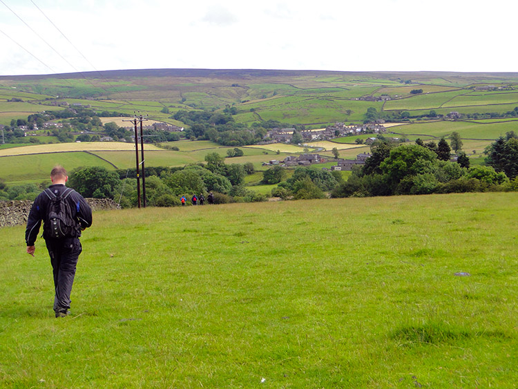 Ambling down to Cowling
After Pinhaw Beacon it was all downhill. First to the hamlet of Lothersdale and then after a short kick over Cowling Hill down further to Cowling village. The weather decided to go downhill too, once again a series of dark clouds rushed in and set a bucket of water on top of us. It was a short downfall but a full on one. Steve demonstrated the merits of his bin liner poncho to us this day, quickly slipping it on over him and completely over his backpack and then just as quickly removing it after the rain had stopped. He loved his poncho. I know only too well because he kept telling me so over the entire journey - though thankfully not on most days as it did not rain all that often during the summer of 2011.
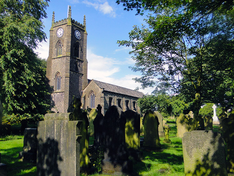 Holy Trinity, Cowling
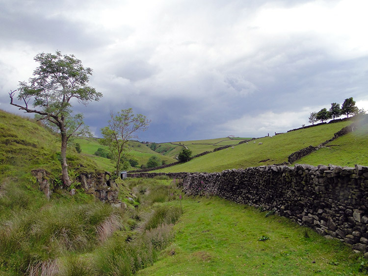 Dean Brow Beck
By the time we had reached Cowling the clouds had gone and the sky was blue again. It was, as I have mentioned earlier, that kind of day. At least Steve and I could say bye to the lads without cowering for shelter which we duly did. After the goodbyes and when six became two we thought about what to do next. It was only five o'clock in the evening and we had a good few hours of daylight left. "Let's get supplies here and crack on for a few more miles" said Steve. "Yes of course. Why not" was my reply. It was a clear choice. We knew we could easily find camp on the moors ahead of us and by walking on today we would shorten the effort tomorrow. That would give us an earlier arrival in Hebden Bridge. All good.
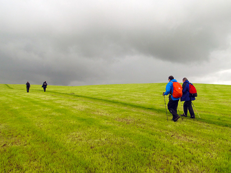
 Brooding cloud over the moor
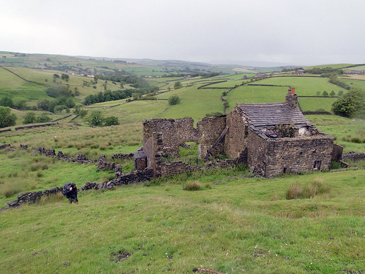 Sanctuary at Further Dean Hole
So we stocked up in Cowling. And then we set off from the village following the Pennine Way path south towards Ickornshaw Moor. As soon as we had cleared the village and had began climbing to the moor the skies filled in with cloud once more. This time they were darker and more intimidating. Both of us guessed a deluge was coming. We hurried on trying to get some height before the rain came. It duly did, as we spotted a derelict farmstead at Further Dean Hole. Bugger to health and safety, we rushed into the ruins and found a dry spot under a section of still intact roof. The rain set in, driving down straight and hard. We waited it out for a while and it kept pouring. Steve pulled out one of the beers he had stocked up with in Cowling and enjoyed it while we watched the rain. I held off doing so until later.
What seemed like an eternity of waiting the storm out was in fact just less than 45 minutes. I know this thanks to my digital camera which shows the time we approached the ruins and the time I took the photograph on this page just after we had left them. I will reiterate, it was a long tortuous 45 minutes. We wanted to get on with the walk while every drop fell.
Of course we could have walked across the moor while the rain had poured but as we were camping we were determined to keep our backpacks and gear as dry as we possibly could. So we resumed walking in the dry.
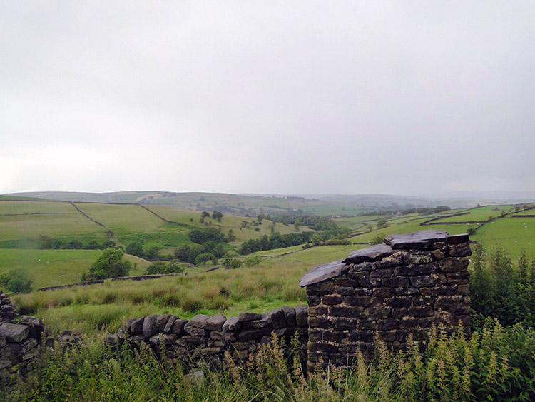
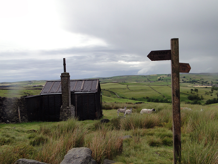 Shooting Hut on Ickornshaw Moor
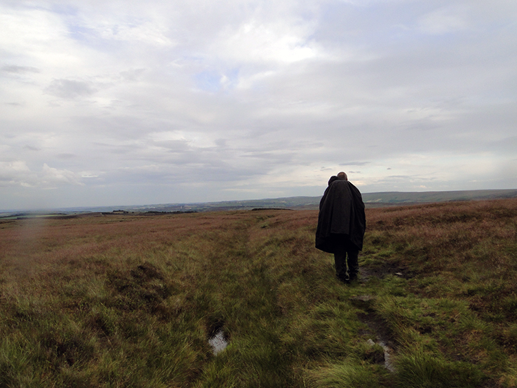 Spirit of the moor
While crossing Ickornshaw Moor one of the most striking things I noticed was the proliferation of Shooting Huts. They were simple wood and corrugated iron structures but it was the number which I noticed. There were plenty of them standing on the fringe of the moor at regular intervals. The Grouse have no chance when the shooters provide themselves with such facilities on the austerity of the moor.
Steve and I were on proper Pennine Way walking terrain now. The type we are familiar with as written about by Wainwright and others. The bleak wild and featureless moor of peat bogs, hags and paths of sodden ground which feet are required to squelch through. Ickornshaw Moor was like that though the Pennine Way provided duck boards to ford us across some of the trickiest parts. Old factory floors too, transported from places where industry has ceased to where walkers now tread. we crossed the moor by all these means. Fortunately for us, while we did so, the rain held off. In fact it was now gone for the day.
We surprised ourselves by making it completely across the moor, over Cat Stone Hill and past Little Wolf Stones. We crossed the sea, or at least a part of the moor called The Sea on the Ordnance Survey Explorer map. We passed Old Bess Stone on Old Bess Hill and continued on to stop at Crag Top which looked over the Worth Valley west of Haworth. We pitched our tents, ate a snack, got out the beers and looked out over the valley below which included a good overhead view of Ponden Reservoir and the village of Stanbury. While we chatted we watched the dusk fall over the valley. One by one the farmsteads and houses of Stanbury lit up as they switched on their lights. The lights of the stars in the sky also lit up as darkness fell. We chatted some more while sat outside the tents and then for a little while longer on retiring to our canvas homes. All was good with the world and I went off to sleep looking forward to tomorrows adventure.


