The Great British Walk
A personal record of my three month walk of the full length of Great Britain from north to south with written journal and photographs. Tracklogs for GPS units and for use with Google Earth are available for download for each stage.
Stage 48: Peak Forest to Hartington
Google Maps Open Source Maps| Statistics and Files | ||
|---|---|---|
| Start: Peak Forest | Finish: Hartington | Distance: 15.1 miles (24.3 km) |
| Time: 7-8 hours | Climbing: 545 metres | Total Distance: 641 miles |
| GPX Route File | Google Earth File | About the White Peak |
| Statistics | |
|---|---|
| Start: Peak Forest | Finish: Hartington |
| Distance: 15.1 miles (24.3 km) | Time: 7-8 hours |
| Climbing: 545 metres | Total Distance: 641 miles |
| GPX Route File | Google Earth File |
Ordnance Survey Explorer Map (1:25,000)
Summary
After days following the gritstone trail of the Pennine Way this stage of my walk involved a return to limestone, the first I had seen for almost a week since walking through Malhamdale in the Yorkshire Dales during stage 42. Everything looks different. Few bogs and little water loving flora flourishes in limestone land. There is much more colourful flora to be seen on this stage which weaves through White Peak country and through the narrow valleys of Dam Dale, Hay Dale, Peter Dale, Monk's Dale and Miller's Dale for the first part and then across open Peak District countryside between Taddington and Hartington for the second part.(Note: My walk of the South Pennines and Peak District was a part of my Great British Walk from the north coast of Scotland to the south coast of England)
Stage Report
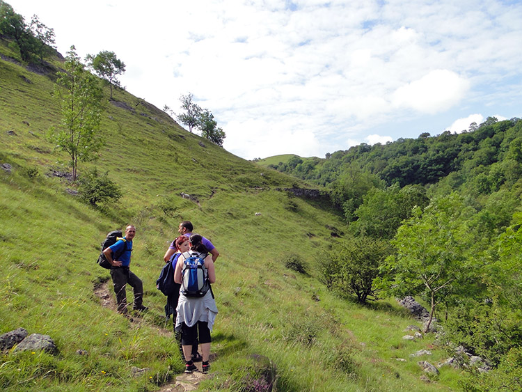
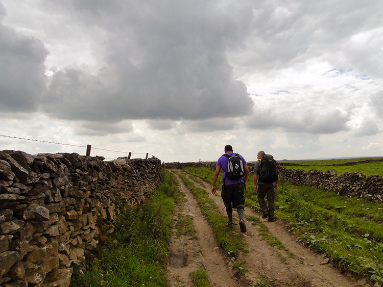
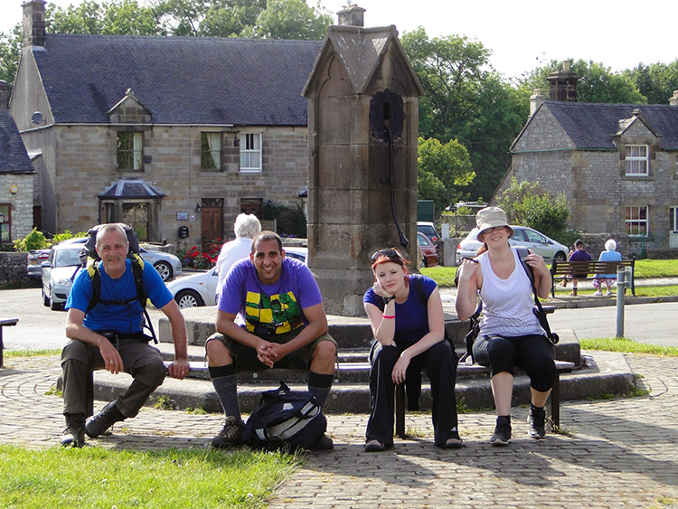
I had unzipped the tent to look out on a promising morning which was just as well as Steve and I would be walking into the heart of the Peak District with three guests who I wished would enjoy a good day on the trail with us. Charlotte, Laura and Simon, each of them work colleagues of mine and for one day most welcome walking buddies as well. After dismantling camp and packing up our gear Steve and I walked the short distance from our patches of grass to the village church where we had arranged to meet with the three of them.
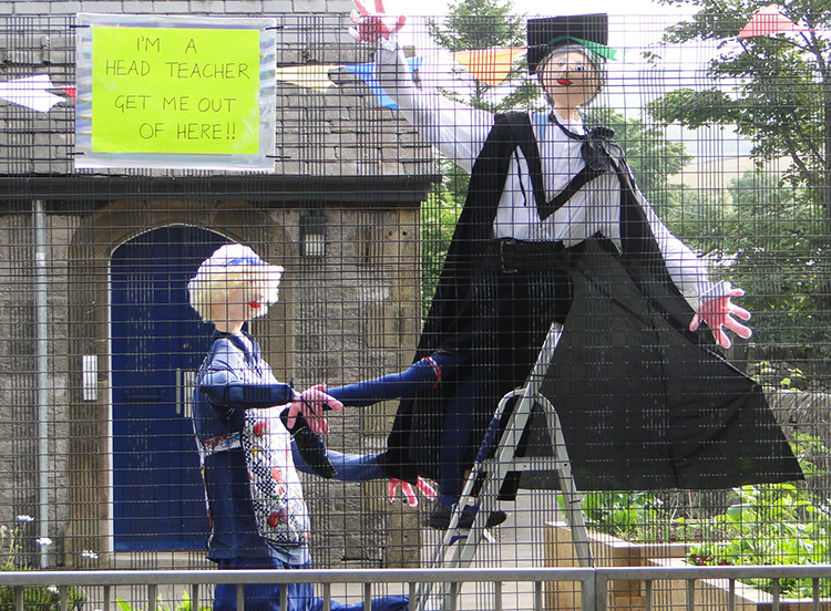 Peak Forest Head Teacher
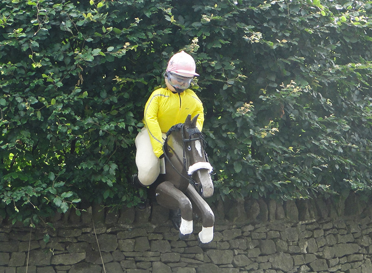 Peak Forest Horse and Jockey
We waited for Charlotte, Laura and Simon while they completed their commute from Sheffield, filling the time by spotting more of the straw and cloth people we had first seen strewn around Peak Forest when we had arrived in the village. There was a demolition worker with a "Danger, Explosives" sign and there was a schoolteacher climbing the school railings with a slogan saying "I'm a head teacher, get me out of here". Finally there was a jockey and the front end of a horse emerging from a garden hedge. All provided amusing diversions during the short wait.
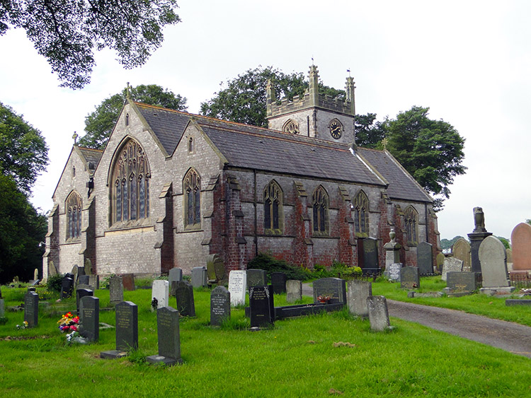 Charles, King & Martyr, Peak Forest
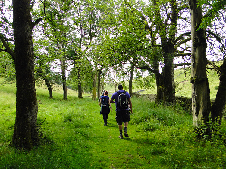 On our way through Hay Dale
Our three guests arrived and after the fair but cloudy early morning we set off walking at just after 9.00am with sunshine already breaking through the weakening cloud. All of us were in good spirits and how could we not be walking on a fine summer's day into sublime limestone dales. It was such a marked change for Steve and me from the high Pennine gritstone and peat moors of the previous moors of the last week. Limestone is lighter and everything was brighter. After leaving Peat Forest the first dale we came to was Dam Dale which was just a tiddler with a line of fields at the base abutting a small limestone outcrop to the east and nothing but a gradual slope to the west. Hay Dale was next and similar to Dam Dale but this time with a spacious Ash wood. And the walking was dead easy, perfectly so for the newcomers as we walked steadily downhill through these dales.
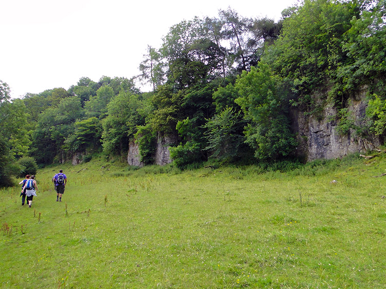 Limestone cliffs near Peter Dale
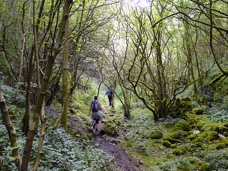 Walking through Monk's Dale
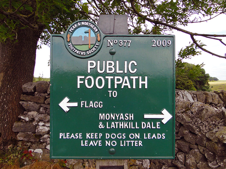
When we had reached Hay Dale we had joined the Limestone Way which Steve and I would follow for a couple of days and at Hay Dale we had also reached a notice board which greeted us to the Derbyshire Dales National Nature Reserve. It told us Hay Dale included wildlife habitats such as limestone grassland, cliffs and screes. It went on to say "centuries of grazing have produced the flower rich sward which is most attractive in early summer. Early-purple orchids, cowslips, common rock-rose and thyme are among the plants the visitor can enjoy..." Good to know, I can tell a Buttercup from a Dandelion but as far as flora goes I am mostly oblivious to which wild flower is which.
I knew perfectly well about cliffs and scree though and found small but impressive limestone cliffs in the next dale we came to which was Peter Dale. The dip of the Peter Dale was more enclosing that Dam Dale and Hay Dale had been and though we were now being surrounded by trees abutting the cliffs and screes on either side of the dale we could still see clear sky ahead. It was not dense at all but that all changed when we reached Monk's Dale. On entering we were immediately closed in by dense woodland which caused the path to meander wildly around the twisting uprights and branches and of the gnarling contorted exposed tree roots which regularly had to be stepped over.
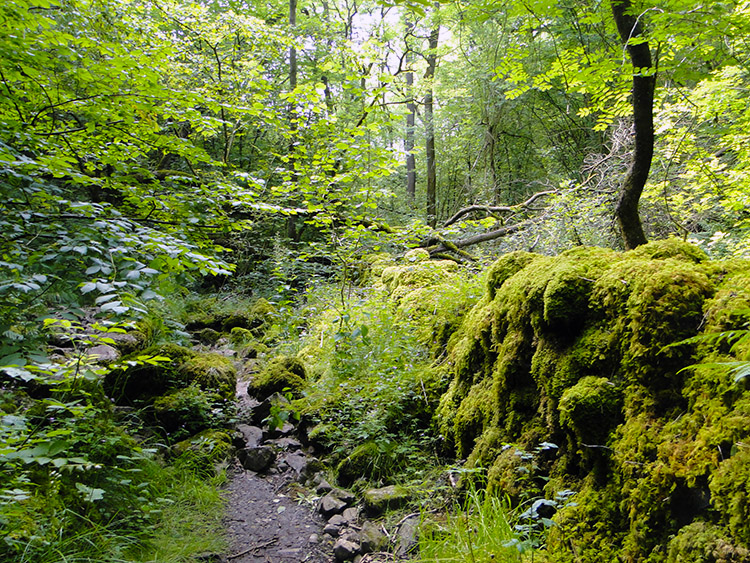 Lichen covered wall in Monk's Dale
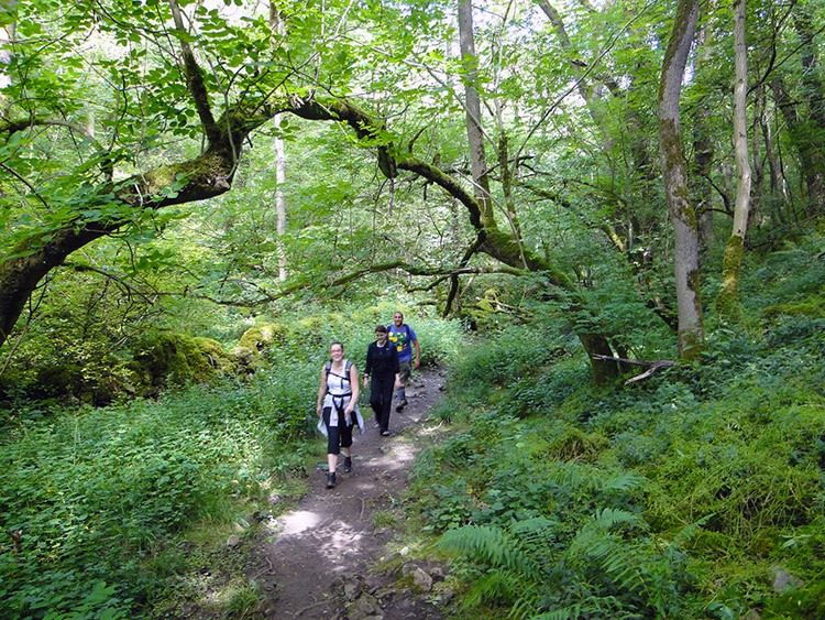 Retrogressive scrub of Monk's Dale
Monk's Dale is so wonderful. I was beguiled walking through it and it appeared to strike my friends with its fairytale appearance too. On researching Monk's Dale I discovered it Monks Dale is an important site of 'retrogressive scrub'. See the ecology report below:
The 'retrogressive scrub' in the dale is particularly rich and the flora includes many species uncommon in Britain such as dark red helleborine Epipactis atrorubens. The stream running through Monks Dale is small and dries up for much of its length during the summer, however, lower down the dale the less permeable Lower Millers Dale Lava is exposed in the stream bed and in these areas water may be present throughout the year. Two species, of stonewort Chara spp. occur in the stream. An important feature of the dale is the occurrence of a number of springs and flushed sites with tufa forming bryophyte communities. The springs have a distinctive community including butterwort Pinguicula vulgaris, common cottongrass
Eriophorum angustifolium and a number of sedges. This is one of the most important dales in the district for lichens (Source: High Peak Council)
The stream was indeed dry through Monk's Dale when we walked through in mid July and there was much evidence of lichen with stone walls covered by it, some so much there was little to see of the natural stone at all. As for the specialised plants and indicators I will take the experts word for it. The overwhelming result of all the factors and of my walk through Monk's Dale is that I fell for it big time. I vowed to return.
 Into the open near Miller's Dale
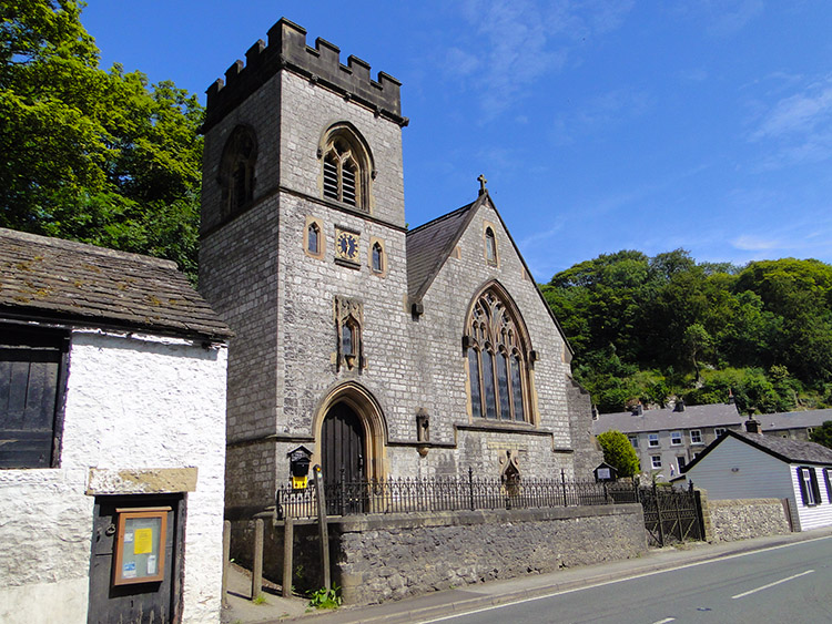 St Anne, Millers Dale
We emerged from the dappled light fairytale of Monk's Dale and climbed to full daylight on the east bank towards the south end of Monk's Dale where, as I also found by reading up, that the grasslands are mostly rich in meadow oat and glaucous sedge but with a local abundance of upright brome Bromus erectus, a species uncommon in Derbyshire. There you go, we are often imperceptive of the rare and precious environment we walk in. I was well aware of the bituminous footpaths and road surfaces we walked on in Miller's Dale though. A life's work saw to the constituents of them permanently set in mind. And it was with frustration we walked up and down the macadam and asphalt of Miller's Dale. We had set our plans on stopping here for a refreshment break. We had been walking for two and a half hours and I knew Charlotte, Laura and Simon wanted a break. I did too, a cup of tea would have been nice on this warm summer day. I had expected at least one cafe to cater for walkers and cyclists in Miller's Dale but drat and blast there was not one. Thwarted we had to carry on.
 Under the Monsal Trail
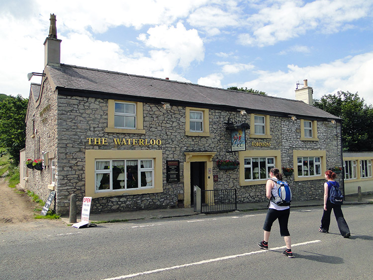 The Waterloo, Taddington
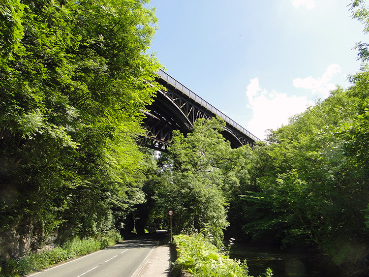
From Miller's Dale we walked westwards along the side of the valley road which took us directly under the twin viaducts of Miller's Dale. The first was built by the Midland Railway in 1866 and the second one built in 1905 which increased the number of railway tracks from two to four. Now the trains are long gone and the tracks up though one of the viaducts is still of use to pleasure seekers and crossed regularly by walkers and cyclists alike while enjoying the Monsal Trail, a cycle and walking trail.
After passing under the viaducts we began climbing for the first time, at just over five miles and at almost a full three hours into the day. We soon left the roadside and continued climbing from the dale and further upwards along Long Lane towards Taddington. It was a brutal climb in the heat of midday with over 250 metres of ascent before we topped off. Both Charlotte and Laura began to slow on the climb and who could blame them. We all found it tough. A mile took nearly an hour before we came to the end of Long Lane at Priestcliffe Ditch, lovely name eh, but then we spotted an inn. And phew it was open for business. Sanctuary! We all ordered and enjoyed the drinks and sandwiches catered for us at the Waterloo on the edge of Taddington village. I recall enjoying the peanuts too. We needed the food and we need the rest which we enjoyed in the sunshine of the back garden of the Waterloo. It was fabulous and we felt all the better for the replenishment on leaving the Waterloo and resuming the climb.
 Following the Limestone Way
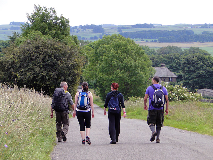 No flagging at Flagg
Rejuvenated we continued following the Limestone Way we had joined earlier to the apex of the stage on Sough Top while stalked by a ominous dark cloud. When spotted it went in a hurry and without bursting out all over us so from our highest point of the walk we could take a deep breath and descend at a leisurely pace into the village of Flagg. And so with the immediate climbing done my walking chums chilled out and walked down the road into the sprawling village. We walked through the quietest of High Peak villages without seeing a single soul.
 Destination Monyash
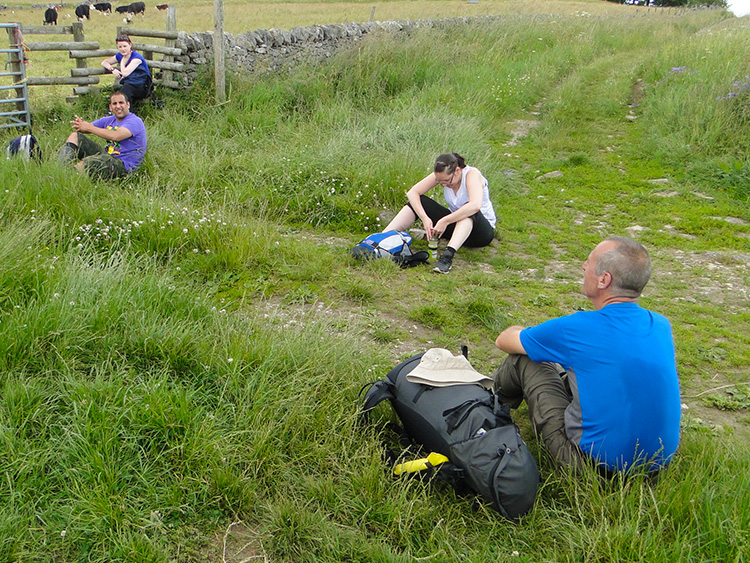 Rest time on Blackwell Lane
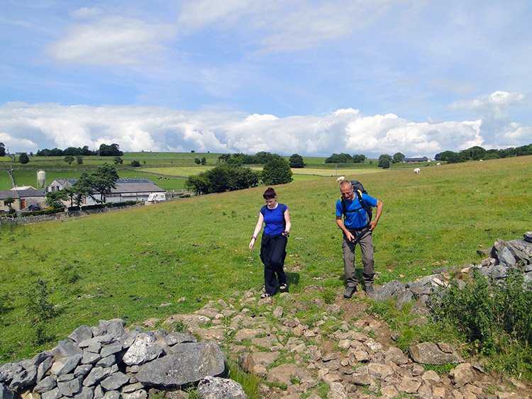
After walking down the main street of the deserted village which was heralded by the return to hot sunshine we continued on by following a series of lanes towards the village of Monyash. First we followed Mycock Lane and then we followed Blackwell Lane to a point just short of meeting the Taddington to Monyash road which would lead us due south into Monyash. It was 2.15pm and we stopped for a fifteen minute break, barely one hour after leaving the Waterloo Inn. We were ten miles into the walk and while Steve and I were used to it our friends were not. It was time to pace ourselves.
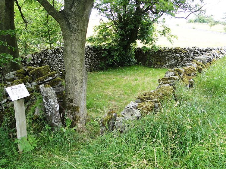 A Pinfold in Monyash
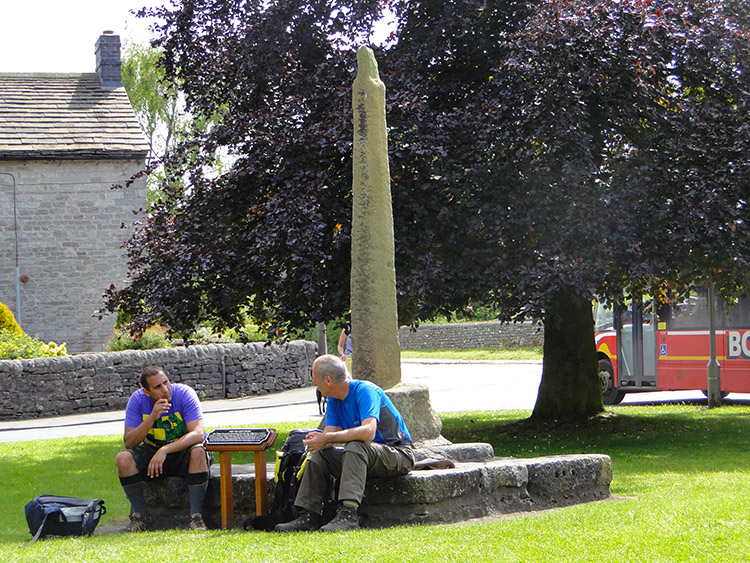 Monyash
After the impromptu break on Blackwell Lane we strolled down the road into the village of Monyash. On the edge of town I stopped at an interesting feature, a small animal paddock by the side of the road known as a Pinfold. A notice by the Pinfold read "PINFOLD - stray cattle and sheep were rounded up by the PINDER and kept in the PINFOLD. The owner collected them but had to pay a fine". It paid to look after your stock, even in olden times. Continuing on we arrived in Monyash, a lovely and smart village which has a spacious village green in the centre. Here, unlike in Miller's Dale earlier in the day we did find a shop. With Monyash being our final village before the end of the walk in Hartington I decided to make a short stop and buy my friends their choice of drink or ice cream. We had a nice break in Monyash.
 Near Parsley Hay
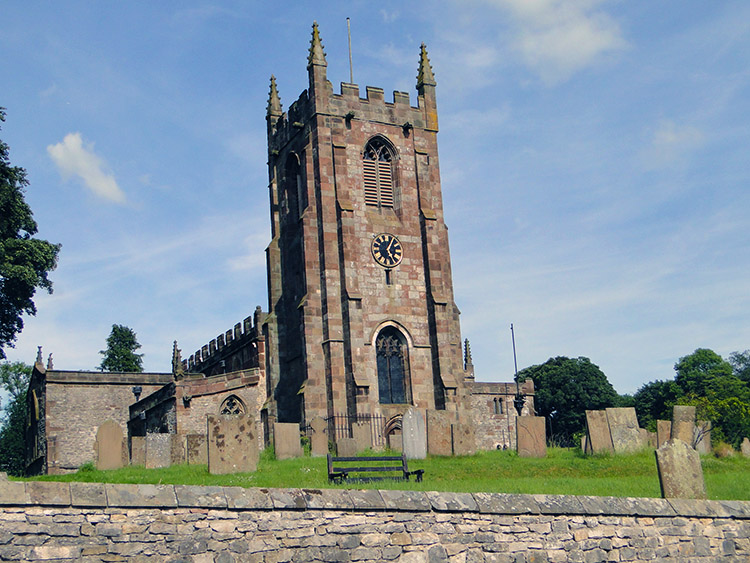 St Giles, Hartington
Clouds continued to disperse and it became a very hot afternoon. Spot on three o'clock we set off from Monyash on the final leg of the walk. The first part immediately led to the second ascent of the day, climbing the Rake towards the settlement of Parsley Hay and after that crossing some fields to Vincent House before climbing again across a short hill to Madge Dale and then down into Hartington. The distance between Monyash and Hartington was 4.5 miles. It took us just two hours which is remarkable because from Monyash Laura struggled. While Steve led the way, as he often does, and while Charlotte and Simon managed to stay with him Laura fell back. She did not stop walking but she slowed and dropped further and further back. I stayed with her, telling the others to keep going and while we walked together she told me that the heat was getting to her. She had put her hat on in Monyash to keep the sun off her but it did not help with her overheating. I suggested stopping with her while the others finished and returned as they had a relief car in Hartington to get themselves back to Peak Forest. Proudly she said no. She wanted to finish.
 Well done team
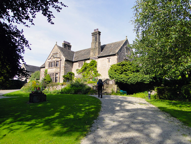 YHA Hartington Hall
And in time finish she did. Not all alone and not just with me. Steve, Charlotte and Simon had waited at the top of the final climb so we could all walk into Hartington together. which is exactly what we did, all achievers and all together. It was just after 5.00 o'clock in the afternoon and eight hours since we had set off from Peak Forest over fifteen miles and a lot of dales, hills, villages, adventures and laughs later. After reaching Hartington and celebrating we said our farewell. Thank you Charlotte. Thank you Simon. Thank you Laura. WELL DONE!


