The Great British Walk
A personal record of my three month walk of the full length of Great Britain from north to south with written journal and photographs. Tracklogs for GPS units and for use with Google Earth are available for download for each stage.
Stage 49: Hartington to Eaton Dovedale
Google Maps Open Source Maps| Statistics and Files | ||
|---|---|---|
| Start: Hartington | Finish: Eaton Dovedale | Distance: 18.9 miles (30.4 km) |
| Time: 8-9 hours | Climbing: 603 metres | Total Distance: 659.9 miles |
| GPX Route File | Google Earth File | About Hartington |
| Statistics | |
|---|---|
| Start: Hartington | Finish: Eaton Dovedale |
| Distance: 18.9 miles (30.4 km) | Time: 8-9 hours |
| Climbing: 603 metres | Total Distance: 659.9 miles |
| GPX Route File | Google Earth File |
Ordnance Survey Explorer Map (1:25,000)
Summary
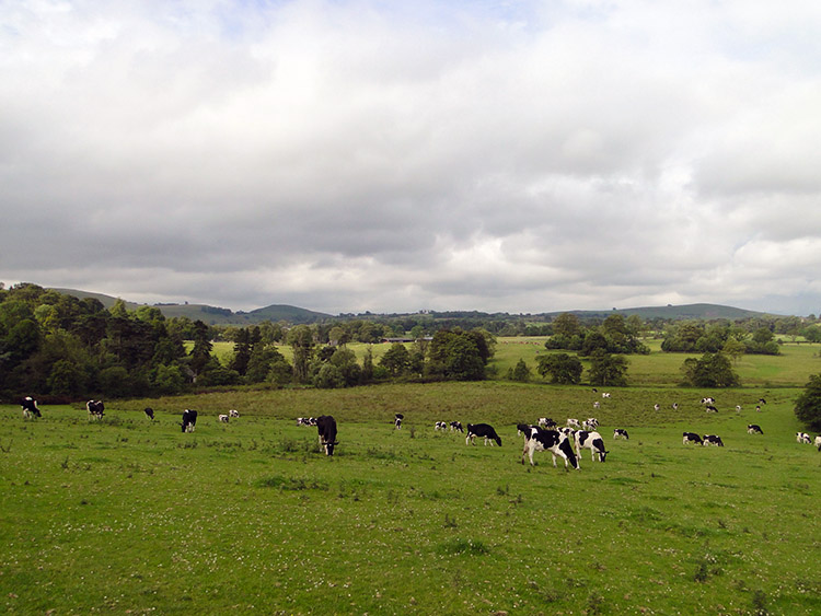
Just two days after walking into the Peak District National Park from the north Steve and I walk from it on its south side during this stage. At around 19 miles the day was a long one but with lovely sunny weather to enjoy and some wonderful Peak District dales still to enjoy before leaving the park including sublime Wolfscote Dale and iconic Dove Dale it was a treat. As was the walk after leaving the Peak District behind in which we headed south through Staffordshire countryside while always being close to the River Dove which serves as the Staffordshire and Derbyshire border.(Note: My walk of the South Pennines and Peak District was a part of my Great British Walk from the north coast of Scotland to the south coast of England)
Stage Report
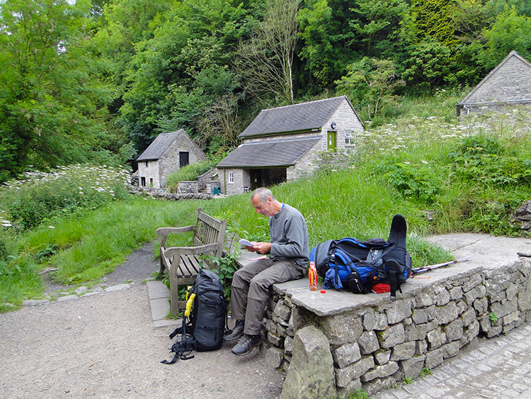
Steve and I were grumpy after rising, when packing and during breakfast. I blame the Youth Hostel. What has happened to these places. When we arrived at the Hartington Youth Hostel we not even shown to our room. When we found it there was no bed linen inside which we had to go and ask for. The room was sparse with nothing in it bar flimsy window curtains. When Steve went down to reception for some soap he was told he would have to buy one of the little soaps you get for free in hotels and bed and breakfasts. And as for breakfast we had to make our own which consisted of toast, jam and cereal. I would have said fair enough in the past when youth hostels were cheap and cheerful but this time we arranged for board and breakfast and paid as much as we would for a reasonable bed and breakfast in the village. It was poor service indeed.
We vowed never to stay in a youth hostel again, such a shame as we had spent some great nights in them in the past. Personally I will remember three youth hostel nights with happy thoughts. The first two were at the youth hostel in Keld during my Coast to Coast walks of 1994 and 1999. Secondly was Grinton Lodge during the 1999 C2C walk. The costs then were more than reasonable and though you had to muck in during meals it was to be expected and therefore very convivial. And the evenings were all memorable with occasions of good chat, reading old books and magazines in the makeshift libraries and playing the games available. Those were the days.
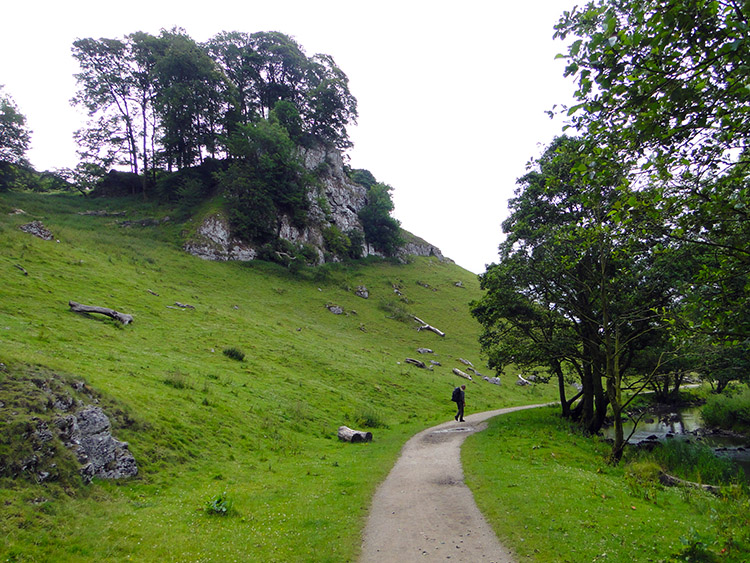
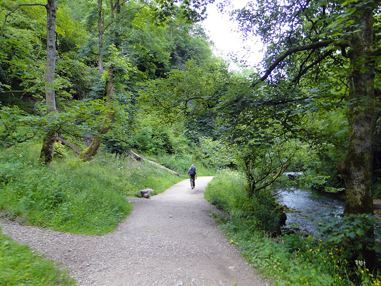
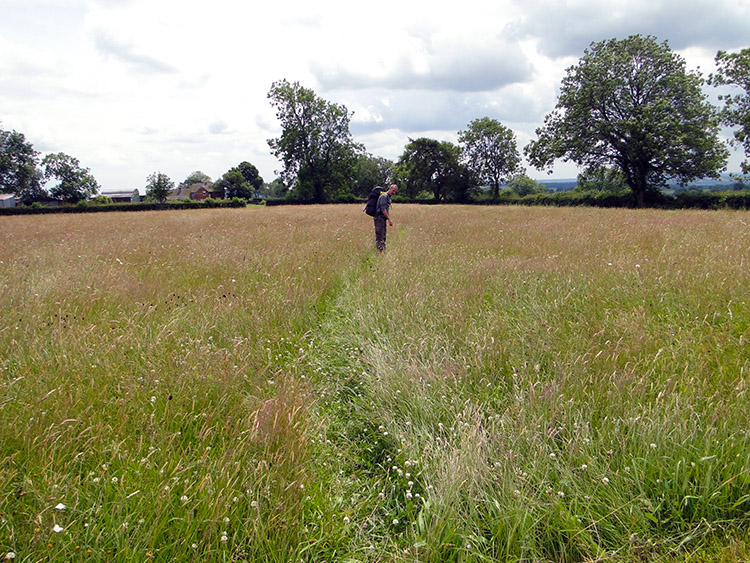
 South of Hartington
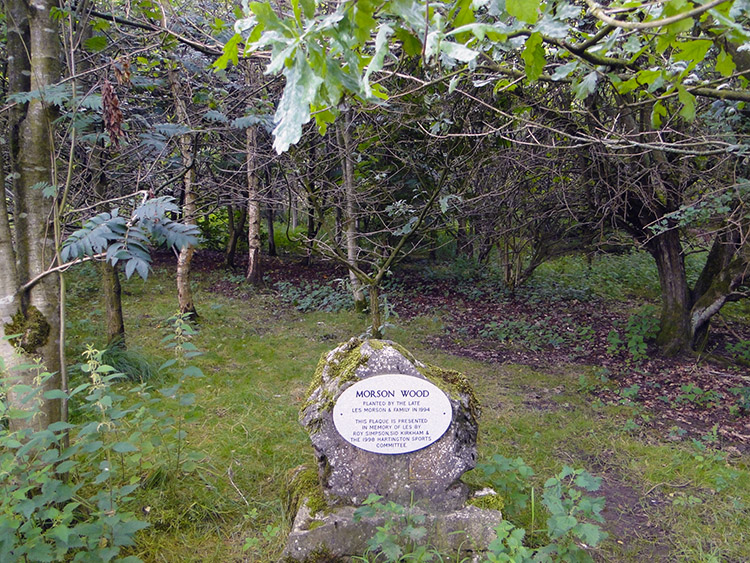 Morson Wood
The pair of grumpy walkers walked out of Hartington Youth Hostel and did not look back. We hoped the walk from the village across some fields to some more delightful Derbyshire dales would cheer us up. We were away by just after 8.00am and the early glimpses of sunshine through the high cloud were already warming up the day. Our first mile saw us cross a few fields at Crossland Sides and around the rim of a hill called Pennilow to reach a young wood. A plaque told us it was Morson Wood which was planted by Les Morson and his family in 1994. The plaque was dedicated to Les who had since passed away by Roy Simpson, Sid Kirkham and the 1998 Hartington Sports Committee. Les must have been quite a man to receive such honour. My tribute to you sir.
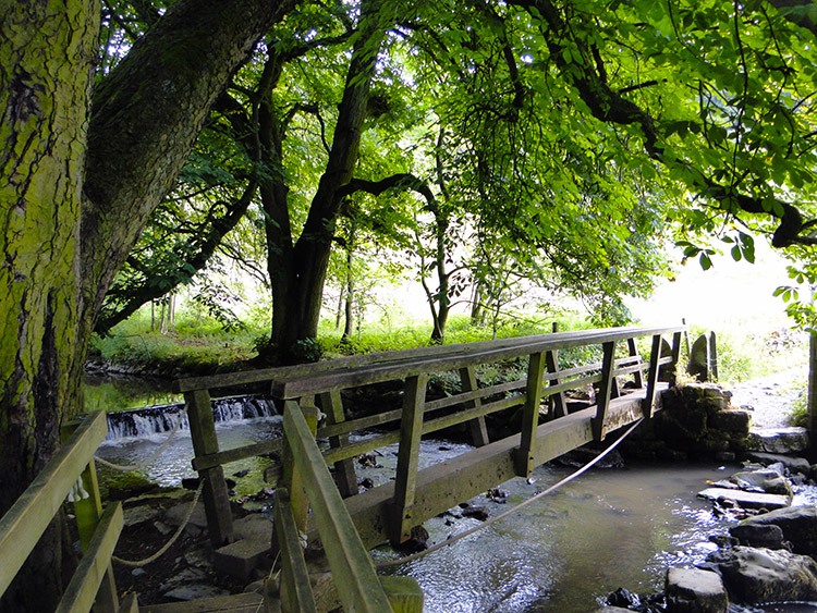 Footbridge in Beresford Dale
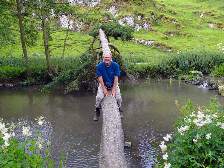 Crossing the River Dove by Log Bridge
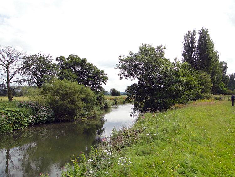
Our passage through Morson Wood which included Ash and Oak took us to Beresford Dale, the first of a series of dales which would see us through to the south side of the Peak District National Park. The walking was dead easy along Beresford Dale as it would be for the first 10 miles of the day on a very constant and gentle line of descent, losing about 10 metres of height per mile. It was hardly distinguishable on the ground but a nice thought in the mind. Beresford Dale is wooded on the northern side which we walked through first. Halfway along we came to the Pike Pool, fabled for its association with Izaak Walton who once fished it with his young friend and pupil, Charles Cotton. Perhaps we were overlooking the waters which were the inspiration for Walton's famous 17th century classic book 'The Compleat Angler or The Contemplative Man's Recreation'.
Moving on from Pike Pool we followed the young River Dove to reached a footbridge from where we continued to walk along side the river while the valley opened out from wooded gorge to wide hay meadow. Across the meadow we arrived at another footbridge heralding our arrival in Wolfscote Dale. Just beyond the second footbridge a collapsed pine tree straddled the River Dove which gave me the opportunity to display my log balancing skills. I did not have the nerve to walk across though, preferring to shimmy across on my bottom to sit astride the log directly halfway over the river.
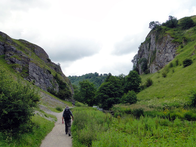
 Wolfscote Dale
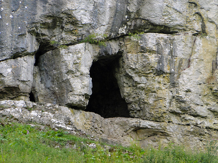 Limestone cave in Wolfscote Dale
I had anticipated reaching Wolfscote Dale and as we began our walk through I looked up to a limestone outcrop on the left side bank of the dale which was topped and surrounded by Oak trees. s we got nearer I pointed out a cave to Steve. I said to him "The last time I was here I sat in the cave while having lunch and watching walkers pass on the path below". It was on a memorable day when I did my Dove Dale and Wolfscote Dale walk. On that occasion I had walked in the other direction through them and it was the happy memories from that walk which had made me decide to make them part of my Great British walk.
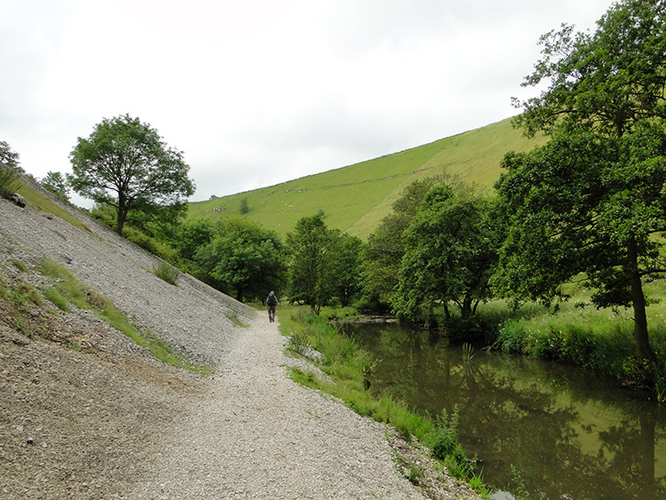 Scree slopes of Wolfscote Dale
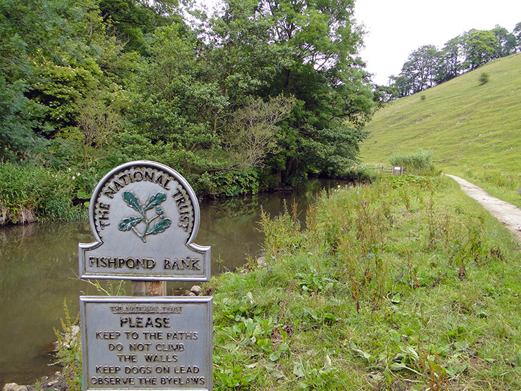 Fishpond Bank
So now I was walking on paths of some familiarity albeit in the opposite direction to that I had taken the first time. Still I came to points along the path where I recognised distinct things. Such as the lines of scree which erupted from the grassy slopes of the east side of Wolfscote Dale. Sometimes the line of grass reached all the way down the bank and sometimes loose scree had torn through to create a barren area of limestone. In the narrowest parts of the gorge the scree tumbled over the path and edged to settle in the water of the River Dove. Beyond the scree slopes we walked to the more open south side of Wolfscote Dale and just short of the end of the dale as we neared Mill Dale we passed a National Trust sign by the riverside titled Fishpond Bank. A house was nearby but the sign pointed away from it in the direction of Wolfscote Dale. Was the house National Trust owned? Was Wolfscote Dale under National Trust management? There were no signs to what Fishpond Bank was. Mysterious.
 Milldale
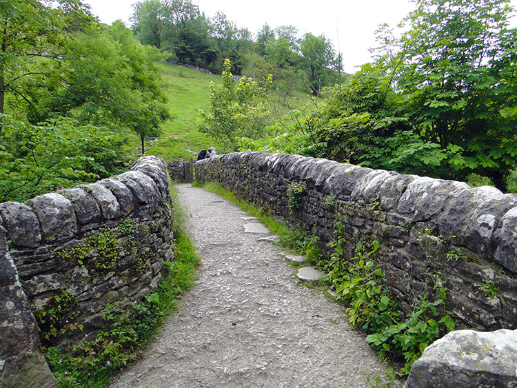 Milldale Bridge
We did not dwell on the mystery of Fishpond Bank, soon after leaving Wolfscote Dale to follow the tarmac road through Mill Dale to the village of Milldale which sat at the joining point of three dales. Mill Dale and Dove Dale saw the transit of the River Dove downstream. The third unnamed dale to the west was headed by the small village of Hopedale, it being a dry dale without a watercourse which I ought to christen Hope Dale. Steve and took a break at Milldale before our walk through Dove Dale. We had been walking for two hours in which we had covered five miles. After our break we crossed Milldale Bridge and began our walk through Dove Dale.
 Into Dove Dale
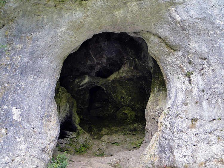 Dove Holes
With it still being early in the day the north side of Dove Dale was relatively quiet of other walkers. In the still of the calm morning we made good headway walking through the dale and past Raven Tors, the Weirs and Nab Springs without stopping to look at anything. I took time out at the limestone caves at Dove Holes though. On the previous walk through Dove Dale and while I had climbed to the cave at the north end of Wolfscote Dale afterwards I had ignored these at Dove Holes because there were quite a few people playing in and around them on that occasion. With it being earlier and quieter I had them to myself so I crossed to them from the path and had a nosy in. I discovered they have no depth to them and certainly no hidden corners so it did not take long to explore them at all. Nothing like as thrilling as Thor's Cave in the next valley along. The Dove Holes exploration was all over in less than five minutes.
 Near Pickering Tor
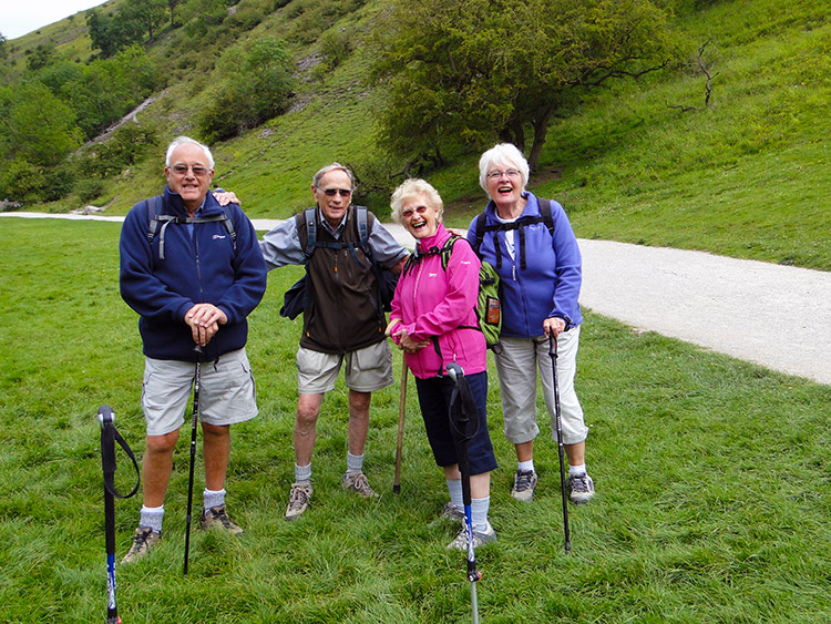 Birmingham Ramblers
Anyone who has walked on the paths in and surrounding the southern end of Dove Dale will probably know when they are there and when they are not. From the quite and less walked paths outside and on the north side of Dove Dale there is an eerie impression of a magicians wand waving and with the sound of the word abracadabra and a puff of smoke people began to appear here, there and everywhere. Just as when I walked through Dove Dale on the previous occasion there were walkers appearing from every direction as we walked on the path between Ilam Rock and the stepping stones over the River Dove. On the last walk through they had all but petered out after passing Ilam Rock on the walk to Milldale and through Wolfscote Dale and then disappeared completely afterwards. I guessed this would be the same and for now Steve and I would enjoy their company while we enjoyed the many marvels of Dove Dale. Between Ilam Rock and the stepping stones there are a host of limestone wonders including Pickering Tor, Reynard's Cave, the Natural Arch and Tissington Spires. I enjoyed recapturing moments with them all and afterwards while near to the stepping stones I chatted with a group of Birmingham Ramblers who were out for the day, enjoying it as much as we were. It was very nice to meet them.
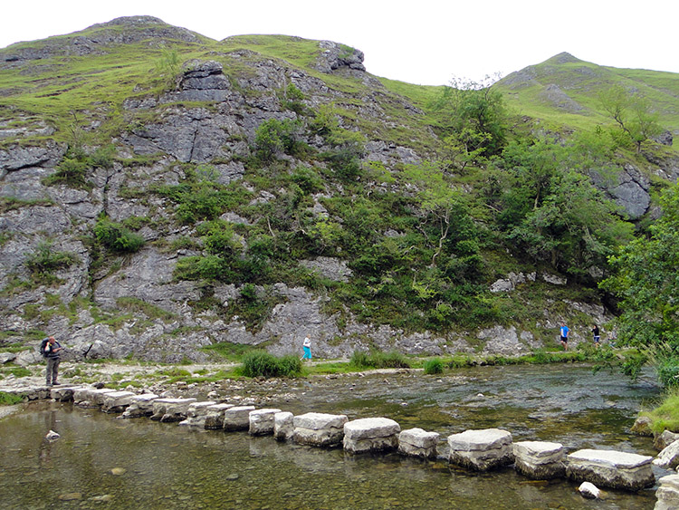 Dove Dale stepping stones
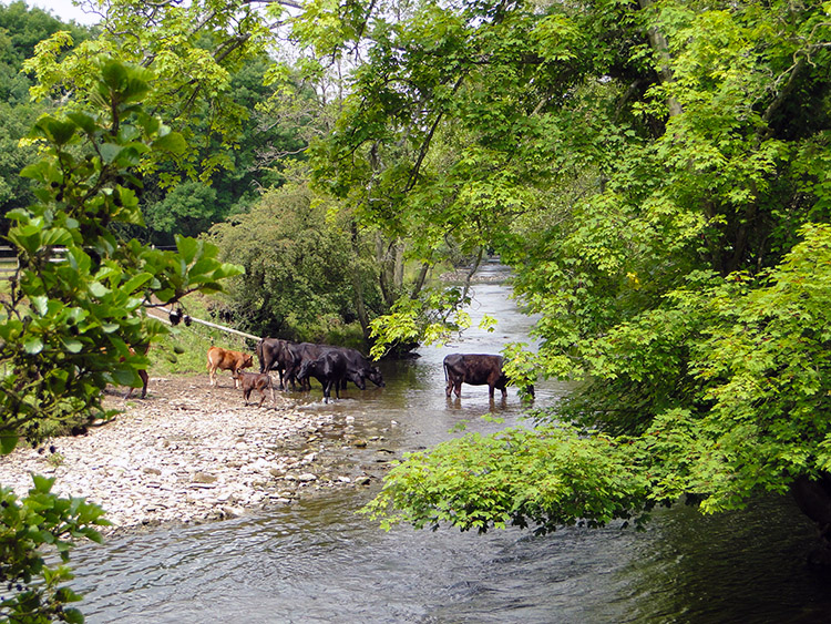 Near Coldwall Bridge
At the stepping stones both Steve and I performed the ritual of walking across them and then walking back across them. The river was running as gently as any in mid-summer with little recent rain so the stepping stone crossings were nothing like the challenge they could have been. It was a doddle. The stepping stones are at a sharp bend in the River Dove as it turns from south-east to south-west. A short walk south-west past Thorpe Cloud took us to the end of our Dove Dale journey. At the south end of the dale there is a car park and we reached it at just before 12.00 noon and it was heaving. It was cloudy but fair and warm and cars were streaming in. We walked through the car park and crossed the Ilam to Thorpe Road near St Mary's Bridge to cross fields southwards to Coldwall Bridge. From the crowds and noise on one side we immediately hit a wall of silence. It was gorgeous. Near Coldwall Bridge a herd of cows set an idyllic scene, some grazing in a field by the River Dove while others were in the river taking a drink.
 Near Upper Mayfield
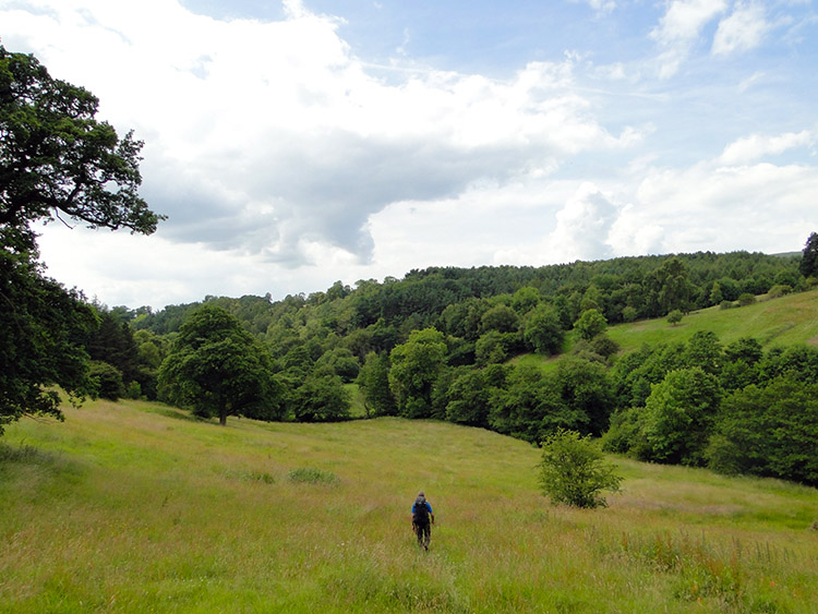 Stanton Wood
We were now through our Peak District National Park stage of my Great British walk. What would the next phase bring? Completely new experiences that was for sure. Most of the walking from now on would be completely new to us and while Steve knew some of the ground we were yet to cover in the south-west all my familiar ground was behind me. Thus I looked at the countryside ahead of us with a sense of awe and with a feeling of much anticipation. Despite leaving the comfort of known surroundings behind I was as thrilled as I could be. We headed into Staffordshire and across the area of Swinscoe, across the A52 at a point I had never driven along, never mind walked. It was magic. Utter magic. The paths, the tracks, the lanes, the villages, the towns, everything would be completely new. The paths here were good, especially so as we were still following the Limestone Way which we had joined at Miller's Dale and left at Monyash on the previous stage and which we had rejoined at Coldwall Bridge a few miles back. We would now be with the Limestone Way for the rest of the day.
 Ellastone
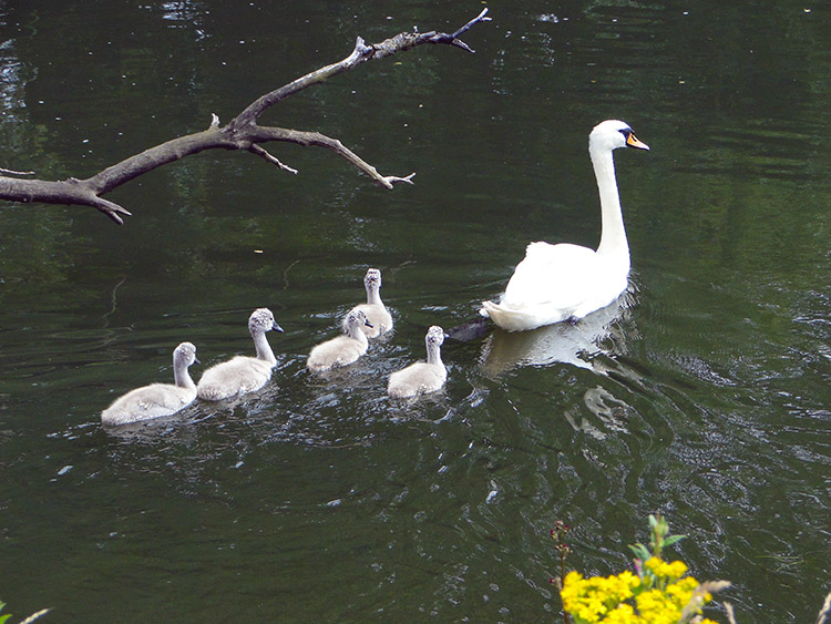 Pen and Cygnets on the River Dove
We had climbed nearly 150 metres since Coldwall Bridge but I had hardly noticed. Much was the enjoyment. After two and a half hours of following the Limestone Way across Staffordshire countryside while sticking close to the course of the River Dove and thus the Derbyshire border we arrived at the village of Ellastone. The village was so quiet. We saw no one as we walked through the village, nothing stirred at all and it was a gobsmacking thought that just two miles west hoards of people would be whooping with delight at the thrills of Alton Towers. Remarkably we did not hear a thing. We looked for a shop in Ellastone but there was no one to be found. Instead I sat on a grass bank near the bridge crossing the River Dove and took my last drink. Rocester surely would serve us with replenishments. Before Rocester though we had just over two miles of walking.
 River Dove at Riverside Doveleys
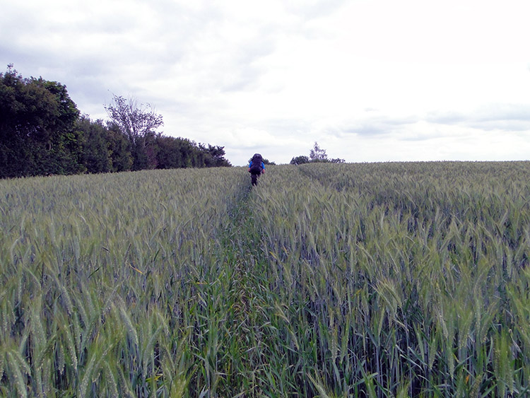 Path through the chaff
The walking between Ellastone and Rocester was along the Limestone Way, the first mile all along the riverbank to Riverside Doveleys, a business complex in a delightful setting. The paths were somewhat overgrown in parts, more likely across cereal fields where the required strip the farmer is obliged to provide was not in evidence. With no other choices when this happened we made our own paths through the chaff. Fortunately the virgin field cutting was done on the level before a short stiff climb of 50 metres took us across the B5030 to Dalesgap before a similar descent took us across the B5030 again and across a field into Rocester.
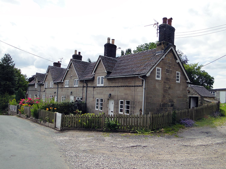
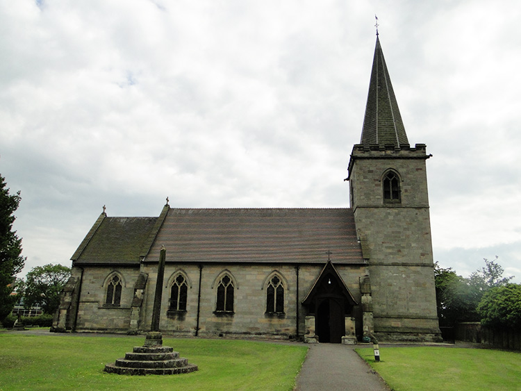 St Michael's Church, Rocester
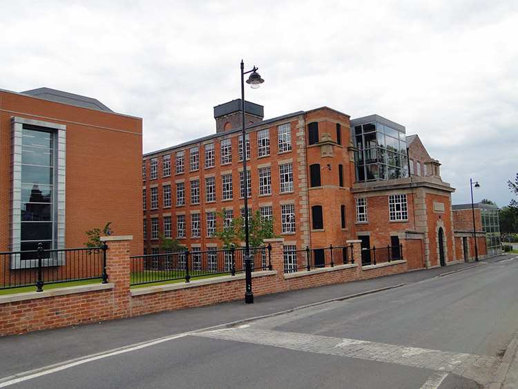 JCB Academy
The village of Rocester was originally a Roman Fort and later an Augustian Abbey was established. Both are long gone with only earthworks remaining. In 1781 Richard Arkwright, the inventor of the Spinning Frame converted an old corn mill into a water powered cotton mill. The mill is now the home of the JCB Academy. The world headquarters of JCB are also in Rocester. Fortunately for me and Steve there was also a shop. We stocked up, resolved to walk on a little further in the lovely evening weather and find somewhere to camp. JCB would feature in that too.
It was 4.30 in the afternoon when we walked from Rocester. We had been on the road eight and a half hours and we had covered just over 17 miles. Still we felt good and so continued on with the hope of finding a decent site to camp. Having also said goodbye to the Limestone Way which terminated in Rocester we had joined the Staffordshire Way for the first time. Surely a county path would provide us with opportunities to camp. First we walked across river plains fields to Sedsall, all too open and exposed for setting up camp. Then we passed a big gated house at Eaton Dovedale, thinking at the time it must be home to someone important but thinking nothing more than that. A little further on and aware that we were soon going to be nearing Uttoxeter we came to the edge of a wood called Eaton Wood and decided to stop beside the wood next to the Staffordshire Way path.
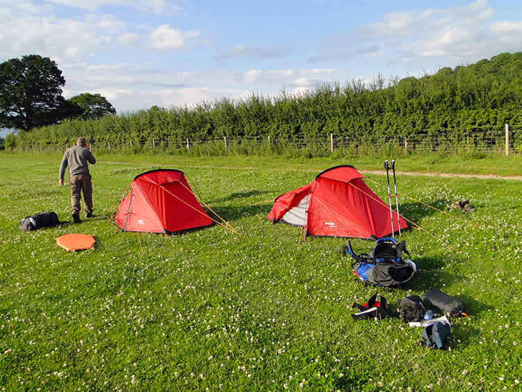 Pitching camp
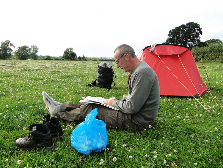 Time to party
We were out of sight of the big house and unlikely to encounter anyone in our middle of nowhere camp site so we took off our backpacks and pitched our tents in a corner of a field next to the wood. No sooner had we got the tents up when we saw two chaps crossing the field from the direction of the big house on quad bikes. "Blooming heck, this looks like trouble" or something like that, I said. "It doesn't look good" replied Steve. The chaps arrived and dismounted from their vehicles. It was clear they were security staff. The senior of the two asked "Who are you. What are you doing here". I explained we were on a Great British Walk from one end of the country to the other and all in a good cause. I added "I am the Walking Englishman. Check out the website for certainty". "All well and good" he said, adding "nevertheless, you cannot stay here". He carried on by saying "Do you realise that is Mr Bamford's house and he will not be pleased if you stay here, within sight of the house". And then he said "But if you pitch up your tents in the corner of the next field, behind the hedge and out of sight then we are happy for you to stay".
And so we agreed to do as they asked, to take down camp and move down to the next field. We promised we would be orderly and to tidy everything up in the morning which is what we always do anyway. They were happy. We were happy. And as a result we set up camp in a much better place. Our original camp was on a slight slope and this second field was as flat as a cricket pitch. Once Steve and I got the camp up and had eaten our dinners we settled down in the field to read the newspaper I had bought in Rocester, to do the crossword, to have a few beers, to chat, to watch wildlife which included birds crossing the Staffordshire sky and to see the sun set on a fine day. We were not grumpy now.


