County Tops of England: Lincolnshire
Normanby Top: 168 metres (Grid Ref: TF121964)
Google Maps Open Source Maps| Route Statistics and Files | ||
|---|---|---|
| Start: Roadside near Radar Station | Grid Ref: TF124960 | Distance: 0.3 miles (0.5 km) |
| Climbing: 3 metres | Time: 15 minutes | Rating: Easy |
| GPX Route File | Google Earth File | Map: 284 Grimsby, Cleethorpes and Immingham |
| Statistics | |
|---|---|
| Start: Roadside near Radar Station | Grid Ref: TF124960 |
| Distance: 0.3 miles (0.5 km) | Time: 15 minutes |
| Climbing: 3 metres | Rating: Easy |
| GPX Route File | Google Earth File |
| Map: 284 Grimsby, Cleethorpes and Immingham |
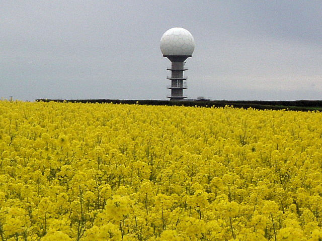
The Walk: You will need permission to cross the field required to reach the trig pillar which marks the spot of Lincolnshire's county top. It is a simple walk along a field side from the radar station but as the land is private it would be illegal to do so without the aforesaid permission.
The Walk I Would Do: Should I bother then after seeking permission I would do this one.
Information: Wolds Top (sometimes also Normanby Hill) is the name sometimes given to the highest point of the Lincolnshire Wolds. It lies some distance to the north of the village of Normanby le Wold in Lincolnshire. The Viking Way passes close by, on a minor road, and there is a radio mast near the summit. The summit is marked with an Ordnance Survey triangulation station. (Source: Wikipedia)


