Saint-Guilhem Way, France
Story of the walk by Scott Anderson, (The Enlightened Traveller)
Six BIG reasons to walk the Saint-Guilhem Way
Statistics:
Distance: 112 miles (180 km)
Climbing: 3,275 metres
Days: 10
The Walk:
Saint-Guilhem Way is Languedoc’s drovers’ trail par excellence: an ancient thoroughfare. Unlike its cousin to the east, Le Chemin de St-Gilles, it has not fallen foul to tarmacking and the automobile. The path offers an extraordinary variety of landscapes en route as you cross the three departments of Lozère, Gard and Herault and get a sniff of a fourth at the beginning – Aveyron.
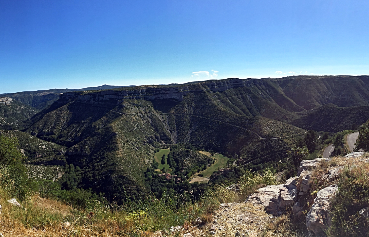
After the volcanic uplands of Aubrac, stride out across the Northern Causse, the Causse de Sauveterre, and cross the River Lot and the Tarn Gorge. Then climb up to Causse Mejean and walk the Mont Aigoual massif. Traverse the Causse de Blandas, before plunging into the topographic marvel that is La Cirque de Navacelles. Explore the Vis Gorge on the penultimate day before enjoying one of the best day’s hiking Le Midi has to offer: the descent to the grande finalé, Saint-Guilhem-le-Dèsert.
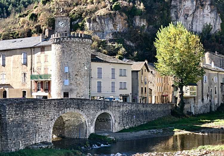
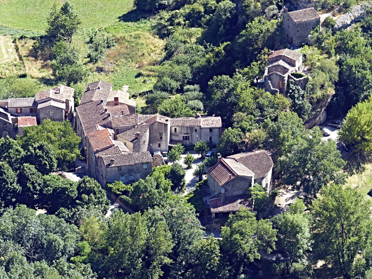
Saint-Guilhem Way was bustling with caravans of mules and traders from the early Middle Ages They were eagerly transporting their produce to and from the fairs of Meyrueis and Le Vigan: salt, wine, oil, milk, cheese, lace and leather. Close on their heels were pilgrims, keen to visit the abbey of Gellone. This is the resting place for William of Orange, with its relic of the Holy Cross donated by his cousin, Emperor Charlemagne. From here pilgrims would join the Arles Route and kick on eastwards to Rome or westwards to Santiago de Compostela.
Day One:
Start: Aubrac
Finish: Col du Trebatut
Distance: 13 miles (21 km)
Climbing: 445 metres
Time: 6 hours
You spend the first day’s hiking walking through the edge of the French department of Aveyron before crossing over into Lozère. Aubrac shares some climatic similarities with the Aigoual Massif. They both have a harsh climate, with short summers, stormy winters and high rainfall. Not to mention high winds, snow and fog. Thankfully, these meteorological characteristics occur out of the hiking season!
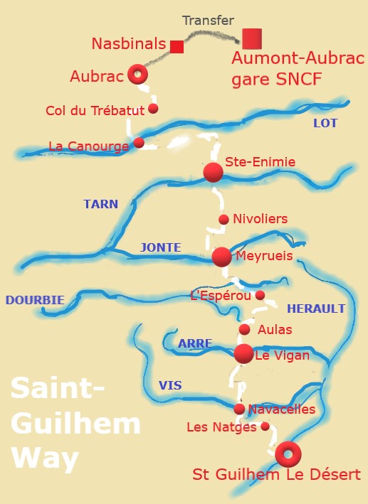
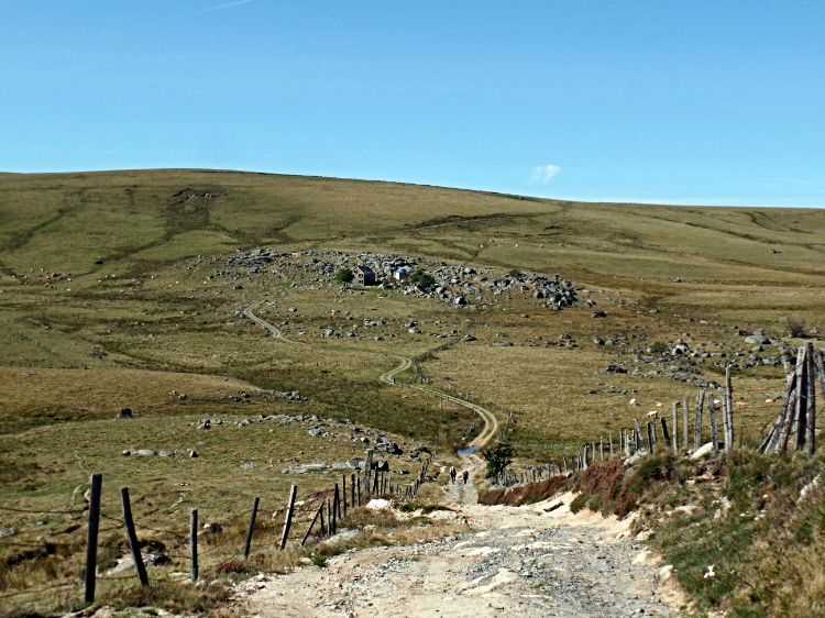
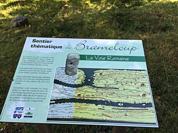
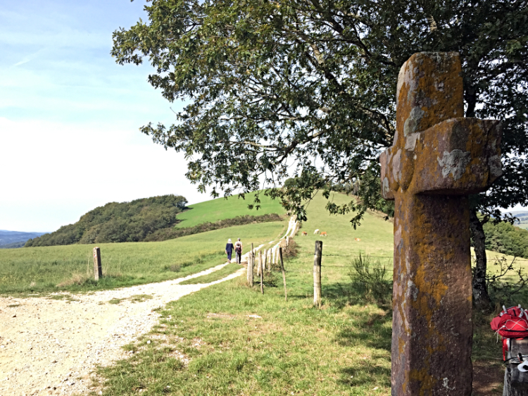
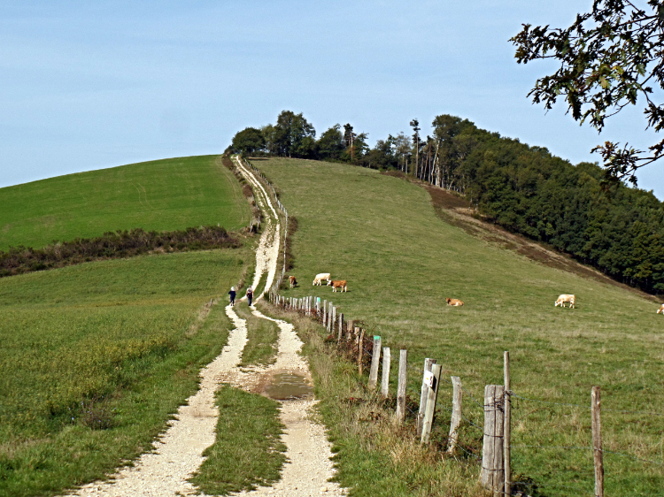
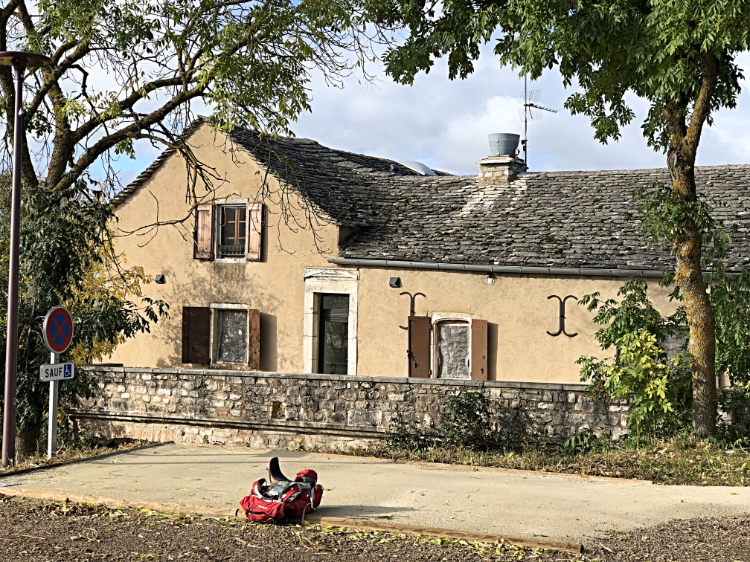
Aubrac village is likely to be calm and peaceful whilst you check your gear and get your bearings before striding out. From the main square, La Place des Fetes, we get off-tarmac almost straight away and onto the GR6A trail. The Aubrac cows are omnipresent during the morning and the walking is extremely varied and punctuated by several crosses dotted for various reasons along the trail. We have the privilege of hiking the sacred turf (some paved) of the Voie Romaine, aka Via Agrippa, one of Gaul’s most important highways that linked Toulouse to Lyon.
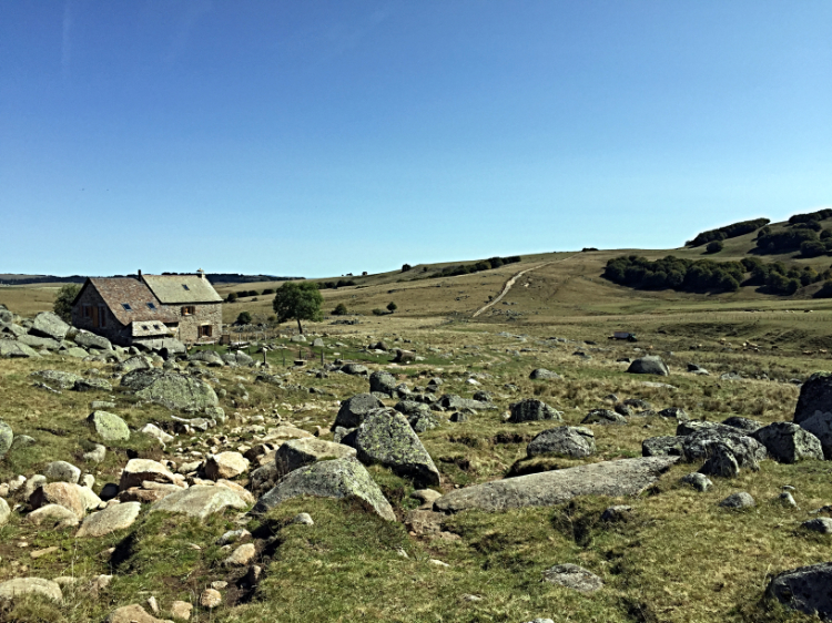
We traverse some rude and rugged open countryside south of a bog before heading south east as far as the Croix de la Rode. From there we follow grassy, rolling uplands as far as the refuge de Rajas, located amidst a chaos of rocks. This is our preferred lunch spot – although many prefer the shelter of the Relais des Lacs at Bonnecombe, some three kilometres further on, where snacks, refreshments and toilets are available.
The climb out of Bonnecombe is a relative challenge after which the walking for the remainder of the afternoon is very much of a functional nature. Fix your mind on the reward ahead: the comfort and wholesome cuisine of your overnight inn.
Day Two:
Start: Col du Trébatut
Finish: La Canourgue
Distance: 9 miles (14.5 km)
Climbing: 70 metres
Time: 4.5 hours
Today we follow the GR60 down to just north of Banassac, where we merge with the GR6. It is largely a day of descent, with one notable climb just after St Germain du Teil. Population density? A mere seventeen people per square kilometre.
St Germain is replete with crosses that guide you through the maze and an interesting central square, with characteristic Lozerean open church belfry. The war memorial tells the familiar WW1 story of the massacre of menfolk, with certain families bearing an inordinate brunt.
The impressive Croix du Tieule marks our exit from the vilage and is the point of departure for our one and only climb of the day. Thankfully short, but a bit of a killer all the same, it takes us up to the Croix du Bois du Juge, with its fine belvedere.
From this cross we commence our circuitous descent into the Lot Valley via a couple of fine hill-crests. At La Blaquiere, approximately eleven kilometres into the day, we find our preferred lunch spot – a bench with a view down to Banassac.
Suitably fortified, we descend steeply to The River Lot and Banassac. This village is very much residential, with little character but for its main Place de l'Église Saint-Médard, with its interesting War Memorial. La Canourge, on the other hand, a mere kilometre further on, is full of life and charm. Its architecture, in the form of canals, bridges and outdoor washrooms, has led some (especially the local tourism office) to call it the "Little Venice Lozérienne".
Day Three:
Start: La Canourgue
Finish: Sainte-Enimie
Distance: 13 miles (21 km)
Climbing: 220 metres
Time: 6 hours
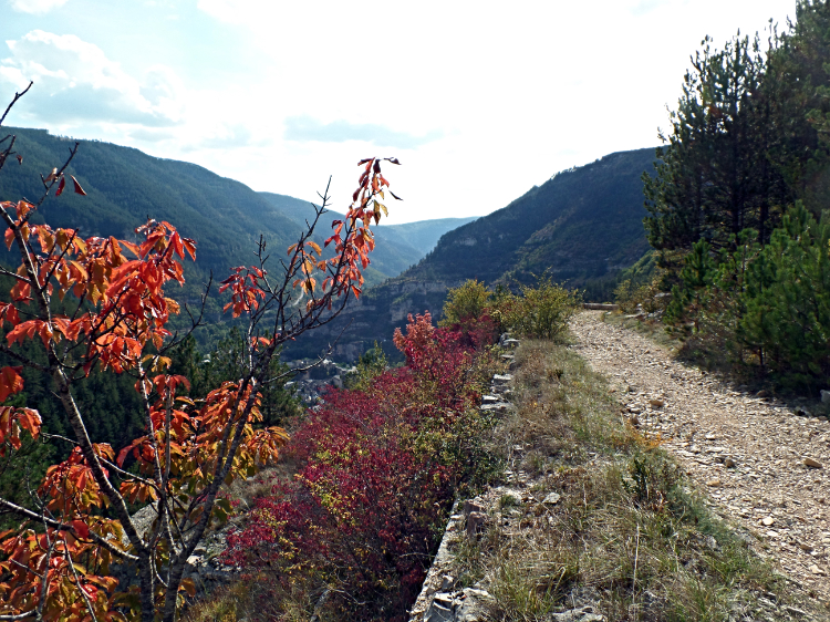
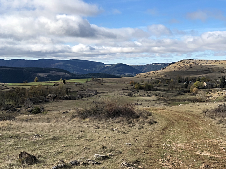
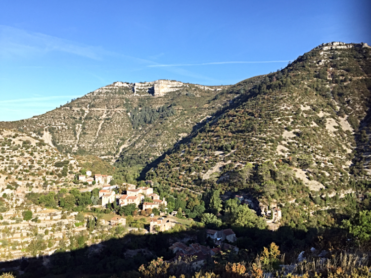
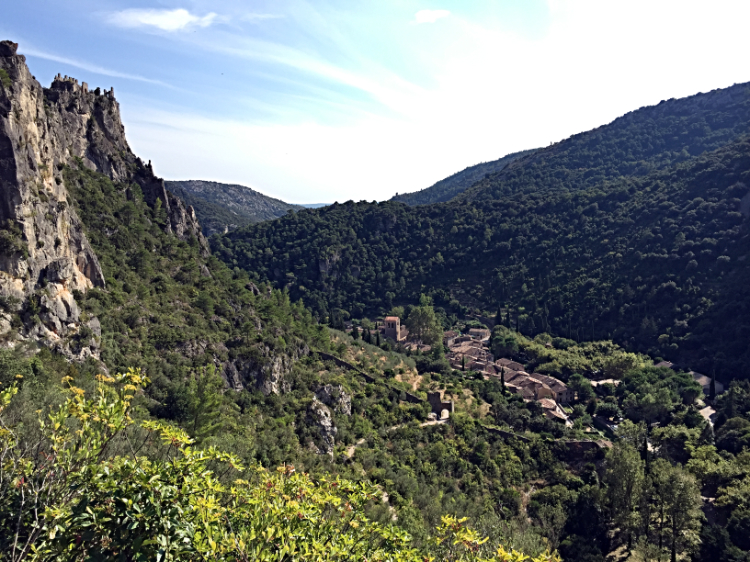
Causse Sauveterre and Causse Mejean are immense, rolling limestone expanses punctured by the deeply-incised canyons of Tarn and Jonte. You enjoy a full three days exploring these, commencing today.
Today we follow the GR60 all the way to Ste-Enimie. Unless opting for the initial taxi transfer, we pick up the day’s trail from opposite the Hotel Commerce and commence a protracted climb up a narrow, stony trail. The views get better the higher you get, and we negotiate some hair-pin bends on the way to tree level at Plo de la Can before walking along the south side of the Vale of La Curée. Then we stride out across open countryside and arrive in the farming hamlet of Les Fons. You have climbed approximately 250 ms in altitude since leaving La Canourge.
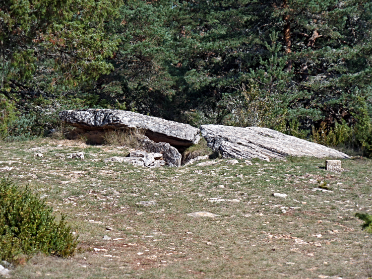
Continuing east, we reach the hamlet of Gazy with its trademark communal oven, stone cross and gite d’etape – as authentic a rural French experience as there ever was, but only suitable for those who are fluent in French. We are 18 kms from Ste-Enimie and have much to discover on the Neolithic front.
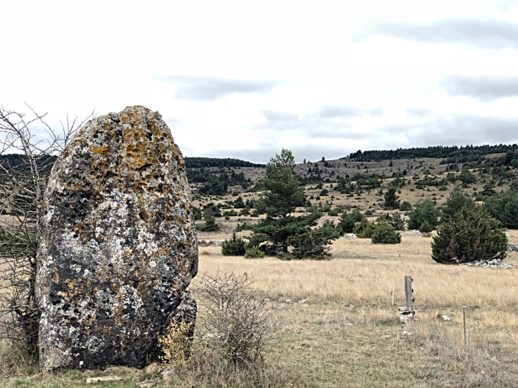
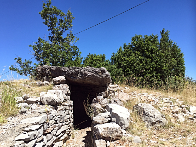
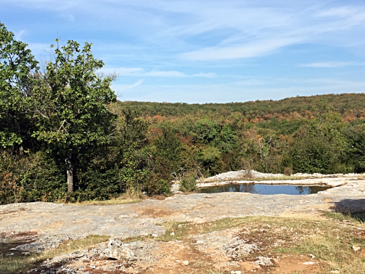
After the first dolmen, we walk the Draille de Lozere, an ancient drovers’ trail. Three kilometres later we visit the Dolmen de la Cham and a kilometre further on the ‘dolmen de l’Aire des trois Seignieurs’ before arriving in the delightful Caussenarde village of Champerboux.
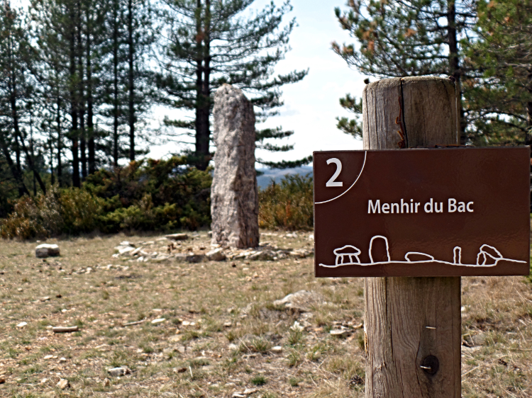
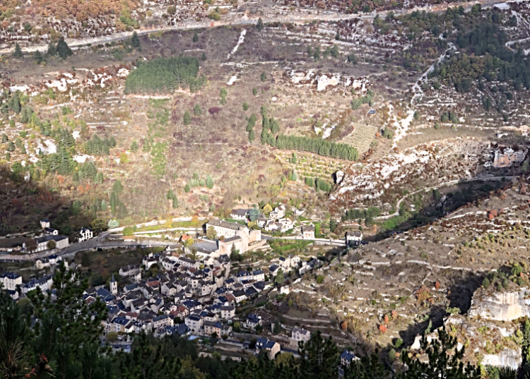
A little over a kilometre further on, we exit some woods to fall upon the most impressive menhir of the whole trail: the Menhir du Bac, encircled by its very own small cromlech. We then head almost due south for nearly eight kilometres along a balcony trail, en route to the tourist honeypot of Ste-Enimie.
Day Four:
Start: Sainte-Enimie
Finish: Nivoliers
Distance: 9.5 miles (15 km)
Climbing: 560 metres
Time: 6.5 hours
Today we continue along the GR 60 and enjoy the first of two splendid days’ walking across the La Causse Mejean. Historically, it is the most important transhumance route across the limestone plateau.
We cross the bridge over the Tarn and climb a rocky trail that steadily climbs up round several twists and turns; with numerous belvederes for pause and enjoyment as well as paved sections underfoot - so typical of steep transhumance routes.
We follow a ledge and climb a rock staircase to a fine belvedere overlooking Ste-Enimie, from where vultures can often be seen hovering overhead. We then ignore the ‘official route’ and head due south across rolling open countryside. Keep your eyes peeled for the menhir des Epougnes and enjoy views south as far as Mont Aigoual.
After another menhir just after the Toulousette Equestrian Farm, the hamlet of La Fraisse is off left/east shortly after, with Nivoliers a gentle 2.5 kms stroll further on.
Nivoliers is a small, isolated and adorable hamlet. The Auberge Chanet is a fine overnight stop, featuring surprisingly-modern and well-appointed rooms and mouth-watering cuisine prepared with devotion by your host, Patrick.
Day Five:
Start: Nivoliers
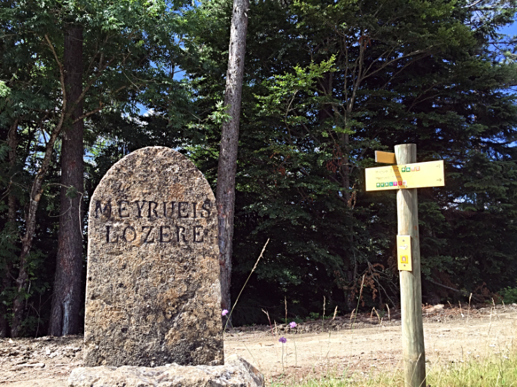
Finish: Meyrueis
Distance: 8 miles (13 km)
Climbing: 220 metres
Time: 5 hours
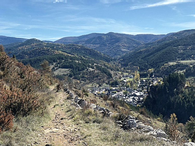
Today we continue our walking across La Causse Mejean via the GR 60, before branching off along the GRP Tour du Causse Mejean. It is a relatively short day, but brim-full of great scenery, fascinating sights and belvederes.
We walk across rolling and open countryside, where the silence and the surrounding landscape is stunning.
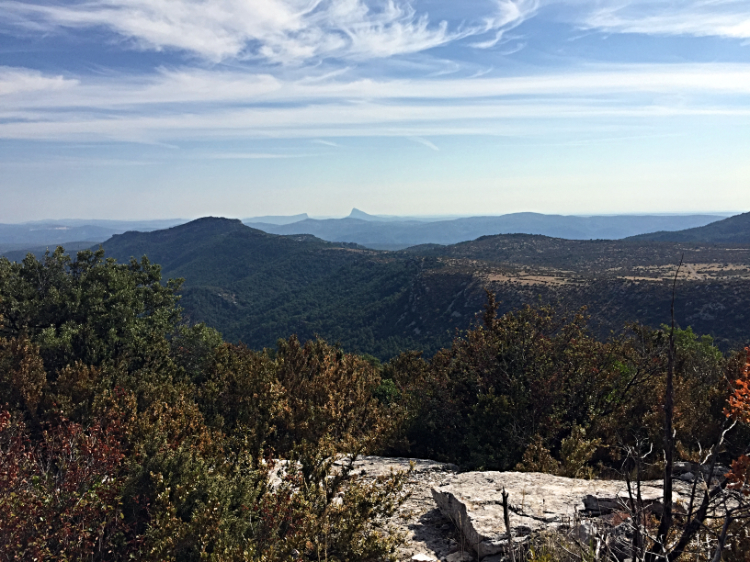
We rise to a vantage point over Mielgues, the first hamlet of the day, where you can visit and enter one of the abandoned homesteads with care. The Gorge de la Jonte falls away steeply off left whilst, across the other side of the Canyon you can see the more tree-covered Causse Noir and Mont Aigoual in the distance.
The view back down the Gorge from Pauparelle will live long in the memory. You are once again in vulture territory! As expected, the descent follows a relatively steep and stony trail that is shared with the GR6.
Enter the village of Meyrueis, cross the river Jonte and walk along the left bank of the Bethuson south-west past the bars, restaurants and commerce en route to your 3-star hotel with out-door pool.
Day Six:
Start: Meyrueis
Finish: L’Espérou
Distance: 12.5 miles (20 km)
Climbing: 675 metres
Time: 8 hours
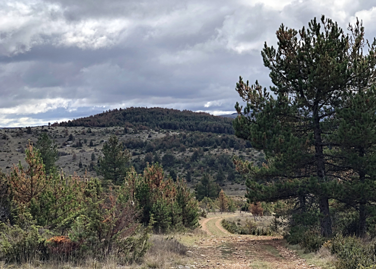
The Cévennes with its schist slopes, punctured by the dominant granite mass of Mont Aigoual to the south, is to be enjoyed today. It is your last day’s walking in Lozere before we enter the department known as Le Gard and walk the very southern limits of Cévennes.
The omnipresence of the walled terraces or ‘bancels’ is testimony to the need to capture and control the scarce water supplies. We follow the GR6-GR66 to just after the Col de la Pierre Plantée, where the GR62 takes over and is our guide until the Maison d’Aigoual. From here to l’Esperou we follow the GR7/GR66.
It is quite a long day that starts gently. We leave town due south towards the Chateau de Roquedols and commence climbing through a series of hairpin bends before arriving at the Bout de Cote, a col and frontier between the departments of Lozere and Le Gard.
You walk the Serre de St Saveur as far as the l’Abime de Bramabiau (grotto) and onto the Lac du Bonheur just after Camprieu village – our preferred lunch spot.
From there, the ‘itineraire equestre’ along the Bonheur valley is a joy to walk before climbing to the Col de la Serreyrede - a watershed for the waters running to the Atlantic and the Mediterranean resulting in quite marked differences in the landscape. The Office du Tourisme and the Maison de l’Aigoual are worth a visit.
From the Col we ignore the monstrous GR60 climb and instead follow the more gentle ascent towards Col de l’Esperou, join the Great Languedoc Drovers’ Trail and follow it until we hit tarmac on the outskirts of l’Esperou.
Day Seven:
Start: L’Espérou
Finish: Avèze (or Le Vigan)
Distance: 13.5 miles (21.5 km)
Climbing: 105 metres
Time: 6 hours
Today we follow the GR7. Walking sticks are recommended and it’s mainly downhill. The GR7 is one of the earliest and original GRs. Cevennes’ most important, it has spawned the likes of the Robert Louis Stevenson Trail (GR70) and the Regordane (GR700) aka The St Giles Way. The Enlightened Traveller was the first tour operator in the world to offer The Regordane.
We climb the Great Languedoc Drovers’ Trail before departing SW along the edge of a forest, crossing the Pueylong stream and following its banks past some ruins.
We cross the Dourbie River and descend sharply on a very narrow trail to Col de la Broue. From there we enjoy fine Cevenol landscape vistas en route to le Col de la Sabliere (1043 ms). The restaurant panoramique called ‘La Cravate’ is a great lunch spot.
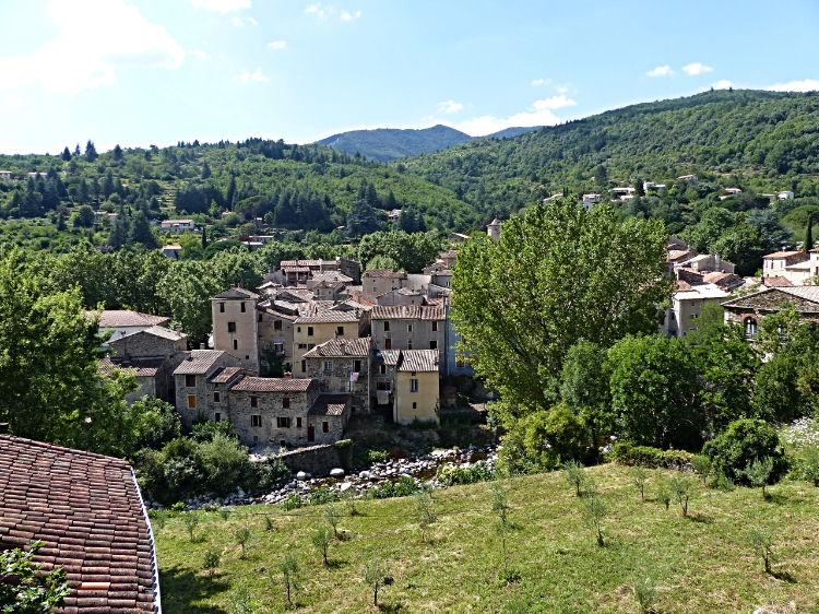
We continue down a stony staircase-like section, cuts across broom and scattered boulders before arriving in Pratcoustals. Some paved sections follow, with great views before we catch our first sight of Aulas, a charming medieval village on the River Coudoulous.
Day Eight:
Start: Avèze (or Le Vigan)
Finish: Navacelles
Distance: 13 miles (21 km)
Climbing: 540 metres
Time: 6.5 hours
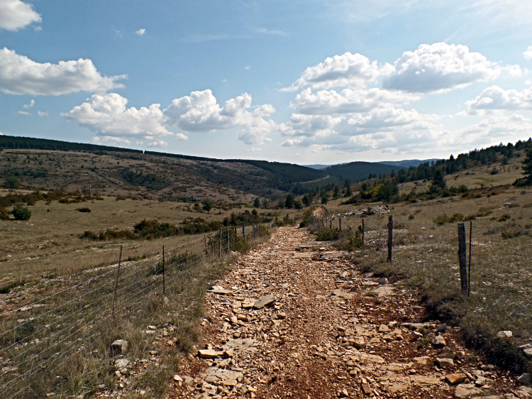
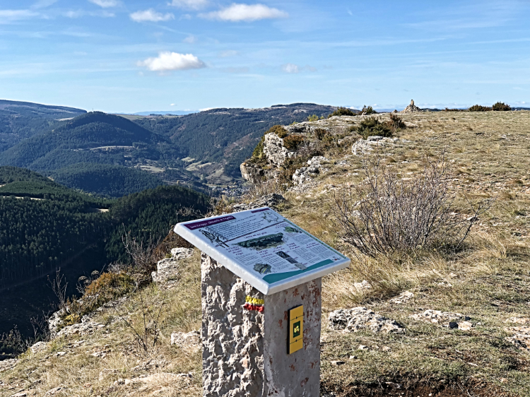
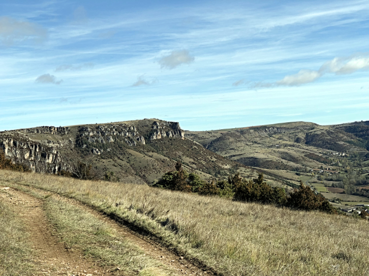
Today we continue along the GR7 and walking sticks are highly recommended for both the climb up to the Causses de Blandas and the descent to Navacelles. This is the most varied and challenging day of the tour, so do make sure you get an early start.
The short descent to Vigan will take about 30 minutes. Cut through the old-town, follow the course of the River Arre riverside before crossing the stone bridge (vieux pont) and walking up into Aveze village (247 ms alt.)
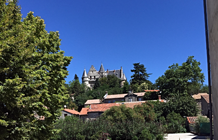
Continue south along its Grand Rue, cross the stream and commence the 400-metre climb out of the valley and up to the Causse. Pace yourself! Montdardier has a café/restaurant and a grocery store - the last chance to buy provisions until St Guilhem. A nice picnic area/fountain with view of Montdardier castle (private) is adjacent.
From Montdardier we stride out direction Blandas, across its eponymous Causse. After 5 kilometres we reach the site of a dolmen and you can visit a Cromlech after a detour of 500 ms.
We exit Blandas village eastwards until the Croix Antoine Fabre, from where we follow an old drovers’ trail south to ‘La Maison du Grande Site de Navacelles.’ This is a tourist centre, but on the positive side you can get refreshments inside.
The trail leading off from near La Maison is not easy to follow/badly waymarked, very steep and potentially dangerous. Our safety-first policy means we follow the D713 for 1.4 kms before taking a sharp-left southwards and descending a manageable trail that gets easier as you descend – but walking canes are advisable. Finally, we cross the river Vis via the humpback bridge and enter the surreal village of Navacelles.
Day Nine:
Start: Navacelles
Finish: Les Natges
Distance: 11 miles (17.5 km)
Climbing: 600 metres
Time: 6 hours
The tour culminates in two days spent crossing the trail’s fourth department – that of L’Herault.
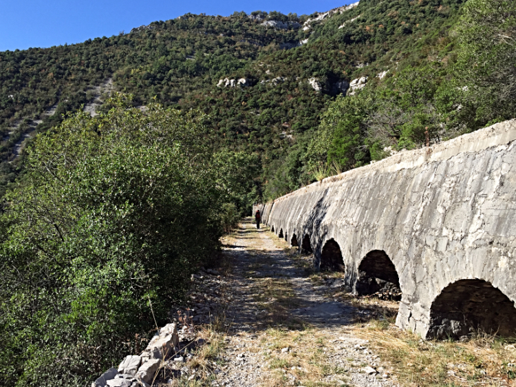
We commence by following the course of the Vis eastwards through and out of Navacelles. Then climb the steep and winding trail out of the gorge with superb views. After descending a rock staircase at Les Roudets, we follow the course of an impressive irrigation canal hewn out of the rock to the right-side of the trail.
A further climb of 250 metres takes us up a stony and twisting trail up to the Causse plateau.Then follow a rock staircase up right en route to a favourite spot for the enigmatic Griffon Vulture, following its recent re-introduction in the Causses.
The central square of St Maurice boasts a private chateau, fountain and church. This makes for the perfect lunch spot with a potable water pump by the castle gate. We bid au revoir to the GR7 here and follow its cousin, the GR74, to Les Natges via Le Rancas. In between, we walk a fine ridge with views of the Vis gorge, the Causse de Blandas and the Aiguoal massif.
Day Ten:
Start: Les Natges
Finish: St Guilhem Le Désert
Distance: 10 miles (16 km)
Climbing: 60 metres
Time: 5 hours
Today we follow the GR74 all the way to the Grande Finalé of St Guilhem le Desert itself. It is mainly downhill apart from the first section.
After a 20-minute walk, we reach the tree line and arrive at a clearing with a large stack of rocks in the centre. This is La Cirque de la Seranne (665 ms alt.) The view is impressive and the two small peaks (escarpments) on the distant horizon are the Pic Saint Loup and Roc Hortus, emblematic high points north of Montpellier in an area (over)rated for its red wines.
After just over one kilometre, we arrive at a stone pillar in memory of French Freedom Fighters (Maquis) killed by the Germans in WW2 followed by a nearby menhir and Lavogne (natural water hole). We walk a fine stony ledge trail that descends to a man-made ‘lavogne’ and the ‘Menhir Christ’. Time for lunch. We climb up into the Foret Domaniale de St Guilhem to the Cap de Ginestet belvedere with views of the massif de Guilhem and the Herault gorge.
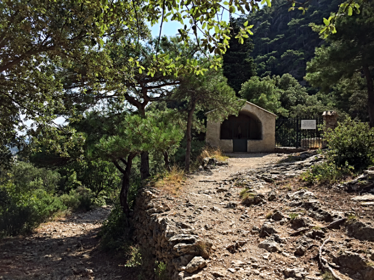
From this high point we commence our final descent to St Guilhem over Dolomite rock and through Salzmann pines along a fine ledge, with splendid views southwards. En route we pass the hermitage of Notre Dame de Belle Grace / The Our-Lady-of-Pleasant-Place - a private and inhabited place of prayer and meditation, just an hour’s walk from the village of Saint-Guilhem-le-Désert,
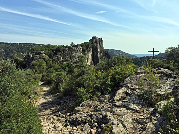
We continue our final descent on a paved trail, pass an iron cross and arrive at a col with views off right to the Cirque de Infernet and the Roc de Bissonne. The ruins of Chateau de Verdu crown the peak ahead and we enjoy your first sight of St Guilhem in all of its medieval glory below. The final approach is via a paved and concrete access trail, through an impressive archway and down to road level.
Congratulations on walking the Saint Guilhem Way and welcome to St Guilhem le Desert!
For full tour details, please visit Walking the Saint Guilhem Way:
Walking Holidays France/ Saint Guilhem Way


