Heidschnuckenweg
The Heidschnuckenweg is a renowned long-distance hiking trail, often voted one of Germany's most beautiful, that runs for roughly 208 km through the Lüneburg Heath (Lüneburger Heide) from Hamburg-Fischbek to the historic town of Celle.
Google Maps Open Source Maps| Statistics and Files | ||
|---|---|---|
| Start: Hamburg-Fischbek | Latitude: 53.473546 | Longitude: 9.850257 |
| Distance: 129 miles (208 km) | Climbing: 3,987 metres | Walk Time: 8-12 Days |
| GPX Route File | Google Earth File | About the Walk |
| Statistics | |
|---|---|
| Start: Hamburg-Fischbek | Distance: 129 miles (208 km) |
| Latitude: 53.473546 | Longitude: 9.850257 |
| Climbing: 3,987 metres | Walk Time: 8-12 Days |
| GPX Route File | Google Earth File |
Suggested Map:
Summary:
The Heidschnuckenweg is a premier long-distance hiking trail in Northern Germany that traverses the unique landscapes of the Lüneburg Heath. Voted Germany's most beautiful hiking trail in 2014, it connects Hamburg-Fischbek in the north to the residence city of Celle in the south.
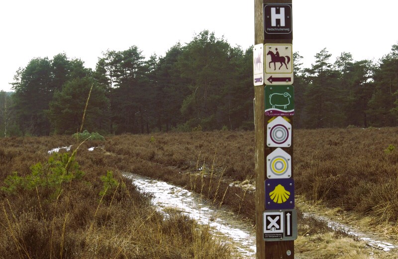
Typically the walk is completed in 12 daily stages, though fast hikers may finish in 7–10 days. It is not a Difficult walk, being generally rated as easy to moderate due to low altitudes and sandy, mostly flat terrain. The highest point is Wilseder Berg at 169 metres, offering panoramic views of the heath. Signage throughout is very good, with markings having a white "H" on a purple background or a St. Andrew's cross.
The trail is open year-round, but specific seasons offer distinct experiences. Heather Blossom (Early August – Mid-September): The most popular time when the landscape turns a vibrant lilac. Note that this period attracts the largest crowds. Spring and Early Autumn (May – July; late September – October): Ideal for avoiding crowds while still enjoying pleasant weather and blooming wildflowers.
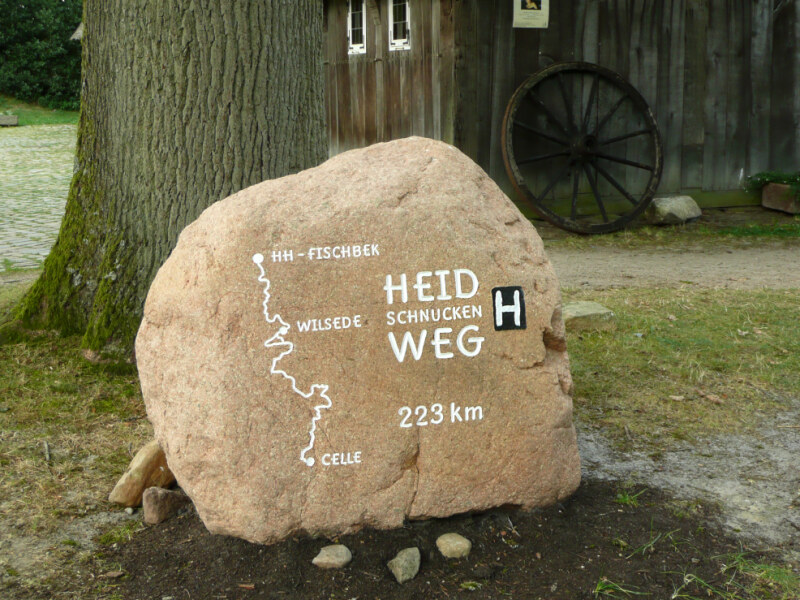 Waymark stone in front of the Emhoff in Wilsede
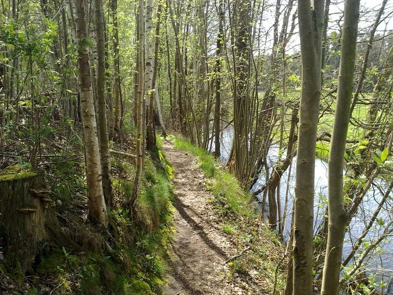 Heidschnuckenweg along the Örtze river near Poitzen
 In the Südheide Nature Park
 Celle Castle
Typically the walk is completed in 12 daily stages, though fast hikers may finish in 7–10 days. It is not a Difficult walk, being generally rated as easy to moderate due to low altitudes and sandy, mostly flat terrain. The highest point is Wilseder Berg at 169 metres, offering panoramic views of the heath. Signage throughout is very good, with markings having a white "H" on a purple background or a St. Andrew's cross.
The trail is open year-round, but specific seasons offer distinct experiences. Heather Blossom (Early August – Mid-September): The most popular time when the landscape turns a vibrant lilac. Note that this period attracts the largest crowds. Spring and Early Autumn (May – July; late September – October): Ideal for avoiding crowds while still enjoying pleasant weather and blooming wildflowers.
Waymark stone in front of the Emhoff in WilsedeHeidschnuckenweg along the Örtze river near PoitzenIn the Südheide Nature ParkCelle CastlePictures, courtesy of Wikipedia
Useful Links:
Germany travel
Hiking Experience
Feedback and Suggestions: To suggest a link for inclusion on a this page please complete the Walking Englishman Feedback Form. Thank you.


