Coronallacs Trail - Ruta Coronallacs
The Coronallacs Trail is a demanding 57 mile (92 kilometres) circular hut to hut hiking route in the Pyrenees mountains of Andorra.
Google Maps Open Source Maps| Statistics and Files | ||
|---|---|---|
| Start: Les Escaldes | Latitude: 42.509065 | Longitude: 1.542101 |
| Distance: 57 miles (92 km) | Climbing: 6,000 metres | Walk Time: 5 Days |
| GPX Route File | Google Earth File | About the Walk |
| Statistics | |
|---|---|
| Start: Les Escaldes | Distance: 57 miles (92 km) |
| Latitude: 42.509065 | Longitude: 1.542101 |
| Climbing: 6,000 metres | Walk Time: 5 Days |
| GPX Route File | Google Earth File |
Suggested Map:
Summary:
The Coronallacs Trail is a demanding, 92-kilometer (approx. 57-mile) circular hiking route in the Pyrenees mountains of Andorra. Designed to be completed in 5 days, it connects the country's four main manned refuges (Illa, Juclar, Sorteny, and Comapedrosa) and is known for its high-mountain scenery, including over 20 lakes and a traverse through the UNESCO-listed Madriu-Perafita-Claror Valley.
Key Details:
• Location: Andorra (starting and ending in Les Escaldes-Engordany)
• Length: Approximately 92–94 km (57–58 miles)
• Duration: 5 days
• Elevation Gain: Over 6,000 meters (approx. 20,000 ft)
• Difficulty: High/Strenuous
• Best Time to Hike: June to the end of September
• Direction: Typically walked in an anti-clockwise direction
Stages of the Route:
The trek is broken down into five distinct, challenging stages:
1. Les Escaldes to Refugi de l'Illa: Starts with a long ascent through the Madriu-Perafita-Claror Valley.
2. Refugi de l'Illa to Refugi de Juclà: Passes by the Pessons lakes and high mountain passes.
3. Refugi de Juclà to Refugi de Sorteny: Covers rocky terrain in the northern part of the country.
4. Refugi de Sorteny to Refugi del Comapedrosa: A challenging stage passing through the Comapedrosa Natural Park.
5. Refugi del Comapedrosa to Les Escaldes: Ends with a descent back to the capital region.
Important Tips for Hikers:
• Accommodation: The four manned refuges must be booked in advance. These offer half-board options (dinner and breakfast).
• Gear: Sturdy, well-broken-in hiking boots are essential due to rocky, steep terrain. Trekking poles are highly recommended.
• Navigation: While generally well-marked with small blue signs, the trail can be tricky, so bringing a GPS-enabled app or physical map (e.g., Editorial Alpina 1:40,000) is advised.
• Logistics: The Tourist Office in Escaldes-Engordany provides a "passport" that can be stamped at each refuge to earn a certificate and a souvenir buff upon completion.
• Weather: Conditions can change quickly, with potential for cold rain or, outside of summer, snow.
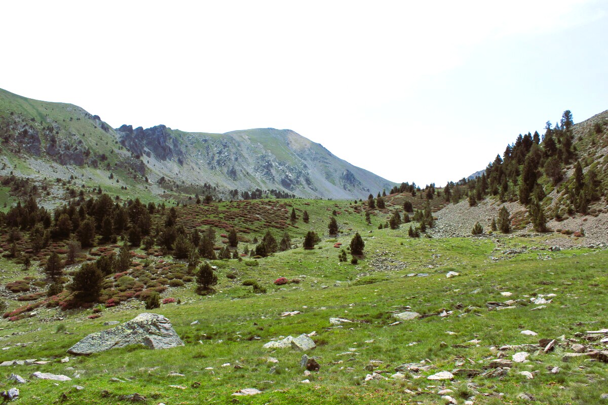 Vall del Madriu-Perafita-Claror
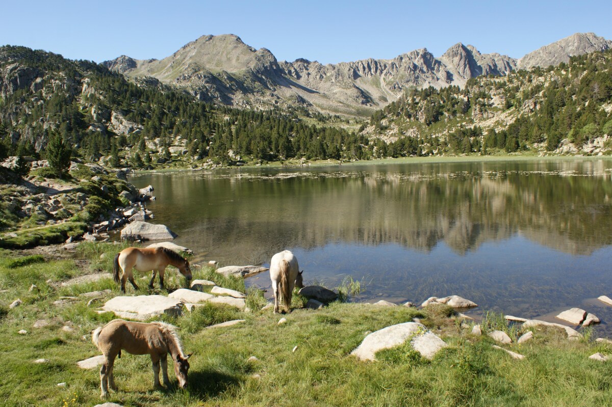 Circ dels Pessons
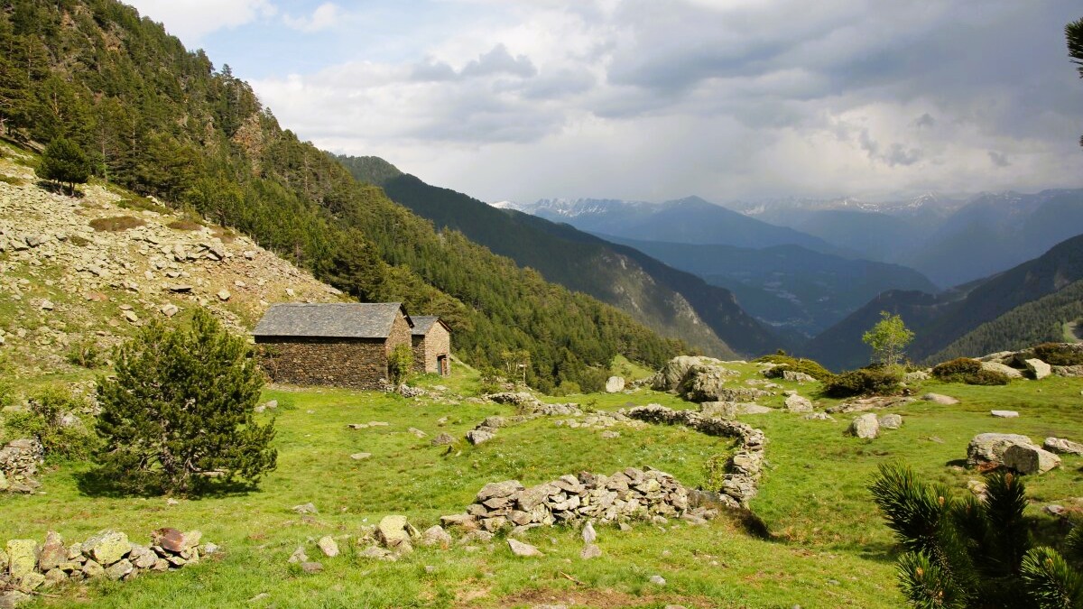 Valls del Comapedrosa (la Massana)
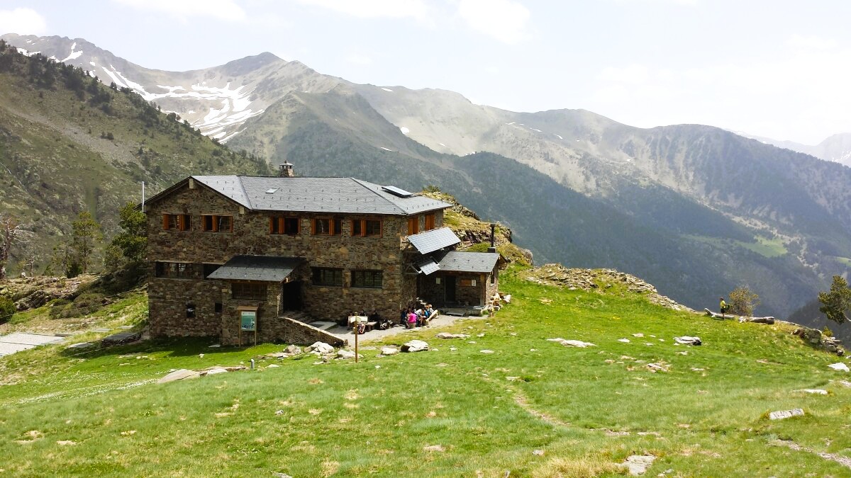 Refugi del Comapedrosa
Key Details:
• Location: Andorra (starting and ending in Les Escaldes-Engordany)
• Length: Approximately 92–94 km (57–58 miles)
• Duration: 5 days
• Elevation Gain: Over 6,000 meters (approx. 20,000 ft)
• Difficulty: High/Strenuous
• Best Time to Hike: June to the end of September
• Direction: Typically walked in an anti-clockwise direction
Stages of the Route:
The trek is broken down into five distinct, challenging stages:
1. Les Escaldes to Refugi de l'Illa: Starts with a long ascent through the Madriu-Perafita-Claror Valley.
2. Refugi de l'Illa to Refugi de Juclà: Passes by the Pessons lakes and high mountain passes.
3. Refugi de Juclà to Refugi de Sorteny: Covers rocky terrain in the northern part of the country.
4. Refugi de Sorteny to Refugi del Comapedrosa: A challenging stage passing through the Comapedrosa Natural Park.
5. Refugi del Comapedrosa to Les Escaldes: Ends with a descent back to the capital region.
Important Tips for Hikers:
• Accommodation: The four manned refuges must be booked in advance. These offer half-board options (dinner and breakfast).
• Gear: Sturdy, well-broken-in hiking boots are essential due to rocky, steep terrain. Trekking poles are highly recommended.
• Navigation: While generally well-marked with small blue signs, the trail can be tricky, so bringing a GPS-enabled app or physical map (e.g., Editorial Alpina 1:40,000) is advised.
• Logistics: The Tourist Office in Escaldes-Engordany provides a "passport" that can be stamped at each refuge to earn a certificate and a souvenir buff upon completion.
• Weather: Conditions can change quickly, with potential for cold rain or, outside of summer, snow.
Vall del Madriu-Perafita-ClarorCirc dels PessonsValls del Comapedrosa (la Massana)Refugi del ComapedrosaPictures, courtesy of Wikipedia
Useful Links:
Visit Andorra
Hiking Trails
Feedback and Suggestions: To suggest a link for inclusion on a this page please complete the Walking Englishman Feedback Form. Thank you.


