Hareden, Totridge, Bleadale Water and Langden Brook
A challenging walk in the Forest of Bowland. Starting near Langden Water Works the walk follows the brook to Hareden Farm before climbing to the high fells which summits on Totridge. Then the walk continues over high fell to the source of Bleadale Water which is followed down the valley of Bleadale to meet Langden Brook which is then followed downstream back to the start.
Google Maps Open Source Maps| Statistics and Files | ||
|---|---|---|
| Start: Langden Water Work | Distance: 8.0 miles (12.9 km) | Climbing: 460 metres |
| Grid Ref: SD632511 | Time: 3-4 hours | Rating: Moderate |
| GPX Route File | Google Earth File | Forest of Bowland |
| Statistics | |
|---|---|
| Start: Langden Water Work | Distance: 8.0 miles (12.9 km) |
| Grid Ref: SD632511 | Time: 3-4 hours |
| Climbing: 460 metres | Rating: Moderate |
| GPX Route File | Google Earth File |
Ordnance Survey Explorer Map (1:25,000)
The Walk: I headed over the border from Yorkshire to Lancashire anticipating a walk in which I would avoid the crowds. For reflective walking in solitude I knew where I was going and after reading a contentious posting on Facebook's 'I love the Lake District' page about the tarmacing of fell bound paths I wished for solace from the argument. This walk would give me the solace I craved and I knew there would be no urbanisation of the paths on these chosen fells. I would be at one with the practically unblemished wild land of the Forest of Bowland. I arrived at Langden in a good mood.
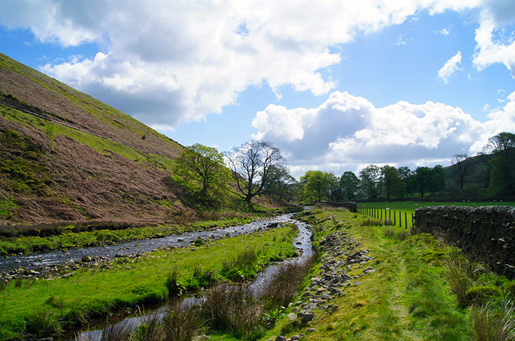 Langden Brook
 Hareden Farm
I was no entirely alone. A few cars were already parked in the generous parking area beside the access road to Langden Water Works. The drivers and passengers were not to be seen though, they had already set off on their short walks, most with dogs, on the good paths to the waterworks and beyond into Langden Dale. All on their pet exercise/ morning constitutional walks for once I was in the distance and walking in the opposite direction I was to see no one until a mile from my return. The moors were to be to myself. I stated by following Langden Brook downstream in a south east direction until I reached the access road to Hareden Farm. I bounded along with Joie De Vivre and with bird song accompaniment as both I and the birds enjoyed the delights of the morning sunshine. I continued on with a wide grin as I left the brook side and turned at a right angle to head south west down the farm road. I continued on, still with bird song accompaniment and walked through the grounds of Hareden Farm, preparing myself for the climb.
 Climbing to Mellor Knoll
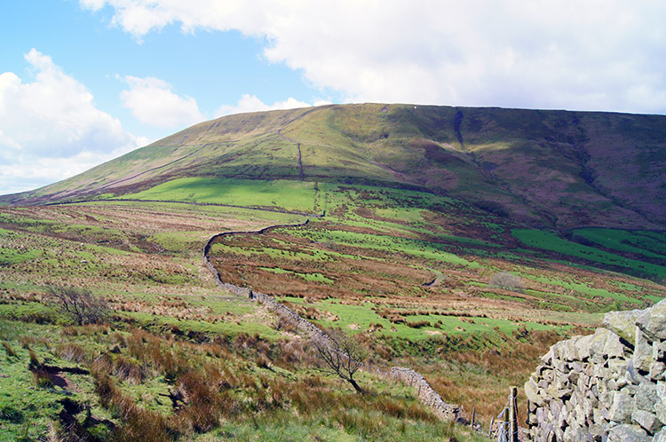 The way up to Totridge
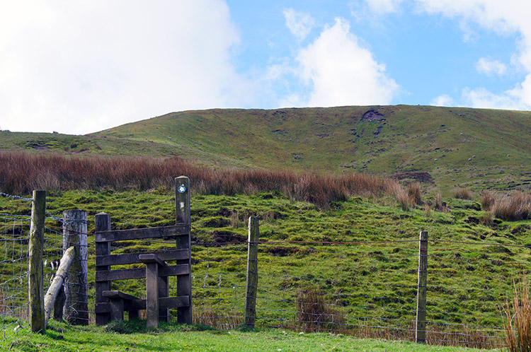
As I climbed I lost one sensory delight but as I did so another replaced it. The springtime bird song I had enjoyed in the valley bottom disappeared as I gained height and left the trees behind. The vocal chorus quietened as I did so on the climb to open fell but what was lost from the ears was gained by the eyes as the views of the hills ahead of me drew me forward. I could not climb quick enough as I made my way upland in a south east direction from Hareden Farm towards the rounded summit of Mellor Knoll. I reached a point about 20 metres from the top of the knoll but did not climb it. My way forward was now in a south west direction directly towards the summit of Totridge. After leaving the environs of Mellor Knoll it was initially downhill though to cross Lane Foot Brook. Once over the brook the serious ascent to Totridge began.
 Totridge
 Looking back to the Forest of Bowland
The walking on the path from Lane Foot Brook to Totridge had to be carefully negotiated. I sidestepped on a number of occasions and rounded areas of tussocky grass on others; all to avoid squelching in the boggy ground. A raised bank showed itself at times which allowed me to walk a true path. It often disappeared where bog predominated. Never was it difficult to make my way up to the higher reaches of Totridge though, it was just a little meandering. Compensations for the constant navigation across the uncertain ground were the views being unveiled to the north and east including a delightful glimpse of a model sized Pen-y-ghent in the far distance. Clouds breezing across the sky from west to east enhanced the view.
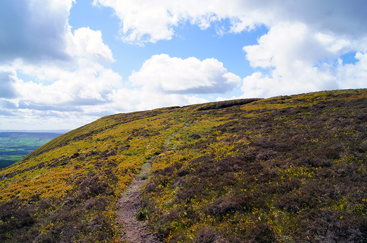 Nearing the summit of Totridge
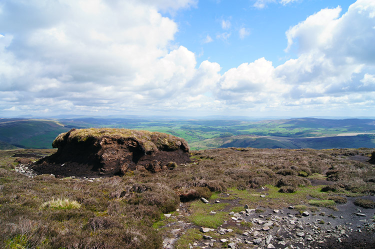 Isolated Peat Hag on Totridge
After the wet patches on the lower stretches of the climb to Totridge's heights the final 200 metres of climbing was surprisingly dry. But then it was a steep section of climbing and any water reaching the surface would run off very quickly. It did not appear though, staying under the surface to give the upper reaches of the south east face of Totridge a very dry feel. The newly growing heather on the upper slopes were a light brown hue, a nice contrast to the various shades of green of the grasses in the lower fells and pastures I had travelled across since Hareden Farm. I levelled off from my climb.
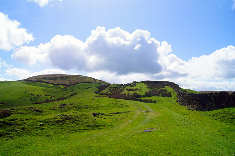
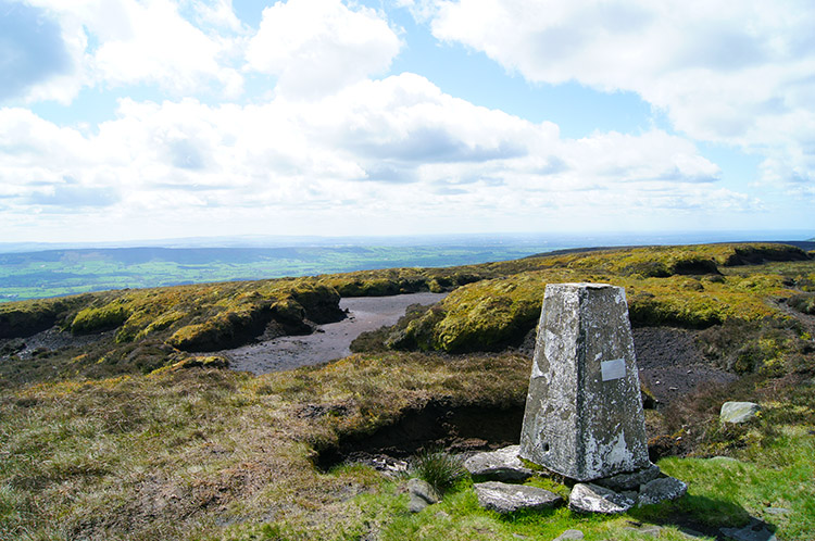 Totridge summit Trig Point at 496 metres
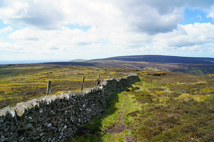 The upland path across the fell
It was a delightful moment to reach the summit plateau of Totridge. No tarmac paths up here, just delightful unaltered natural surroundings. The moment was so tranquil too as I stood and looked around. The quiet was only pierced by the lovely piping calls from Meadow Pipits flying low around the peat hags and hollows. I stood silently enjoying the beauty of it all. Bliss indeed. Eventually I had to move on and I made my way towards the summit. On finding the trig point I saw it was precariously positioned on the edge of a collapsing peat bank. Someone, perhaps a few, has packed stones into the growing hollow under the trig point but the temporary repairs will not arrest a collapse. If no extensive repairs are done the trig point will fall - perhaps in the true nature of things here it should be allowed to. It is redundant for its original purposes now.
Then again perhaps the trig point should be saved. There are many walking enthusiasts who visit the trig points of Great Britain. To some it is a lifelong obsession to bag them all. And this trig point had one more accolade to it. It was important enough to friends of Bill Smith who have attached a commemorative plaque to the trig point. It says Bill Smith, 1936-2011 Fell Running Legend, Died on the Fell. He was the author of Stud Marks on the Summit who died near here on the Bowland Fells in October 2011. Sadly his body was lost on the fells for three weeks before being found.
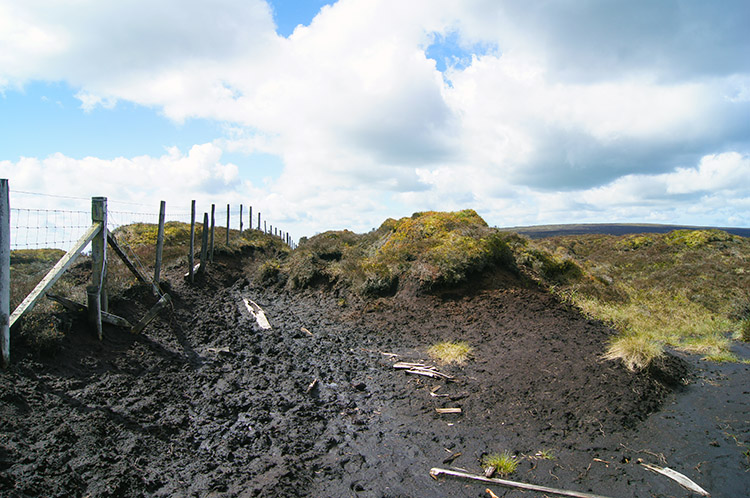 The going gets boggier
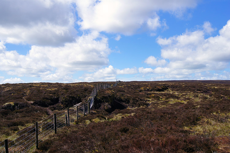 Hareden Fell
After leaving the deteriorating site of the trig point I headed south west across the open fells. The path to follow was clear at most times but often disappeared from view in the increasingly common morasses of sunken peat and brackish standing water. I never found the going too difficult though and as it had been below Totridge I simply had to meander and walk around the impassible places. Sometimes I appeared to be walking around in circles of 50 metres circumference to make what would be a straight line walk of three of four metres - just too much to leap across. When I could leap across a water filled divide to avoid the detours I did. When I could not I went further. To be honest it was fun; the wildlife around, mostly piping Meadow Pipits must have been giggling at my antics. I was at myself. It was two miles of fun walking in no straight line at all but near to the path from Totridge summit via Whitmore Fell, Fair Oak Fell and Hareden Fell to Beasley's Steady.
 Near the source of Bleadale Water
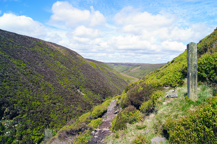 Bleadale Head
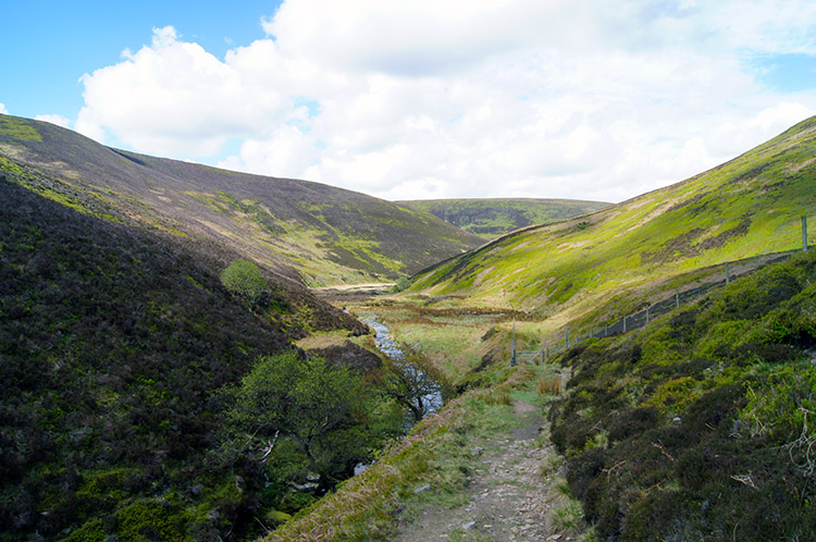
Beasley's Steady marked the point at which I descended from the plateau of the high fell into the beginning of Bleadale. At first the path was not obvious. I fact I could not find one but I could see Bleadale so I knew where to head. I crossed open moor from Beasley's Steady on a slight descent which increased in angle as I began to hear the trickle of evolving water courses. I headed due north bisecting Bleadale Well and Bleadale Grains, all capturing water draining off the fell into Bleadale Water. The flat open fell collapsed into the valley which was becoming Bleadale. I followed the collapse down and soon met the path heading down the valley. Now, after a little concentrated navigation and treading over moor and side-stepping down falling banks I could relax on the true path and enjoy following the full length of the valley shaped by Bleadale Water.
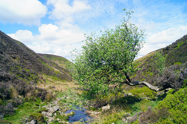 Tree blocking the path in Bleadale
 Tree rooted to higher ground in the valley
I had not seen another person for hours, since leaving the Langden valley at Hareden Farm. It was just me and the local wildlife enjoying the peaceful tranquility of Bleadale. And how it was enchanting to be with nature and having it all to myself. Bleadale was gorgeous and I really did have an uplifting experience following the valley down towards Langden. Single hardy hawthorns spread their spring green leaves over the valley adding more perfect contrast. And they did not conform by standing erect, instead they leaned into the valley, wanting to be at one with it. I stopped halfway down the valley and took lunch. Bird song came once more to serenade me over my break. Perfect.
 Continuing my delightful walk through Bleadale
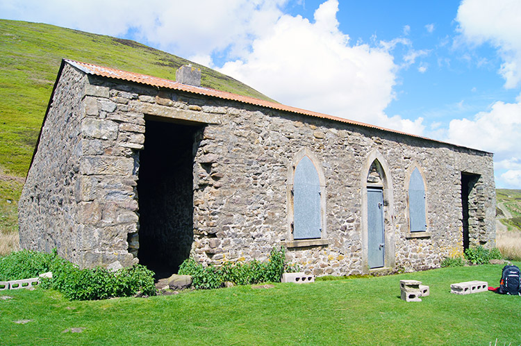 Langden Castle
After my twenty minute break which could and should have been much longer I walked on towards the bottom of Bleadale. The sun was shining, it was perfect for snoozing in the tranquil valley shielded by perfectly sized and shaped hills and I could have lingered longer; the end came all too soon. But before I continue let me say Bleadale has left me with a will to return one day; it has forced me to do that by the sheer draw of its natural beauty and perfect form. On leaving my new friend I entered Langden and headed towards a building which showed on the map as Langden Castle (ruin). As I drew closer I saw it to be a stock shelter, a refuge for sheep from the fells on extreme weather days. I could not find anything out about a castle but it is said that in the past the stock building was used to secure prisoners en route to Lancaster Castle. Fiction?
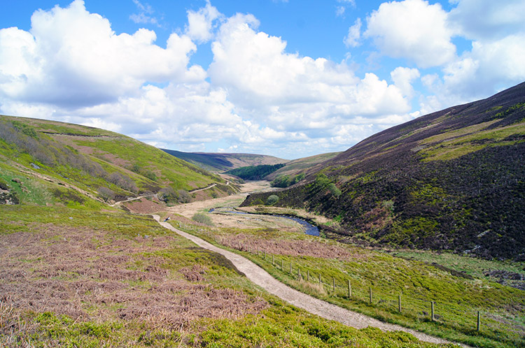 Langden Dale
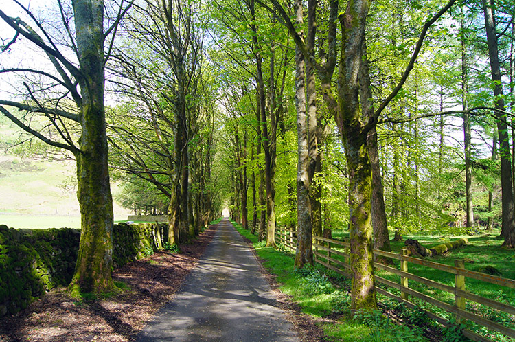 Tree lined avenue to Langden Water Works
I took a second short break at Langden Castle and then made my way on the good track provided above Langden Brook. Only now did I encounter people again and quite a few actually who had parked up at Langden Water Works and who were enjoying a stroll on a lovely sunny spring afternoon. I met a couple of ladies, a mother and daughter. he mother had lived near here as a child and then moved to Devon when she married. This area held a lifetime affection in her heart though and she was sharing it with her daughter. We chatted a while about the merits of both Lancashire and Devon. We are lucky to live in such a diverse land with different natural environments. On chatting we appreciated that. I bade them a good farewell and for them to continue to enjoy their day. I approached another group of walkers who left the path before I reached them. They headed into wetland nearer the brook, being led by a chap with Binoculars. Probably a Nature Reserve Warder showing the local wildlife to visitors.
The acquaintances and observations took me on my way along the path parallel to Langden Brook and before long I was at the water works. Signs highlighted the status of the area as a special place for wildlife and a leaflet headlined itself 'Treading Carefully - helping ground nesting birds'. It is so good now that we care. Not too long ago the Forest of Bowland was barred to walkers by landowners who managed birds for shooting. Now most of us prefer shooting birds with cameras rather than with guns. Hoorah. I walked on along the road past the water works and finally along a lovely tree lined avenue back to my car. I reflected on a superb walk and wow would I do it again. Everything about this walk is so memorable - I love it.


