County Tops of England: Bedfordshire
Dunstable Downs: 243 metres (Grid Ref: TL008194)
Google Maps Open Source Maps| Route Statistics and Files | ||
|---|---|---|
| Start: Robertson Corner | Grid Ref: TL008198 | Distance: 0.5 miles (0.8 km) |
| Climbing: 16 metres | Time: 1 hour | Rating: Easy |
| GPX Route File | Google Earth File | Map: 181 Chiltern Hills North, Aylesbury, Berkhamstead and Chesham |
| Statistics | |
|---|---|
| Start: Robertson Corner | Grid Ref: TL008198 |
| Distance: 0.5 miles (0.8 km) | Time: 1 hour |
| Climbing: 16 metres | Rating: Easy |
| GPX Route File | Google Earth File |
| Map: 181 Chiltern Hills North, Aylesbury, Berkhamstead and Chesham |
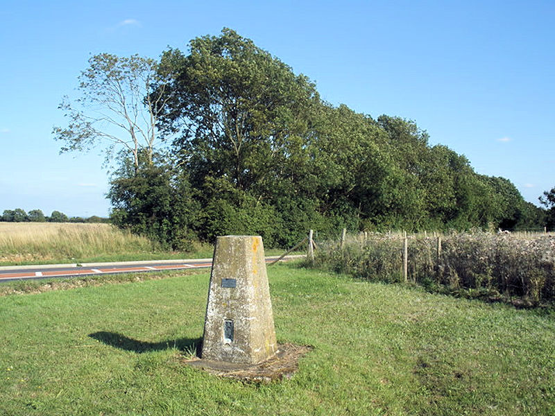
The Walk: Simply walk south along the side of the B4541 from the car park at Robertson Corner for 400 metres to the trig point. Touch it if you like to make the connection and walk back to the car. (Note: There is also a car park near the trig point so you could make the walk even shorter).
The Walk I Would Do: I would probably design a short walk of just over two miles starting out from Beecroft. I would head south to Robertson Corner by following the Icknield Way and after continuing to the trig pillar I would cross the the west edge of Dunstable Downs before heading back along the Chiltern Way. Map and files for this option are available on request.
Information: Dunstable Downs are part of the Chiltern Hills, in southern Bedfordshire in England. They are a chalk escarpment forming the north-eastern reaches of the Chilterns. At 243 m, Dunstable Downs are the highest point of the county of Bedfordshire. Because of its elevation, Dunstable Downs hosted a station in the shutter telegraph chain which connected the Admiralty in London to its naval ships in the port of Great Yarmouth during the years 1808 to 1814. Whipsnade Zoo has cut an enormous lion shape into the chalk into the side of one of the hills. The lion can be seen from the B489 (Aylesbury to Dunstable road). The downs are used by gliders, kite fliers, hang gliders and paragliders in the area because of their height. The London Gliding Club is based at the foot of the downs. Much of the downs are managed by the National Trust as part of the Dunstable Downs, Countryside Centre and Whipsnade Estate property. (Source: Wikipedia)


