County Tops of England: Westmorland
Helvellyn: 950 metres (Grid Ref: NY341151)
Google Maps Open Source Maps| Route Statistics and Files | ||
|---|---|---|
| Start: Glenridding | Grid Ref: NY385170 | Distance: 7.5 miles (12.0 km) |
| Climbing: 958 metres | Time: 4-5 hours | Rating: Technical |
| GPX Route File | Google Earth File | Map: OL5 The English Lakes – North Eastern Area |
| Statistics | |
|---|---|
| Start: Glenridding | Grid Ref: NY385170 |
| Distance: 7.5 miles (12.0 km) | Time: 4-5 hours |
| Climbing: 958 metres | Rating: Technical |
| GPX Route File | Google Earth File |
| Map: OL5 The English Lakes – North Eastern Area |
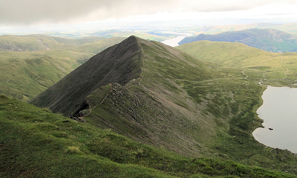
The Walk: This is one of the best walks to a county top in all of England. The walk from Glenridding to reach Helvellyn which includes the thrill of crossing Striding Edge on the way there and Swirral Edge on the way back makes for a superb day out in the mountains of the Lake District. For the complete story on doing this walk read my full report.
The Walk I Would Do: This one, without a doubt. It is a classic route and my favourite circular to Helvellyn. I have an alternative route which avoids the scramble of Striding Edge and Swirral Edge. Click here to view it.
Information: Westmorland is an area of North West England and one of the 39 historic counties of England. It formed an administrative county from 1889 to 1974, after which the whole county was administered by the new administrative county of Cumbria. In 2013, Secretary of State for Communities and Local Government Eric Pickles formally recognised and acknowledged the continued existence of England's 39 historic counties, including Westmorland. (Source: Wikipedia)


