The Wrekin and the Ercall
This walk is probably the most well known in all of Shropshire and possibly the most popular walk for miles around or part of it at least. The Wrekin is a very famous hill and affectionately loved by the local population as well as travellers from further afield, particularly the Birmingham area. When Steve and I visited on a midweek day in September 2012 the car parking lay-bys were already short of spaces and when we finished the pay car park was also quite full which testified to the Wrekin's popularity. The hill is one of fable but more about that on the walk.
Google Maps Open Source Maps| Statistics and Files | ||
|---|---|---|
| Start: Lawrence's Hill Car Park | Distance: 8.6 miles (13.8 km) | Climbing: 632 metres |
| Grid Ref: SJ637094 | Time: 3-5 hours | Rating: Hard |
| GPX Route File | Google Earth File | About the Wrekin |
| Statistics | |
|---|---|
| Start: Lawrence's Hill Car Park | Distance: 8.6 miles (13.8 km) |
| Grid Ref: SJ637094 | Time: 3-5 hours |
| Climbing: 632 metres | Rating: Hard |
| GPX Route File | Google Earth File |
Ordnance Survey Explorer Map (1:25,000)
The Walk:
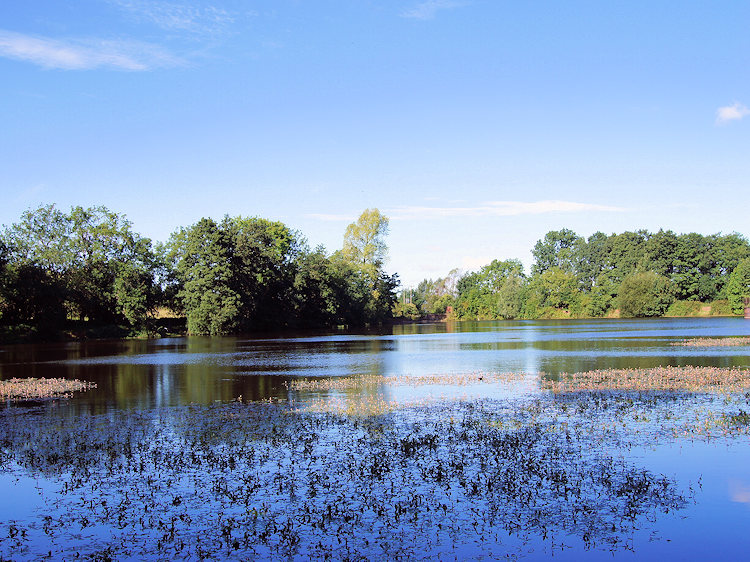 Reservoir near Lawrence's Hill
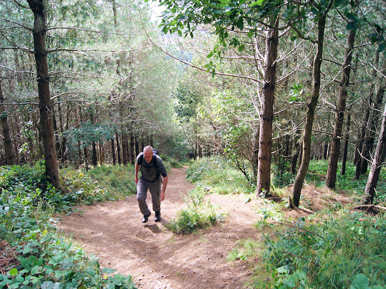
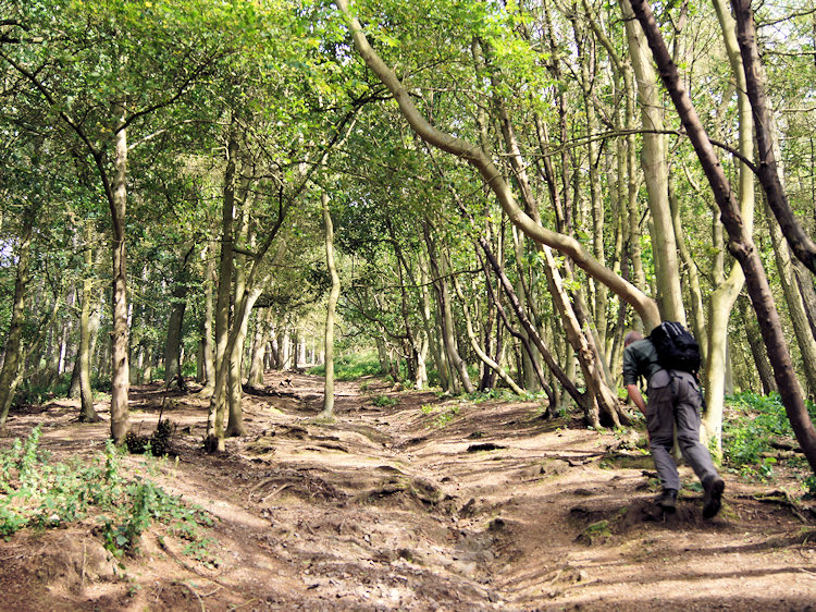
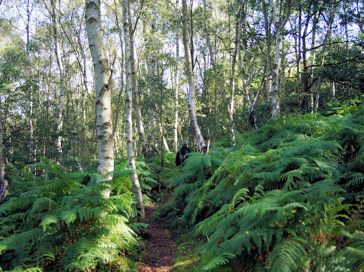 Climbing through woodland on the Ercall
There are some views that capture the imagination, views that entrap the mind's eye. One such view caught me when I was visiting the Ironbridge area in the mid 1990's. I was travelling from Ironbridge where I was staying and touring the local countryside. I don't recall which direction I was going but what I do recall is my eyes being drawn to a hill appearing above the flat countryside I was travelling through. As I drove closer I could not take my eyes of it and I just had to get closer. Eventually I reached a car park and walked briskly up the hill to take in the brilliant view before immediately walking down again. I had discovered the Wrekin, climbed it and that moment will stay with me forever. Sometime later on my next visit to Ironbridge with my future wife Lil I took the brisk walk straight up and straight down again, this time to show her the view. Next time I had the chance I resolved to pay the Wrekin and the surrounding area the compliment of a proper walk. It took me over 10 years to fulfill my promised obligation but in 2012 I finally got the chance to do it.
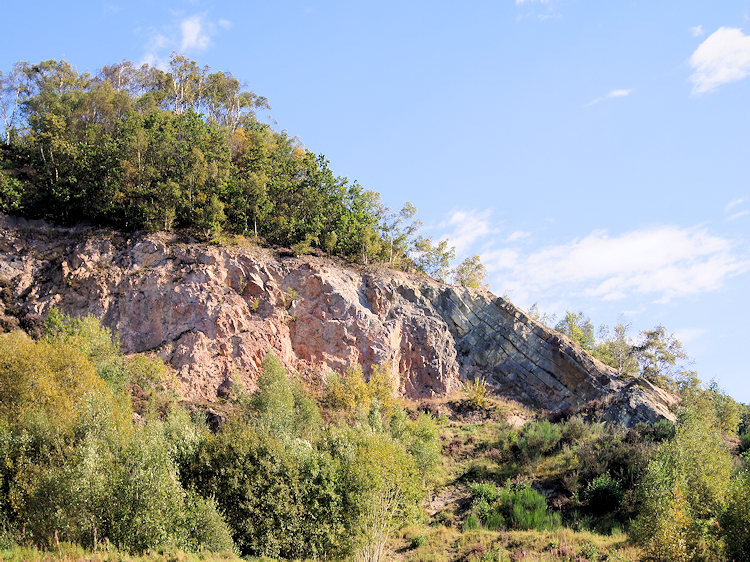 Ercall Quarry and geology fault line
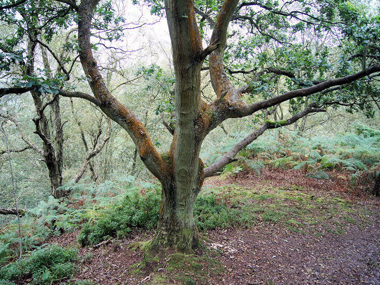
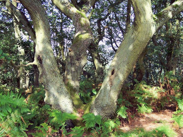 Ancient Oak in Ercall Wood
I had stayed the night before in Rugby with Steve and the following night we were booked in accommodation in Wolverhampton for a music concert. How fitting we thought to make the day the complete package by doing a walk and so Steve gave me the opportunity to plan one we would both enjoy in an area neither of us were familiar with; except for one hill that is. The circumstances made it possible for me to finally realise that overdue promise I had made to myself in the previous century! In the days leading up to our golden day I scanned over the map of the Wrekin and the surrounding countryside and I discovered a countryside rich in history with areas of ancient woodland and in their midst a huge scar caused by progress and the result of quarrying to build the nearby A5. Despite the quarrying care has been conducted by the Shropshire Wildlife Trust to return it to nature. Thus it was not difficult to plan a fulsome walk that would take around four hours, just the time we had.
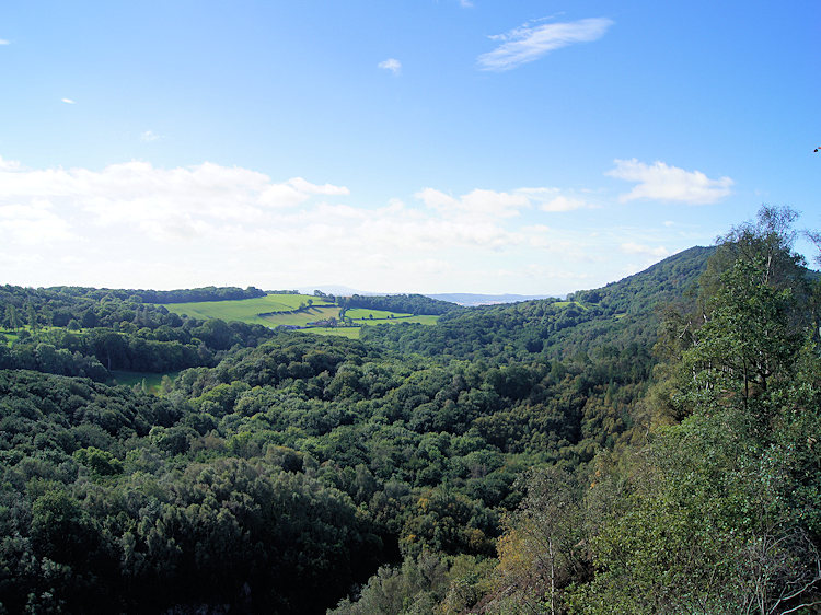 The view from above the Ercall Quarry
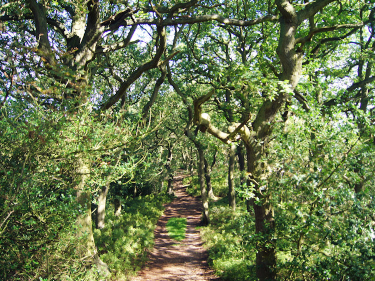 Glorious path through Ercall Wood
We drove over from Rugby to Wellington and picked up provisions in a local shop before driving to the vicinity of Buckatree Farm where we found a parking space in a generous lay-by. As mentioned in the summary there were a number of cars already parked up in the area and more arriving all the time. Most of the vehicles occupants were heading up the nearby track to the Wrekin, the same track I had used on my two brief visits to the Wrekin previously. This time I went in the opposite northerly direction along a road and soon Steve and I passed a Severn Trent Water reservoir which I looked over before leaving the road and climbing through Birch woodland to the north of Lawrence's Hill and toward the Ercall.
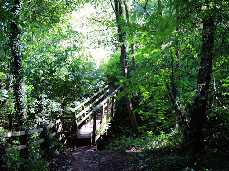 Footbridge indicating the way from Ercall Wood
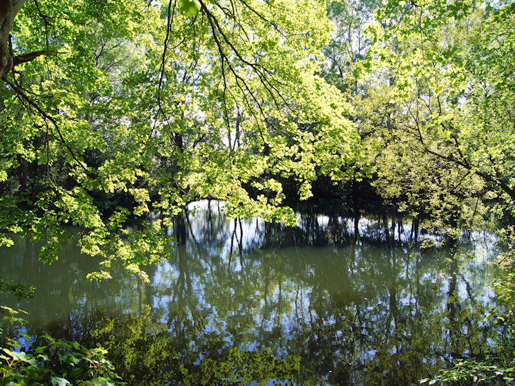 Pond at the beginning of Limekiln Wood
The following piece exactly describes my experience over the next mile of walking through the Ercall "Little sister to the famous Wrekin, The Ercall has its own grandeur. Ancient oak woodland, spectacular views and more than 500 million years of history can be enjoyed here. Human activity is dramatically evident in the huge chunk blasted out of the hillside to provide road stone for the nearby A5. This was certainly destructive, but it had the unexpectedly wonderful effect of laying bare the earth's history; revealing rocks from the earliest beginnings of life on this planet. Ripples in the surface where waves lapped on an ancient shoreline some 500 million years ago are distinctly visible. Amazingly, this part of Britain used to be 60 degrees south of the equator - stand here on a wet, wintry day and imagine that" Source: Shropshire Wildlife Trust.
Especially striking is the clear fault line between Ercall Granophyre and Wrekin Quartzite, the Ercall stone being of volcanic origin like its larger neighbour the Wrekin. The Wrekin stone is sedimentary and one once lying on the bed of a tropical sea. It always amazes me to imagine it so.
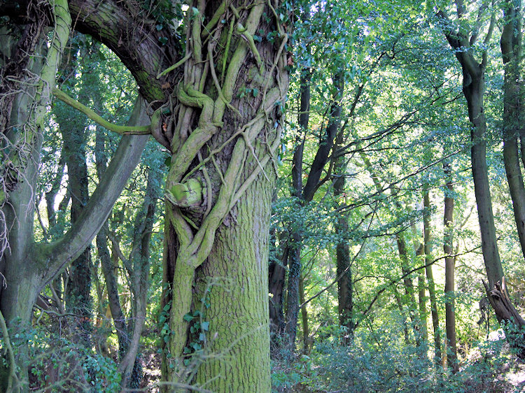
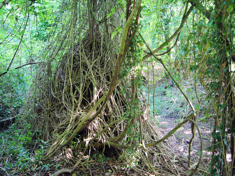 Tree being strangled by invasive Ivy
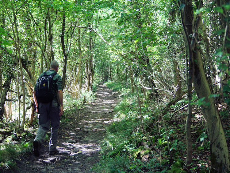 Steve makes his way through Limekiln Wood
Drawing my mind away from the imagination of such ancient times I continued my spectacular walk. The Ercall woodland was particularly awesome with a rich proliferation of ancient native Oak. Steve mused how it might be possible to tell the difference between different oaks and he got the chance soon later when we stopped and he referred to my book of trees. He discovered there were many types and telling them apart was not as easy as it should be. The leaves don't help much, closer inspection is required and we had a walk to enjoy. Eventually and to my sadness we came to the end of the Ercall and left Ercall Wood by a footbridge which led us along a small copse and past a tree surrounded pond, probably man made to the entrance of Limekiln Wood.
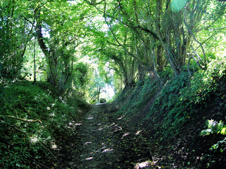 Holloway
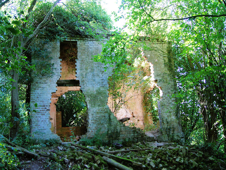 Derelict building near Black Hayes
The wood was spectacularly beautiful but somewhat different to Ercall Wood. There were no Oak trees in Limekiln Wood but I read that it contains over 150 different woodland plants including, Lily of the Valley, Dog’s Mercury and Bird’s Nest Orchid and that the abandoned mine workings in the area have also been used as roosting sites by Daubentons, Pipistrelle and Long–Eared Bats. I saw plenty of woodland plants but not any bats though Steve and I did come across a derelict building which may be a roost for them. I did not inspect too closely.
 Entwining
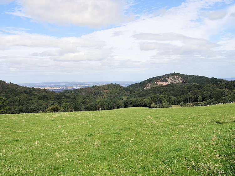 The view back to Ercall Hill from near Maddock's Hill
The woodland continued to amaze me as I walked through and ivy was very prolific, sometimes enshrouding trees completely. The battle between host and invader must have been going on here for centuries not just in human terms and in the animal world but in the trees, shrubs and plants too. Ivy certainly knows how to take advantage here, I had never seen so much. After what seemed a good time we eventually left woodland and crossed open fields on the north-east side of Wenlocks Wood which we were heading into. The brief respite of close tree attention allowed us to look back at the Ercall and the huge scar of the quarry within. Trees and other foliage will one day close it out of view again. Before we entered Wenlocks Wood we also got a good view of the south-east aspect of the Wrekin. The sides of the hill are, as with the Ercall, completely wooded and from our viewpoint the climb we knew was to come did not look intimidating at all. What Steve and I were looking at was a very old hill with a remarkable history as is explained in the following paragraph.
"The Wrekin is home to amongst the oldest rocks in the county of Shropshire (677 million years old). The Wrekin itself, despite having a cone-like appearance, is not actually a volcano, but is made up of thick layers of lava erupted from volcanoes. Geologists think that Shropshire must have been very much like Japan around this time: a volcanic island, sitting in an ocean, near a larger continent" Source: Shrophire Geology
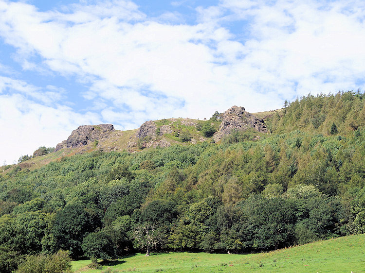 Lava outcrops on the Wrekin
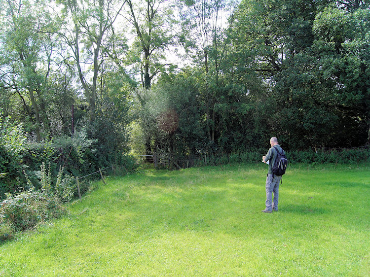 Making sure we enter Gibbons Coppice
While walking toward Wenlocks Wood Steve and I felt an eeriness around us, as if we were in the midst of strangers. Apparently there are often strange goings on here, most recently a crop circle appearance where we were walking. The wood is also mentioned in Alfred Edward Housman's famous Shropshire Lad poem. No wonder it seemed strange as Steve and I walked through Wenlocks Wood; I put it down to the lovely late summer sunshine casting chasing shadows on the ground all around us. Despite all its history and odd goings on we left Wenlocks Wood hale and hearty. who wouldn't on such a glorious walk and after checking the map after passing Wrekin Farm we proceeded into yet another area of woodland, this being a short tramp through Gibbons Coppice which led us to the Little Wenlock to Longwood and Rushton Road.
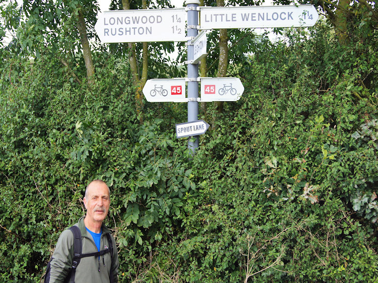 Road sign at Bank Farm on Spout Lane
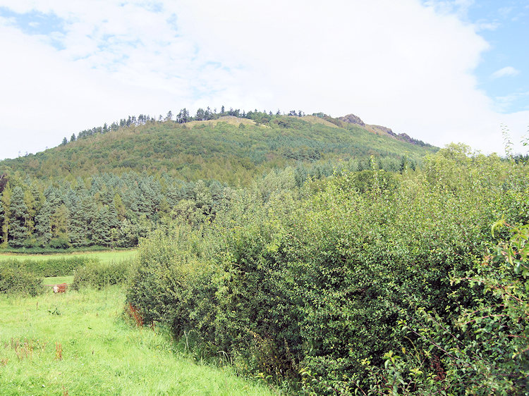 Last open view of the climb of the Wrekin ahead of us
The walk along the road lasted for one mile and in the twenty sun kissed minutes it took us to walk the road we were passed by one tractor and one car. We could tell they were heading our way in plenty of time, the only noise around being the drone of small aircraft flying from a nearby airfield and of wildlife in the countryside around us. What was astonishing was that we had not seen one other walker so far, since leaving the host of people walking up the Wrekin from where we parked the car. Soon that had to change as we neared the end of the road section and turned right to begin our climb of the Wrekin.
 The climb of the Wrekin was steep from the start
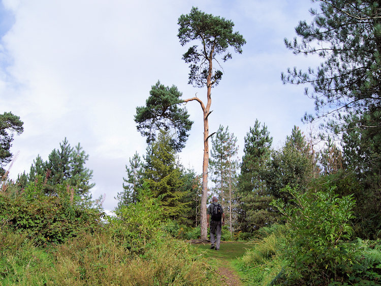 First glint of light on the crest of Little Hill
We left the road by following the first marked track heading north after Little Hill Farm and up the Wrekin in a northeast direction. Almost immediately we were in dense foliage for the umpteenth time on the walk but as ever the tracks were good and easy to follow. Soon the climb got progressively steeper and after tacking over left to the main track and up the spine of the hill the climbing got even steeper. Steve and I hauled ourselves up the hill in good time though, not bad for a pair with a combined age approaching 120! Without any real breaks to catch breath we were on top of Little Hill. Only the bigger hill to go.
 The steepest part of the walk
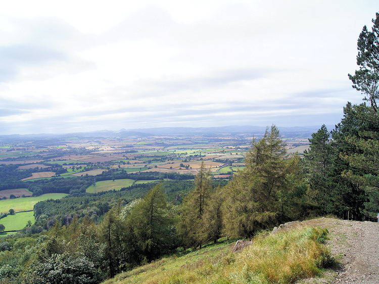 Into daylight near Needle's Eye
After resting for a moment on the open crest of Little Hill we descended down the track for a short while and in doing so losing 30 metres of height we had just worked hard for "Its these down sections that bug me" I said and added "sometimes I wish they would bridge the hollows" I did not really mean it but it can be frustrating especially as when we began to climb again it was of the steepest part of the whole walk. On this section we finally met other walkers too. The first three were a group of ladies who were sat resting as one had fallen on the steep descent. We passed others scuttling down the hill with care as we hauled ourselves up. Some mentioned how tough a climb and descent it was as we passed and exchanged pleasantries. One thing is for sure, this side of the Wrekin is steep indeed and not one to consider in wet conditions unless you are completely assured and competent. I suggest many unwary walkers have fallen and hurt themselves between Little Hill and Needle's Eye. For us and for our fellow walkers on the Wrekin this day at least it was dry and the best of conditions underfoot.
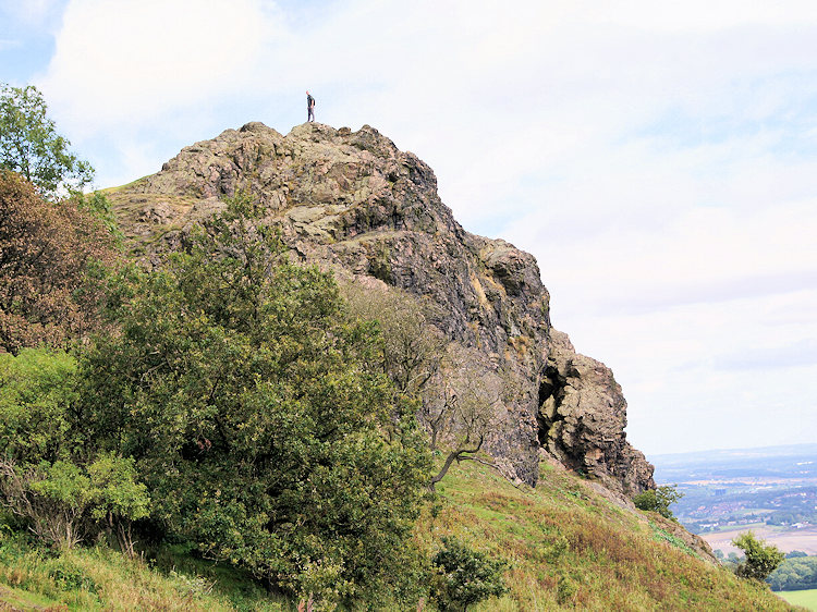 Needle's Eye
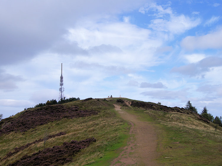 Approaching the summit of the Wrekin
Soon Steve and I had climbed to Needle's Eye, a magnificent rocky cleft jutting out from the south east profile of the Wrekin. It is a magnificent sight and face like when approached from southwest. Folklore has it that Needle's Eye was cut by an axe thrown by one of two giants who were fighting over the Wrekin. It is said that a maiden passing through the Eye must give her man a kiss on emerging at the other side. Otherwise she will pay the penalty of never marrying. Alas we never saw any maidens while at Needle's Eye. What we did see beyond Needle's Eye was the summit of the Wrekin. We were now out of the tree line and on the approach to an open rounded hilltop with the most striking views.
 The view north from the summit of the Wrekin
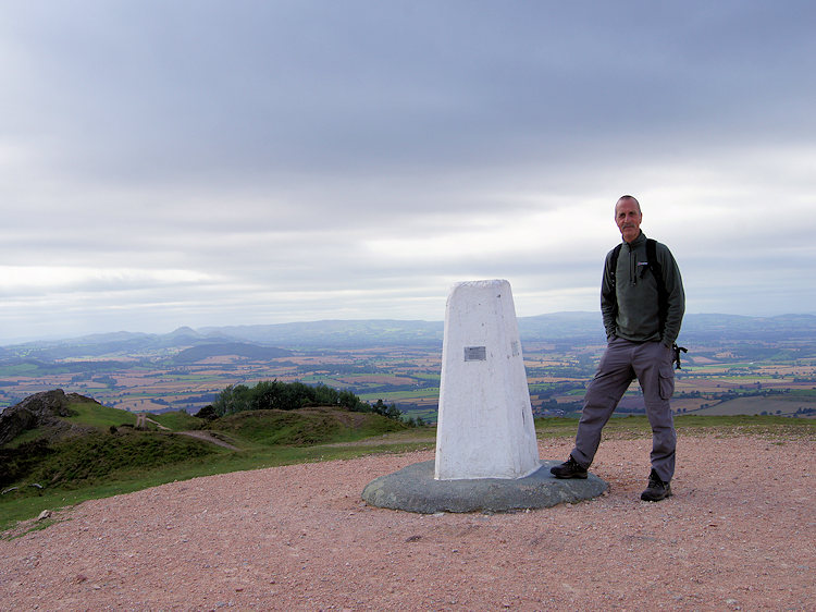 A moment of achievement
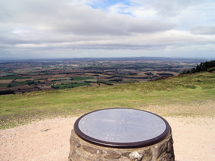
The Wrekin is indeed a marvellous viewpoint, I know of few better and on a clear day there are the most spectacular views of middle England and Wales to be had. As has been written there are few mountains in Britain, let alone hills, that have exerted the same powerful influence or sense of place on its surrounding communities. Perhaps Glastonbury Tor, towering over the willow-dotted Somerset Levels, is the nearest parallel. From a Guardian newspaper feature they quote: "You feel like you are on the roof of the Midlands, and the 360-degree view from the summit of the Wrekin, complete with circular toposcope, is breathtaking, said to take in no less than 17 counties. In clear conditions, you should be able to make out the blue outline of the Malvern Hills 40 miles to the south; the neighbouring Shropshire summits of the Clee Hills, wooded Wenlock Edge and the long whaleback of the Long Mynd, fronted by the shark's tooth of Caer Caradoc to the south west; and the misty shapes of the Berwyns, the first hills of Wales, filling the western horizon 30 miles away. Nearer at hand, due south, are the smoking cooling towers and chimney at Buildwas, which stand at the entrance to the Severn Gorge; Coalbrookdale and Iron Bridge, birthplaces of the Industrial Revolution, are just downstream" I couldn't put it better myself, it is a perfect description of the views Steve and I were enjoying. Naturally we took a break here to look out and soak it all in. Then with the usual reluctance we left the hilltop.
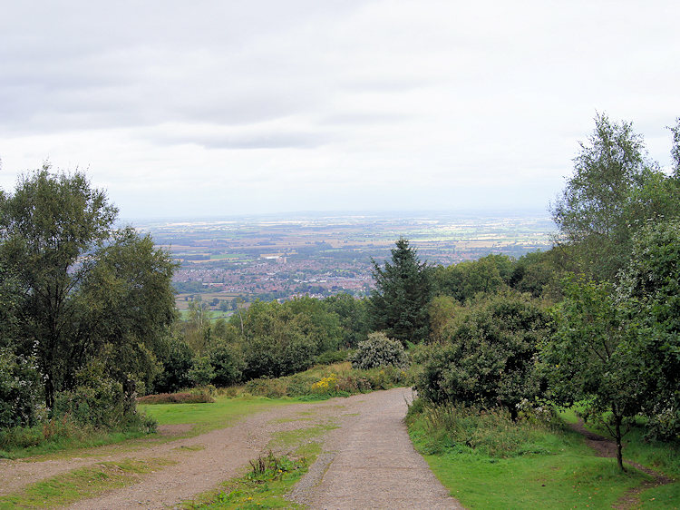 Telford can be seen on the descent from the Wrekin
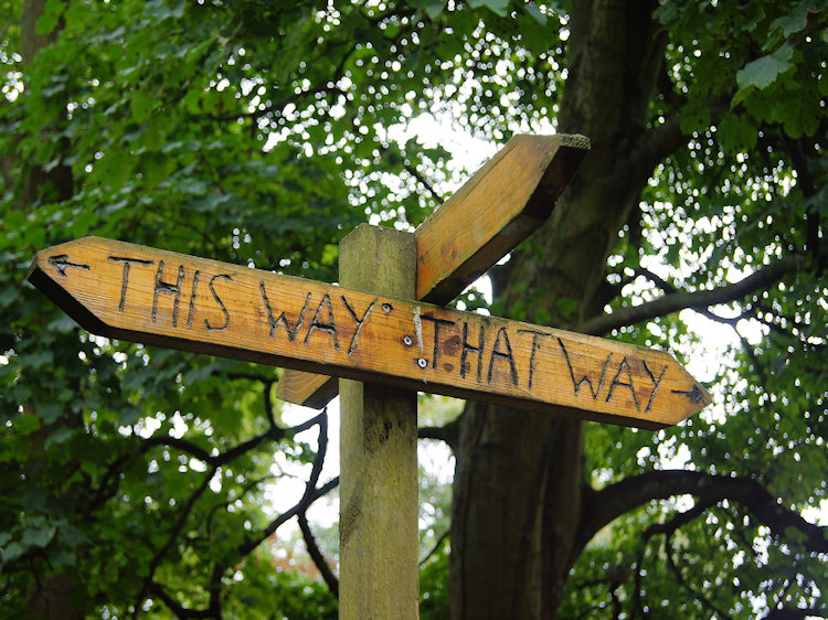 Perfectly clear instructions!
The walk down was familiar to me, this was the short haul route I had taken on my two previous all too brief walks up the Wrekin, Only now did I know what I had missed out on, a walk of immense character with an hidden side and rock outcrops of stupendous character missed twice but found - very much third time lucky. On the descent we struck out from the obvious central track down to meander somewhat on equally good but narrower trails. Oak trees of superb character, many gnarled and intricately shaped trunks marked our way down the hill. It was steep as the ascent was from the other side of the Wrekin but our zigzag route made it less so. Soon we came to a sign which clearly pointed our way home. It was 'that way'.
 More ancient oak woodland on the final descent
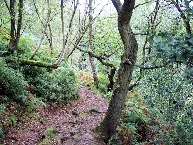 Nearing the end of a perfect walk
Soon we were down to the bottom of the hill. On the final mile and a half of descent we passed lots of people, many of them families or courting couples taking the popular route. Good for them to make the time to climb up and take in the views although I am sure many of them would venture further to explore more of the hill if only they new of the spectacular places all around. For Steve and I this was a superb walk and for me a personal ambition fulfilled. I can say without doubt that the Wrekin is my favourite Shropshire Hill and perhaps the favourite for miles and miles around. It is a hill of immense character as is neighbouring Ercall Hill which itself should be explored at length. Together they are a superb pair of ancient hills and with all that is to enjoy both in natural history and in our ancient past this is a walk I thoroughly recommend.


