Allexton, Blaston, Medbourne and Hallaton
With an evening meeting to attending on the eastern fringe of Leicester why waste the day when there's good walking country close by. I parked close to the Leicester Peterborough road at Belton in Rutland but crossing the busy A47 and the Eye Brooke I was soon into Leicestershire starting the walk at the tiny settlement of Allexton.
(Note: This walk is kindly contributed by Ken Brockway)
Google Maps
Open Source Maps
| Statistics and Files | ||
|---|---|---|
| Start: Allexton | Distance: 13.6 miles (21.9 km) | Climbing: 435 metres |
| Grid Ref: SK819005 | Time: 5-6 hours | Rating: Hard |
| GPX Route File | Google Earth File | About Allexton |
| Statistics | |
|---|---|
| Start: Allexton | Distance: 13.6 miles (21.9 km) |
| Grid Ref: SK819005 | Time: 5-6 hours |
| Climbing: 435 metres | Rating: Hard |
| GPX Route File | Google Earth File |
Ordnance Survey Explorer Map (1:25,000)
The Walk: Taking a field road almost due south marked on the map only by red or green dots, depending on the map in your hand it was a pleasure to find most of the route well defined on the ground or open fields of pasture grazed by sheep. At Knob Hill Farm I was a little apprehensive about the reaction from varied poultry penned in the yard through which the 'road' passed.
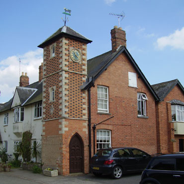 Blaston clock tower
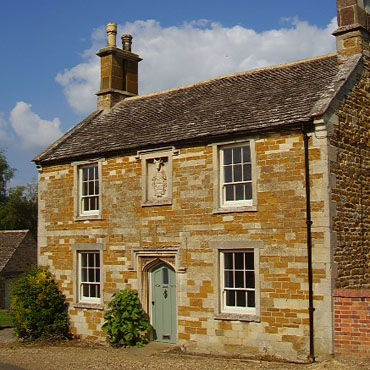 Cottage at Nevill Holt
From Burn Hill there were good views across the Eye Brooke valley towards Rutland's second largest settlement, Uppingham. At Blaston Hollows I made the all to obvious error when on a well defined farm track, of staying with it. So I missed the Definitive line across the field of Oil Seed Rape, but then there was little incentive to follow a path that had not been cleared through this crop.
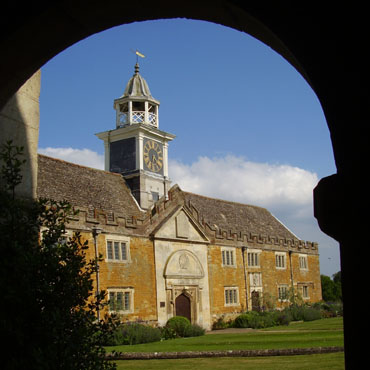 Nevill Holt stable block from the church porch
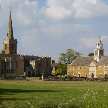 Nevill Holt Hall, church and stables
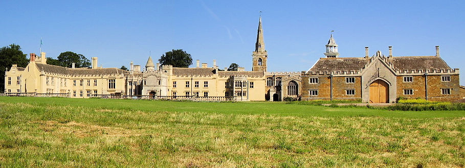
Blaston is a memorable little village for it's clock tower standing in front of rather plain houses. It was perhaps provided because the diminutive church is towerless. Another field road then a bridleway provides the route to Nevill Holt one of my favourite hidden gems. There are so many little treasures to be discovered only by those on foot and this is one of them. The village church is cheek by jowl with the hall and the footpath to the church door offers good views over the grounds while Definitive path B65a provides the best view of hall, church and stable. The hall is Grade I and was owned by the Cunard family until 1912, then became a private school but has now been restored to glory by the co-founder of Carphone Warehouse.
 Nevill Holt Hall, Church and Stables
The tree lined avenue is a quite public road which also serves as the Hall drive with impressive gates now permanently open, but I strayed into the adjacent cricket field to avoid the occasional car. This area of Leicestershire is blessed with very pretty villages and easily challenges the more popular 'Honeypot' destinations. A well kept secret so the locals say. While the Nevill Arms offers the usual services including beds I opted for a pint from the village shop. It was so good on this warm June day that I had a second. It must be those third pint bottles we had at school that makes me choose milk on occasions such as this.
I took the road out of Medbourne, a shame it is not possible to walk the parallel Roman Road to the south, part of the Gartree Road which connected Colchester to Chester and passed through Leicester. At the bridge of the old railway line I stopped to admire the huge garden pond created on the former track bed below me, before turning north onto the Macmillan Way and more field roads taking me to Hallaton.
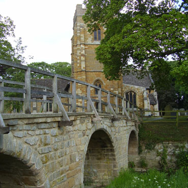 Medbourne pack horse bridge and church
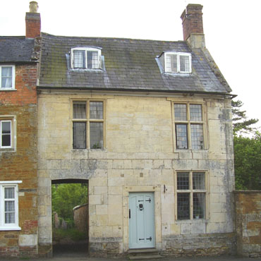 Hallaton with footpath
I recall my first visit to Hallaton, to meet as it happens a Footpath Officer from Leicestershire County Council. I was struck by a footpath from the village street that had a house built over it. Unlike today's disregard of these minor highways, here we have evidence of past due regard for those on foot. Hallaton home of the Hare Pie Scramble and Bottle-Kicking, an event to challenge Ashbourne's Royal Shrovetide Football match. On this quieter day the village has much to offer before pressing on for the final leg of the walk.
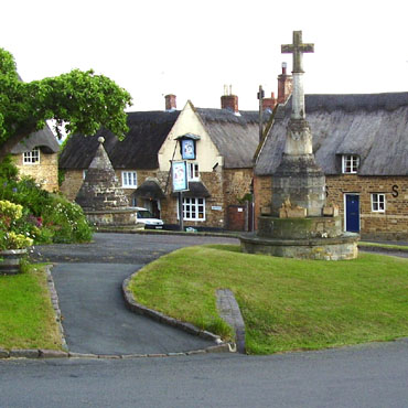 Hallaton village green and Bewicke Arms
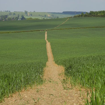 Footpath to Allexton
From Hallaton we join the Leicestershire Round, a circular walk of one hundred miles around Leicestershire and part of Rutland as the walk was created when Rutland had been dragged screaming into the neighbour's boundary. The walk was devised and initially promoted by members of the Leicestershire Footpath Association to celebrate the organisation's centenary in 1987. Leicestershire was one of the first authorities to really make an effort to improve the rights of way network. Along the way walkers are guided by tall yellow topped posts, good stiles and a firm approach is taken to ensure compliance with the 1990 Rights of Way Act which requires farmers to keep paths clear of crops and make them apparent on the ground. This is nowhere more apparent than on the return to Allexton.
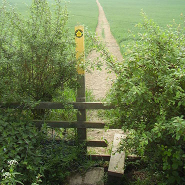 Leicestershire marker post & stile
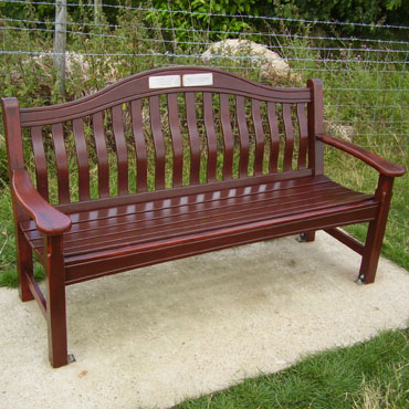 Seat near Fearn Farm on Leicestershire Round
On the way we can pause to soak up the view south into the Welland valley from a seat near Fearn Farm, it has two plaques which read. "Arthur Hopson 1922-2006, In Loving Memory, From His Family" and "Leicestershire Footpath Association - Pause here and remember friends". And that is just what I did.


