Repton, Foremark and Milton
A walk in south Derbyshire countryside from the history filled village of Repton to Foremark Hall, former home of the Burdett family of Bramcote and now the site of Repton public school and then rambling south and north over countryside to Milton before returning to Repton.
(Note: This walk is kindly contributed by Ken Brockway)
Google Maps
Open Source Maps
| Statistics and Files | ||
|---|---|---|
| Start: Repton | Distance: 7.9 miles (12.7 km) | Climbing: 128 metres |
| Grid Ref: SK304270 | Time: 3 hours | Rating: Moderate |
| GPX Route File | Google Earth File | About Repton |
| Statistics | |
|---|---|
| Start: Repton | Distance: 7.9 miles (12.7 km) |
| Grid Ref: SK304270 | Time: 3 hours |
| Climbing: 128 metres | Rating: Moderate |
| GPX Route File | Google Earth File |
Ordnance Survey Explorer Map (1:25,000)
The Walk: We start this walk of 8 miles in the south Derbyshire village of Repton which has two claims to fame. The settlement established in the sixth century was to become the capital of the Saxon kingdom of Mercia. Also, for the past 450 years, it has been home of the famous public school, which bears its name. With some 600 pupils drawn from around the world Repton School occupies many fine buildings in the village. Take time at the start or end of your walk to seek out buildings from the 8th century to recent times that warrant Repton's designation as a Conservation Area.
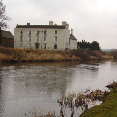 The Hall at Twyford
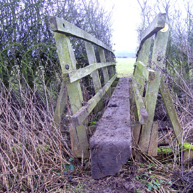 Footbridge
The ramble starts with some easy walking across the washlands of the mighty River Trent, its banks once lined with many coal fired power stations. Leaving the village centre down Brook End it appears that The Boot Inn has ceased trading, one down three surviving. An interesting slate plaque tells me about an arch under which water once flowed before the said arch was moved to its present position. Why do I need to know this? I was also set to wonder about the "ordinary traffic of the district" as a 38 ton articulated lorry passed over the parish bridge. Leaving the houses behind the track initially follows the Old Trent Water which was navigable until the 19th century. We then turn right and head for the spire of Twyford church but there's no opportunity to explore this hamlet unless a ferry has been introduced.
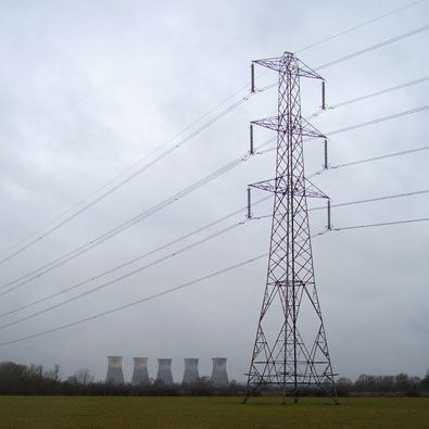 Willington power station
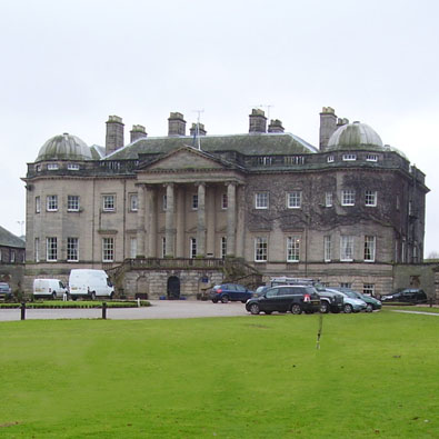 Foremarke Hall
The footpath across to Windmill Hill was less well used and I nearly strayed on a couple of occasions as our path heads towards Foremark church, but save that for later. On the outward journey turn along the service road, a rutted unsurfaced track, into the grounds of Foremarke Hall (without the 'e' on the O.S. map). This is Repton's Prep school which moved post WW2 to this impressive Georgian mansion built in the Palladian style in 1760 for the parliamentary reformer, Sir Francis Burdett. We need to be confident of our ground along this path with no waymarking and signs that suggest we are not wanted. It's surprising really that the path still passes through the grounds. The view of the hall and the lake opposite came as a pleasant surprise, which I have now spoiled for you, sorry, but the grounds are crowded with less attractive annexes.
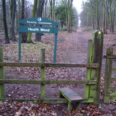 Heath Wood, a Forestry Commission site
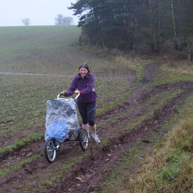 Jogger on a mission
From the few houses that must be Foremark village a former tree lined ride gently climbs towards, then passes through, Heath Wood but before we enter note the block of tall conifers in the field on your right and signs making clear access is not permitted. The map shows this area as a Danish Barrow Cemetery and is the only known Scandinavian cremation cemetery in England. Later I ponders the significance of a stone standing alongside the path. I should have studied the map as I stood there because it's marked as Hanging Stone and this link will tell you they are to be found throughout the country. The bridleway drops down through pleasant heath like woodland, it 's a well used track with signs of those on foot, horseback and cycle but I was surprised to see a young mother jogging over some challenging ground with child in a light but robust three wheeled push chair.
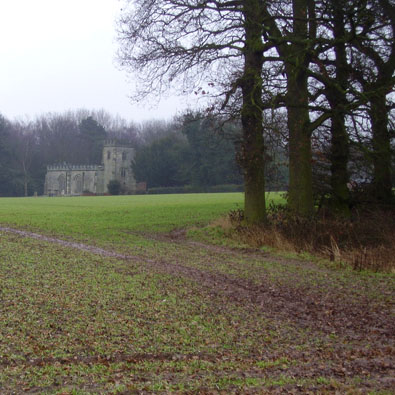 Foremark church
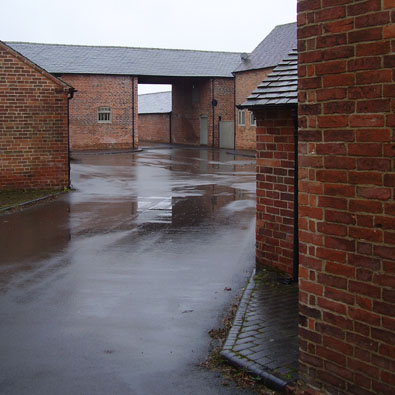 Farm conversion work in Milton
Now is your opportunity to visit Foremark church, be sure to circumnavigate the exterior to find the imposing gateway at the head of the walk from the Hall. Our final port of call is Milton where many of the farms and old building have been tastefully converted to create homes, while a few still await developers' attention. It was pleasing to find our exit path passing between the homes created in a former farm, rather than the more common diversion around the perimeter.
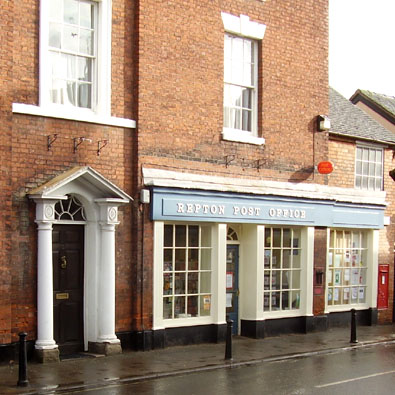 Repton Post Office
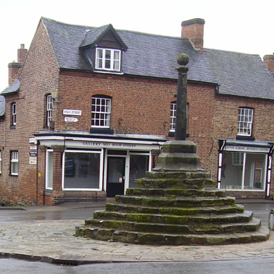 Repton Cross
Returning to Repton I could see at The Bulls Head folk settled around a roaring fire and an array of inviting handpumps on the bar, sadly I couldn't find an open door at 11.45am. Heading towards the cross Mercia Court attracted my attention, now flats to buy or let but what was the original use of this building? At noon the village suddenly came to life with students walking between school buildings, folders and books under their arms, among my many thoughts I questioned, why they carried no bags? The branch of Natwest bank had two signs by the door, "Welcome we're here to help" but only between 10am and 2,30pm on Monday, Thursday and Friday. It was Tuesday, so I got my cash at the Post Office.


