British Camp and Herefordshire Beacon
Through the Malvern Hills to an Iron Age Fort
Google Maps Open Source Maps| Statistics and Files | ||
|---|---|---|
| Start: Car park on A449 | Distance: 5.0 miles (8.0 km) | Climbing: 323 metres |
| Grid Ref: SO 76291 40403 | Time: 3 hours | Rating: Hard |
| GPX Route File | Google Earth File | About the Malvern Hills |
| Statistics | |
|---|---|
| Start: Car park on A449 | Distance: 5.0 miles (8.0 km) |
| Climbing: 323 metres | Grid Ref: SO 76291 40403 |
| Time: 3 hours | Rating: Hard |
| GPX Route File | Google Earth File |
Ordnance Survey Explorer Map (1:25,000)
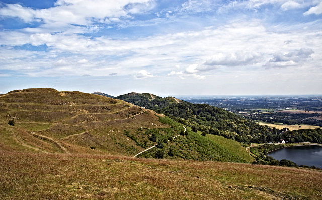
The Walk: This walk combines some of the most varied scenery offered in the Malvern Hills, a popular beauty spot in the West Midlands, with a wealth of wildlife on Castlemorton Common and one of the most impressive Iron Age hill forts in Britain.
 British Camp (
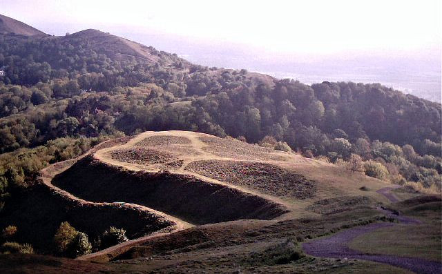 Herefordshire Beacon (
Leaving the busy British Camp car park behind, the walk drops down beside an attractive reservoir, built in the 19th century to provide Malvern with water. A short stretch of farmland, giving a view north to Little Malvern Priory with its church tower, leads on to Castlemorton Common. The common contains a large site of special scientific interest, with many rare plants, particularly along its streams and pools. Impressive features include about 60 rare black poplars.
Castlemorton Common was originally part of Malvern Chase, a medieval hunting ground which stretched from the hills to the River Severn. There are many so-called squatter cottages in small enclosures on the common; by tradition, anyone occupying a plot on the common for a year and a day without being turned off it, gained squatters rights. The 1,114 foot (333 metres) high Herefordshire Beacon contains many periods of human habitation, as well as fine views to east and west. The Giant's, or Clutter's Cave was probably carved out by medieval shepherds who may have used it as a shelter.
When you reach the main ridge, the low ridge with ditches on either side by the direction finder is part of the Shire Ditch, or Red Earl's Dyke. This was built in 1287-91 by Gilbert de Clare, earl of Gloucestershire, to divide his hunting lands from those of the Bishop of Hereford. The summit, British Camp, was once a Norman castle mound, but the rest of the earthworks are part of a pre-Roman hill fort.
Acknowledgments: Text derived from the Out and Out Series; Discovering the Countryside on Foot. Pictures courtesy of Wikipedia.


