Avening and Nailsworth
Through Cotswold villages once at the heart of the wool trade
Google Maps Open Source Maps| Statistics and Files | ||
|---|---|---|
| Start: Tiltups End | Distance: 7.7 miles (12.4 km) | Climbing: 338 metres |
| Grid Ref: ST 84502 97122 | Time: 4 hours | Rating: Moderate |
| GPX Route File | Google Earth File | About Avening |
| Statistics | |
|---|---|
| Start: Tiltups End | Distance: 7.7 miles (12.4 km) |
| Climbing: 338 metres | Grid Ref: ST 84502 97122 |
| Time: 4 hours | Rating: Moderate |
| GPX Route File | Google Earth File |
Ordnance Survey Explorer Map (1:25,000)
The Walk: The walk begins with a long slow descent from the top of the Cotswold plateau to the old wool village of Avening. This is a fairly open landscape, in striking contrast to the later stages, where there are deep valleys, small communities, old mills and secluded ponds. Much of the initial route follows the dry valley of Ledgemore Bottom. Most rainwater here sinks rapidly down the porous limestone rock of the Cotswolds. These plateau lands were traditionally pasture land for sheep, whose wool brought wealth to the region.
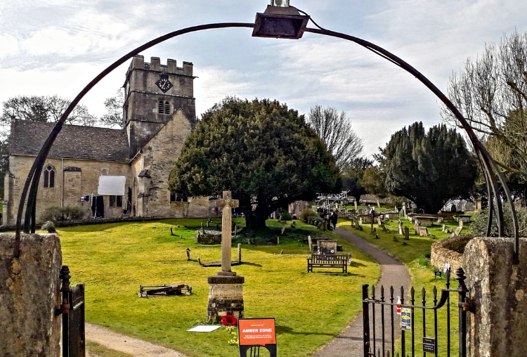 Holy Cross Church, Avening
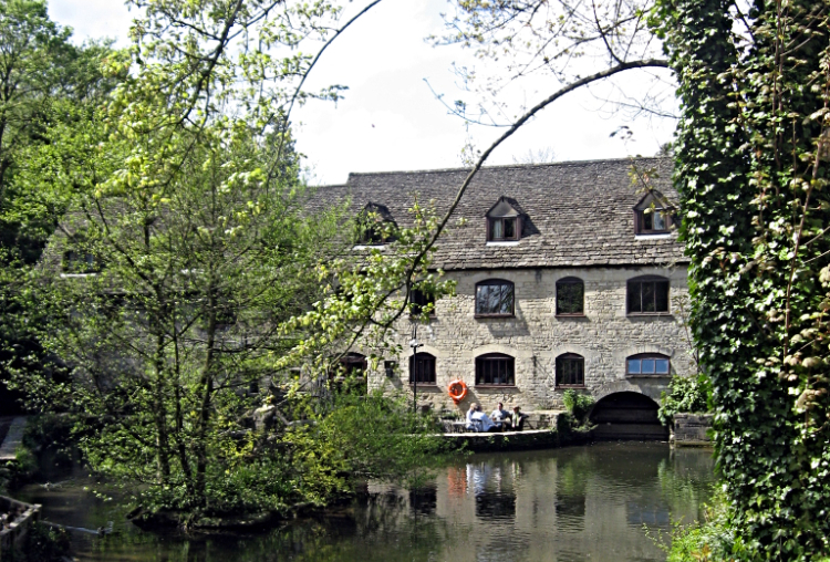 Egypt Mill, Nailsworth
Avening itself is a long established settlement, as shown by the numerous prehistoric remains nearby. The best long barrows are found north of the village, notably the Tingle Stone. The village was the centre of the early woollen industry, when weavers worked at home, and there are a few industrial remains; a few old clothiers houses, on three floors with large upstairs workshops, can be found near Holy Cross Church. Dating from the early Norman period, the church is shaped like a cross with the tower at the centre. The interior includes a monument to Henry Bridges, a notorious pirate who lived at nearby Avening Court.
Beyond Avening the walk climbs back on the ridge and there is a fine view across the valley to Gatcombe Park, home of Princess Anne. Dropping down again into the valley the walk passes near Longford's Mill, just east of the Weightbridge Inn. This mill continued in production until the 1990's, remaining profitable because it had the largest mill pond in the area and hence the most reliable power. The path then approaches the mill town of Nailsworth through the woods but avoids the town centre.
The walk then follows paths and alleys up a side valley towards Horsley, which contains several old mills and two large millponds. From here the path climbs to the little weaving hamlet of Harleywood, then through the woods above the Midland Fisheries - another large millpond more recently used for fish farming - back up to the top of the plateau. On the way there is a fine view back to St Martin's Church in Horsley, with its impressive Norman tower.
Acknowledgment: Text derived from the Out and Out Series; Discovering the Countryside on Foot. Pictures courtesy of Wikipedia.


