Linacre Reservoirs and Old Brampton
The Linacre Valley - A short walk through quiet woodlands fringing three reservoirs
Google Maps Open Source Maps| Statistics and Files | ||
|---|---|---|
| Start: Reservoirs Car Park | Distance: 3.4 miles (5.5 km) | Climbing: 147 metres |
| Grid Ref: SK 33457 72888 | Time: 2 hours | Rating: Easy |
| GPX Route File | Google Earth File | About Linacre Reservoirs |
| Statistics | |
|---|---|
| Start: Reservoirs Car Park | Distance: 3.4 miles (5.5 km) |
| Climbing: 147 metres | Grid Ref: SK 33457 72888 |
| Time: 2 hours | Rating: Easy |
| GPX Route File | Google Earth File |
Ordnance Survey Explorer Map (1:25,000)
The Walk: The old coal valleys in the Derbyshire Coalfield and east of the Peak District National Park tend to be overlooked by visitors from other areas of the country. This one, however, is well worth exploring, and is particularly attractive by three bodies of water, the reservoirs that were formerly Chesterfield's only public water supply. The route descends from the car park in Kitchenflat Wood, in medieval times the site of Linacre House which was sadly demolished because of drainage problems caused by the creation of the lower reservoir.
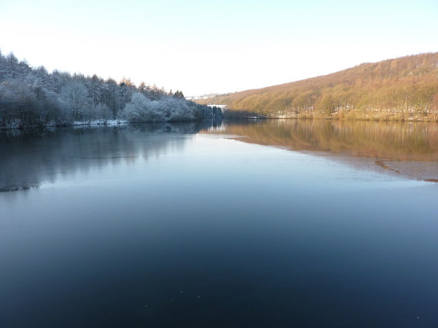 Linacre Middle Reservoir
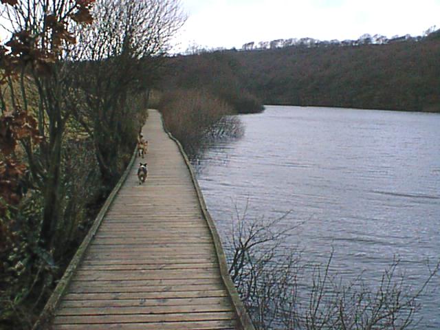 Linacre Upper Reservoir boardwalk
The ambitious reservoirs construction plan, conceived to supply all Chesterfield's water needs, was undertaken in the typically bold spirit which epitomised so many Victorian endeavours. Work began in 1855 with the construction of the smallest upper reservoir. This was followed in 1863 by the largest reservoir. The middle reservoir was built in 1904. Although widely admired as feats of engineering, the reservoirs and their surrounding woodland remained mysterious and little visited until Severn Trent Water Board took over the valley in the 1970's. Since then the area has been opened to the public and car parks and picnic facilities have been provided.
Although artificial in origin, the reservoirs have become a natural home to all kinds of waterfowl; mallards, little grebe, moorhens and coots are common. After walking around the reservoirs the walk climbs away from them by following North Lane and negotiating the Forty Steps leading to the historic village of Old Brampton, one of the prettiest villages in the region. The village was listed in the Domesday Book as Brantune. The blunt spired parish church was rebuilt in the 13th century but original Norman work can still be seen on the outer wall near the south doorway. A remarkable feature of the church is the 63 minute hour clock on the tower, the result of a workers inaccuracy many years ago.
Old Brampton Hall stands under tall trees opposite the church. Its low west wing contains medieval cruck (curved) timbers, which indicate that this fine house must have exited for at least five centuries. Heading north out of the village, the path branches right to the impounding wall of the lower reservoir, then back past the picnic site to the start of the walk.
Acknowledgment: Text derived from the Out and Out Series; Discovering the Countryside on Foot. Pictures courtesy of Wikipedia.


