West Wycombe, Hearnton Wood and Great Cockshoots Wood
The Hellfire Walk - Through beautiful countryside in an area with a colourful past
Google Maps Open Source Maps| Statistics and Files | ||
|---|---|---|
| Start: West Wycombe | Distance: 3.5 miles (5.5 km) | Climbing: 195 metres |
| Grid Ref: SU 82658 94748 | Time: 2 hours | Rating: Easy |
| GPX Route File | Google Earth File | About West Wycombe |
| Statistics | |
|---|---|
| Start: West Wycombe | Distance: 3.5 miles (5.5 km) |
| Climbing: 195 metres | Grid Ref: SU 82658 94748 |
| Time: 2 hours | Rating: Easy |
| GPX Route File | Google Earth File |
Ordnance Survey Explorer Map (1:25,000)
The Walk: Mention West Wycombe to anyone and the subject of the Hellfire Caves will sooner or later come up. The Dashwood family who bought the local estate in 1698 were a colourful lot and none more so than Sir Francis, the second Baronet, who inherited in 1724. In the 1740's he founded the notorious Hellfire Club, also known punningly as the 'Knights of St Francis of Wycombe'. This was a dining club with a difference and the members definitely did not take monastic vows of chastity. The Hellfire Club existed for lively conversation, dining, and womanising. The membership included the painter William Hogarth, John Wilkes and other leading whig politicians, as well as poets, artists and members of the gentry. The man-made caves, excavated in 1748-1750 tunnel into the hillside for 400 metres with numerous side chambers and passages. These were used for great candlelit dinners and lavish parties.
 Dashwood Mausoleum
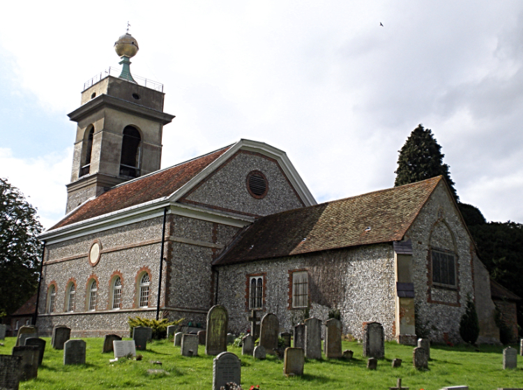 St Lawrence's Church
The walk starts in the attractive village of West Wycombe, which has many timber framed buildings including the Church Rooms, originally built as eight medieval lock-up shops with a large hall above. There are also good Georgian brick houses and the view up Church Lane, with its narrow brick houses climbing the hill, is truly memorable. Both the village and the mansion in its park belong to the National Trust.
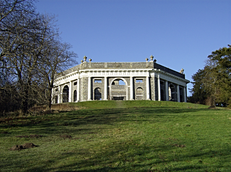
Leaving the village, the route climbs up to the iron age hillfort where the 18th century Sir Francis dramatically rebuilt most of the parish church in Georgian style, crowning the tower with a golden ball, in which people could sit. Next to the church, on a site commanding superb views across High Wycombe, Sir Francis built a hexagonal structure. This is the Mausoleum, designed in 1763 and intended for the ashes of members of the Hellfire Club.
From the church the route continues north along the beechwooded ridge with fine views to east and west before descending towards the local nature reserve in the valley. Passing 17th century timber framed farmhouses and barns in the valley, the route then climbs up the ridge and left into Great Cockshoots Wood. Afterwards the walk descends the ridge with fine views over the village of West Wycombe and the park towards the lake. On entering the village again the route passes the entrance gates to West Wycombe House, transformed by Sir Francis Dashwood by using the architects John Donovell and Nicholas Revett. The house is striking, with ochre coloured render and cool stone. The park in the valley of the River Wye was gradually filled with buildings, many in the form of Greek or roman temples.
Acknowledgment: Text derived from the Out and Out Series; Discovering the Countryside on Foot. Pictures courtesy of Wikipedia.


