Stonor Park, Turville, Fingest, Skirmett and Great Wood
A walk which explores the less frequented hills and valleys of the beautiful stretch of beech-clad Downs, the Chilterns
Google Maps Open Source Maps| Statistics and Files | ||
|---|---|---|
| Start: Stonor | Distance: 9.0 miles (14.4 km) | Climbing: 436 metres |
| Grid Ref: SU 73680 88955 | Time: 4-5 hours | Rating: Hard |
| GPX Route File | Google Earth File | About Stonor Park |
| Statistics | |
|---|---|
| Start: Stonor | Distance: 9.0 miles (14.4 km) |
| Climbing: 436 metres | Grid Ref: SU 73680 88955 |
| Time: 4-5 hours | Rating: Hard |
| GPX Route File | Google Earth File |
Ordnance Survey Explorer Map (1:25,000)
The Walk: This circular walk passes through three remote villages with curious names, Turville, Fingest and Skirmett. The walk starts from the village of Stonor and passes through Stonor Deer Park where a grand house with over eight hundred years of history is found. Standing on a fold of a hill, the house and its 14th century chapel are seen from the path through the beechwoods, across a narrow valley where deer graze. Soon after leaving the woods the county border between Oxfordshire and Buckinghamshire is crossed.
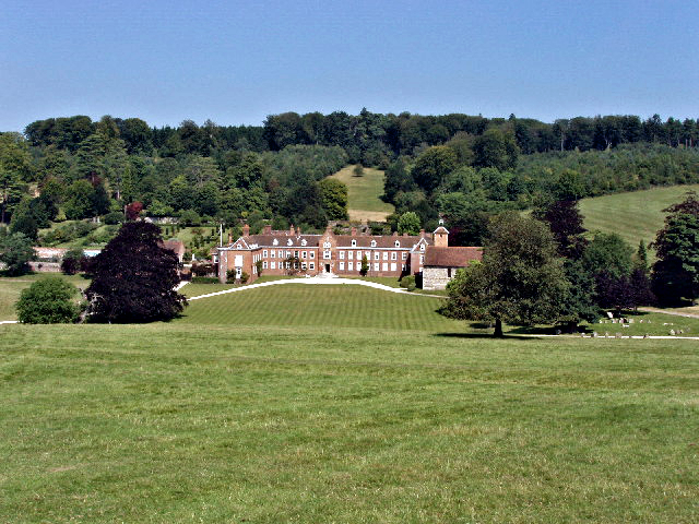 View to Stonor House from the Deer Park
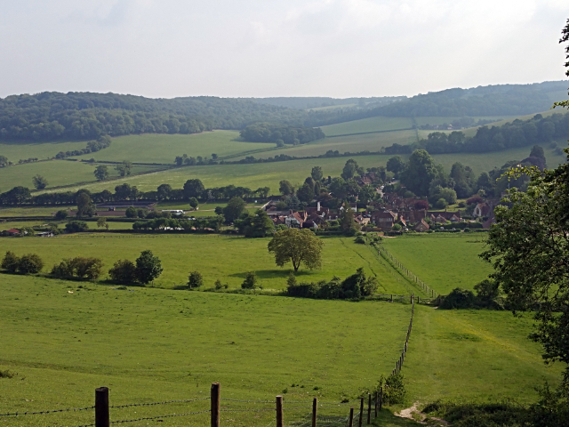 View to Turville from the Chiltern Way
Shortly after passing the hamlet of Southend the high ground affords wide views over the surrounding wooded hills. Turville Mill, a weatherboarded smock mill is prominent on the hill ahead. Smock mills were developed in the 1600's. These mills were fitted with a revolving cap to which the sails were fixed, together with a fantail mechanism: the fan automatically turns the cap so that the sails always faced into the wind. Descending through fields the village of Turville is entered by way of a lane lined with flint-faced cottages. The lane opens into the middle of the village. Cross the main road, climb a little around the edge of Turville Hill and descend into the village of Fingest.
The village of Fingest's most striking feature is St Batholomew's Church, which has an unusual church tower, crowned with a double gable. Opposite is the well preserved 17th century Chequers Inn. You could now walk steadily along a lane to the village of Skirmett but the better option is to strike out from Fingest on the climb to the Chiltern hill behind Fingest Wood, claiming the summit and then descending through Adam's Wood into Skirmett. Here the flint church of All Saints dated from the mid-19th century and has now been deconsecrated and converted into a private house.
From Skirmett the walk returns to Stonor by way of a climb into Great Wood before descending to Dolesden Lane and then climbing once more, this time into Kimble Wood. Continuing on a high line across the Chilterns, passing Kimble Farm and edging Kildridge Wood the walk provides stunning views southwards towards the River Thames valley and to Henley-on-Thames. Afterwards the finale of this exhilarating walk is a steep descent by Almshill Wood back into Stonor.
Acknowledgment: Text derived from the Out and Out Series; Discovering the Countryside on Foot. Pictures courtesy of Wikipedia.


