Ilmington and Ebrington Hill
Little Everest - From an attractive village to the highest point in Warwickshire
Google Maps Open Source Maps| Statistics and Files | ||
|---|---|---|
| Start: Ilmington | Distance: 7.0 miles (11.3 km) | Climbing: 302 metres |
| Grid Ref: SP 20973 43449 | Time: 3 hours | Rating: Moderate |
| GPX Route File | Google Earth File | About Ilmington |
| Statistics | |
|---|---|
| Start: Ilmington | Distance: 7.0 miles (11.3 km) |
| Climbing: 302 metres | Grid Ref: SP 20973 43449 |
| Time: 3 hours | Rating: Moderate |
| GPX Route File | Google Earth File |
Ordnance Survey Explorer Map (1:25,000)
The Walk: This walk climbs the highest hills in Warwickshire. The height reached is 855 feet (361 metres) are there are extensive views over the Avon vale. The uplands are of Jurassic limestone and akin to the Cotswold escarpment. The scenery is similar and truly lovely with a combination of rough pasture sheeplands, woodlands teeming with wildlife, a great country mansion in a green hollow and a pretty village to start and end at.
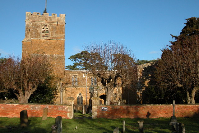 St Marys Church, Ilmington
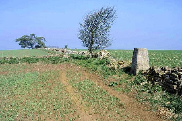 Ebrington Hill
The village is Ilmington, where the buildings are a mix of butter-hued limestone and weathered brick. Ilmington has all the buildings typical of an English village. The Community Shop seems to stock almost everything, There are historic inns and religious buildings including St Mary's Church where the walk begins. The church dates from the 13th century and has magnificent Norman arches.
Nearby is Ilmington Manor. This fine gabled house dates from Elizabethan times and was built with limestone from the local quarries, which were still worked until the 1920's. The house received some fame in 1934 when it was used in the first royal Christmas broadcast. Another interesting building in Ilmington is the 17th century Crab Mill House in Grump Street. Once this will have served the many cider orchards in the area.
From the church you go through the churchyard and along pathways and a lane to Front Street by the village hall. Nearby stones in the grass indicate the area of the pound where stray animals were penned. Quiet lanes lead to a footpath, which passes Fish Pool, an attraction to several species of waterfowl. From the next footpath we overlook the gardens of Foxcote and soon see the early Georgian house.
Estate roads, which are public rights of way, lead to a path over sheeplands. The route continues to climb to the county of Warwickshire's highest point, Ebrington Hill, known locally as Little Everest. The high lane that you follow was once a Roman highway, then a drover's road. Past a farmstead a track is well waymarked to as pond filled by a chalybeate, or mineral, spring. As you descend you can see the ridge of Edge Hill, a civil war battle site in 1642, in the distance.
The route, at seven miles, is enough to justify calling in at one of Ilmington's fine pubs for refreshments at the end of a lovely walk in Warwickshire countryside.
Acknowledgment: Text derived from the Out and Out Series; Discovering the Countryside on Foot. Pictures courtesy of Wikipedia.


