Over Haddon and Lathkill Dale
A walk through one of Derbyshire's finest limestone dales
Google Maps Open Source Maps| Statistics and Files | ||
|---|---|---|
| Start: Over Haddon | Distance: 6.9 miles (11.1 km) | Climbing: 411 metres |
| Grid Ref: SK 20351 66436 | Time: 3 hours | Rating: Moderate |
| GPX Route File | Google Earth File | About Over Haddon |
| Statistics | |
|---|---|
| Start: Over Haddon | Distance: 6.9 miles (11.1 km) |
| Climbing: 411 metres | Grid Ref: SK 20351 66436 |
| Time: 3 hours | Rating: Moderate |
| GPX Route File | Google Earth File |
Ordnance Survey Explorer Map (1:25,000)
The Walk: This is a classic walk through dramatic limestone scenery and wildlife habitats along one of the most beautiful dales in the White Peak district of Derbyshire. Starting from the attractive hill village of Over Haddon, the greater part of the walk follows the crystal clear, rushing waters of the River Lathkill as it flows on limestone through a National Nature Reserve, which is particularly rich and varied in flora and fauna. The return route is over quiet, rolling hill farm land, providing many extensive views across the limestone hills and dales and over to the gritstone edges and moors of the Dark Peak lands that lie to the east.
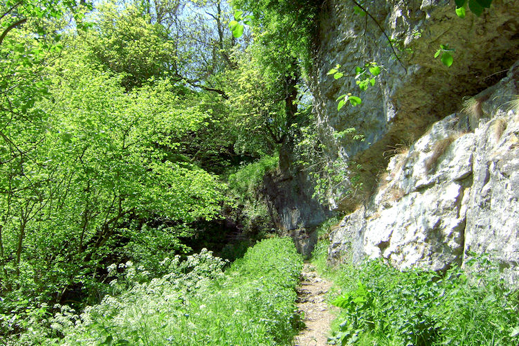 White limestone cliffs of Lathkill Dale
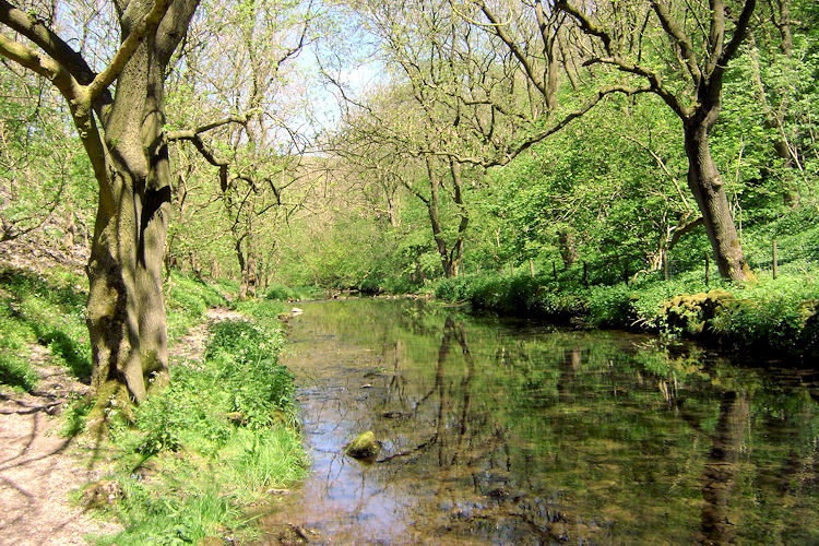 River Lathkill
A short distance along the route old ruined buildings are passed on the right of the path. These are the remains of the engine house built around 1840 to house a Cornish beam engine that pumped water from the Mandale Lead Mine. A long vein of lead runs north-west from here. Known as the Mandale Rake it was worked from medieval times. The height of the mining activity was for a century between 1760 and 1860. The arched opening and water channel on the left of the path is the drainage level. There is still an open, side entrance to the mine, which the miners used, but the workings are unstable and partially flooded and on no account should be entered. For safety to entry is now barred and locked.
Continuing you reach Palmerston Wood where more remains of mining activity can be seen. There are ruined buildings and spoil heaps, partly for lead, and also for chert, a mineral substance much like flint. This is a good area to look for dogwood, guelder rose, harts tongue fern and lily of the valley at the appropriate seasons throughout the year. Carrying on alongside the river you reach Carter's Mill. Only the foundation stones can now be seen of the 19th century mill that ground corn brought down from Over Haddon. You may find remains of the millstones used here and the weirs and dams too. A little further on you arrive at Tufa Dam Waterfall (see picture below). This is a natural water fall unlike the weirs further down the river. It is of unusual interest to geologists as it is formed of Tufa, a complex built up of mineral deposits formed from calcium carbonate. The waterfall is a favourite haunt for dippers which I can confirm, having watched a pair here coming and going from the water by the waterfall for five minutes during one of my walks here.
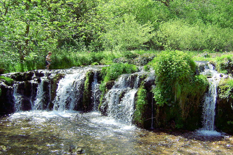 Tufa Dam Waterfall
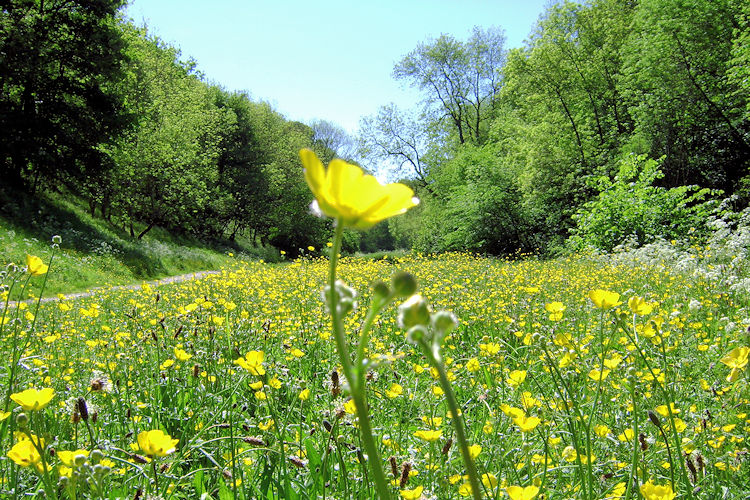 Buttercup meadow near Conksbury Bridge
Soon after the waterfall, on the spur from the walk, is Lathkill Head Cave. In times of heavy rains the river surges in torrents from the cave but in summer it is dry. Although wide and high at the entrance, the cave soon narrows and lowers, although it extends back through more than 1,000 feet of passages. This is strictly the domain of experienced cavers and pot-holers. Returning to the main route you come to three smaller caves in the Lathkill valley. Remains of Lynx were found in the upper two caves. This spot is known as Caves Dale and for centuries sheep were brought down here to a sheep wash by the river. The ruined walls of the sheep folds and pens can still be seen today in the area near the footbridge.
Leaving the river you now climb to pass Calling Low Farm which was once a monastic estate. In the wood nearby is an Iron Age burial ground called Bee Low. Next follows a walk over fields and then along Back Lane road to rejoin the river at Conksbury Bridge, once the site of a large medieval monastic settlement. Earth works f the settlement can still be seen on the left bank of the river close to the bridge. The last stretch of the walk includes a particularly attractive section of the river known as Blue Waters. It is a popular area for anglers and picnickers too. In late spring and early summer buttercup meadows glow in bring yellow and green. After these delights you retrace your steps back up the path from the valley to Over Haddon.
Acknowledgment: Text derived from the Out and Out Series; Discovering the Countryside on Foot. Pictures courtesy of Wikipedia.


