Grindon, Thor's Cave, Wetton and Beeston Tor
The Manifold Valley - A strenuous walk through Staffordshire's classic limestone scenery
Google Maps Open Source Maps| Statistics and Files | ||
|---|---|---|
| Start: Grindon | Distance: 6.3 miles (10.1 km) | Climbing: 418 metres |
| Grid Ref: SK 08531 54435 | Time: 3 hours | Rating: Moderate |
| GPX Route File | Google Earth File | About Grindon |
| Statistics | |
|---|---|
| Start: Grindon | Distance: 6.3 miles (10.1 km) |
| Climbing: 418 metres | Grid Ref: SK 08531 54435 |
| Time: 3 hours | Rating: Moderate |
| GPX Route File | Google Earth File |
Ordnance Survey Explorer Map (1:25,000)
The Walk: A walk of much geological interest on the edge of the3 Staffordshire moorlands and the White Peak of Derbyshire. The route passes through the two attractive hill villages of Grindon and Wetton, follows the deep limestone gorge of the Manifold valley, with its disappearing river, and climbs up to the spectacular sited Thor's Cave, an imposing cavern which can be safely entered and explored.
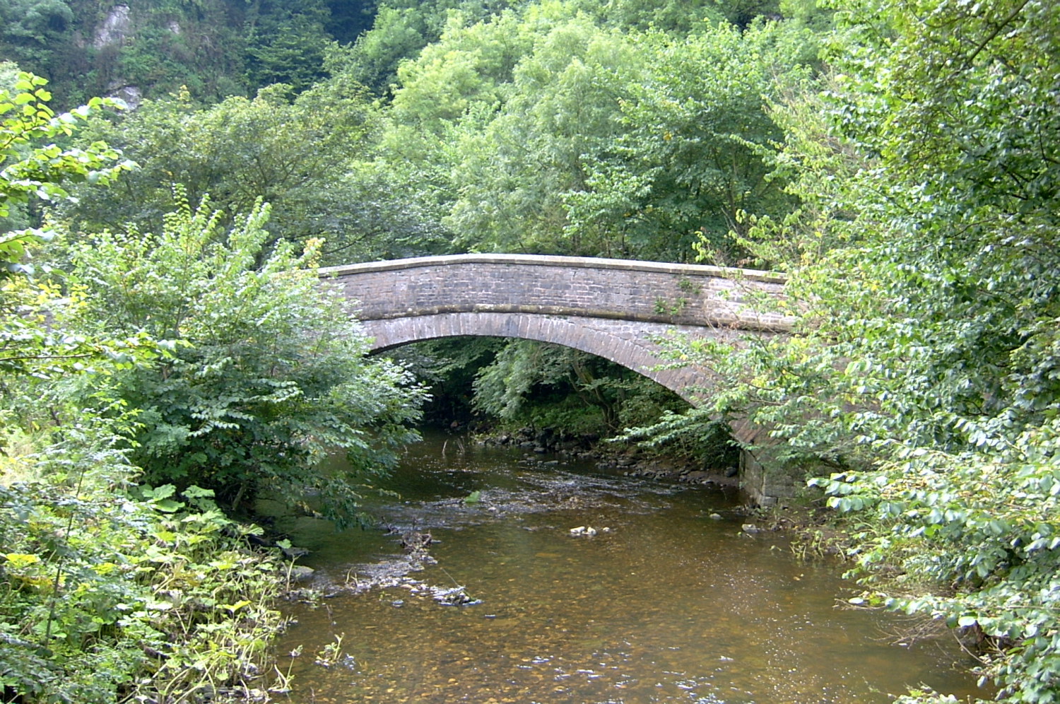 Bridge spanning the River Manifold
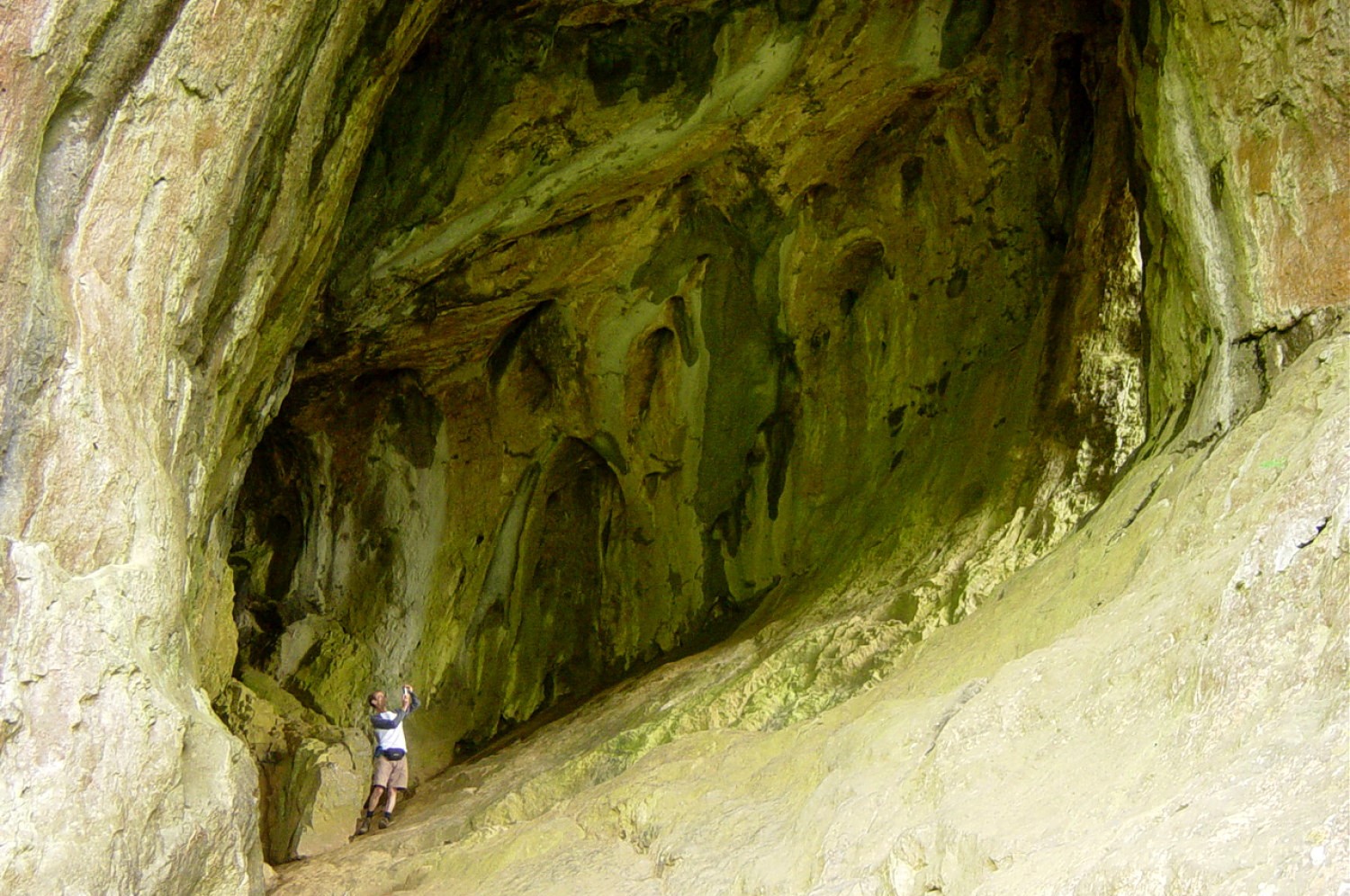 Thor's Cave
The walk begins in the pretty hill village of Grindon which lies on the 1,000 foot (304 metre) contour line. It contains many charming old limestone buildings. The large 19th century church, with its dominant spire, is locally known as the 'Cathedral of the Moor'. The interior of the church contains a plaque recording a tragedy in the severe winter of 1947. The village was cut off for several days because of the heavy snowstorms and food supplies began to run low. A Halifax plane was used to drop essential supplies but crashed on Grindon Moor killing all six crew members and several bystanders too.
After reaching the open country alongside the stream you come to Wetton Mill. There was a corn mill here in the 19th century, but the main building, now managed by the National Trust, includes a cafe. There is an interesting limestone crag to the left with many small caves and fissures. Crossing the footbridge you walk along the old railway line. This track, which goes right up the Manifold Valley to Hulme End and comes up the River Hamps valley from Waterhouses, was originally the Leek and Manifold Light Railway - a narrow gauge line built between 1902 and 1904 to serve the farms, mines and quarries along the dale. Although it was a delightful rural line it never paid its way and was closed in 1934. The whole length of the line is now a walking trail.
Shortly you reach the part of the River Manifold known as the 'disappearing river'. Except in extremely wet conditions the river begins to sink underground between the two footbridges. It disappears down fissures in the rock known as swallow holes. The river re-emerges further on downstream in boiling springs in the grounds of Ham Hall. Further on, you climb to Thor's Cave. Entirely natural and formed by water action on the limestone, the cave entrance is 350 feet (107 metres) above the river. The cave is open for exploration. Within, arrow heads, bronze brooches, an iron adze and a complete skeleton, possibly neolithic, have been discovered. Lower down the crag of Thor's Cave is Thor's Fissure Cavern, which was excavated in the late 1920's to reveal an amazing range of animal bones including bear, deep, wolf and most incredibly a dolphin.
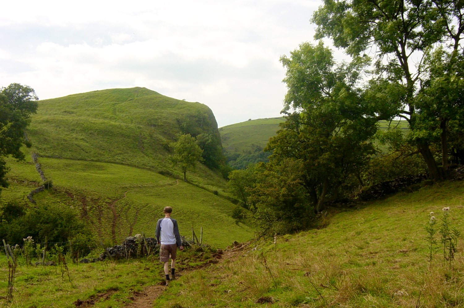 Between Thor's Cave and Wetton
 Manifold Country
From Thor's Cave the walk continues to the delightful upland village of Wetton. The village has opportunities for refreshments during the walk including a cafe and a pleasant pub. From Wetton the final stretch of the walk includes a clear view of Beeston Tor which overlooks the confluence of the River Hamps with the River Manifold. The tor is a popular rock climbing site with some high grade climbing routes. About 140 feet up the tor, on the right-hand side, is Lynx Cave, so called for the animal bones found there. At the base of the tor is St Bertram's Cave, which is a site for experienced pot-holers. Saxon coins were found in the cave.
The limestone cliffs and grasslands have fascinating plants. Bird's cherry and globeflower sprout from crevices out of the rock and out of reach of grazing animals. Bloody cranesbill, mountain pansy and Nottingham catchfly are among the local plants to be found here. There are also several species of Butterfly recorded. Dark green fritillaries - large chequered orange insects - are sometimes seen on the hills too. Enjoy looking out for them on your way back to Grinton.
Acknowledgment: Text derived from the Out and Out Series; Discovering the Countryside on Foot. Pictures courtesy of Wikipedia.


