Shrawley and the River Severn
Alongside the River Severn and around an ancient wood
Google Maps Open Source Maps| Statistics and Files | ||
|---|---|---|
| Start: Shrawley | Distance: 3.9 miles (6.2 km) | Climbing: 130 metres |
| Grid Ref: SO 80685 64750 | Time: 2 hours | Rating: Easy |
| GPX Route File | Google Earth File | About Shrawley |
| Statistics | |
|---|---|
| Start: Shrawley | Distance: 3.9 miles (6.2 km) |
| Climbing: 130 metres | Grid Ref: SO 79934 66335 |
| Time: 2 hours | Rating: Easy |
| GPX Route File | Google Earth File |
Ordnance Survey Explorer Map (1:25,000)
The Walk: This short walk combines farmland, riverbank, woodland and parkland. The walk begins and ends at Shrawley church, which mostly dates from the 12th century. From the church you descend to the River Severn, Britain's longest river, passing Court House which was the old manor house. Just below the farm are several artificial mounds known jointly as 'Oliver's Mound' which seem to be part of an old fortification defending a river crossing.
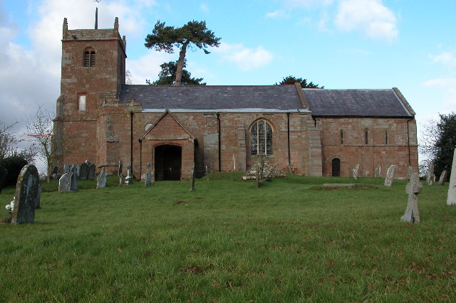 St Mary Church, Shrawley
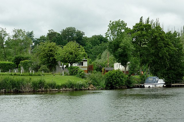 River Severn and Shrawley Wood
Soon afterwards you pass an outcrop of new red sandstone, the stone of which the church is constructed. A swampy area next to the river contains plants such as balsam. Walking along the river, you will see a variety of passing traffic, from swans to barges. Leaving the Severn behind, the path takes you a short way up the valley of the Dick Brook. It is now almost impossible to believe that 350 years ago this was an important industrial site. The lower Severn valley, from the Forest of Dean in the south to the side valley of the River Stour, leading up to the Birmingham area, was the heart of England's iron industry. Forges used charcoal from the riverside woods for fuel, and the water power of steeper tributaries to drive hammers and bellows.
Where the Dick Brook joined the river there was a lock and extensive wharves, at which cargo was transferred to small boats which could go up the brook. There used to be another lock halfway between here and the stepping stones where you cross the stream. These were at the site of a forge, with another wharf, and power was provided by a millpond further upstream. From the Dick Brook, the path follows a shaded side valley up into Shrawley Wood, which the route skirts around.
Shrawley Wood, a luxuriant 500 acres in size, is notable for the small leaved lime trees, native to Britain, which form the underwood. It abounds with ransom (wild garlic) and also contains the rare wood fescue grass. The final section of the walk goes through the grounds of the 19th century Shrawley Wood House, passing an artificial lake and crossing a fine avenue of beech trees.
Acknowledgment: Text derived from the Out and Out Series; Discovering the Countryside on Foot. Pictures courtesy of Wikipedia.


