Napton on the Hill, Lower Shuckburgh and Beacon Hill
Midlands Waterways - From a peaceful hillside village through quiet farmlands and along canal towpath
Google Maps Open Source Maps| Statistics and Files | ||
|---|---|---|
| Start: Napton on the Hill | Distance: 7.9 miles (12.7 km) | Climbing: 175 metres |
| Grid Ref: SP 46553 61257 | Time: 4 hours | Rating: Moderate |
| GPX Route File | Google Earth File | About Napton |
| Statistics | |
|---|---|
| Start: Napton on the Hill | Distance: 7.9 miles (12.7 km) |
| Climbing: 175 metres | Grid Ref: SP 46553 61257 |
| Time: 4 hours | Rating: Moderate |
| GPX Route File | Google Earth File |
Ordnance Survey Explorer Map (1:25,000)
The Walk: The village of Napton, where the walk begins, is very much 'on the hill', standing high above the surrounding countryside. From the village there is a short stroll across fields to a land that leads down to the valley. Part way down there is a splendid view of the locks on the Oxford Canal and of the tower windmill - a prominent landmark of Napton. Further down are flooded clay pits, the clay being used for brick making. By the canal there are old stables, reminders that once the working boats on the canal were pulled by horses.
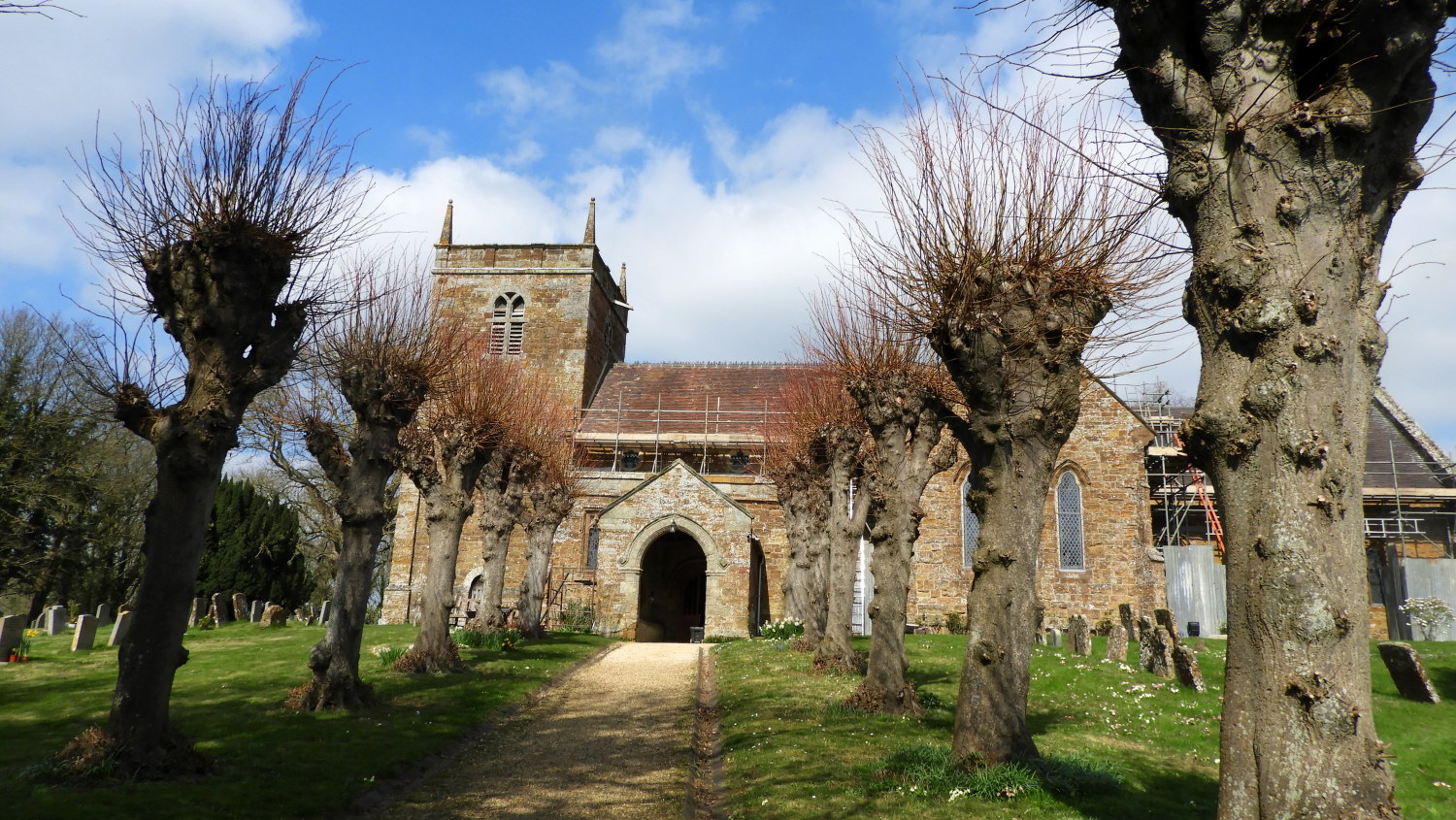 St. Lawrence's Church, Napton
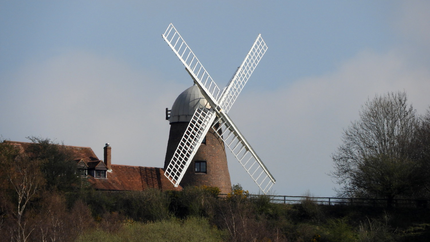 Napton Windmill
The next section of the walk follows the towpath. Building the canal started in 1769 and James Brindley, the chief engineer, followed his usual practice of running it along the contours of the land, so it snakes its way around the hill. The towpath is narrow and often overgrown in summer, so more often than not, walkers have to walk in single file. It is a delight for lovers of wild flowers. On one side you have hedgerow plants and on the other reeds and water plants.
There are still reminders of the old life of the canal. The first road bridge has been widened for modern traffic, but you can still see how the original bridge was built on the skew, involving a complex pattern of bricklaying. Beyond it is a widened section of canal known as a winding hole, where the 70 foot long old narrowboats could be turned.
The walk now leaves the canal and continues across fields to Napton Reservoirs. These were built to supply water for the canal and are now very popular with water birds of all kinds. Beyond is another canal, the Grand Union, which was built later than the Oxford. It has wide locks able to take two narrowboats side by side. You continue across fields and by an area of woodland, before rejoining the Oxford Canal by a dismantle bridge.
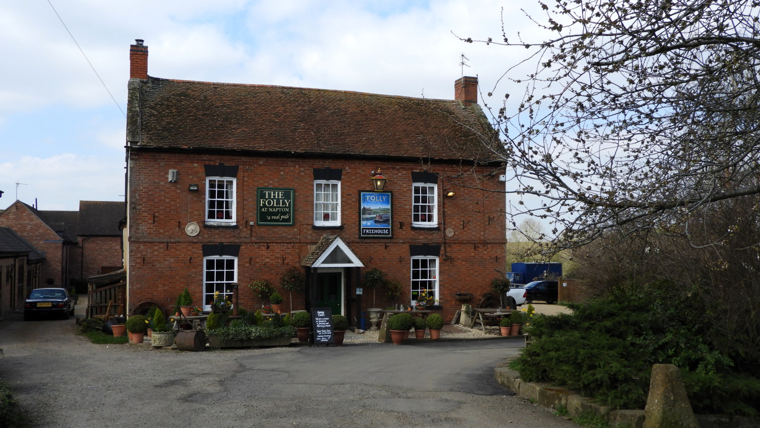 The Folly at Napton
 Napton Junction
Leaving the canal, the walk goes past the curious little gothic church of Lower Shuckburgh. The interior is even more remarkable than the exterior, with bright red brick pillars and arches. The path now leads steadily up the grassy hill towards a knoll crowned with trees. It runs close to a large private wood on one side, with an attractive lake, surrounded by rhododendron, while to the left one sees Shuckburgh Park, with its little chapel, home farm and imposing Shuckburgh Hall.
The route now runs along the ridge of the Shuckburgh Hills and from the summit on Beacon Hill there are brilliant views of the countryside. Napton Hill can be seen, as can modern structures of telecommunications including the radio station masts at Daventry. Nearer at hand, there is a 'fossilised' medieval farming landscape, the old pattern of ridge and furrow, formed by the plough still visible under the grass.
The path now leads back down hill to the farmland of the valley, where it skirts round, and at times cuts through, fields of pasture and grain. The walk is completed by the side of the road leading back into Napton, including a steep climb up Godsons Lane.
Acknowledgment: Text derived from the Out and Out Series; Discovering the Countryside on Foot. Pictures courtesy of Wikipedia.


