Great Malvern, North Hill and Worcestershire Beacon
On the Ridge Top - From a spa town to a magnificent viewpoint on the Malvern Hills
Google Maps Open Source Maps| Statistics and Files | ||
|---|---|---|
| Start: Priory Road | Distance: 6.1 miles (9.8 km) | Climbing: 516 metres |
| Grid Ref: SO 77892 45816 | Time: 3-4 hours | Rating: Hard |
| GPX Route File | Google Earth File | About the Malvern Hills |
| Statistics | |
|---|---|
| Start: Priory Road | Distance: 6.1 miles (9.8 km) |
| Climbing: 516 metres | Grid Ref: SO 77892 45816 |
| Time: 3-4 hours | Rating: Hard |
| GPX Route File | Google Earth File |
Ordnance Survey Explorer Map (1:25,000)
The Walk: Little Malvern, Malvern Wells, Great Malvern, Malvern Link, North Malvern and West Malvern are the six settlements that have grown up around the foot of the great ridge of the Malvern Hills. This walk is from Great Malvern, but looks down over Malvern Link, North Malvern and West Malvern. The hills, rising steeply from the Worcestershire and Herefordshire Plain, are some of the most distinctive landmarks of the Midlands and consist of hard rock, 600 million years old, the oldest in England.
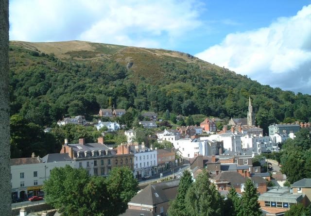 View to North Hill from Great Malvern
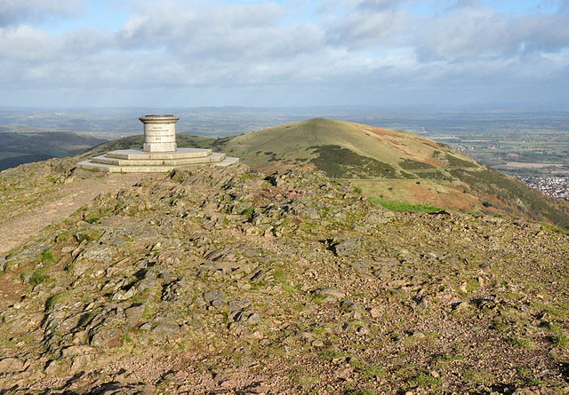 Worcestershire Beacon
The Priory Park and its Winter Gardens nestle in the shadow of the Malvern Hills. In the park is a bronze bust of Sir Edward Elgar, who lived in Malvern and composed many of his finest works here, including the Enigma Variations and The Dream of Gerontius. Music and theatre have long links with the town, and a regular supporter of the theatre was George Bernard Shaw, who wrote his play The Apple Cart for the first Malvern Festival in 1929.
The granite of the Malvern Hills was quarried in many places, leaving unsightly disused quarries, but all work has now been stopped to preserve the hillsides. The Malvern Hills Conservators, one of the first organised conservation groups in the world, have been looking after these hills since 1884.
The summit of the Worcestershire Beacon at 1,396 feet (425 metres) is the highest land in the area and on a clear day the surrounding views are spectacular. Looking to the east, the Cotswolds scarp, Bredon Hill and the towers and spires of churches are prominent. To the west is Wales and southwards is the outline of the old British Camp, an Iron Age hill fort on the top of the Herefordshire Beacon.
Malvern has also achieved fame for its crystal clear spring water, which is a worldwide brand. During the Victorian era, Malvern became popular as a spa town. Donkeys were regularly seen carrying people to the top of the beacon and some old donkey stables survive at the top of St Anne's Road. Other Victorian relics can be seen on Great Malvern Station, which was built as a showpiece in the 1860's.
Acknowledgment: Text derived from the Out and Out Series; Discovering the Countryside on Foot. Pictures courtesy of Wikipedia.


