Ellesmere, Welshampton, Cole Mere and Blake Mere
Shropshire's Lake District - Through farmland, alongside a canal and lakes rich in birdlife
Google Maps Open Source Maps| Statistics and Files | ||
|---|---|---|
| Start: Castlefields Car Park | Distance: 7.7 miles (12.3 km) | Climbing: 106 metres |
| Grid Ref: SJ 40546 34422 | Time: 4 hours | Rating: Moderate |
| GPX Route File | Google Earth File | About Ellesmere |
| Statistics | |
|---|---|
| Start: Castlefields Car Park | Distance: 7.7 miles (12.3 km) |
| Climbing: 106 metres | Grid Ref: SJ 40546 34422 |
| Time: 4 hours | Rating: Moderate |
| GPX Route File | Google Earth File |
Ordnance Survey Explorer Map (1:25,000)
The Walk: Although this area is commonly known as the Shropshire Lake District, this is not quite right. These water expanses are meres, not lakes. Lakes have streams or rivers flowing in and out of them, meres do not. This walk explores three of the largest meres and the abundant wildlife they attract. This group of meres are the largest in Shropshire and 'the Mere' at Ellesmere is the greatest of these. It used to be much larger, surrounding the old town on three sides as a natural fortification. However, in 1805 the level was lowered artificially to allow the town to expand.
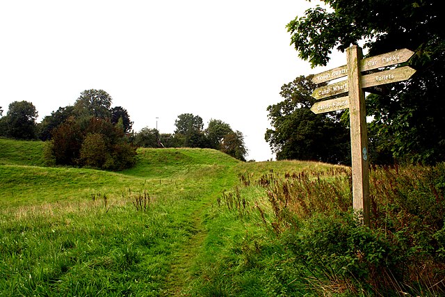 Site of Ellesmere Castle
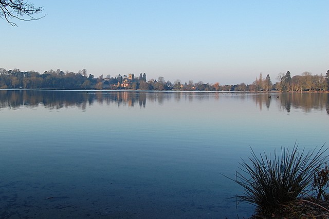 The Mere at Ellesmere
The walk begins at the visitor centre by the Mere. The lakeside is usually well populated by many species of waterfowl. Mallards, coot and tufted duck mingle with Canada geese and black headed gulls. The ground is bare due to the grazing birds. Out on the lake you will notice an island. The tree tops contain the large nests of herons that return here each spring.
The island is not a natural feature. In 1812 the Duchess of Bridgewater undertook the task of terracing the gardens of Ellesmere House. This was done in the hard winter of that year, to provide work in the town. The excavated soil was carted out onto the frozen mere and dumped, thus forming an island when the ice melted. In 1812 Napoleon retreated from Moscow and so the island acquired the name 'Moscow Island'. Since then it has been abbreviated to, or retitled 'Cow Island'.
Cremorne Gardens were given to public use in 1953 by Lord Brownlow. The gardens had been laid out in 1955, when the last of the tanneries that used to be on the lake shore closed down. From Cremorne Gardens you continue around the corner of the Mere, past the outflow that maintains the water at the new level set in 1805. Near the landing stage, a grove of beech trees with two giant sequoia is to be found. These grow to 300 feet (90 metres), and can live for 3,000 years. In the summer evenings this area is populated by bats hunting small insects. The pipistrelle, long-eared and noctule bat have all been seen.
You soon reach the Mere's other island. This is also man-made. In 1846, the churchyard collapsed into Church Street. The soil was removed, complete with human remains, and was carted away by a man named Neddy Jebb. This work was done at night and the new island, which appeared in the Mere, has since been known as Neddy Jebb's Island. The channel separating it has been kept clear to provide a haven for nesting birds.
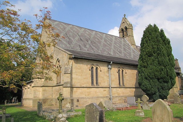 Church of St Michael and All Angels, Welshampton
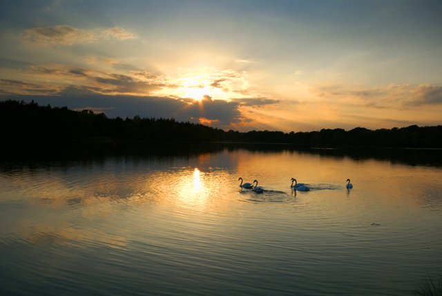 Cole Mere at dusk
Continue to Crimp's field where the path turns away from the Mere. As you cross the farmland, see how the land undulates due to moraines deposited over the area by glaciers 12,000 years ago. Look out for other small meres that cover the Shropshire and Cheshire plains. As Cole Mere is approached, a bridge over the canal takes you to Little Mill. A lakeside path goes through a plantation of Douglas Fir and Norway Spruce dating back to 1965. Continue around the lake to an exposed shoreline. Notice the variety of colours in pebbles placed here by the glaciers of 12,000 years ago. The pink ones are local sandstone, but the dark blue ones are slate carried here from Wales. Paler speckled ones are granites from Scotland and the Lake District.
St John the Evangelist Church, Colemere is built of sandstone and dates from 1870. From the church the route now takes you through Cole Mere Country Park and back to Little Mill where the path meets itself after the full round of Cole Mere. Around the intersection, some canal side buildings will be found. These are workshops and stables for the horses that towed the barges of the Shropshire Union Canal. One of the main cargoes was limestone from Llangollen and limekilns can be found around here.
The canal towpath is now followed to Blake Mere, which is much more secluded, having no direct road access and no right of way to the far bank. Consequently it is a haven for wildlife. Fish, particularly pike, perch and bream are abundant. These attract heron and kingfisher. The sheltered setting also attracts insects that, in turn, bring warblers, swallows and martins. The opposite bank is a private estate covered with woodland of sycamore, oak and Scots pine bordered by rhododendron.
You leave Blake Mere by entering the cutting to the tunnel. From here to Llangollen the tunnels all have a towpath through them, which is unusual. As you return to the Mere notice the hillocks to the right of the road. This is a glacial moraine deposited on the clay. It is well drained and was once covered by oak trees. These dry sites close to water and fish attracted early man and so it is not surprising that a bronze age canoe was found in the area.
Acknowledgment: Text derived from the Out and Out Series; Discovering the Countryside on Foot. Pictures courtesy of Wikipedia.


