Bridgnorth, River Severn and Eardington
Views High and Low - Around a historic Severnside town on two levels
Google Maps Open Source Maps| Statistics and Files | ||
|---|---|---|
| Start: High Town, Bridgnorth | Distance: 7.5 miles (12.0 km) | Climbing: 242 metres |
| Grid Ref: SO 71449 93550 | Time: 4 hours | Rating: Moderate |
| GPX Route File | Google Earth File | About Bridgnorth |
| Statistics | |
|---|---|
| Start: High Town, Bridgnorth | Distance: 7.5 miles (12.0 km) |
| Climbing: 242 metres | Grid Ref: SO 71449 93550 |
| Time: 4 hours | Rating: Moderate |
| GPX Route File | Google Earth File |
Ordnance Survey Explorer Map (1:25,000)
The Walk: The town of Bridgnorth has a split personality: Low Town, on the River Severn, was a busy river port for centuries, while High Town grew up around the superb strategic position afforded by a sandstone bluff that towers 100 feet above the river. The two are joined by ancient steps and narrow streets that tumble down the hillside, as well as by Britain's only inland cliff railway. Both have handsome half-timbered buildings from the 17th century. This walk enters the old town via Northgate, the only survivor of five medieval stone gates.
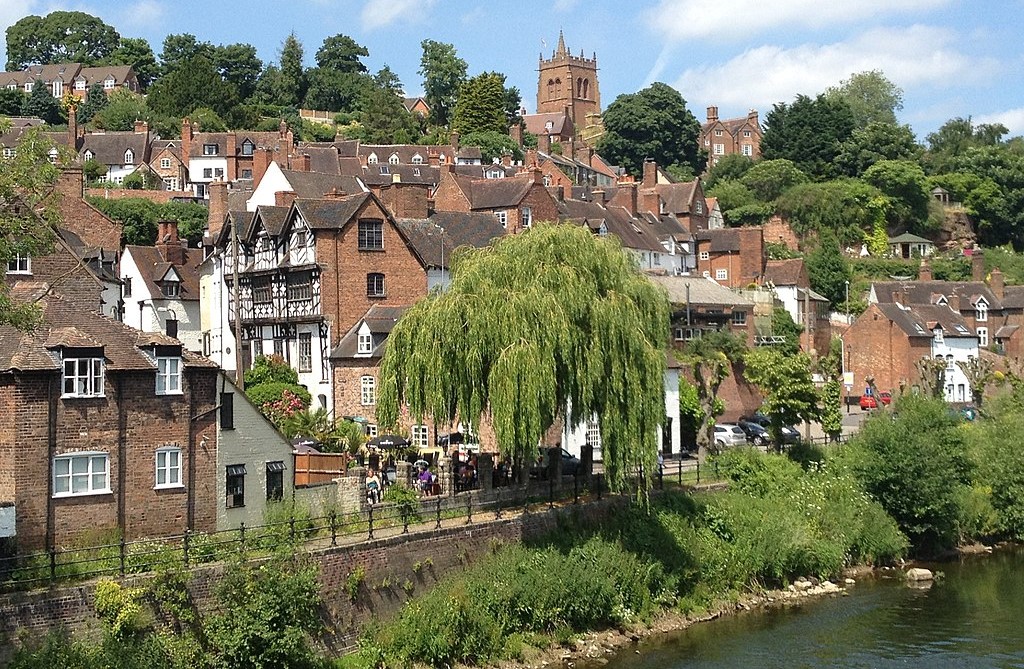 High Town, Bridgnorth
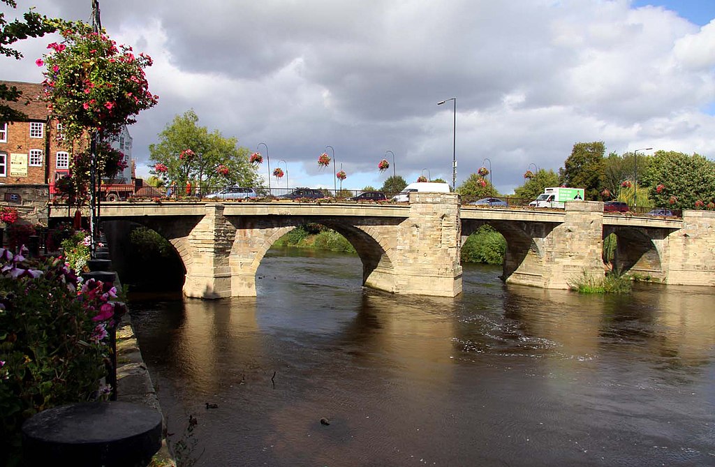 Bridgnorth Bridge
St Leonard's Church occupies the town's highest point. The present building is Victorian, but there has been a church here since the 13th century. Near the churchyard is a small half-timbered house where Richard Baxter, the famous Puritan preacher, lived when he was a curate at Old St Leonard's in 1640-41.
Further on you pass the Grammar School, built in 1629, and three brick-faced 17th century houses, formerly a schoolhouse and the homes of the schoolmaster and the vicar. Beyond these are Granary Steps, which lead down to the site of a 13th century Franciscan friary.
Walking along Friar Street, you come to the Cartway. This was the only route accessible to wheeled vehicles from the river wharves of Low Town up to High Town. The ribbed brick pavements helped prevent pack donkeys from slipping as they climbed. In the sandstone cliff faces are caves, which were inhabited up until 1856. Residents bricked up some of the entrances and installed proper doors and windows to make life more comfortable.
The descent to Low Town can be made by the cliff railway or by Stoneway Steps. Either way, you can make a slight detour at the bottom to visit Lavington's Hole, created during the Civil War, when royalist forces were besieged in the castle above.
The riverside at Underhill Street was the centre of Bridgnorth's busy river traffic for centuries. The local industry of tanning, weaving, drapery, malting, nailing and an iron foundry were all serviced by the river. Barges or Trows were towed upstream by teams of men, later replaced by horses. This trade survived until the coming of the railways, the last barge coming downriver in 1895.
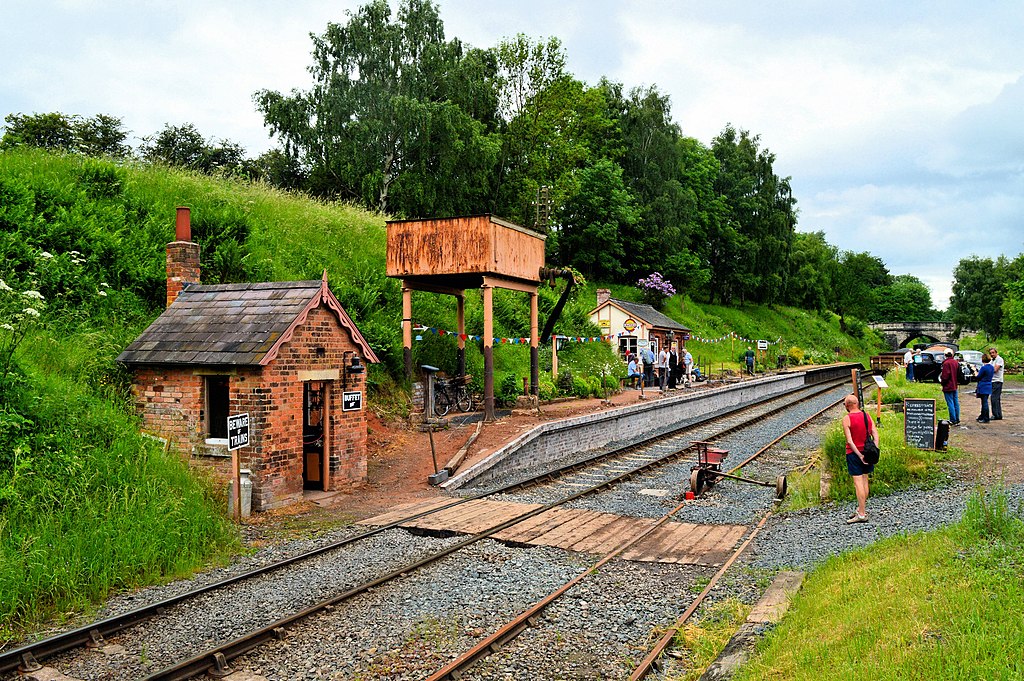 Celebrating Eardington Station
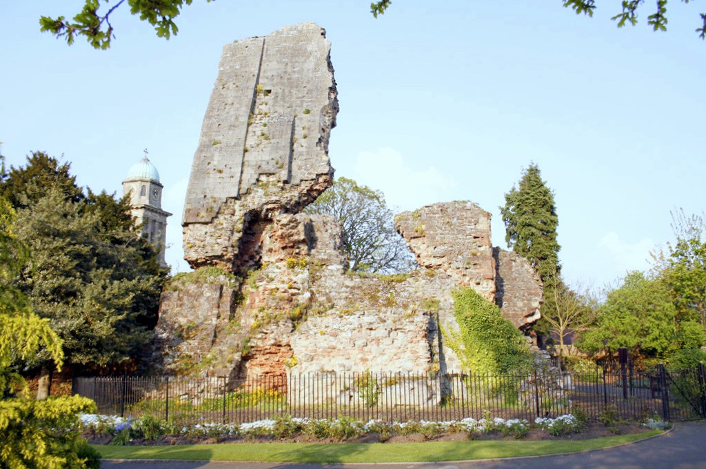 Ruins of Bridgnorth Castle
The route leaves the town at this point to follow thew River Severn to Daniel's Mill. There was no Daniel, the mill evolving from Donynges to Dunnings and then Dunnells before adopting its present name around 1880. The original mill had no house attached, and a journeyman miller operated the machinery seasonally. It operated until 1957 and is now a public attraction.
From Daniel's Mill the walk continues along the river, then loops back to Bridgnorth by lanes and by-ways - crossing the railway in due course. Both Eardington Station and Bridgnorth Station are visited on the route, both stations now supported by industrial heritage enthusiasts. The line is the old Severn Valley Line, a victim of the Beeching cuts of 1963. However, the Severn Valley Railway would not die, restored as a viable heritage line and now operating a steam train from Bridgnorth to Kidderminster.
Returning to High Town, there are good views of the ruins of Bridgnorth Castle, blown up by Oliver Cromwell's forces three months after the ending of the siege. There are good views of Panpudding Hill too, where the Parliamentarian armies guns were placed to pummel the castle. The return walk along the High Street passes the Town Hall, which was completed in 1652, shortly after the end of the Civil War. Bridgnorth suffered considerably in the conflict, and many public buildings were rebuilt at about this time.
Acknowledgment: Text derived from the Out and Out Series; Discovering the Countryside on Foot. Pictures courtesy of Wikipedia.


