A walk around Shrewsbury
By Dogpole and Grope Lane - A stroll in Shrewsbury, arguably England's finest Tudor town
Google Maps Open Source Maps| Statistics and Files | ||
|---|---|---|
| Start: Frankwell | Distance: 3.8 miles (6.0 km) | Climbing: 67 metres |
| Grid Ref: SJ 49076 12853 | Time: 2-3 hours | Rating: Easy |
| GPX Route File | Google Earth File | About Shrewsbury |
| Statistics | |
|---|---|
| Start: Frankwell | Distance: 3.8 miles (6.0 km) |
| Climbing: 67 metres | Grid Ref: SJ 49076 12853 |
| Time: 2-3 hours | Rating: Easy |
| GPX Route File | Google Earth File |
Ordnance Survey Explorer Map (1:25,000)
The Walk:
The River Severn forms almost a perfect circle around the heart of Shrewsbury, forced to do so by a significant hill which forms the basis of Shropshire's largest town. The narrow neck of land which forms the break in this circle is reasonably high and easily defendable, making this the obvious site for a fledgling town. Possibly once a Welsh tribal capital, the town was certainly occupied by the Saxons, and by 1066 it was a significant town with five churches. After the Norman invasion, it was fortified by Roger de Montgomery, the second richest and most powerful Norman after William I, who built a castle here. The town and castle underwent further fortification until the Welsh were finally defeated, and Shrewsbury became a market town. It prospered in the middle ages and throughout the reign of the Tudors.
Between 1560 and 1660, the town's population doubled. Much building work was undertaken, particularly of timber framed mansions, and a good deal of the old town is still in evidence today. Beside the many fine buildings there are ancient streets such as 'Doggepol' (today's Dogpole) and 'Le Wyle', both on record as early as 1246. Many interconnecting alleys such as Grope Lane (1305), are also still in use.
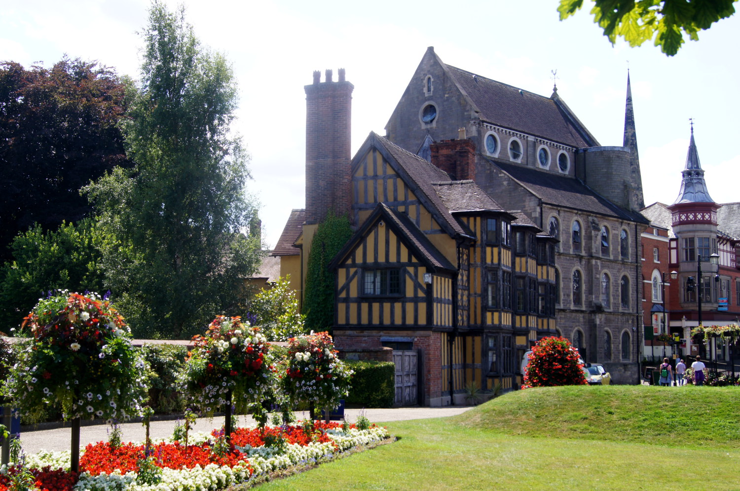 In the grounds of Shrewsbury Castle
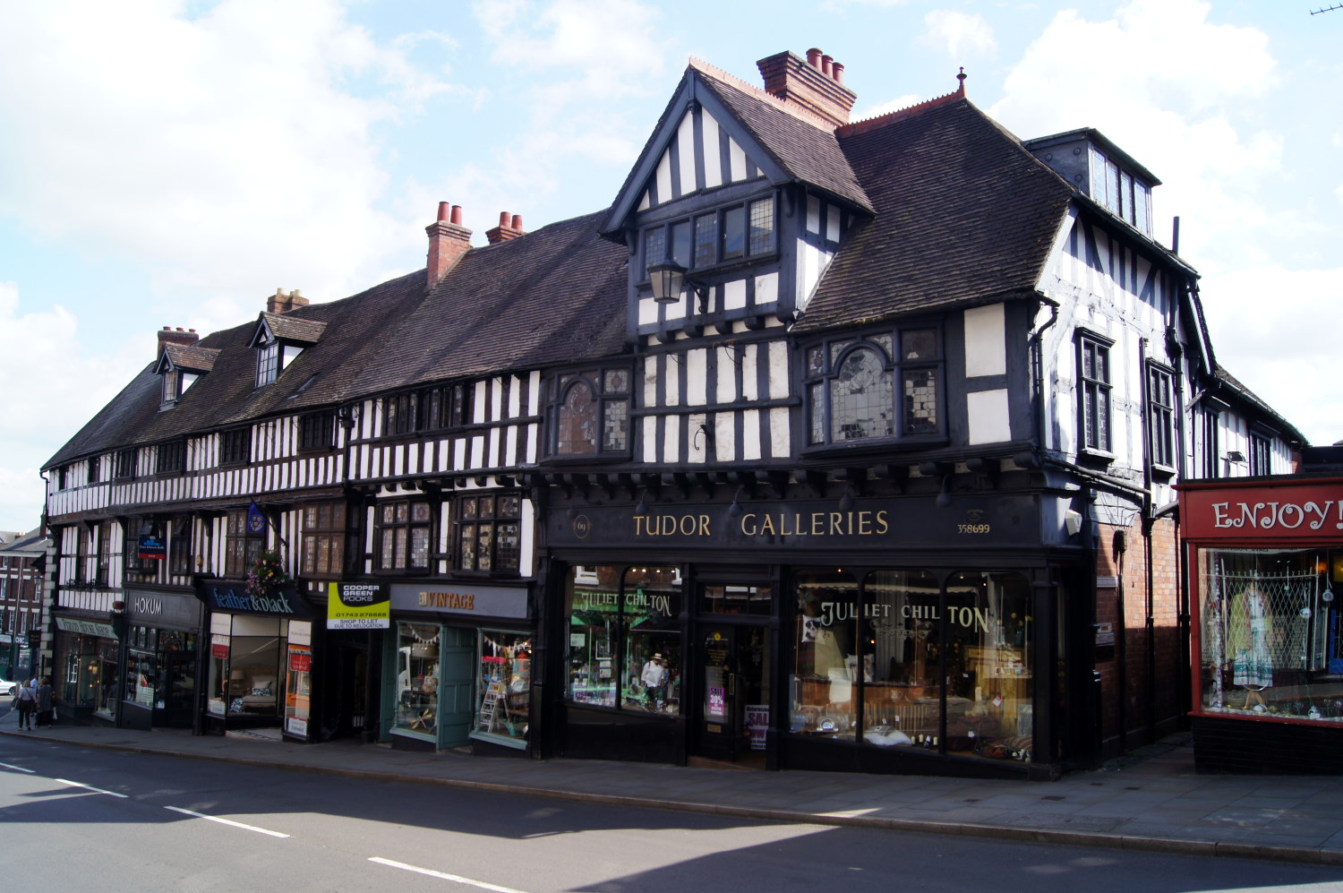 Tudor architecture in Shrewsbury
The walk starts from outside the Frankwell car park, on the opposite bank of the Severn to the old town, and crosses the river at Welsh Bridge. The present bridge was completed in 1795 but earlier versions date back to 1155. The first significant building on the route is Rowley's House off Hill's Lane. Now a museum, it has displays of Roman artefacts from nearby Wroxeter and also exhibits from Shrewsbury's medieval past. The route continues through the Victorian Arcade to the Mardol, where there is a 15th century inn, the King's Head.
In School Gardens are the old buildings of Shrewsbury School, which date from the 1590's, although the school was founded by Edward VI in 1552. By the end of the 19th century, the school had outgrown the buildings and moved to a site across the river at Kingsland. One of its best known pupils was Charles Darwin, who was born at the Mount near the start of the walk. The route leaves his statue to cross the road to Castle Gates House, built in the 17th century in the Dogpole but moved to this site in 1702.
The gateway survives of de Montgomery's original Shrewsbury Castle, but the remainder is the result of rebuilding by Edward I. Restoration was carried out by Thomas Telford at the end of the 18tyh century and Laura's Tower, which provides a great view over Shrewsbury, was one of Telford's additions. The Shropshire Regimental Museum is housed in the castle.
In Castle Street is the old Council House, where the Council of the Welsh Marches met until its abolition in the Civil War. Charles I and James II both stayed here. In Windsor Place, the route passes the 16th century Perches Mansion and the 18th century Windsor House, before reaching St Mary's Place. Next, St Mary's Court leads to the ancient Dogpole, which you cross the reach the church in St Alkmund's Square. The tower is medieval both the remainder was rebuilt in 1793-95.
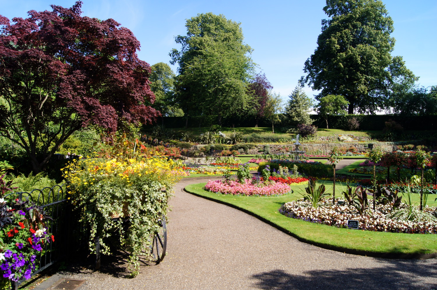 The Dingle Botanical Park
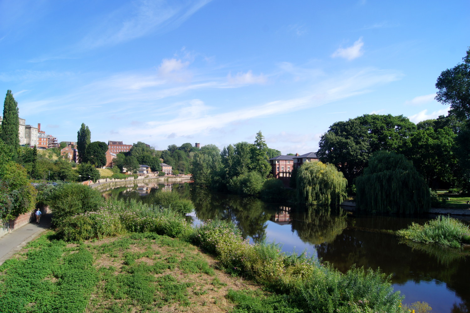 River Severn in Shrewsbury
Bear Steps Hall, dating from the 14th century, now stages exhibitions. The actual Bear Steps lead to Grope Lane, named in 1324 when it was a dark and narrow passage. This area, more than any other, retains the feel of medieval Shrewsbury. The Square became the focal point of the town in 1292, when the market was moved here. The Market Hall, built in 1595, reflects the towns prosperity in the Tudor period. On the inside of one of the columns in the north side are some peg holes, once used to record the sales of fleeces.
Coffee House Passage takes you through to the Clive House Museum on College Hill. Lord Clive, better known as Clive of India, lived here when he was Mayor of Shrewsbury. Barracks Passage leads you to Wyle Cop, and Henry Tudor House where the future Henry VII stayed on his way to the Battle of Bosworth Field, defeating Richard III to end the Plantagenet era in favour of the Tudor dynasty. Continuing on the walk, you pass Myttons Mansion and the Nag's Head Inn to reach English Bridge.
Gay Meadow, Shrewsbury Town's football ground until 2007 was on the left. On match days it was not unknown for the match ball to be launched into the River Severn. To manage this, a man in a boat was employed to patrol the river in a traditional coracle for the sole purpose of retrieving the ball.
Just the other side of English Bridge is Shrewsbury Abbey. This Benedictine monastery, of which the Abbey Church is virtually all that remains today, was founded by Roger de Montgomery in 1080 on the site of a Saxon Church. From the abbey, as you walk towards Coleham footbridge, you pass the Pumping Station. Within, two large steam engines were built in 1900 and have been restored to working order.
The return journey follows the riverside path around the outside of the town into the Quarry. The park is the site of an annual flower show. Standing in a commanding position at the top of the opposite bank is the main school building, originally a workhouse of the present Shrewsbury School.
Acknowledgment: Text derived from the Out and Out Series; Discovering the Countryside on Foot. Pictures courtesy of Wikipedia.


