Tegg's Nose and Ward's Knob
Around reservoirs and a country park with splendid views
Google Maps Open Source Maps| Statistics and Files | ||
|---|---|---|
| Start: Car Park | Distance: 2.6 miles (4.2 km) | Climbing: 192 metres |
| Grid Ref: SJ 95032 73292 | Time: 2 hours | Rating: Moderate |
| GPX Route File | Google Earth File | About Tegg's Nose |
| Statistics | |
|---|---|
| Start: Car Park | Distance: 2.6 miles (4.2 km) |
| Climbing: 192 metres | Grid Ref: SJ 95032 73292 |
| Time: 2 hours | Rating: Moderate |
| GPX Route File | Google Earth File |
Ordnance Survey Explorer Map (1:25,000)
The Walk: This walk takes you through a quarry that was closed in 1955 and has since been reclaimed by nature. It is now a country park.
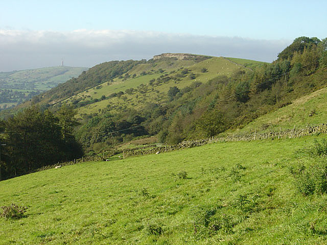 View to Tegg's Nose from the north
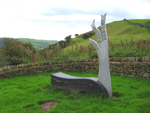 Sculpture at Tegg's Nose Country Park
The walk begins at Tegg's Nose Country Park visitor centre where you can gaze over drystone-walled fields and the town of Macclesfield. The area is high, 1,148 feet (250 metres) above sea level, and exposed - the quarry you have parked on and the house above it are called Windy Way. The plants have to be tough and low growing; bilberry and heather with shrubby willow and some hawthorne predominate alongside the grasses.
The hills around are of millstone grit, a type of sandstone that was valued for millstones (hence its name), and had many other uses. The quarrying exhibition illustrates the various uses of the stone quarried in this area. A stone built building and stone wall enclose an area of exhibits of quarrymen's products. The building houses information on the geology of the cliff facing you, plus a display of quarrymen's tools.
Outside there is machinery typical of a quarry, a stone saw and a stone crusher. Further on you will see the deep hole left here by quarrying operations and the sheer face used by rock climbers.
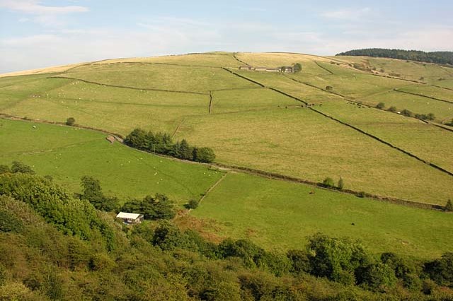 The view north-east from Tegg's Nose
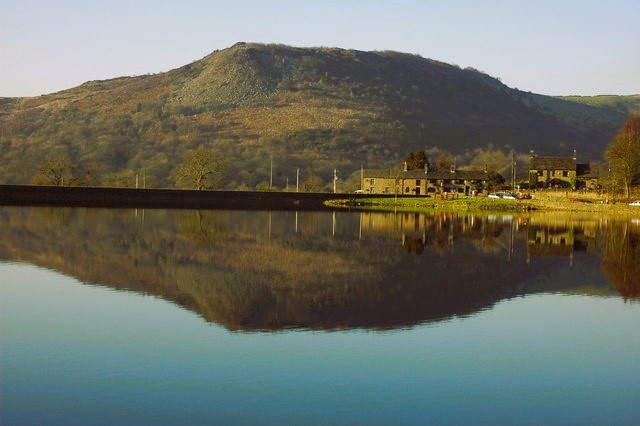 Tegg's Nose, seen from Ridgegate Reservoir
The Information Board at the Tegg's Nose viewpoint tells you about the geology of the area and the reservoirs. The larger Ridgegate Reservoir is for drinking water, and the two smaller ones, Teggsnose and Bottoms, were built to keep the level of the River Bollin topped up once Ridgegate Reservoir reduced its levels.
From Tegg's Nose the route drops steeply down to the floor of the valley of the River Bollin. This section can be tricky in the wet so care is needed. Take a breather half-way down at ard's Knob, another scenic viewpoint over the valley.
Saddlers Way, which is followed on the return journey, is an old packhorse route, one of many that used to criss-cross the area. It was resurfaced between 1984 and 1987, and there is a plaque part of the way along it providing information.
Acknowledgment: Text derived from the Out and Out Series; Discovering the Countryside on Foot. Pictures courtesy of Wikipedia.


