Gringley on the Hill, Clayworth, Wiseton and Chesterfield Canal
Along the Chesterfield Canal from an attractive hilltop village
Google Maps Open Source Maps| Statistics and Files | ||
|---|---|---|
| Start: Gringley on the Hill | Distance: 8.0 miles (12.9 km) | Climbing: 120 metres |
| Grid Ref: SK 74145 90735 | Time: 4 hours | Rating: Easy |
| GPX Route File | Google Earth File | About the Chesterfield Canal |
| Statistics | |
|---|---|
| Start: Gringley on the Hill | Distance: 8.0 miles (12.9 km) |
| Climbing: 120 metres | Grid Ref: SK 74145 90735 |
| Time: 4 hours | Rating: Easy |
| GPX Route File | Google Earth File |
Ordnance Survey Explorer Map (1:25,000)
The Walk:
Gringley on the Hill has a remarkable position, spread along a ridge at the end of a long range of low hills that stretches from Nottingham. The village is attractive by any standards, with many fine houses on its steep hills. The walk begins just east of the village at Beacon Hill, a green mound at the very end of the ridge. Opinions differ as to whether it is natural or artificial. Some say it was built by the Romans, and others that it contains a Viking burial.
From the top there is a panorama stretching for 20 to 30 miles. Lincoln Cathedral is visible to the east on a clear day, while to the north stretched some of the flattest, least populated and quietest acres of England. The Isle of Axholme, the Carrs, Hatfield Moors and Hatfield Chase. No land north of here, until the Yorkshire Wolds, rises more than 30 feet. Beacon Hill has been used for beacon fires and in the 1920's and 1930's it was a popular spot for radio enthusiasts.
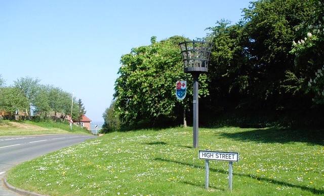 The Beacon in Gringley on the Hill
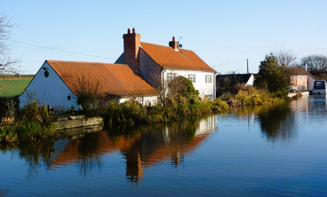 Chesterfield Canal at Clayworth
From the start, in the village, we reach the Church of St Peter and St Paul, a mainly perpendicular building with a Norman door in the base of the tower, and a classical 17th century door in the North Aisle. The church's beautiful shaft piscina, a basin and drain for washing holy vessels, is over 650 years old.
The Butter Cross is set at the junction of Cross Hill and the High Street, just beyond the church, though nobody knows how long it has been there. Only the upright now remains. On market days, the farmer's wives sat on its steps, selling their eggs and butter.
The route heads across fields, passing a four storey windmill that dates from 1830, to the village of Clayworth. The village straddles the old Roman road between Doncaster and Lincoln. Most of the houses on the narrow main street date from the 1700's. Clayworth was once famous for its celery. The Clayworth Pink variety originated here, and the common land was divided between the villages for growing this crop.
St Peters Church has a base that dates from before the Norman Conquest, but the building is perpendicular. There is a rare 14th century stone screen inside, and much Victorian decoration and stained glass, as well as memorials to the families of Royston Manor, which is now a hotel. The manor's south front is said to date from 1588 but everything visible from the road was rebuilt in 1891. This was the ancestral home of the Otter family until they sold their lands in 1948.
Otter's Bridge leads you to the Chesterfield Canal. The canal takes you past Wiseton, a completely unspoilt village of cottages dating from the 18th and 19th centuries. You pass under an ornamental bridge over which passes the drive to Wiseton Hall. The hall was built in 1771 and demolished in 1960. Just the 18th century stables survive. The Acklom family first owned the hall; a member of the family, Jonathan Acklom did much to improve the estate from 1814 to 1863. Later, it was owned by the Acklom's in-laws, the Spencers, ancestors of Diane, Princess of Wales.
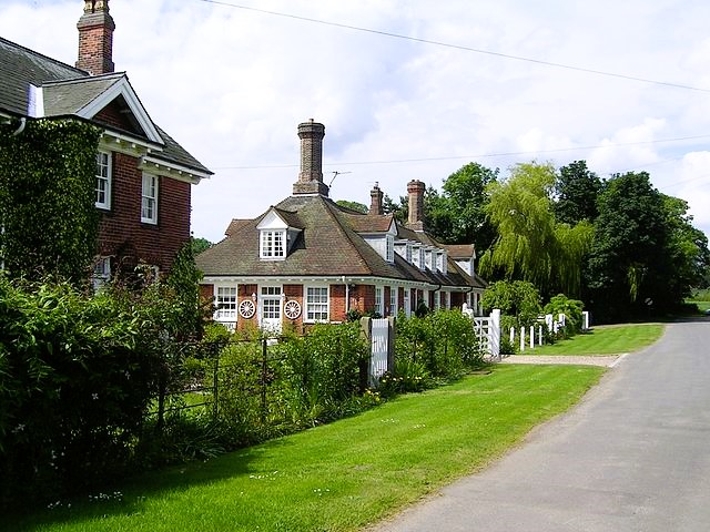 Pretty houses in Wiseton
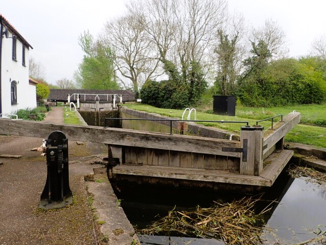 Gringley Top Lock on the Chesterfield Canal
Drakeholes Tunnel was a natural place for a busy wharf in the canals heyday; the boats were forced to stop to harness or unharness the horses because of the 154 yard long tunnel, and the road is nearby. A regular packetboat service operated from here.
The Griff Inn, next to the tunnel was built in the early 1800's, and was previously known as the White Swan. The landlord was responsible for organising the wharf and cargoes, and stagecoaches called here from places such as Sheffield, Louth, Gainsborough and Lincoln. Jonathan Acklam Of Wiseton Hall had a hand in the design of the hotel because he wished to see decorative buildings from his terrace. As the canal declined, so did the trade of the pub, but it was completely restored and reopened in 1982. Opposite the pub, a pair of lodges mark the old entrance to Wiseton Hall.
Further along the canal is Gringley Top Lock, a wide lock with its cottage still occupied, that dates from the opening of the canal. From here the walk returns to the village of Gringley on the Hill, across the fields and up a steep street leading straight into the village centre.
Acknowledgment: Text derived from the Out and Out Series; Discovering the Countryside on Foot. Pictures courtesy of Wikipedia.


