Ashwell and the Seven Springs of the River Rhee
A country walk centered on a village full of architectural interest
Google Maps Open Source Maps| Statistics and Files | ||
|---|---|---|
| Start: Ashwell | Distance: 4.9 miles (7.9 km) | Climbing: 80 metres |
| Grid Ref: TL 26686 39846 | Time: 2 hours | Rating: Easy |
| GPX Route File | Google Earth File | About Ashwell |
| Statistics | |
|---|---|
| Start: Ashwell | Distance: 4.9 miles (7.9 km) |
| Climbing: 80 metres | Grid Ref: TL 26686 39846 |
| Time: 2 hours | Rating: Easy |
| GPX Route File | Google Earth File |
Ordnance Survey Explorer Map (1:25,000)
The Walk: Ashwell has a long history. It lies on an old trade route, Ashwell Street, and is close to the important ancient highway, Iknield Street. There is evidence of both Roman and Celtic settlements. The Domesday Book points to it as one of the six most important towns in Hertfordshire, and in the Middle Ages it was a wealthy market town. For various reasons it did not attain the stature of Saint Albans or Hertford, and today is no more than a substantial village. Its past, though, has bequeathed it many fine buildings. Nikolaus Pevsner, the architectural historian, wrote, "the village has more architecturally worthwhile houses than in the other in the country".
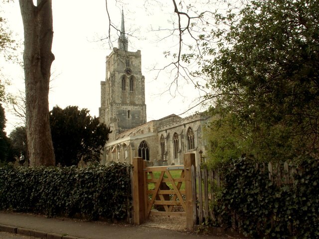 St Mary's parish church in Ashwell
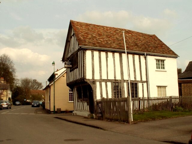 Ashwell Museum on Swan Street
The walk heads out of the village via Ashwell Street and a quiet lane, to the gentle hills to the south. Here there are wide views with long horizons and immense skies. Great sweeping fields cover the slopes.
The route heads back north past Arbury Banks Hill Fort. From the ground, only the banks themselves can be seen, but aerial photographers have shown up stock enclosures and a possible Romano-Celtic temple, as well as defensive structures.
North of the town, the fields are much neater and more compact. There are several fine houses, such as moated Ashwell End, painted white with green shutters. Ashwell Bury was renovated by Sir Edwin Luytens and has a garden designed by Gertrude Jekyll. Next to it are two renovated brewery buildings.
Back in the village, St Mary's church boasts a remarkable tower at 176 feet high, the tallest in the county. This soaring edifice is topped with an octagonal lantern, and a leading spirelet, or spike that is typical of Hertfordshire. The church itself is also large, a testament to the medieval prosperity of Ashwell. The building is faced with Totternhoe stone, a chalk that weathers badly. Inside the church is light and spacious - etched in the walls of the tower are two pieces of 14th century graffiti, an inscription in latin describing the aftermath of a plague in 1350, and another noting a dreadful tempest in 1361.
Nearby is an early Tudor townhouse, once used for collecting tithes for the Abbot of Westminster, and later as a meeting hall. It now contains Ashwell Museum, which began life as a collection of curios gathered by two village boys. When they grew up, they were instrumental in having the derelict building restored to house their ever growing collection. The range of exhibits is amazing (extending even to a mummified black plague rat) and provides a unique record of village life from the earliest times.
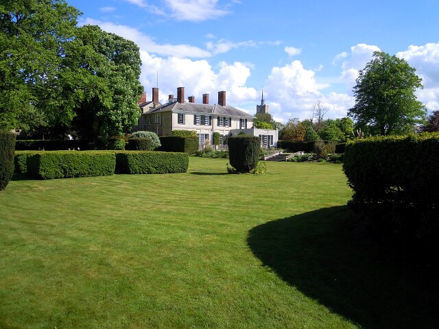 Ashwell Bury
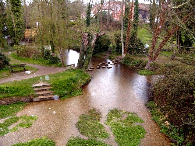 Source of River Rhee at Seven Springs, Ashwell
The walk continues along High Street, which contains a number of Ashwell's best buildings. Amongst these are the 15th century Kirby Manor, the Rose and Crown next door, and Bear House, whose rich internal timbering indicates the wealth of its builder.
Especially interesting are the 1476 Guildhall of St John the Baptist, now a Baker's shop, and the pargetted Guildhouse of 1681 next door. Further on are Plait Hall, a timber frame building once associated with the plaiting of straw for hats; 15th century Forester's Cottages; and Jessamine House, formerly a farm and now the headquarters of the Veteran Car club.
The final part of the walk passes the Holy Well or Sacred Spring of Seven Springs which bubble out of the chalk into a pleasant pool, the Springs Basin, before flowing off north to form the River Rhee, a tributary of the River Cam. They are a Site of Special Scientific Interest, because the water contains a rare species of Flatworm, and are surrounded by descendants of the ash trees that give the town its name.
Acknowledgment: Text derived from the Out and Out Series; Discovering the Countryside on Foot. Pictures courtesy of Wikipedia.


