Cheddleton, Caldon Canal, Churnet Valley and Consall
Follow a little known river valley to a woodland nature reserve
Google Maps Open Source Maps| Statistics and Files | ||
|---|---|---|
| Start: Cheddleton | Distance: 9.1 miles (14.6 km) | Climbing: 335 metres |
| Grid Ref: SJ 97256 52441 | Time: 4-5 hours | Rating: Moderate |
| GPX Route File | Google Earth File | About Cheddleton |
| Statistics | |
|---|---|
| Start: Cheddleton | Distance: 9.1 miles (14.6 km) |
| Climbing: 335 metres | Grid Ref: SJ 97256 52441 |
| Time: 4-5 hours | Rating: Moderate |
| GPX Route File | Google Earth File |
Ordnance Survey Explorer Map (1:25,000)
The Walk:
The north-east corner of Staffordshire gloriously lays the lie that the county has been ruined by heavy industry and potteries. The River Churnet, one of the English countryside's great secrets, winds through a wooded gorge. The scenery is not disturbed by any roads. There was once industry in this valley, but it was served by canal, river, railway and tramways, all of which feature in this peaceful walk.
Cheddleton Village sits astride the ancient trade route between Buxton and Stafford. The heart of the old village lies up an old sunken lane, Hollow Lane, where this walk starts. Folds and terraces of tiny cottages and larger yeomans houses huddle opposite a 12th century church of mellow sandstone.
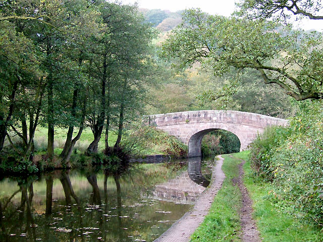 Caldon Canal at Cheddleton
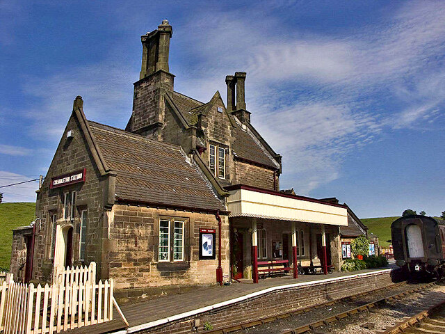 Cheddleton Station
The village's former industrial centre lies below, at the foot of a steep sandstone bluff. Between the river and the canal are an old brewery, warehouses and the marvellous Flint Mill. For nearly four miles, the walk follows the Caldon Canal. This was surveyed by the renowned canal builder, James Brindley, though he died before it opened in 1777. It was constructed to convey limestone from the massive quarries at Caulden to the main Trent and Mersey Canal in Stoke on Trent.
Other uses were soon found for it, associated with the pottery industry, and it was extended to Uttoxeter in 1811. A victim of road and rail competition, it was abandoned in 1944. But in 1974 became the first canal to be fully rescued and restored by enthusiasts and volunteers. At Basford Bridge, a short detour from the towpath leads to Cheddleton Station where the North Staffordshire Railway Company is based. The Neo-Gothic station building is attributed to the Victorian architect Augustus Pugin, best known for his work on the Houses of Parliament.
The walk now follows the wide flat valley of the Churnet to Oakmeadow Ford Lock, where canal and river join forces at the start of a long winding gorge. A little way downstream, the remains of two limekilns are all but hidden in the encroaching woods. Here, limestone from Cauldon was roasted to rid it of impurities, before being transported on a horse-drawn tramway to Western Conyers, about seven miles away, and sold for fertiliser, whitewash and many other uses. The grassy track of the tramway can be seen disappearing up a wooded side valley above the kilns. Two signposts, one metal, one sandstone, record the respective canal mileages to Uttoxeter and frog hole. Etruria, also mentioned on the mileposts, is the junction of the Caldon Canal with the Trent and Mersey Canal.
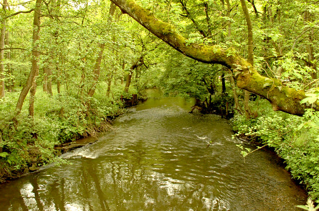 River Churnet
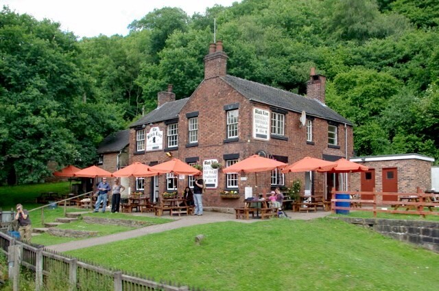 Black Lion, Consall
Peaceful Consall Forge was once one of the main industrial centres of the upper Churnet. Iron ore and limestone were combined in furnaces to produce pig iron. This was transferred by canal, rail or packhorse to Leek and other locations to be transformed into fire grates, domestic utensils and tin plate.
A great bank of kilns still stands beside the canal while in Crowgutter Wood, south=east of the hamlet, there are tumbled ivy covered walls lost in the woodland. Until recently, it was all but impossible to reach this spot by car, and most people still arrive by foot or boat, aiming for the characterful Black Lion Inn which overlooks the lock where river and canal once again separate.
The walk leaves the towpath and enters Consall Wood, an open access nature reserve managed by the County Council and criss-crossed by waymarked trails. The reserve protects the habitat of dozens of species of birds; the steep wooded valleys thick with birch and ash woodland. Beneath the trees, there are small bricked or fenced off shafts, the remains of small scale coal mining activity that occurred here sporadically over many centuries.
Despite the waymarks, many of the paths are little used and hard to distinguish. This is true in particular of those in Upper Ladypark Wood. Between the woods and Consall village, there are extensive views across the rolling countryside to the distinctive range of the Roaches, north of Leek and to the conical shape of Shuttingsloe, south-east of Macclesfield. Beyond Consall, the route follows field paths through farmland, then follows the opposite bank of the canal to that on the outward route, to return to Cheddleton.
Acknowledgment: Text derived from the Out and Out Series; Discovering the Countryside on Foot. Pictures courtesy of Wikipedia.


