Parkend, Cannop Ponds and Forest of Dean
Exploring the industrial past of the Forest of Dean
Google Maps Open Source Maps| Statistics and Files | ||
|---|---|---|
| Start: Parkend | Distance: 6.5 miles (10.5 km) | Climbing: 243 metres |
| Grid Ref: SO 61687 07857 | Time: 3 hours | Rating: Moderate |
| GPX Route File | Google Earth File | About Parkend |
| Statistics | |
|---|---|
| Start: Parkend | Distance: 6.5 miles (10.5 km) |
| Climbing: 243 metres | Grid Ref: SO 61687 07857 |
| Time: 3 hours | Rating: Moderate |
| GPX Route File | Google Earth File |
Ordnance Survey Explorer Map (1:25,000)
The Walk:
The Forest of Dean is one of England's two great broadleaved forests. The great natural beauty that today draws scores of visitors was once almost its downfall. Its oaks were much prized for shipbuilding, and both the Spanish Armada and, later, Napoleon's army had the forest marked as a prime target for destruction if their invasion plans came to fruition.
The village of Parkend, where this walk begins, once hosted tin-plate works, furnaces, collieries and stoneworks. All are now gone, but a link with its past remains in the form of the Dean Forest Steam Railway, with its headquarters just south of the village. This is the sole remnant of the once extensive tram roads and railways in the Forest of Dean.
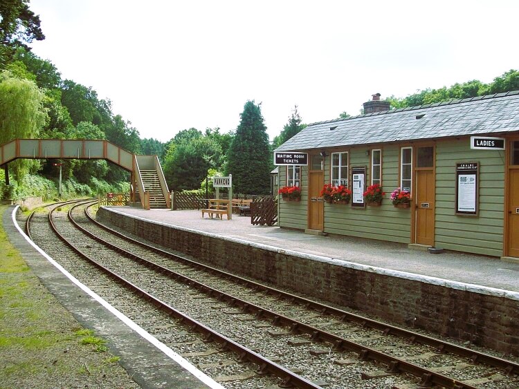 Parkend Railway Station
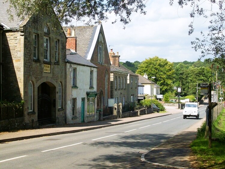 Parkend village
The forest is criss-crossed by rough surfaced roads. Their obvious value to the Forestry Commission belies their origin. Many were built by the United States Army during World War Two to facilitate the movement of ammunition, offering safety from aerial observation, the forest was a major munitions store. A pleasant walk along a path from one such road leads to the Cannop Ponds. Higher Cannop Pond is a valuable wildfowl refuge - this and a lower pond to the south were created in the 1820's as reservoirs. The head of water they build up powered a massive waterwheel, 51 feet in diameter, which worked blast furnaces at Parkend.
Beyond the adjoining road, the walk plunges into a plantation of quick growing conifers. The view from a clearing near the top of Barnhills Plantation reveals forest as far as they can see. The route emerges from the trees at the lip of Bixslade Quarries, disused for several years. One quarry is now producing stone again. Keep a close eye on the great slabs and spoil heaps as you pass, and you may be repayed with finds of fragments of fossilised trees, coral and shells.
The undressed stone is today carried to stone works by lorry. Until 1946, a horse drawn tramway served this function. Its route, down lonely Bixslade, is still marked by the stone-block sleepers to which iron rails were once bolted.
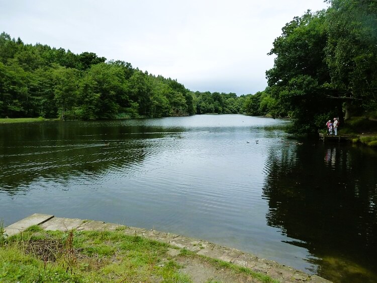 Cannop Ponds
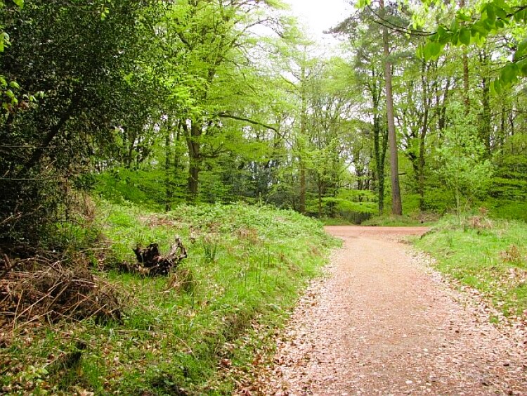 Nagshead Plantation
Halfway down Bixslade. a forest road leads off to a tiny coal mine. This is a 'Gale', worked by a handful of 'freeminers'. In order to be granted freemining privileges by the Crown's representatives in the Forest of Dean, 'the Gaveller', the men must be locally born residents and have worked in one of the forests major pits which were in their heyday around the middle of the last century.
The trail of stone sleepers ends at a long established stoneworks, which is still busy dressing locally hewn stone for use throughout Britain. Towards its end, the route enters one of the best remaining tracts of broadleaved woods, Nagshead Plantation. Many of the trees are around 250 years old, and are part of an important RSPB bird sanctuary. A small information centre provides advice and guidance for visitors. From the woods, you return to Parkend along a disused track bed of the Great Western Railway.
Acknowledgment: Text derived from the Out and Out Series; Discovering the Countryside on Foot. Pictures courtesy of Wikipedia.


