Whitegate Way, Weaver Navigation, Valeroyal Cut and Foxwist Green
A track bed, canalside and footpath walk in central Cheshire
Google Maps Open Source Maps| Statistics and Files | ||
|---|---|---|
| Start: Car Park | Distance: 7.6 miles (12.2 km) | Climbing: 129 metres |
| Grid Ref: SJ 61495 68007 | Time: 4 hours | Rating: Easy |
| GPX Route File | Google Earth File | About Whitegate |
| Statistics | |
|---|---|
| Start: Car Park | Distance: 7.6 miles (12.2 km) |
| Climbing: 129 metres | Grid Ref: SJ 61495 68007 |
| Time: 4 hours | Rating: Easy |
| GPX Route File | Google Earth File |
Ordnance Survey Explorer Map (1:25,000)
The Walk: The geographical heart of Cheshire is also the centre of the county's, as well as the country's, salt mining industry. This walk offers a glimpse of this old industry and makes the most of Cheshire's rich agricultural and ecclesiatical heritage. The walk begins in the old station yard at Whitegate, now the car park for the Whitegate Way, a footpath and nature trail along the old railway, which was one of Dr Beeching's victims of the 1960's railway cuts. The line was built to transport salt from the mines, to the main line a few miles away.
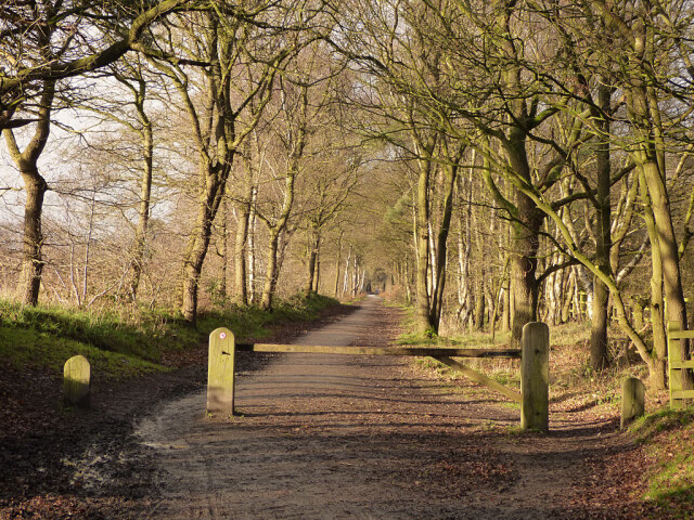 Whitegate Way
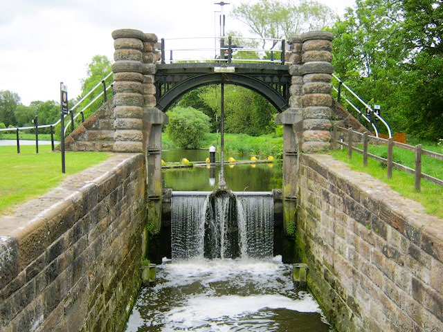 Vale Royal Locks
An old moated area, just off the line, is all that remains of Marton Grange. Bricks and stones from its walls were used in local farmhouses, such as adjoining Marton Hall Farm. Small ponds on either side of the line are resplendent with rushes and yellow flag irises in the summer. Nearby woodland shimmers with the white of anemones and ransoms, and vivid bluebells in season.
At the end of Whitegate Way, you emerge into a landscape of small bare mounds, glistening in places as the sun catches crystals of salt. This is Winsford Salt Mine, one of the largest in Cheshire. Brown rocksalt, mined from underground caverns, is sold as road salt or to the chemical industry. Table salt is made in a different way - it is pumped from underground as brine and then separated by evaporation.
You descend to the Valeroyal Cut of the Weaver Navigation. This peaceful wooded stretch also owes its existence to salt. The River Weaver was straightened, widened and deepened, so that the large coastal steamers could carry bulk rocksalt to the River Mersey and out to sea.
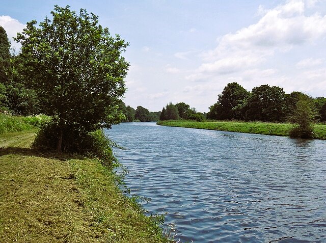 Valeroyal Cut
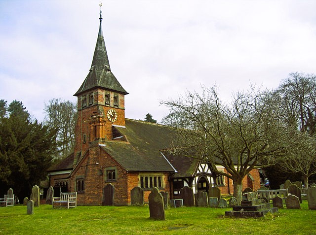 St Mary's church, Whitegate
The adjoining ponds, parts of the old river, are rich in bird life. The keeper at Valeroyal Locks, a keen ornithologist, spreads news of the latest sightings and rarities via the lock-side noticeboard. The locks, among the largest in Britain, are now back in use, but for a while they were redundant. The Anderton Boat Lift, near Northwich, was under long term repair for a number of years, and while so, this peaceful backwater was isolated. Now back in full working order, the cut is navigable once more.
There are views across meadows to the imposing mansion of Vale Royal, a remodelled remnant of a vast Cistercian abbey, the largest in England. Founded in 1277 by Edward I, it was never completely finished. After the Dissolution in 1534, it was home to various noble families, but later fell into ruin. It was refurbished in the 1990's, and reopened as a training centre.
The walk eventually leads to the pretty hamlet of Foxwist Green, a small hamlet with medieval origins. Close to Foxwist Green is Cassia Lodge. During World War Two, George VI and his family came here to escape, for a time, the trials of London in the Blitz. A contemporary houseguest was General Eisenhower, who often stayed here while visiting American servicemen based nearby.
Acknowledgment: Text derived from the Out and Out Series; Discovering the Countryside on Foot. Pictures courtesy of Wikipedia.


